Beaver Surveys in Shropshire

Beaver Surveys in Shropshire

Specialist Beaver Surveys for planning and development across Shropshire, supporting projects affecting rivers, streams, wetlands and connected freshwater habitats within the River Severn and Shropshire Hills catchments.

Request a Beaver Survey

Request a Beaver Survey

Maximum file size: 8.39MB

Fast, Clear, Planning-Ready Support

Fast response 

Calls answered in 2 rings, emails replied to within the hour.

Free expert advice

Clear guidance before you commit.

Cost-effective

Working in partnership with clients to ensure planning approval first time

Typical 10-day turnaround

Industry Leading Standard

Expert Team

We stay with you from first call through to submission. 

Do You Need a Beaver Survey in Shropshire?

Beavers have returned to Shropshire for the first time in more than 400 years, making them an increasingly important consideration for development affecting suitable freshwater habitat.

The county now has multiple licensed beaver projects, including the Old River Bed in Shrewsbury and the River Clun headwaters in the Shropshire Hills.

A Beaver Survey may be requested where proposed works could affect beavers, their breeding or resting sites, or habitats they rely upon.

This may include:

  • Development alongside rivers, streams or wetlands
  • Works within the River Severn or River Clun catchments
  • Riverbank excavation or engineering
  • Bridge, culvert, outfall or watercourse crossing works
  • Drainage and flood management schemes
  • Clearance of bankside trees or vegetation
  • Development affecting ponds or connected waterbodies
  • Infrastructure close to suitable riparian habitat
  • Changes to water levels, drainage or hydrology

The presence of a river or stream does not automatically mean a Beaver Survey is necessary.
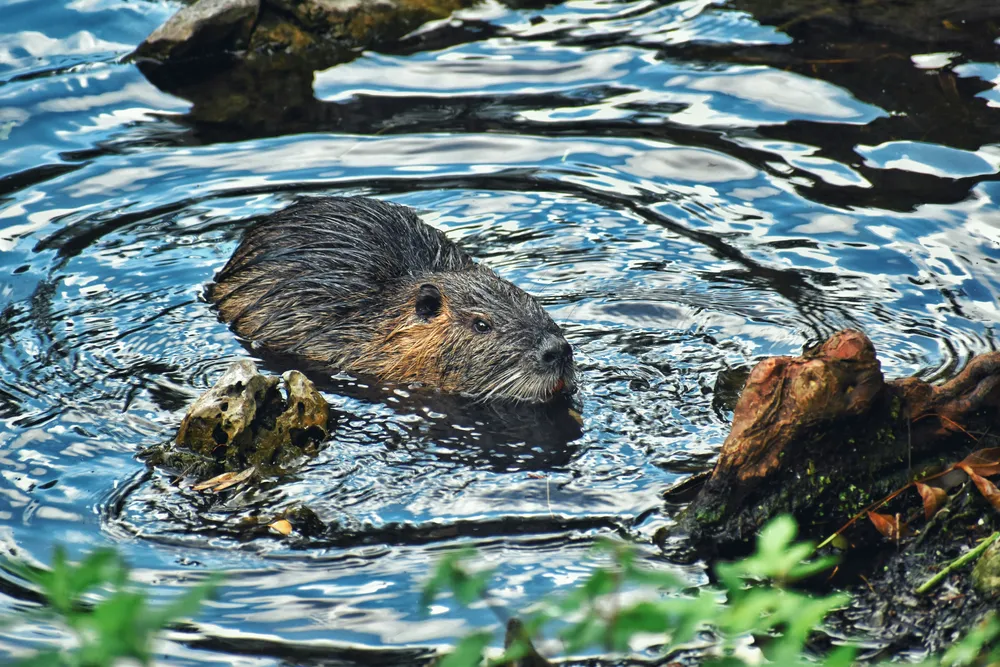
Eurasian beaver swimming through a freshwater river surrounded by rocks and waterside vegetation.

Where an LPA requests further ecological information, ProHort can undertake the appropriate assessment and provide clear ecological evidence to support the planning application.

Beaver Surveys & Shropshire Planning

Shropshire contains an extensive network of rivers, upland streams, wetlands and floodplains stretching from the Welsh border through the River Severn catchment.

Important river systems include the River Severn, River Tern, River Perry, River Clun, River Onny and River Rea, together with numerous smaller brooks and wetland habitats.

The planning authority will generally be either:

  • Shropshire Council

  • Telford & Wrekin Council

Where development could affect beavers or protected breeding and resting sites, the LPA may require sufficient ecological information to understand the potential impacts before determining an application.

Potential impacts can include damage to burrows or lodges, disturbance, removal of bankside vegetation, changes to water quality and alterations to hydrology.

Early ecological input can help provide the information requested by the LPA and reduce the risk of protected species matters causing avoidable delays.

Compliance & Legislation

Conservation of Habitats and Species Regulations 2017 (as amended)

Eurasian beavers are a European Protected Species. The legislation protects beavers from deliberate killing, injury, capture and disturbance, and protects their breeding sites and resting places from damage or destruction.

Wildlife and Countryside Act 1981 (as amended)

Provides additional legal protection relevant to beavers, including controls relating to certain methods of capture and their release into the wild.

For development in Shropshire, proposed works that could affect beavers, their breeding or resting sites, or important supporting habitat may require appropriate ecological assessment, mitigation and, in some circumstances, a Natural England licence.

ProHort provides proportionate, evidence led advice and reporting to help support a compliant route through planning.

Local Beaver Insight: Shrewsbury's Old River Bed

Shropshire's best known beaver project is at the Old River Bed Nature Reserve in Shrewsbury. In February 2025, a pair of Eurasian beavers were released into a purpose built enclosure within the Site of Special Scientific Interest, marking the return of beavers to Shropshire after more than four centuries.

The project is a partnership between Shropshire Wildlife Trust and Shrewsbury Town Council, with Natural England licensing the release. The beavers quickly established a lodge, began coppicing willow, altered water channels and transformed wetland habitat within the reserve. Later in 2025, the project's first beaver kit was confirmed, representing the first beaver born in Shropshire for more than 400 years.

For planning and development, this demonstrates that beavers are now an active part of Shropshire's ecological landscape rather than simply a future aspiration.

The River Clun & Shropshire Hills Project

A second important project is taking place within the upper River Clun catchment.

In March 2025, a breeding pair of beavers was released into a carefully designed enclosure in the headwaters of the River Clun as part of a river restoration project led by Severn Rivers Trust.

The project aims to:

  • Slow water flow

  • Improve water quality


  • Restore wetland habitat

  • Reduce downstream flood risk

The River Clun is already an ecologically significant river supporting species such as Atlantic salmon and freshwater pearl mussels, making habitat restoration particularly important.

This project is distinct from the Shrewsbury enclosure but reinforces Shropshire’s growing role in beaver recovery.

How do Beaver Assessments work

Our specialist ecology team assesses suitable habitat and identifies evidence of beaver activity, including feeding signs, tracks, burrows, lodges and dams.

You receive clear, planning ready advice identifying any ecological constraints and the appropriate recommendations for your project.

Key Deliverables for Shropshire projects:

• Beaver activity and habitat assessment

• Mapping of relevant burrows, lodges, dams and field signs

• Development impact assessment

• Clear mitigation and avoidance recommendations

• Natural England licensing advice where required

• LPA ready ecological report with practical next steps

Our reports provide the ecological information needed to help you respond to planning requirements and progress your Shropshire project.

Step 1

Schedule

We review your plans, site location, freshwater habitats and available ecological information to understand the project and any ecological issues that may need to be addressed.

Step 2

Fieldwork

Our ecologists survey suitable watercourses and connected habitats for beaver activity, including feeding signs, tracks, burrows, lodges and dams.

Step 3

Reporting

We assess how the proposed works could affect beavers, protected features, movement routes and supporting habitat.

Step 4

Integration with other Surveys

You receive a clear, LPA ready report setting out the findings and any appropriate avoidance, mitigation, monitoring or licensing recommendations.

Next Steps

Has your LPA requested a Beaver Survey, or are you planning works affecting a river, stream or wetland in Shropshire?

ProHort can undertake the appropriate ecological assessment and provide clear, planning ready reporting to help you respond to the LPA’s requirements and progress your project.

Beaver Survey FAQs for Shropshire

Are there beavers in Shropshire?

Yes. Beavers returned to Shropshire in 2025 through licensed projects at the Old River Bed in Shrewsbury and the River Clun headwaters in the Shropshire Hills.

The Old River Bed Nature Reserve is in Shrewsbury and contains an enclosed beaver project managed by Shropshire Wildlife Trust and Shrewsbury Town Council.

Yes. The first beaver kit was confirmed in 2025, marking the first beaver born in Shropshire for more than 400 years.

The River Clun project is a river restoration initiative in the Shropshire Hills, where a breeding pair of beavers was released into an enclosure to help restore natural processes and improve river health.

No. The presence of a river alone does not automatically establish a survey requirement. The LPA determines what ecological information is required based on the site and proposed works.

Could works near the River Clun require beaver consideration?

Potentially. Current ecological records, habitat suitability and the proposed works should be considered where development interacts with the River Clun catchment.

Our ecologists can look for gnawed or felled trees, feeding remains, tracks, slides, scent mounds, burrows, lodges and dams, together with evidence of how beavers are using the surrounding habitat.

Surveys can be undertaken throughout the year, although October to March normally provides the most accurate conditions for detecting field signs.

No. Beaver presence does not automatically prevent development. Potential impacts should be assessed and avoidance considered first, with mitigation or licensing where necessary.

If your Local Planning Authority requests further information relating to beavers, ProHort can undertake the appropriate ecological assessment and provide a clear, LPA ready report to support your planning application.

Where activity or protected features are identified, our ecologists can provide proportionate recommendations for avoidance, mitigation, further monitoring or licensing where applicable, helping you respond to the LPA’s requirements and keep your project progressing.

Related Services

Still have questions?

Still have questions?

Beaver Surveys in Staffordshire

Beaver Surveys in Staffordshire

Planning ready beaver surveys and habitat assessments across Staffordshire, providing clear ecological evidence, proportionate recommendations and practical support for developments affecting watercourses, wetlands and riparian habitats.

Request a Beaver Survey

Request a Beaver Survey

Maximum file size: 8.39MB

Fast, Clear, Planning-Ready Support

Fast response 

Calls answered in 2 rings, emails replied to within the hour.

Free expert advice

Clear guidance before you commit.

Cost-effective

Working in partnership with clients to ensure planning approval first time

Typical 10-day turnaround

Industry Leading Standard

Expert Team

We stay with you from first call through to submission. 

Do you need a Beaver survey in Staffordshire?

Developments close to rivers, streams, ponds, lakes, wetlands and other freshwater habitats may require consideration of beavers where suitable habitat and evidence of activity are present.

A beaver survey may be required where your Staffordshire development involves:

  • Works within or alongside a river or stream

  • Riverbank excavation or engineering

  • Bridge, culvert or crossing works

  • Drainage or flood management works

  • Clearance of bankside trees or vegetation

  • Development affecting wetlands or connected waterbodies

  • Infrastructure close to suitable riparian habitat

  • Changes to water levels, drainage or hydrology

  • Preliminary Ecological Appraisal identifying potential beaver habitat or activity

The requirement for further assessment depends on the habitat present, evidence of beaver activity and the potential effects of the proposed development.

Early assessment can establish whether beavers represent a genuine planning constraint and what ecological work is actually necessary.

Depending on the location of your site, the relevant planning authority may include Stafford Borough Council, Staffordshire Moorlands District Council, Cannock Chase District Council, Lichfield District Council, South Staffordshire Council, East Staffordshire Borough Council, Newcastle under Lyme Borough Council, Stoke on Trent City Council or Tamworth Borough Council.

Beaver considerations are particularly relevant where proposed development affects rivers, streams, wetlands or associated riparian habitat, including sites connected with the River Trent, River Dove, River Churnet, River Sow, River Penk, River Blithe and River Tame, or their tributaries.

Compliance & Legislation

Conservation of Habitats and Species Regulations 2017 
Eurasian beavers are a European Protected Species. The legislation protects beavers from deliberate killing, injury, capture and disturbance, and protects their breeding sites and resting places from damage or destruction.

Wildlife and Countryside Act 1981 
Provides additional legal protection relevant to beavers, including controls relating to certain methods of capture and their release into the wild.

For development in Staffordshire, proposed works that could affect beavers, their breeding or resting sites, or important supporting habitat may require appropriate ecological assessment, mitigation and, in some circumstances, a Natural England licence.

How Beaver assessments work

Our specialist ecology team carries out a Beaver Survey to identify signs of beaver activity, including feeding signs, tracks, burrows, lodges, dams and important habitat. You receive a clear, LPA ready report assessing potential impacts and setting out any required mitigation, monitoring or licensing considerations, helping your project stay on schedule and compliant.

Key Deliverables for Staffordshire projects:

We provide proportionate, evidence led recommendations focused on the minimum necessary ecological work required to support your Staffordshire project:

  • Practical next steps for designers, planners and contractors
  • Identification and mapping of burrows, lodges, dams and activity 
  • Assessment of feeding areas, movement routes and supporting habitat 
  • Evaluation of potential impacts from the proposed development
  • Clear avoidance and mitigation recommendations 
  • Futher monitoring recommendations where necessary

Step 1

Initial Site Review

We review your site location, development proposals, existing ecological information and nearby freshwater habitats to establish whether beaver assessment is likely to be required.

Step 2

Fieldwork

Our ecologists inspect suitable watercourses, banks and connected habitats for evidence of beaver activity, including feeding signs, tracks, slides, scent mounds, burrows, lodges and dams.

Step 3

Impact Assessment

Where beaver activity or protected features are identified, we assess how the proposed works could affect beavers, their breeding or resting sites, movement routes and supporting habitat.

Step 4

Reporting

You receive clear, planning ready findings with proportionate recommendations. Where necessary, this may include avoidance measures, mitigation, further monitoring or advice on Natural England licensing.

Next Steps

Need a beaver survey in Staffordshire? Let’s confirm your site’s requirements and keep your project on track. 

FAQ - Beaver Surveys in Staffordshire

When is a beaver survey required for a development in Staffordshire?

A beaver survey may be required where proposed works could affect beavers, their breeding or resting sites, or suitable freshwater habitat. This is particularly relevant for development close to rivers, streams, wetlands, ponds, lakes and associated riparian habitat where beaver activity is known, suspected or identified during a Preliminary Ecological Appraisal.

Not automatically. The presence of a river or stream alone does not mean a beaver survey is required. The need for assessment depends on habitat suitability, available records, evidence of beaver activity and how the proposed development could affect the watercourse or surrounding habitat.

Staffordshire has an extensive network of rivers and tributaries, including the River Trent, River Dove, River Churnet, River Sow, River Penk, River Blithe and River Tame. Developments affecting these or other suitable watercourses may require ecological assessment where there is potential for beavers or their habitat to be affected.

A beaver survey can include searches for gnawed or felled trees, feeding remains, tracks, slides, scent mounds, pathways, burrows, lodges and dams. Our ecologists also assess the surrounding habitat to understand how beavers could be using the watercourse and adjacent land.

Beaver surveys can be undertaken throughout the year, although October to March normally provides the clearest conditions for identifying field signs because vegetation is reduced. Surveys undertaken between April and September may require a follow up survey between October and March before works begin.

Can finding beavers delay my Staffordshire planning application?

It can if potential impacts are identified late. Finding beavers does not automatically prevent development, but the Local Planning Authority may require sufficient ecological information to understand how the proposals could affect beavers and their protected breeding or resting sites. Early assessment allows avoidance and mitigation to be considered before they become a project constraint.

Yes. Works involving riverbanks, culverts, crossings, drainage infrastructure, flood management or changes to water levels and hydrology can potentially affect beavers and their habitat. The need for a survey depends on the location, habitat and nature of the proposed works.

Our ecologists assess the feature, evidence of activity and its relationship with the proposed development. Where possible, impacts should be avoided. If this is not possible, appropriate mitigation, working methods and potentially a Natural England licence may need to be considered.

Yes. Eurasian beavers are a European Protected Species under the Conservation of Habitats and Species Regulations 2017. The legislation protects beavers and their breeding sites and resting places. Proposed works that could affect protected features therefore need appropriate ecological consideration.

You receive a clear, LPA ready ecological report setting out the survey findings, identified beaver activity and relevant habitat features, potential development impacts and any necessary avoidance, mitigation, monitoring or licensing considerations. Our recommendations focus on establishing the minimum necessary ecological work required to support your project.

Related Services

Still have questions?

Still have questions?

Environmental & Laboratory Testing

Which Environmental and Laboratory Testing Service Do I Need?

Testing requirements vary depending on material type, regulatory framework and intended outcome.


Use the guide below to identify the analysis most relevant to your site or project.

Request a Testing and Analysis Service

Request a Testing and Analysis Service

Maximum file size: 8.39MB

A Quick Guide to Environmental & Laboratory Testing Services

Regulatory decisions depend on defensible analytical data.

Environmental and laboratory testing provides the data needed to understand the condition and classification of soil, plant tissue and waste materials. Whether you’re investigating contamination, meeting regulatory requirements or informing a management strategy, accurate analysis provides the evidence needed to make confident decisions.

Every project begins by identifying the most appropriate testing requirements before samples are collected and analysed to recognised standards. At ProHort, we coordinate the sampling process, laboratory testing and reporting, ensuring the results are clear, compliant and tailored to your project.

UKWIR Testing

When: Excavation or reuse of soil linked to water industry assets. 

Purpose: Confirm compliance with UK Water Industry Research guidelines for reuse or transfer.

Timing: Year-round 

Soil Testing and Analysis

When: Planning conditions, contamination checks or BNG soil suitability

Purpose: Assess nutrient levels, pH, contamination or soil health

Timing: Year-round (weather-dependent sampling).

Leaf Analysis

When: Diagnosing nutrient uptake or pollution stress in trees and shrubs. 

Purpose: Measure nutrient balance to guide management or mitigation

Timing: April to October

Phytophthora Testing

When: Tree or shrub decline, especially in planning or import-control contexts.

Purpose: Detect Phytophthora pathogens and confirm plant health compliance. 

Timing: April–September (weather-dependent); year-round for scoping (PEA).

Waste Acceptance Criteria (WAC) Testing

When: Excavated soils or materials require waste classification

Purpose: Define hazardous/non-hazardous status for disposal or reuse

Timing: Year-round

Your Next Step

Choosing the right testing approach from the outset helps avoid unnecessary delays, reduces compliance risks and ensures decisions are based on reliable technical evidence. Whether you need a single laboratory analysis or a coordinated testing programme, we’ll identify the most appropriate solution for your project.

Tell us about your site or requirements, and our team will recommend the most suitable testing and analysis service.

Environmental and Laboratory Testing Service FAQs

What is environmental laboratory testing in planning and compliance?

Environmental laboratory testing analyses soil, plant tissue or waste materials to confirm classification, contaminant thresholds and regulatory status. In development and land management projects, this evidence supports planning validation, waste disposal decisions, remediation strategy and environmental compliance under UK regulation.

WAC testing (Waste Acceptance Criteria testing) determines whether soil or waste materials meet landfill acceptance standards. It is required before material can be disposed of at licensed facilities and forms part of UK waste classification and environmental compliance obligations.

Without valid WAC results, material cannot be lawfully accepted.

UKWIR testing follows Water UK Industry Research guidance to assess material suitability where contact with drinking water infrastructure or controlled water systems may occur. It confirms that soils or imported materials meet regulatory thresholds for water safety and environmental protection.

Soil testing and analysis measures contaminants, heavy metals, hydrocarbons, nutrients and pH levels. It establishes land quality status and supports contaminated land risk assessment, remediation design, planning condition discharge and due diligence reporting.

Soil testing is typically required where development involves potential contamination, waste reuse, remediation works or discharge of planning conditions. Early sampling confirms environmental status before disposal, design or regulatory decisions are fixed.

This prevents misclassification and costly re-work.

What is Phytophthora testing?

Phytophthora testing identifies regulated plant pathogens within soil or plant tissue samples. Laboratory confirmation is required where root rot, dieback or biosecurity risk is suspected. Accurate diagnosis supports containment strategy, planting decisions and regulatory reporting.
Phytophthora is confirmed through accredited laboratory methods such as ELISA or PCR analysis. Visual symptoms alone are not sufficient for compliance or management decisions. Laboratory verification provides defensible evidence for biosecurity action.

Leaf analysis measures nutrient uptake and plant health indicators within tissue samples. It supports nutrient management planning, performance monitoring and environmental assurance in landscape, arboricultural and agricultural contexts.

Accredited laboratory testing confirms contaminant levels and classification thresholds before material is disposed of, reused or remediated. This protects against regulatory enforcement, rejected waste loads, insurance exposure and programme delay.

Defensible data reduces liability.

The correct test depends on your regulatory objective.

  • WAC testing for landfill disposal

  • UKWIR testing for water infrastructure compliance

  • Soil testing for contamination assessment

  • Phytophthora testing for plant health and biosecurity

  • Leaf analysis for nutrient and performance monitoring

Early review ensures sampling strategy and reporting align with project timelines and regulatory standards.

Legal Reports for Vegetation, Invasive Plants and Soil

Which Legal Report Do I Need for Invasive Weeds?

Report requirements vary depending on the plant involved, the nature of the allegation and whether proceedings are anticipated.

Select the report below that aligns with your instruction and evidential needs.

A Quick Guide to Legal Reports to for Invasive Plant Disputes

Where vegetation, soil or invasive plants become the subject of dispute, evidence must be objective and defensible.

Legal reports provide independent, evidence-based assessments where vegetation, trees, invasive plants or land conditions are central to a dispute, insurance claim, planning matter or legal instruction. Prepared using a robust, evidence-based approach, they establish the facts surrounding issues such as encroachment, damage, contamination or the presence of invasive species.

Part 35 Compliant Expert Witness Reports

When: legal proceedings demand independent expert opinion under CPR Part 35.

Purpose: provide a structured, impartial report suitable for disclosure, cross-examination and court reliance.

Timing: year-round.

Japanese Knotweed Identification and Removal Reports

When: required for property transactions, mortgage compliance or legal proceedings.

Purpose: confirm knotweed presence, extent and legal compliance under the Wildlife and Countryside Act 1981 and RICS Knotweed Guidance (2022). 

Timing: year-round.

Legal Reports: Bamboo

When: bamboo encroachment or root spread causes property damage or dispute.

Purpose: confirm species, extent, spread source and remediation responsibility.

Timing: year-round.

Legal Reports: Plants (General)

When: trees, hedges or vegetation are linked to property or boundary disputes.

Purpose: provide a certified, evidence-based report identifying damage, cause and proportional remediation.

Timing: year-round.

Legal Reports: Soil

When: soil condition, contamination or movement contributes to damage or planning enforcement.

Purpose: establish soil profile, contamination, and causative role in the issue.

Timing: year-round.

Your Next Step

Every report is prepared with independence, a clearly defined scope and evidence-based reasoning to provide clear, objective findings that can support negotiation, mediation or court proceedings.

Provide details of the allegation or instruction, and we’ll recommend the most appropriate evidential approach for your circumstances.

Legal Reports FAQs

When is a vegetation or invasive plant expert report required?

An expert report is required where vegetation, invasive plants or soil conditions are central to a boundary dispute, property transaction, insurance claim, enforcement matter or anticipated litigation.

If liability, causation, disclosure or compliance is questioned, structured technical evidence should be obtained before formal position is taken.

Early expert input reduces evidential uncertainty and strengthens legal strategy.

A Part 35 expert report is prepared in accordance with the Civil Procedure Rules (CPR Part 35). It must include:

• A clear statement of instructions
• Defined methodology
• Assumptions relied upon
• Full reasoning
• A declaration confirming the expert’s overriding duty to the court

Non-compliant reports may be challenged or excluded. Procedural correctness is as important as technical accuracy.

No. It is not a criminal offence simply to have Japanese Knotweed growing on private land.

However, under Section 14 of the Wildlife and Countryside Act 1981, it is an offence to plant or otherwise cause Japanese Knotweed (a Schedule 9 species) to grow in the wild. Contaminated soil containing knotweed material is classified as controlled waste under the Environmental Protection Act 1990, meaning improper disposal may result in enforcement action.

Separate from criminal law, civil liability may arise where rhizomes encroach across a boundary and interfere with neighbouring land. Claims are typically assessed under private nuisance principles.

Independent identification and root mapping establish factual extent before dispute escalates.

A defensible legal assessment typically includes:

• Confirmed botanical identification
• Rhizome extent mapping
• Boundary relationship analysis
• Review of historic treatment
• Structural risk assessment (where alleged)
• Opinion on causation and spread

Evidence must be site-based and proportionate to withstand scrutiny in negotiation or court.

Bamboo disputes are assessed under private nuisance law. While most bamboo species are not listed under Schedule 9, liability may arise where roots or rhizomes encroach and cause measurable interference or damage.

Assessment focuses on species behaviour, root spread pattern, proximity to structures and boundary impact. Technical mapping and causation analysis are central to evidential clarity.

What legislation may apply to invasive plant disputes?

Depending on circumstances, disputes may engage:

• Wildlife and Countryside Act 1981 (Schedule 9)
• Environmental Protection Act 1990
• Anti-social Behaviour, Crime and Policing Act 2014 (Community Protection Notices)
• Private nuisance principles in civil law

Expert reports interpret how statutory and common law frameworks apply to the specific facts of the case.

Legal soil reports may assess contamination status, waste classification, root influence or subsidence factors. Sampling methodology, laboratory analysis and threshold interpretation must align with recognised environmental standards.

Clear analytical reporting supports defensible conclusions where liability or regulatory compliance is contested.

Yes. Disturbing or removing vegetation before independent inspection can compromise evidential position. Unrecorded removal may obscure rhizome extent, prevent accurate mapping and weaken causation analysis.

Early documentation preserves clarity and protects legal position.

Where liability is disputed, expert evidence should inform legal correspondence. Acting without technical assessment risks incorrect assumptions and weakened negotiation leverage.

Objective evidence strengthens structured resolution.

For advisory reports, the expert provides independent professional opinion to the instructing client. For Part 35 court reports, the expert’s overriding duty is to the court.

Independence, transparency and proportionality are fundamental to evidential weight.

Ecological Surveys

Which Ecological Surveys Do I Need?

Most planning applications that affect greenfield land, buildings, trees or water features trigger ecological survey requirements.

Use the guide below to identify the survey stage most likely to apply to your scheme.

Request an Ecology Survey

Request an Ecology Survey

Maximum file size: 8.39MB

A Quick Guide to Ecology Surveys

Local Planning Authorities often require ecological evidence where development proposals may affect habitats, protected species, or other ecological features. Identifying those considerations early can make a significant difference to the planning process, helping to avoid unexpected delays, seasonal survey constraints, and last-minute design changes.

That is where ProHort can help. We provide the ecological surveys and assessments needed to support planning applications, giving homeowners, architects, developers, and landowners a clear understanding of the ecological requirements affecting their site. With that information in place early, projects can move forward with greater certainty and fewer surprises along the way.

Preliminary Ecological Appraisal (PEA)

When: preparing a planning application or where boundaries include vegetation or mixed habitats.

Purpose: establish the ecological baseline early.

Timing: year-round.

Botanical Surveys

When: grassland, wetland or species-rich vegetation influences BNG or design.

Purpose: confirm species composition and habitat distinctiveness. 

Timing: May – September.

Habitat Action Plans (HAP)

When: long-term habitat management or enhancement is required by planning conditions.

Purpose: structure post-planning habitat delivery and BNG stewardship.

Timing: year-round once baseline data exists.

Species Action Plans (SAP)

When: protected or priority species are recorded or predicted.

Purpose: formalise mitigation, enhancement and monitoring actions.

Timing: year-round (plans informed by seasonal survey data).

Environmental Impact Assessment (Ecology)

When: schemes meet EIA thresholds or affect designated habitats.

Purpose: provides the ecology chapter for Environmental Statements.

Timing: Season-dependent — scope early to avoid delays.

Ecological Clerk of Works (ECoW)

When: development enters construction and ecological conditions, licences or RAMS apply. 

Purpose: oversee site activity so ecological requirements are followed in practice, not just on paper. 

Timing: year-round. 

Ecological Method Statements

When: Required where ecological constraints or planning conditions need to be managed during construction.

Purpose: Sets out the measures needed to protect habitats and species during site works.

Timing: Usually prepared before construction begins — early instruction helps avoid programme delays.

Your Next Step

Every site is different, and the surveys or ecological support required will depend on the habitats, species, planning context, and proposed works involved. Understanding those requirements early can help avoid delays, reduce uncertainty, and give your project a clearer path forward.

ProHort provides practical, planning-focused ecological advice alongside clear, technically robust reporting, helping homeowners, architects, developers, and landowners move forward with confidence. If you are unsure which survey or ecological service applies to your project, our team can review your proposal and advise on the most appropriate next step.

Ecological Surveys FAQs

What is an ecology survey?

An ecology survey assesses how a proposed development interacts with habitats and protected species. It establishes the ecological baseline required for a planning application and determines whether further surveys or assessments are necessary.

Most projects begin with a Preliminary Ecological Appraisal (PEA), which identifies site constraints and defines the appropriate next steps.

You may need an ecology survey for planning permission where development could affect habitats or protected species. Local planning authorities require ecological evidence to validate applications and assess environmental impact.

Depending on the scale and sensitivity of the project, this may include a PEA, targeted protected species surveys, a Botanical Survey, or an Ecological Impact Assessment (EcIA).

An ecology survey typically begins with a Preliminary Ecological Appraisal (PEA), including habitat mapping and assessment of protected species potential.

Where required, this may progress to:

  • Targeted species surveys

  • A Botanical Survey

  • An Ecological Impact Assessment (EcIA) for larger or more complex schemes

Each stage is defined by site evidence and planning requirements.

An Ecological Impact Assessment (EcIA) is required where development is likely to result in significant ecological effects. It evaluates impacts, proposes mitigation measures and supports planning decision-making on larger or environmentally sensitive projects.

An Ecological Clerk of Works (ECoW) provides on-site ecological supervision during construction. This ensures works comply with planning conditions, method statements and protected species requirements.

ECoW support reduces risk during site operations and helps contractors meet environmental obligations.

What is a Botanical Survey?

A Botanical Survey records plant species and habitat composition within a site. It may be required where habitat quality, Biodiversity Net Gain calculations or designated plant communities are relevant to planning.

Species Action Plans (SAP) and Habitat Action Plans (HAP) set out long-term management measures to protect or enhance ecological features. They may form part of mitigation strategies or planning conditions where biodiversity enhancement is required.

The cost of an ecology survey depends on site size, habitat type and whether additional assessments such as a Botanical Survey, EcIA or protected species surveys are required. Early ecological input helps define requirements clearly and manage cost.

Ecology survey reports, including PEAs and EcIAs, are generally considered valid for up to two years, provided site conditions have not materially changed. Planning authorities may request updated surveys where necessary.

Ecological surveys provide the evidence required for planning validation and decision-making. They identify environmental risks early, inform mitigation design and support Biodiversity Net Gain requirements.

Without appropriate ecological evidence, applications may be delayed or subject to additional information requests.

Japanese Knotweed Identification and Removal

Japanese Knotweed Identification & Removal

Planning-ready Japanese knotweed reports that confirm presence, clarify liability and enable proportionate removal — delivered nationwide by qualified specialists. 

Do you need a Japanese knotweed report?

You may need a Japanese knotweed report if the plant has been recorded on your property or a neighbouring site, or if an insurer, lender or planning authority requires formal evidence of identification, extent or management. 

These reports provide the independent documentation needed for legal, mortgage, or planning purposes, with clear next steps for remediation. 

Most clients tell us early clarity here prevented prolonged lender delays and avoided unnecessary escalation. 

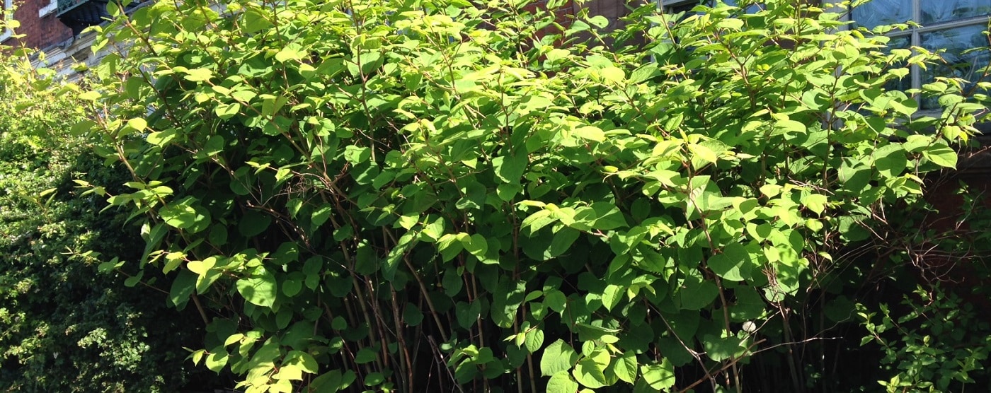
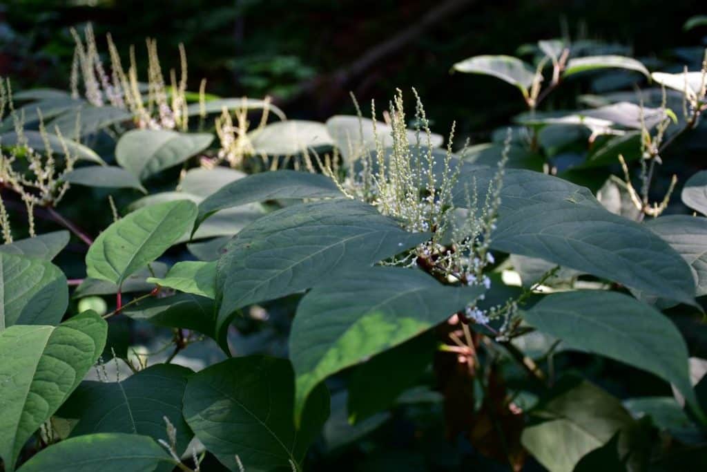
Japanese Knotweed with flowers to demonstrate in training session

What is Japanese knotweed?

Japanese knotweed is one of the UK’s most invasive plants, introduced from Japan for ornamental use in the 19th century. 

It spreads rapidly through underground rhizomes, growing up to 10 cm per day during the growing season. Its roots can penetrate structures, drains and cavity walls, creating significant management challenges. 

Although it’s not illegal to have knotweed on your property, landowners have a legal responsibility to prevent it spreading onto neighbouring land under the Wildlife & Countryside Act 1981 (Schedule 9) and relevant local authority policies. 

Unchecked growth can: 

  • cause damage to buildings, drains and hard surfaces 
  • delay planning or property transactions 
  • lead to enforcement or legal action 
  • reduce property value by 5–15 % depending on severity 
Japanese Knotweed

What is a Legal Report: Japanese Knotweed?

A Legal Knotweed Report provides formal identification, mapping, and legal context for any infestation. 

It evidences presence, source and spread, and defines the remedial actions required under law or policy. 
Reports are structured for CPR Part 35 compliance when used in litigation or insurance cases, or as advisory documents for planning and conveyancing. 

Our legal and technical reports often lead directly to remediation through our specialist partners at Japanese Knotweed Expert, ensuring continuity from evidence to action nationwide. 

Quick check: 
Send your postcode, site plan or photographs for a fast, accurate recommendation. 

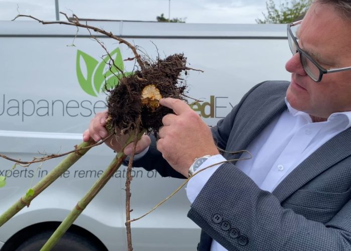
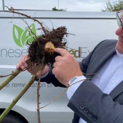
Surveyor from Japanese Knotweed Expert inspecting vegetation for Japanese knotweed and Points to Roots symptoms.

Legal Compliance & Planning risk

Authorities, lenders and courts rely on qualified evidence under:

  • Civil Procedure Rules (CPR) Part 35 
  • Wildlife & Countryside Act 1981 (Schedule 9) 
  • Environment Act 2021 
  • Anti-Social Behaviour, Crime and Policing Act 2014 (Community Protection Orders) 
  • National Planning Policy Framework Section 15 

Failure to document or manage knotweed correctly can result in:

  • mortgage refusals or reduced valuations 
  • planning delays or enforcement notices 
  • neighbour disputes or civil claims 
  • increased removal costs due to regrowth 

Early alignment with these standards ensures your authority, lender or insurer receives clear, compliant evidence from the first submission — no second rounds required. 

What We Deliver

Service Purpose Outcome
Initial Site Survey Confirm presence and extent of infestation. Fast confirmation and mapped evidence.
Formal Identification & Mapping Record species, boundaries and growth potential. Independent, photographic documentation.
Legal Report (CPR Part 35 or advisory) Present findings for legal, mortgage or planning use. Structured, defensible report ready for submission.
Remediation Plan & Verification Define safe and proportionate treatment or removal steps. Clear pathway from evidence to eradication.
Expert Witness Support (if required) Provide independent opinion for disputes or litigation. Compliant testimony and cross-examinable evidence.

That’s how evidence stays proportionate, liability stays contained, and your project keeps moving. 

How it Works

Scope & Confirm Instruction

Send your location and brief description of the issue. We confirm the correct report type and timescale..

Site Inspection & Evidence Collection

A qualified consultant inspects, photographs and maps the infestation, recording associated risks.

Report & Next Steps

You receive a planning- or court-formatted report, with mapped data and remediation pathway through our Japanese Knotweed Expert partners.

Timing & delivery

Each day gained here protects programme stability and prevents legal or transactional delay. 

Nationwide coverage across England, Scotland and Wales 

Inspection Availability

Year-round

Report Turnaround

Typically within 24 hours

Survey Booking

Within 7 working days

What You Receive:

  • Independent on-site identification and mapping 
  • Legal compliance check and liability summary 
  • Proportionate remediation plan 
  • CPR Part 35 or advisory format report 
  • 24-hour turnaround from inspection 
  • Full coordination with Japanese Knotweed Expert for removal 

Evidence lenders, planners and courts trust. 
Reasoning that keeps your project or transaction moving. 

Why Clients Choose ProHort:

  • Integrated ecological, legal and environmental expertise 
  • Reports accepted by lenders, solicitors and insurers 
  • 24-hour reporting with national coverage 
  • Partnership with Japanese Knotweed Expert for seamless remediation 
  • Transparent communication and defensible reasoning 

Compliance & professional standards

Reports produced in accordance with: 

• CPR Part 35 and RICS practice standards 

• Wildlife & Countryside Act 1981 (Schedule 9) 

• Environment Act 2021 

• NPPF Section 15 

• ProHort Quality Assurance and peer review protocols 

Each report is structured for traceability, proportionality and defensible reasoning. 

Your Next Step

Need a P35 Expert Witness Report in relation to Japanese Knotweed? Contact us today:

Phone: 0800 494 7479 
Email: [email protected] 

Case Note

A buyer’s solicitor requested a knotweed assessment before mortgage approval. The inspection confirmed limited growth on a boundary and no structural impact. A 12-month treatment plan was agreed through Japanese Knotweed Expert, and the sale completed without delay.

Japanese Knotweed FAQs

Do I need a Japanese knotweed report?

Yes — if the plant has been recorded on or near your property, or a lender, solicitor or planner has requested formal evidence.

Yes. Reports can be formatted to CPR Part 35 standards for litigation, or advisory for planning and property transactions.

Reports are typically turned around within 24 hours of inspection.

Surveys are usually available within 7 working days from your initial call.

Will you arrange removal or treatment?

Yes — we coordinate with our specialist partners at Japanese Knotweed Expert for proportionate remediation.

Can this affect property value or mortgage offers? 
Yes — uncontrolled knotweed can reduce property value by 5–15 %, and many lenders require evidence of a treatment plan before approving finance. 

Yes — with consent, we provide reports directly to your representatives for transparency and speed.

Yes — services available across England, Scotland and Wales.

Still have questions?

Still have questions?

Related Services

Biodiversity

What BNG Related Survey Do I Need?

The majority of planning applications trigger formal Biodiversity Net Gain requirements.

Use the guide below to match your site conditions to the survey most likely to apply.

Request a Biodiversity Net Gain Assessment

Request a Biodiversity Net Gain Assessment

Maximum file size: 8.39MB

A Quick Guide to BNG Related Surveys

By working with you from the outset, we can reduce the need for additional Biodiversity Net Gain (BNG) units and support a cost-effective approach. Actions taken before baseline assessment, including habitat clearance, can negatively affect unit calculations and lead to increased mitigation requirements.

Our team clarifies what is required, when it is needed and how it integrates with your wider scheme, keeping progress proactive rather than reactive. The result is a thorough, evidence-led report that stands up to local planning authorities and supports approval at first submission.

Biodiversity Net Gain (BNG) Assessment

When: development must achieve or evidence ≥ 10 % gain.

Purpose: quantify ecological change and define uplift routes.

Timing: baseline year-round.

Biodiversity Gain Plan (BGP)

When: after baseline/BNG assessment, once layout and habitat proposals are broadly fixed.

Purpose: set out how required BNG units will be delivered, managed and secured.

Timing: usually post-permission, pre-commencement to discharge BNG conditions.

Biodiversity Enhancement Plans

When: where planning policy or a planning condition requires biodiversity improvements as part of the development.

Purpose: explain what ecological enhancements will be delivered, how they will be put in place and how they will be maintained over time.

Timing: usually submitted with the planning application or approved by condition before development begins.

Habitat Management and Monitoring Plan (HMMP)

When: once BGP or BNG strategy is agreed and habitats are defined.

Purpose: detail how habitats will be managed, monitored and reported on for a duration of 30 years.

Timing: typically required alongside or shortly after the BGP for condition discharge.

Your Next Step

Get in touch for specialist Biodiversity Net Gain support. Whether you’re a developer, landowner, or part of a wider planning team, we can help you achieve compliance, reduce risk, and keep your project moving forward.

Biodiversity FAQs

What is Biodiversity Net Gain in planning?

Biodiversity Net Gain (BNG) is a statutory planning requirement in England that requires most developments to deliver at least a 10% increase in biodiversity value compared to the site’s baseline condition. It is measured using the Government’s Biodiversity Metric and must be secured for a minimum of 30 years through approved habitat creation or enhancement.

Biodiversity Net Gain applies to most planning applications submitted under the Town and Country Planning Act in England. The requirement is triggered at the point of planning permission and must account for all habitats affected by the proposal, including distinct habitat types and their condition. A Biodiversity Gain Plan must then be approved before development can lawfully commence.

Developers must demonstrate a minimum 10% net gain in biodiversity units compared to the pre-development baseline. This requires a metric calculation, clear habitat proposals and a secured management commitment for at least 30 years. The gain must follow the statutory mitigation hierarchy and be formally approved by the local planning authority.

The Biodiversity Metric is a standardised calculation tool published by the Government. It measures the biodiversity value of a site based on habitat type, condition, distinctiveness and area. The metric is used to quantify losses and gains in biodiversity units and determine whether the 10% requirement has been achieved.

BNG units are the quantified measure of biodiversity value calculated using the Biodiversity Metric. They represent the ecological value of habitats before and after development. Planning approval requires the post-development unit total to exceed the baseline by at least 10%.

What is a Biodiversity Gain Plan (BGP)?

A Biodiversity Gain Plan is the formal document submitted to the local planning authority to demonstrate how a development will achieve the required 10% biodiversity net gain. It sets out the baseline metric calculation, proposed habitat delivery, and how gains will be secured for at least 30 years. Development cannot lawfully commence until the Biodiversity Gain Plan has been approved.

A Habitat Management and Monitoring Plan outlines how newly created or enhanced habitats will be established, maintained and monitored over the required 30-year period. It defines management actions, performance indicators and reporting intervals to ensure biodiversity gains are delivered in practice, not just on paper.

A Biodiversity Enhancement Plan sets out practical measures to improve ecological value within a site. On smaller developments or where full BNG does not apply, it may be required as a planning condition. The plan focuses on achievable, site-specific enhancements such as habitat creation, native planting or integrated features for protected species.

Certain developments are exempt, including householder applications, some self-build projects, and sites impacting very small areas of habitat below defined thresholds. However, exemptions are specific and should be confirmed early, as most standard development proposals remain subject to BNG.

If sufficient biodiversity gain cannot be delivered within the red line boundary, off-site biodiversity units can be secured from an approved provider. These units must be formally allocated and legally secured before development proceeds. Statutory credits are available only where on-site and off-site options are not feasible.

Still have questions?

Still have questions?

Landscape Architecture

Which Landscape Architecture Service do you need?

The right landscape service depends on project stage and planning requirement.


Use the guide below to identify the assessment or design support most relevant to your scheme.

Request a Landscaping Service

Request a Landscaping Service

Maximum file size: 8.39MB

A Quick Guide to Landscape Architecture Services

Landscape decisions influence planning outcomes and long-term site value.

Strategic landscape architecture integrates visual impact assessment, 3D design modelling and detailed scheme preparation to support both planning approval and successful delivery. LVIA establishes visual context and sensitivity. 3D landscape design communicates intent clearly. Landscaping schemes translate strategy into buildable detail.

We structure landscape input around policy, context and programme requirements from the outset. The result is a coherent landscape strategy that strengthens consent and enhances development quality.

Landscaping Visual Impact Assessment (LVIA)

When: required when development affects views, landscape character or sensitive receptors.

Purpose: tests visual change and landscape effects for planning.

Timing: start early in design; viewpoints must be agreed before modelling.

3D Landscape Design

When: useful when proposals need clear visual communication for planners or clients.

Purpose: shows layout, materials and planting in realistic 3D form.

Timing: best at concept stage or during pre-application discussions.

When: needed for applications involving external works, planting or visual mitigation.

Purpose: provides the plans and planting detail that support validation and condition discharge.

Timing: typically required before validation or at early design freeze.

Your Next Step

Landscape Architecture FAQs

What is a Landscape and Visual Impact Assessment (LVIA)?

A Landscape and Visual Impact Assessment (LVIA) evaluates how a proposed development may affect landscape character and visual amenity. It considers site context, sensitivity and magnitude of change to inform planning decisions.

LVIA is commonly required for sensitive, large-scale or visually prominent schemes.

An LVIA may be required where development could significantly alter landscape character or visual receptors, particularly in open countryside, designated landscapes or elevated sites.

Local planning authorities determine the requirement, often referencing national guidance and local policy.

An LVIA typically includes:

  • Baseline landscape character assessment

  • Visual receptor identification

  • Viewpoint photography and visualisations

  • Assessment of magnitude and significance of effects

  • Mitigation and design response

The report supports robust, defensible planning submissions.

3D landscape design models how proposed landscaping will look and function before construction. It improves communication between architects, planners and clients, supporting design clarity and stakeholder engagement.

3D modelling strengthens both planning submissions and delivery coordination.

Yes. 3D visualisations can help illustrate landscape mitigation, spatial layout and visual integration, supporting clearer understanding by planning officers and consultees.

While not always mandatory, it often strengthens submissions.

What is a landscaping scheme in planning?

A landscaping scheme is a detailed planting and hard landscape proposal prepared to discharge planning conditions or deliver approved mitigation.

It includes species schedules, planting plans, specifications and implementation details aligned with planning approval.

Yes. Landscaping schemes often contribute to Biodiversity Net Gain delivery by defining habitat creation, planting composition and long-term management proposals.

Design decisions can influence both ecological value and visual integration.

An LVIA focuses specifically on landscape and visual effects.
An Environmental Impact Assessment (EIA) is a broader statutory process that may include landscape, ecology, noise, traffic and other disciplines.

LVIA can form part of an EIA where required.

Landscape input is most effective at the earliest design stages. Early strategy informs layout, visual mitigation and policy alignment before design becomes fixed.

Late-stage assessment can limit flexibility and increase redesign risk.

Strategic landscape design enhances visual integration, strengthens planning defensibility and improves long-term site quality.

Clear landscape strategy can:

  • Reduce visual impact concerns

  • Support policy compliance

  • Improve placemaking

  • Strengthen consent prospects

  • Enhance market appeal

Landscape architecture supports both approval and long-term development value.

Training

Training


Professional environmental and ecological training courses designed to build practical

knowledge, improve compliance and support informed decision making across the industry.

Request Information on Training Courses

Request Information on Training Courses

Maximum file size: 8.39MB

Get the practical knotweed expertise clients expect.
Clear, practical training in the identification, assessment and management of Japanese knotweed for property, surveying and remediation professionals. Delivered nationwide by in-house experts.

When sites get pressured, competence matters.

Whether you’re surveying land, advising clients, or protecting a project’s value, you need to recognise knotweed early and act with confidence.

Our training gives you the edge: clear identification, practical methods, and the right language for lenders, planners and clients. You’ll know what to look for, what to record, and how to move a project forward without hesitation.

Align Your Training With Real-World Demands

Most situations that involve knotweed follow predictable pressure points.


Join our CPD training to keep ahead of any Knotweed issues.

Japanese Knotweed Training Courses

Who It’s For: professionals who want to spot knotweed fast and stay ahead of risk. Speak with confidence on site, in reports, and in front of clients.

Purpose: Learn the essentials that set you apart: fast ID, smart treatment choices, and clear, credible advice – the authority clients expect.

Timing: year-round.

Your Next Step

Not sure where to start? Speak to our team and get a clear recommendation.

Japanese Knotweed Training FAQ

What does the Japanese Knotweed training course cover?

Japanese Knotweed training covers identification throughout the seasons, treatment options, legal responsibilities and practical reporting. Courses combine classroom and real-world content designed to improve confidence and skills in recognising and managing knotweed.

These courses are ideal for surveyors, property professionals, estate agents, contractors and land managers who need practical understanding of invasive plant identification, assessment and implications for property, land use and compliance.

Yes. The training is CPD-accredited by a recognised Continuing Professional Development certification body, ensuring it meets professional development standards and supports ongoing competence.

Completing a CPD course deepens your ability to identify Japanese knotweed, understand treatment options, and apply legal and reporting best practice. It helps enhance professional confidence, competence and industry awareness.

Japanese Knotweed CPD courses provide strong practical understanding but do not qualify delegates to issue guarantee-backed knotweed survey reports or treatment plans. High-risk cases still require specialist survey qualifications.

How long are the training courses?

Courses vary in length and format. Options typically include full-day, half-day or online modules, each designed to deliver core identification, treatment, reporting and legal content at different depths.

Yes. In-person Japanese Knotweed training often includes practical demonstrations such as spraying and injection techniques under expert supervision, along with guidance on preparing client-facing reports.

Training enhances the ability to confidently recognise knotweed, understand liability and legal implications, and engage with surveyors, lenders and planners with informed awareness of risks and reporting practices.

Yes there are  online Japanese Knotweed training courses, delivering core identification and management modules in a flexible format suitable for remote learning.

Continuing Professional Development (CPD) training ensures professionals stay up to date with industry standards and best practice in identifying, assessing and discussing Japanese Knotweed, helping reduce uncertainty and support appropriate decision-making.

Bat Surveys

What Bat Survey Do I Need?

Most planning applications involving roof works, conversions, demolition or tree removal trigger bat survey requirements.

Use the guide below to identify the survey stage most likely to apply to your project.

Request a Bat Survey

Request a Bat Survey

Maximum file size: 8.39MB

A Quick Guide to Bat Surveys

Bats are a common planning consideration, particularly where projects involve older buildings, roof works, tree removal, or the conversion of existing structures. Finding out that bats may need to be considered can feel like an unexpected hurdle, but understanding what is needed early on can help avoid delays and make the planning process much more straightforward.

Bats are legally protected, and Local Planning Authorities often require survey evidence where buildings, trees, or other structures could provide roosting opportunities.

We carry out Preliminary Roost Assessments to establish whether bats are likely to be present and whether any further survey work is needed. The guide below explains the different survey stages, when they are typically required, and what happens next.

Preliminary Roost Assessment (PRA)

When: buildings, bridges or mature trees show roost potential, or lighting and demolition could affect bats.

Purpose: Assess buildings and trees for roost potential.

Timing: Year-round 

Next Steps: If no evidence of bats is found and the building or structure is not suitable for bats, a PRA is all that’s required.

If evidence of bats is found or if the building or structure has roost potential, further emergence surveys will be needed

Bat Emergence Survey

When: The results of the PRA will determine how many emergence surveys are needed.

Purpose: If there is evidence of bats or if the building or structure has bat roost potential.

Timing: May to August

Your Next Step

Do you require a bat survey? Call us today to book in one of our expert ecologists.

Bat Survey FAQs

Do I need a bat survey for planning permission?

A bat survey for planning permission is required where development may affect buildings, trees or structures with potential bat roosting features. All bat species in the UK are protected under the Wildlife and Countryside Act 1981 and the Conservation of Habitats and Species Regulations 2017. Local planning authorities require survey evidence where roosts may be impacted before determining an application.

A bat survey becomes a legal requirement where development has the potential to disturb or damage a bat roost. It is an offence to damage or destroy a bat roost, even if bats are not present at the time. Survey evidence is therefore required to demonstrate compliance with wildlife legislation before works proceed.

Developers, architects, homeowners and contractors may need a bat survey where works involve roof alterations, loft conversions, demolition, extensions, barn conversions or tree removal. If a structure could support roosting bats, survey evidence is typically required at planning stage.

A Preliminary Roost Assessment is the first stage of a bat survey. It involves a daytime inspection of a building, tree or structure to assess roosting potential and record any direct or indirect evidence of bat presence. The findings determine whether further bat emergence surveys are required.

A bat emergence survey involves dusk and/or dawn monitoring to observe bats entering or leaving a structure. These surveys confirm presence, roost type and usage levels. They follow recognised ecological guidance and are required where roosting potential or evidence has been identified during a Preliminary Roost Assessment.

What time of year are bat surveys carried out?

Preliminary Roost Assessments can be undertaken throughout the year, although winter inspections may be limited by reduced visibility of evidence. Bat emergence surveys must be carried out during the active bat season, typically between May and September, in accordance with survey guidance.

A Preliminary Roost Assessment is usually completed in a single site visit. If bat emergence surveys are required, multiple visits are undertaken during the appropriate seasonal window to meet recognised survey standards.

Bat survey validity depends on site context and planning authority expectations. In most cases, survey reports are considered valid for up to two years, provided site conditions and surrounding habitat have not materially changed.

If a bat survey confirms the presence of bats, a mitigation strategy must be designed to avoid or minimise impacts. In some cases, a European Protected Species licence from Natural England may be required before works commence. Survey findings determine the appropriate mitigation pathway.

The cost of a bat survey depends on the size and complexity of the site and whether only a Preliminary Roost Assessment is required or further bat emergence surveys are necessary. Early assessment helps define scope clearly and align survey requirements with programme and budget.

---