(PRA) Preliminary Roost Assessment in Buckinghamshire

Preliminary Roost Assessment (PRA) in Buckinghamshire

Unsure whether bats could delay your planning application in Buckinghamshire?

Our expert-led PRAs provide early clarity on constraints and protect your programme from avoidable setbacks.

Fast, Clear, Planning-Ready Support

Fast response 

Calls answered in 2 rings, emails replied to within the hour.

Free expert advice

Clear guidance before you commit.

Cost-effective

Working in partnership with clients to ensure planning approval first time

Typical 10-day turnaround

Industry Leading Standard

Expert Team

We stay with you from first call through to submission. 

Do you Need a Preliminary Roost Assessment (PRA) in Buckinghamshire?

If you’re a homeowner, a PRA is typically required where loft conversions, roof replacements, barn conversions or structural alterations affect buildings with any potential bat roost features. Buckinghamshire councils will usually seek confirmation that bats are not using the structure before works proceed.

For developers, PRAs are required where existing buildings, trees or structures form part of a planning submission and planners need early, defensible evidence of bat risk before determining whether further surveys are necessary. This commonly affects housing schemes, conversions, infrastructure upgrades and regeneration sites.

Early confirmation at PRA stage prevents seasonal bottlenecks, redesign and unexpected licensing risk.

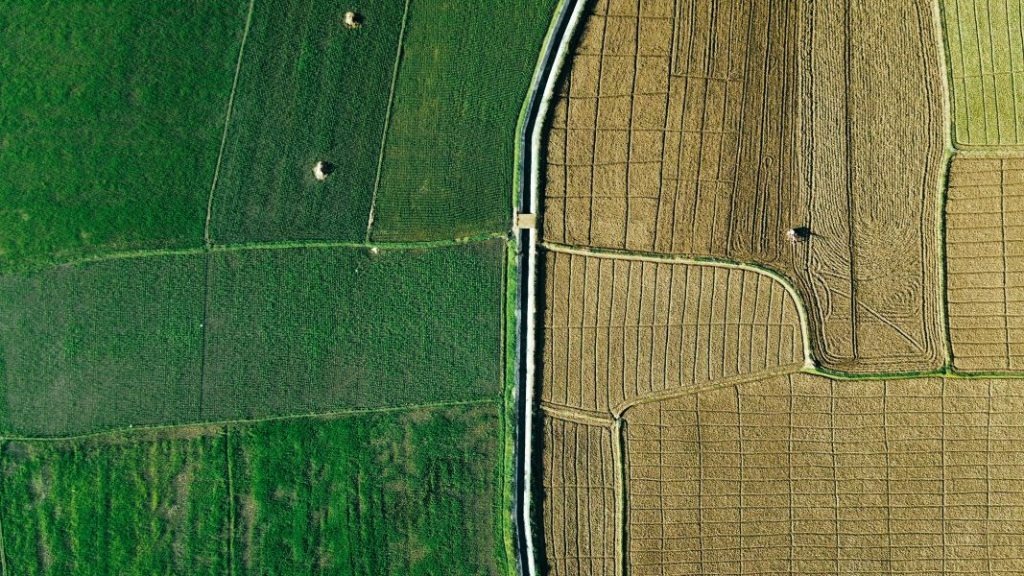
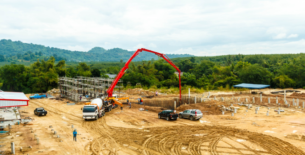
Across Buckinghamshire, PRAs are most frequently requested where development overlaps:

• Tiled and slate roof housing stock in Aylesbury, High Wycombe and Milton Keynes

• Rural conversions and estate buildings in South Bucks and the Chilterns

• Brownfield reuse and regeneration within commuter belt settlements

• Linear woodland, chalk valley systems and riparian corridors tied to the River Chess and Misbourne

Where roost potential is evident, PRAs are routinely checked before validation proceeds.

Our Bat Dusk Emergence Survey services span Buckinghamshire, from expanding settlements and Chilterns landscapes to villages, farmland and heritage estates.

Why Buckinghamshire Planning Authorities Request Preliminary Roost Assessments

Buckinghamshire planning authorities require PRAs wherever buildings, trees or structures present any credible roost potential to ensure compliance with the Wildlife & Countryside Act 1981, the Conservation of Habitats and Species Regulations 2017, and national planning policy. Without a PRA, planners cannot lawfully determine whether emergence surveys or licensing will be required. Where early evidence is missing, applications commonly face validation blocks, additional ecological conditions or forced seasonal delay.

If a Buckinghamshire project involves demolition, conversion or structural alteration, PRA evidence should be confirmed before the application reaches validation.

Local Case Insight

A Buckinghamshire property bordering green belt and hedgerow systems required roof reconstruction. A PRA confirmed no roost evidence despite low-level access features. Buckinghamshire’s planners validated the application without requesting further seasonal surveys. Early ecological design adjustments supported works to proceed without licensing.

The Preliminary Roost Assessment Process

Our Preliminary Roost Assessments in Buckinghamshire provide fully compliant reports accepted by local planning authorities. It prevents avoidable emergence delays, stabilises planning submissions and ensures that any further survey requirements are proportionate and justified.

Key Deliverables for Buckinghamshire Projects

Where bat scoping is required to unlock planning in Buckinghamshire, a PRA provides:

  • a legally defensible preliminary roost assessment report

  • confirmed classification of roost potential

  • identification of whether emergence surveys are required

  • early determination of licensing likelihood

  • documentation structured for Staffordshire LPA review

The outcome is certainty, not escalation.

Step 1

Programme & Scoping

Proposed works, construction sequence and planning feedback are reviewed to define PRA scope.

Step 2

Daytime Roost Inspection

Inspection of buildings, structures or trees for roost features and bat evidence in line with lawful survey guidance.

Step 3

Assessment

Roost potential classification and planning implications interpreted against LPA validation requirements.

Step 4

Reporting & Integration

Evidence is reported for planning submissions and coordinated with Bat Emergence Surveys or PEAs where required.

Next Steps

Need to confirm whether a Buckinghamshire property or development requires a Preliminary Roost Assessment?


Submit the site details and confirmation is provided before your application reaches validation.

FAQ - Preliminary Roost Assessments in Buckinghamshire

What is a Preliminary Roost Assessment in Buckinghamshire?

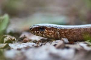
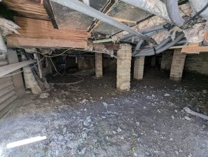
A Preliminary Roost Assessment is a daytime bat survey undertaken by a qualified ecologist to determine whether a building has potential to support roosting bats. It is commonly required to support planning applications involving roof alteration, demolition or building conversion.

Often yes. Buildings within or close to the Chiltern Hills frequently sit within active bat foraging landscapes. Roof alterations and barn conversions in these areas commonly trigger bat survey requirements.

Planning guidance for Buckinghamshire Council can be accessed at:
https://www.buckinghamshire.gov.uk/planning-and-building-control/

They can. Properties located adjacent to woodland or mature tree lines may have increased bat activity in the surrounding landscape, and structural works often require assessment.

Often yes. Stable blocks and equestrian structures commonly contain roof voids or exposed rafters suitable for bats and require inspection before demolition or redevelopment.

In many cases, yes. Demolition of an existing property as part of a replacement dwelling scheme may require bat survey information before planning approval.

Are large detached homes in commuter villages subject to PRA requirements?

They can be. Detached properties with pitched roofs and loft spaces may require bat assessment where roof structures, dormers or gable ends are altered.

Yes. Where safe access is available, the ecologist will inspect loft spaces internally and carry out a detailed external inspection of rooflines and structural junctions.

Yes. A PRA is a daytime inspection and can be carried out year round. If moderate or high roost potential is identified, further surveys may be seasonally restricted.

If moderate potential is recorded, dusk emergence or dawn re entry surveys may be recommended before works proceed.

ProHort provides professional Preliminary Roost Assessments across Buckinghamshire for homeowners and developers. Our reports are proportionate, clearly structured and aligned with local planning validation requirements to support efficient project progression.

Related Services

Preliminary Roost Assessment

Preliminary Roost Assessment (PRA) Survey

Planning-ready bat assessments for homes, conversions and development projects across England and Wales. 

Fast, clear and proportionate PRA surveys that establish roost potential, confirm planning risk, and set out a predictable route forward — with reporting written for planners, developers and homeowners.

Do you need a PRA?

For planners and developers: 
A PRA is the gateway assessment that determines the level of survey required. Submitting planning without it usually results in validation delays or seasonal postponement. 

For homeowners: 
A PRA provides clarity, prevents unexpected survey requests, and ensures work remains lawful. 

You are likely to need a Preliminary Roost Assessment if your project involves: 

  • Loft conversions or roof works 
  • Demolition of any age of building 
  • Refurbishment or re-cladding 
  • Tree works (mature trees, cracks, cavities) 
  • Extensions involving roof lines or eaves 
  • Barn conversions, agricultural buildings, outbuildings 
  • Older structures (pre-1990 are especially scrutinised) 
  • Any site where your PEA flagged roost potential 
  • Planning officers requesting a bat assessment 


a bat has been rescued in a survey

What is a Preliminary Roost Assessment (PRA)?

Preliminary Roost Assessment is the first stage of a roosting bats or nesting birds survey. It is a structured inspection of buildings, trees or structures to identify whether bats or birds could be using them. 

A roost doesn’t necessarily look like a nest. 
Bats use surprisingly small openings and often leave no visible signs at all — which is why planners require PRA evidence before demolition, roof works or redevelopment. 

The PRA determines roost potential (negligible, low, moderate or high) and whether a Dusk Emergence Survey is legally required. 

Trigger points — signs your site needs a PEA

Before development, planners will expect a PRA if any of the following apply: 

Early warning signs: 

  • lifted tiles, gaps in facias or flashing 
  • gaps along ridge lines and under roof tiles
  • cavity walls or hollow voids 
  • cracks, crevices and weathered brickwork  
  • internal signs such as droppings, staining or feeding remains 
  • mature trees with splits, hollows or peeling bark 
  • proximity to woodland, hedgerows or water  

The PRA identifies the level of risk before you commit to further surveys or design changes. 

These small details regularly trigger planning queries — a PRA resolves them early and keeps your project on-track. 

What We Deliver

We provide a robust, planning-ready PRA with clear interpretation and next steps. 

Service Purpose Outcome
Preliminary Roost Assessment (PRA) Identify bat roost or nesting bird potential in buildings/trees Negligible/Low/Moderate/High classification + clear next steps
Internal/Endoscope Inspection Check accessible features for evidence Rapid confirmation where features allow
Dusk Emergence Surveys (if required) Confirm presence/ likely absence Legally defensible results for planning
Activity Surveys Assess wider site use Data for layout, lighting, design & mitigation
Mitigation & Licensing Support If roosts are confirmed Proportionate, lawful measures aligned to your programme

Every recommendation is explained in practical terms, so you know exactly what each step means for your build schedule. 

How it Works

Our process is designed to remove friction and keep decisions moving. 

Scope & Schedule

Send the site location, timeline and project details. We confirm the exact level of survey required.

Fieldwork

PRA surveys are available year-round. Internal inspections and endoscopes used where safe and appropriate.

Reporting & Interpretation

Concise, defensible recommendations outlining next steps and programme impact.

Timing & Survey Windows

Missing the Spring emergence window normally means waiting until next year. 


We schedule early to secure your position and protect your programme

PRA Survey

Year-round

Dusk Emergence Surveys

Seasonal: May – August

Activity Surveys

May–August

Why planning officers request PEAs 

All bat roosts,  even if bats are not present, are protected under UK law. Planning authorities must request evidence where roost potential exists. 

Without a PRA, the risks include: 

  • planning refusal or validation queries 
  • enforced delays until Spring survey windows 
  • stop-work notices if roost features are found during works 
  • penalties for disturbing a roost 
  • redesign or licensing requirements 
  • increased project costs due to late discoveries 

Relevant legislation: 

  • Conservation of Habitats and Species Regulations 2017 
  • Wildlife & Countryside Act 1981 
  • National Planning Policy Framework (NPPF) 
  • Local Authority biodiversity policy 

Our commitment: 
We deliver PRA surveys to recognised UK standards, strict legal expectations, and planning-authority requirements — with reporting built for scrutiny, not just submission. 

Our Approach

We understand the scrutiny that comes with ecology and meet it with clarity, accuracy and planning-focused delivery. 

Your planning-ready report will include: 

  • Roost potential classification (negligible/low/moderate/high) 
  • Clear interpretation: what the rating means for planning 
  • Photographs, evidence and rationale 
  • reasoning behind classification 
  • Presence/likely absence results (if emergence needed) 
  • Planning-ready report 
  • Clear, actionable next steps 
  • any need for emergence surveys  
  • clear explanation of what that means for planning  
  • timelines your contractors can work around 
  • Practical, legally compliant mitigation routes 

Evidence that satisfies planning and guides project teams.

Why homeowners, planners and developers choose ProHort:

  • Nationwide capability across England and Wales 
  • Programme-led scheduling 
  • Reports designed for LPA scrutiny 
  • Straight, practical communication 
  • Specialists in development-focused ecology 
  • Transparent interpretation — no vague language 
  • High trust and high clarity, reinforced at every stage 
  • Fast-track turnaround option.

How to interpret your PRA Report

Many clients, especially homeowners, are unsure what “negligible”, “low”, “moderate” or “high” means in practice. 

Your report explains: 

  • Whether bats were present 
  • What “likely absence” means legally 
  • Whether any parts of your project can proceed now 
  • Whether timing restrictions apply 
  • Whether a licence is required (only if a roost is confirmed) 
  • How to plan works safely and legally 

We also add summaries, so you understand exactly what the outcome means for your build, budget and schedule. 

Case Insight

A semi-detached property required a loft conversion. The PRA identified low roost potential due to lifted tiles and cavity access. One dusk emergence survey in June confirmed likely absence. Planning validated immediately and the contractor proceeded without redesign or delay.

Your Next Step

Get the clarity that keeps your design on track. 

Phone: 0800 494 7479

Email: [email protected]

Areas We Cover

We cover many areas across England. Click below to find out more.

FAQ - Preliminary Roost Assessment

What is a Preliminary Roost Assessment (PRA)?

A Preliminary Roost Assessment (PRA) is an initial bat survey used to determine whether a building, structure, or tree has the potential to support roosting bats. It is typically required to support planning applications where development may affect features suitable for bats. The survey provides a risk-based assessment and confirms whether further surveys are necessary.

A PRA is usually required where works involve buildings, roof structures, trees, or other features that could support bats. Many Local Planning Authorities request a PRA as part of planning validation where there is any reasonable likelihood of bat presence, particularly on older or rural sites.

For straightforward residential properties, PRAs typically start from:

£499 + VAT

This applies to single dwellings or small outbuildings with clear access.

Larger properties, complex roof structures, multiple buildings, or restricted access are quoted individually.

The PRA fee includes:

  • External and internal inspection
  • Roost suitability assessment
  • Risk categorisation
  • Planning-ready report
  • Advice on whether further survey work is required

If emergence or activity surveys are required, these are quoted separately.

The survey involves a detailed inspection of the building or structure, including external features and accessible internal areas such as loft spaces. The ecologist will assess potential roosting features and surrounding habitat, alongside reviewing local bat records where relevant.

Yes. A PRA can be undertaken throughout the year as it is based on visual inspection and habitat assessment rather than bat activity surveys. This allows it to be completed at any stage of the planning process.

Does a PRA confirm whether bats are present?

No. A PRA assesses the potential for bats to be present rather than confirming presence or absence. If evidence is found, or the site is assessed as having suitable features, further surveys may be recommended to confirm bat activity.

If the site is assessed as having moderate or high potential for bats, additional surveys such as bat emergence or activity surveys may be required. These surveys are seasonal and are used to confirm presence, species, and roosting behaviour.

Most PRA surveys are completed within a few hours on site, depending on the size and complexity of the property. Reports are typically issued within a few working days, supporting timely planning submissions.

In most cases, a PRA helps to avoid delays by identifying potential constraints early in the process. As it can be completed year-round, it allows any further survey requirements to be identified and planned in advance.

Not all applications require a PRA, but it is commonly requested where bats could be affected. Requirements vary by Local Planning Authority and site characteristics.

Guidance can be found via:
https://www.gov.uk/guidance/protected-species-how-to-review-planning-applications

and relevant local authority planning portals.

A PRA is the first stage of bat assessment and focuses on identifying potential roosting features. A bat survey (such as an emergence survey) is a follow-on stage used to confirm bat presence, species, and behaviour where required.

Related Services

Tree Damage Survey

Tree Damage Survey

Focused assessments to confirm whether trees are causing structural, surface or drainage damage — clear evidence, measured solutions and stable decision-making. 

Damage around trees often appears suddenly: lifting surfaces, cracked walls, displaced paving or recurring drainage issues. A Tree Damage Survey identifies whether the tree is directly involved, indirectly contributing, or simply nearby. 

When damage appears, assumptions aren’t enough...

Tree-related damage is frequently misunderstood. Some symptoms look significant but are unrelated; others reveal a genuine structural interaction. A clear assessment distinguishes cosmetic issues from real risk, helping you avoid unnecessary works or delays.

What is a Tree Damage Survey?

A Tree Damage Survey investigates whether a tree is contributing to structural, surface or drainage damage by assessing: 

  • root pathways and physical root pressure 
  • proximity, species and growth characteristics 
  • soil behaviour and local ground conditions 
  • cracks, displacement and surface lifting 
  • drainage conflicts and root ingress 
  • structural context and load distribution 

The assessment provides a clear conclusion on whether tree influence is: 

confirmed, possible, or unlikely. 

Reports are suitable for planning, structural investigations, insurance queries and contractor guidance. 

Pavement cracked and lifted by tree roots, indicating subsurface root damage.

Do I need a Tree Damage Survey?

You may need a tree damage survey if you’ve seen:

  • lifting or cracked driveways or paths 
  • displaced retaining walls 
  • recurring damage to hard landscaping 
  • roots emerging at the surface 
  • drainage blockages or infiltration 
  • cracks appearing near trees or hedgerows 
  • damage raised by surveyors, planners or insurers 

A Tree Damage Survey identifies the cause and sets out proportionate next steps.

Mature tree emerging through a damaged brick wall, suggesting absent or insufficient arboricultural survey evidence from AIA assessment.

Why this matters for planning

Trees fall under planning legislation as material considerations. 
When damage occurs, LPAs require reliable evidence to determine: 

  • whether a tree is genuinely causing harm 
  • whether removal or pruning is justified 
  • whether designs need modification 
  • whether conditions should be applied 

Without clear reporting, applications may stall, trigger further questions or require design changes. 

A Tree Damage Survey includes:

A clear, practical and defensible assessment: 

  • on-site inspection of damage type and extent 
  • species identification and growth characteristics 
  • proximity assessment and root pathway analysis 
  • evaluation of soil behaviour and ground conditions 
  • cracking and displacement interpretation 
  • drainage interaction checks (where relevant) 
  • assessment of tree involvement: likely / possible / unlikely 
  • proportionate recommendations 
  • guidance for planning, engineering or contractor work 

Our Approach

Evidence-First

Diagnosis based on visible symptoms, structural context and root behaviour.

Measured Solutions

No exaggerated claims. Recommendations are aligned with real risk.

Planning Aware

Reporting structured to support planning decisions and avoid unnecessary delays.

Straight Communication

Clear explanations without technical fog.

Tree Damage Survey Process

Step Description
1. Initial Review Provide photos, site details and any previous notes.
2. Site Assessment Inspection of trees, surfaces, structures and ground conditions.
3. Diagnosis Tree involvement identified as confirmed, possible or unlikely.
4. Recommendations Options aligned to risk and project requirements.
5. Reporting A clear, planning-ready and contractor-friendly report.

Your Next Step

Need a Tree Damage Survey? Share your site details and we’ll confirm exactly what’s required. 

Phone: 0800 494 7479 
Email: [email protected] 

Areas We Cover

We cover many areas across England and Wales. Click below to find out more.

Case Note

A modern detached property showed lifting to a block-paved driveway near a mature silver birch.
Surface displacement suggested possible root pressure. Assessment confirmed shallow, fibrous roots directly beneath the paving, with no structural impact to the house. The issue was classed as a surface-level conflict. Localised root pruning and correct reinstatement of the driveway resolved the problem without tree removal.

Tree Damage Survey FAQs

What is a Tree Damage Survey?

A Tree Damage Survey is a specialist arboricultural assessment used to investigate whether trees are causing structural damage to buildings, walls, drives, or other built assets. It provides clear, evidence based conclusions on causation, supported by site inspection, tree data, and where required, soil and foundation analysis.

A Tree Damage Survey is typically required when there are signs of structural movement such as cracking, subsidence, or heave, and trees are present nearby. It is often requested by homeowners, insurers, loss adjusters, or solicitors to establish whether vegetation is contributing to the issue.

Trees can contribute to subsidence by extracting moisture from shrinkable clay soils, leading to ground movement. In some cases, direct damage can occur through root growth affecting drains, paving, or shallow foundations. A professional survey determines whether the tree is a contributing factor or not.

Proving causation requires a combination of arboricultural assessment and supporting evidence. This may include tree species identification, distance from the structure, soil type, seasonal movement patterns, and in some cases laboratory soil testing or root identification. A Tree Damage Survey brings this evidence together into a defensible conclusion.

Responsibility depends on ownership and whether negligence can be demonstrated. If a tree owner has been made aware of a risk and failed to act reasonably, liability may arise. A Tree Damage Survey provides the technical evidence needed to support or defend a claim.

You cannot automatically force removal, but if damage is proven and liability established, legal action may be taken. In many cases, issues are resolved through insurance claims or professional negotiation supported by survey evidence.

Yes, insurers often require a professional Tree Damage Survey to confirm causation before accepting or rejecting a subsidence claim. The report provides the technical justification needed to support decisions on liability and remedial action.

Costs vary depending on the complexity of the case, number of trees, and level of investigation required. As a guide, straightforward assessments typically start from around £495 plus VAT, with more detailed investigations quoted individually where specialist testing or monitoring is needed.

What does a Tree Damage Survey include?

A typical Tree Damage Survey includes a site inspection, tree identification and measurement, assessment of distance and influence, review of visible damage, and a clear professional opinion on causation. Where required, recommendations for further investigation or management are also provided.

Yes, Tree Damage Surveys are often used in legal and insurance contexts. Reports can be prepared in line with Part 35 of the Civil Procedure Rules where required, making them suitable for dispute resolution and expert witness use.

Site inspections are usually completed within a few hours depending on site size and complexity. The full report is typically issued within a few working days, although more complex cases involving testing or third party data may take longer.

Yes, where damage is proven, the survey can support applications for tree works, including works to protected trees. Applications must be submitted to the relevant Local Planning Authority, such as:
https://www.planningportal.co.uk/applications/trees

If the tree is not responsible, the report will clearly state this and may identify alternative causes such as drainage defects, construction issues, or natural settlement. This ensures decisions are based on evidence rather than assumption.

No. Cracking can occur for many reasons, including thermal movement, settlement, or structural defects. A Tree Damage Survey ensures that trees are only implicated where there is clear supporting evidence.

Yes, in some cases more than one tree may influence soil moisture levels and contribute to movement. The survey assesses the combined impact of all relevant vegetation to provide an accurate conclusion.

Related Services

Preliminary Ecological Appraisal

Preliminary Ecological Appraisal (PEA)

Planning ready ecological appraisals that identify constraints early, stabilise design and keep your project moving with clarity and control — delivered nationwide by qualified ecologists. 

Do you need a PEA?

If your project involves vegetation, buildings or ground boundaries, early ecological clarity is essential. 
Preliminary Ecological Appraisal provides it — the recognised first stage under NPPF Section 15 and CIEEM best practice. 

When completed before design lock-in, a PEA turns uncertainty into foresight. 
Each week gained here protects months later in the programme. 

What is a PEA?

A PEA establishes your ecological baselinerecording habitats, identifying protected species potential and mapping planning risk. 

Trigger points — signs your site needs a PEA

These indicators suggest your site might require more than a basic walkover and may attract LPA scrutiny:

  • vegetation clearance or landscaping 
  • alteration to roofs, barns or outbuildings 
  • hedgerow or treeline removal 
  • groundwork near ditches, scrub or rubble piles 
  • ponds or wet features on or near the site 
  • earlier advice highlighting ecological uncertainty 
  • tight programmes overlapping seasonal windows 

If any apply, acting now secures survey capacity while it’s still available. Delay it and ecology becomes the factor that dictates your timeline. 

What We Deliver

We keep guidance clear and planning-ready — supporting predictable project delivery. 

Service Purpose Outcome
Ecological Walkover Record habitats and features Solid ecological baseline
Protected Species Screening Assess realistic species risk Focused next steps
Mapping & Site Context Identify constraints and opportunities Evidence planners can trust
Survey Roadmap Outline seasonal requirements Predictable sequencing
Practical Mitigation Guidance Inform design and construction Reduced ecological and schedule risk
Integration with BNG/Design Align ecology with wider goals Cleaner design development
Reporting & Recommendations Deliver structured reasoning Planning ready evidence

How it Works

Our process is designed to remove friction and keep decisions moving. 

Scope & Project Insight

Send your boundary and proposed works. We confirm scope against policy and planning context.

Fieldwork

On-site ecological walkover using DEFRA-aligned UKHab methods.

Reporting

Concise, defensible recommendations outlining next steps and programme timing.

Each report follows CIEEM and Natural England methodology, ensuring evidence stands up anywhere in the UK. 

Timing & Survey Windows

Early instruction secures the survey window and keeps ecology off the critical path. 


That’s how project control is maintained. 

PEA Survey Season

Year-round

Follow-on Species Surveys

Seasonal

BNG integration

Year-round

Why planning officers request PEAs 

Local authorities must protect biodiversity under the Wildlife & Countryside Act 1981Habitats Regulations and NERC Act 2006. 
They rely on PEAs to confirm that risk has been identified and managed proportionately. 

For your project, this means fewer validation queries and smoother dialogue. 
A clear PEA shows you’ve anticipated compliance — not waited for enforcement. 

That foresight keeps planning predictable. 

Our Approach

Each ProHort appraisal follows CIEEM guidanceNatural England standards and UKHab classification, producing reports LPAs recognise immediately. 

It includes: 

  • ecological walkover 
  • protected species risk screening 
  • mapping and site context 
  • practical, proportionate recommendations 
  • a predictable survey roadmap 

Every PEA is built around the project, not the paperwork. We interpret each site through the lens of planning delivery, balancing ecological rigour with programme momentum. 

How this supports your project

A well-timed PEA: 

  • identifies constraints before design lock-in 
  • aligns ecology with planning milestones 
  • fulfils baseline duties under national and local policy 
  • defines survey strategy and seasonal timing early 
  • integrates seamlessly with BNG or EIA ecology 

Early clarity maintains schedule stability. Later discovery creates delay. 
This is where foresight pays off. 

Case Insight

A mixed-use scheme showed treeline habitats with moderate species potential. A PEA confirmed low bat and manageable reptile risk, defining a single targeted follow-up. No redesign, no resubmission — just evidence that satisfied validation first time. Foresight protected the schedule.

Your Next Step

Get the ecological clarity that keeps your design on track. 

Phone: 0800 494 7479

Email: [email protected]

Areas We Cover

We cover many areas across England. Click below to find out more.

PEA FAQ - Planning and Programme Clarity

How much does a Preliminary Ecological Appraisal (PEA) cost?

A compliant Preliminary Ecological Appraisal is a full planning document, not simply a site visit.

For most residential developments, fees typically start from:

£1,200 + VAT

This includes licensed ecological data searches, habitat classification, protected species risk assessment, and a planning ready technical report.

Costs increase depending on site size, habitat diversity, and overall planning complexity.

A compliant PEA involves significantly more than a walkover survey.

Professional fees reflect the full scope of work, including:

  • Purchase of licensed ecological data (typically £300–£500)
  • Review of Local Planning Authority constraints
  • Detailed habitat classification
  • Protected species risk assessment
  • Technical report preparation (typically 8+ hours of specialist drafting)
  • Professional sign off and liability

Lower cost surveys often exclude formal data searches or provide limited reporting, which can result in planning delays or requests for further information.

A Preliminary Ecological Appraisal is the first stage ecological survey used to support a planning application.

It identifies habitats on site, assesses the potential for protected species, and provides clear recommendations to inform planning decisions and determine whether further ecological surveys are required.

In most cases, yes.

Local Planning Authorities require ecological information where a site has the potential to support habitats or protected species. Without a PEA, planning applications are commonly delayed, made invalid, or refused due to insufficient ecological evidence.

A PEA includes a site walkover survey carried out by a qualified ecologist, combined with desk based data analysis.

This assesses habitats, identifies ecological constraints, and evaluates the likelihood of protected species being present. The findings are then compiled into a planning ready report.

A compliant PEA report typically includes:

  • Habitat classification
  • Ecological constraints assessment
  • Protected species risk evaluation
  • Desk study data findings
  • Clear recommendations for mitigation or further surveys

The report is structured to meet Local Planning Authority requirements and support planning validation.

How long does a Preliminary Ecological Appraisal take?

The site survey itself is usually completed within a single visit.

Reports are typically issued within a few working days, depending on site complexity and data search returns. Larger or more complex sites may require additional time for analysis and reporting.

Yes.

A Preliminary Ecological Appraisal can be undertaken year round because it focuses on habitat assessment rather than detailed species surveys.

However, if further surveys are required, these may be seasonally constrained and should be planned accordingly.

No.

A PEA assesses the likelihood of protected species being present based on habitat suitability. If potential is identified, targeted surveys such as bat surveys or great crested newt surveys will be recommended to confirm presence or likely absence.

PEA costs vary depending on:

  • Site size and layout
  • Habitat diversity
  • Number of ponds within 250m
  • Hedgerows and tree coverage
  • Number of buildings on site
  • Development scale
  • Access constraints
  • Likelihood of protected species
  • Local Planning Authority requirements

More complex or larger sites are quoted individually following an initial review.

A PEA is an initial, high level assessment used to identify ecological constraints and survey requirements.

An Ecological Impact Assessment is a more detailed study that evaluates the effects of a proposed development and outlines mitigation, compensation, and enhancement measures.

A PEA often informs whether an EcIA is required.

Most Local Planning Authorities require ecological assessments where biodiversity may be affected.

Guidance is typically set out within local validation checklists and national planning policy. Further information can be found via:
https://www.planningportal.co.uk/

Submitting a PEA alongside a planning application helps ensure compliance and reduces the risk of delays.

Related Services

Environmental Impact Assessment (EIA)

Environmental Impact Assessment (EIA)

Planning-ready ecological evidence for Environmental Impact Assessments — defensible reasoning, proportionate methods and predictable outcomes that keep large-scale projects moving across the UK. 

Do you need an EIA?

If your project meets EIA Regulations thresholds or your LPA has issued a screening opinion, you’ll need formal ecological input. 
These assessments form part of the Environmental Statement and must withstand technical scrutiny from planners, consultees and statutory bodies. 

Handled early, EIA ecology turns regulatory obligation into programme control. 
Late scoping, by contrast, triggers multi-season survey cycles and costly resubmissions. 

What is an EIA?

EIA assesses how development will affect ecological receptors, habitats, species and designated sites, through construction, operation and long-term management. 
It forms one chapter of the Environmental Statement and connects directly with other technical disciplines such as drainage, noise and landscape. 

Aerial view of boundary lines which could trigger a PEA

Trigger points — signs your site needs an EIA

These indicators suggest your site might require more than a basic walkover and may attract LPA scrutiny:

  • Schedule 1 or 2 EIA development thresholds exceeded 
  • proximity to SAC, SPA, SSSI or LWS/SINC designations 
  • large-scale habitat loss or complex receptor networks 
  • multi-phase or long-term construction activity 
  • interaction with drainage, lighting or landscape corridors 
  • potential effects on protected or notable species 
  • high public or consultee sensitivity 

If any apply, scoping now secures survey capacity and prevents multi-year programme drift. 

What We Deliver

We keep guidance clear and planning-ready — supporting predictable project delivery. 

Service Purpose Outcome
Ecological Scoping Identify receptors, constraints and survey effort Focused, proportionate EIA scope
Baseline Surveys Map habitats and species risk Solid data for significance testing
Receptor Evaluation Determine ecological importance Transparent impact reasoning
Impact Assessment Assess construction, operational and cumulative effects Defensible ecological conclusions
Mitigation Hierarchy Avoid, reduce and compensate Clear environmental control
Significance Assessment Evaluate magnitude and likelihood Evidence aligned to EIA regs
Monitoring & Management Provide long-term ecological oversight Predictable compliance
Full EIA Ecology Chapter Structure findings for submission Planning-ready ES evidence

How it Works

Our process is designed to remove friction and keep decisions moving. 

Screening & Scoping

We review your proposal, screening opinion and environmental sensitivities to define a proportionate ecology scope.

Baseline Surveys

Targeted habitat and species surveys using nationwide methods consistent with CIEEM and Natural England guidance.

Impact Assessment

Construction and operational effects evaluated with clear significance reasoning.

Reporting & Integration

We produce a concise, policy-linked ecology chapter ready for submission within the Environmental Statement.

Timing & Survey Windows

Early clarity keeps ecology off the critical path — late starts rarely recover lost time. 

EIA Survey

Year-round

Follow-on Species Surveys

Seasonal

BNG Survey

Year-round

Why planning officers request PEAs 

Under the EIA Regulations (2017 as amended), LPAs must consider ecological significance when determining major applications. Planners depend on structured, transparent evidence, compliant with legislation.

An EIA aligns with: 

  • The Town and Country Planning (Environmental Impact Assessment) Regulations 2017 (as amended) 
  • Conservation of Habitats and Species Regulations 2017 
  • Wildlife and Countryside Act 1981 
  • NERC Act 2006 (Section 41 priority species and habitats) 
  • National Planning Policy Framework (Section 15) 
  • Local plan ecology policies 

ProHort delivers consistent, regulation-ready evidence nationwide — concise enough for planners, robust enough for inquiry. 

Our Approach

We translate ecological complexity into planning certainty.

A planning-ready EIA ecology chapter includes: 

  • verified ecological baseline and mapping 
  • evaluation of key receptors and significance 
  • mitigation hierarchy and cumulative impact assessment 
  • proportionate monitoring and management proposals 
  • full integration with EIA methodology and BNG data 

Our ecologists scope proportionately, survey precisely and report concisely — aligning every recommendation to EIA procedure and programme timelines.

How this supports your project

Robust EIA ecology keeps dialogue efficient, predictable and defensible. 

A well-timed EIA delivers structured, transparent evidence that demonstrates: 

  • complete baseline data and receptor evaluation 
  • quantified impact significance and residual effects 
  • compliance with the mitigation hierarchy 
  • integration with the BNG metric and long-term management 

Starting scoping in Q1 protects survey continuity through spring, summer and autumn windows. 
Early scheduling also prevents BNG, drainage and landscape teams from competing for data dependencies. 

Case Insight

A major infrastructure scheme required full EIA ecology across multiple receptor groups. Early scoping defined survey tiers precisely, preventing the need for a second season of data. The final ecology chapter integrated seamlessly with hydrology and landscape disciplines, achieving LPA approval without resubmission. That’s how proportionate ecology protects programme certainty.

Your Next Step

Get the ecological clarity that keeps your design on track. 

Phone: 0800 494 7479

Email: [email protected]

Your Next Step

We cover many areas across England and Wales. Click below to find out more.

EIA FAQ - Planning and Programme Clarity

What is an Environmental Impact Assessment?

An Environmental Impact Assessment is a formal process used to identify, assess and manage the likely environmental effects of a proposed development before planning permission is determined.
It ensures that environmental considerations are fully understood and taken into account by the Local Planning Authority.

Yes, where a development is considered likely to have significant environmental effects under the EIA Regulations.
In these cases, an Environmental Impact Assessment is mandatory and must be submitted as part of the planning application.

An Environmental Impact Assessment is required for developments that fall within specific thresholds or are located in environmentally sensitive areas.
A Screening Opinion from the Local Planning Authority confirms whether the requirement applies to a specific site.

A Screening Opinion is a formal request submitted to the Local Planning Authority to determine whether an Environmental Impact Assessment is required.
It provides clarity at an early stage and helps avoid unnecessary delay or risk in the planning process.

The Environmental Impact Assessment process typically includes:
Screening to confirm requirement
Scoping to define assessment parameters
Baseline data collection
Impact assessment
Mitigation design
Preparation of the Environmental Statement
Review and decision making by the Local Planning Authority

Each stage ensures that environmental effects are properly considered and addressed.

Scoping defines the extent of the Environmental Impact Assessment and identifies which environmental topics require detailed assessment.
Agreeing scope early with the Local Planning Authority ensures the process is proportionate, robust and aligned with planning policy.

The Environmental Statement is the primary document produced as part of the Environmental Impact Assessment.
It includes baseline environmental conditions, assessment of likely significant effects, mitigation measures and a summary of residual impacts.

The required surveys depend on the site and development type.
Common assessments include ecology, arboriculture, landscape and visual impact, noise, air quality and water environment studies.

The scope is confirmed during the Scoping stage.

How long does an Environmental Impact Assessment take?

The timeframe depends on the complexity of the site and the surveys required.
In many cases, the process can take several months, particularly where seasonal ecological surveys are necessary to support the assessment.

No.
Most small scale developments do not require an Environmental Impact Assessment.
However, larger developments or those in sensitive locations may still trigger the requirement.

Yes.
If an Environmental Impact Assessment is required and not provided, the Local Planning Authority is likely to refuse or invalidate the application.

An Environmental Impact Assessment is based on identifying likely significant effects, applying proportionate assessment, and designing mitigation to reduce impacts.
It ensures transparency, evidence based decision making and compliance with planning policy.

An Environmental Impact Assessment demonstrates that environmental risks have been properly assessed and mitigated.
This provides confidence to planning officers and consultees and supports a robust and policy compliant planning submission.

Local Planning Authorities assess Environmental Impact Assessments based on the scale of development, environmental sensitivity and the quality of the submitted Environmental Statement.

For example, authorities such as Manchester City Council and Birmingham City Council provide guidance on validation requirements, which must be followed to ensure compliance.

The Environmental Statement is reviewed as part of the planning application and is subject to consultation with statutory bodies and the public.
The findings are taken into account by the Local Planning Authority when determining the application.

Yes.
In addition to identifying potential impacts, an Environmental Impact Assessment can highlight opportunities for environmental enhancement, including biodiversity improvements, landscape design and sustainable development measures.

Related Services

Landscape Visual Impact Assessment

Landscape & Visual Impact Assessments (LVIA)

Planning-ready LVIA assessments that clarify visual effects, reduce risk and strengthen applications for complex or sensitive sites.

Do you need an LVIA?

You’re likely to need an LVIA if your proposals alter how the landscape looks, feels or functions, especially where development may be visible from public viewpoints, heritage assets or sensitive landscapes.

What is an LVIA?

An LVIA assesses how a development alters landscape character and how it changes what people see. It evaluates landscape sensitivity, visual receptors, magnitude of change and the significance of effects — alongside proportionate mitigation to shape a more acceptable scheme.

In short: it explains what changes, for whom, and how much it matters in planning terms.

Trigger points — signs your site needs an LVIA

Common triggers include:

  • visible new development (housing, energy schemes, schools, commercial units)

  • changes to landform, levels, open space or boundary structure

  • works affecting rural–urban edges or valued views

  • infrastructure such as roads, tracks or utilities

  • solar, wind, mineral or forestry proposals

  • any proposal screened into EIA, or flagged during pre-application

If you’re unsure, share your site address — we’ll confirm the requirement within minutes.

What We Deliver

We keep guidance clear and planning-ready — supporting predictable project delivery. 

Service Purpose Outcome
LVIA Baseline Assessment Establish landscape character, features and sensitivities A clear, defensible baseline for planning decisions
Visual Impact Assessment Evaluate changes to key views and receptors Evidence of visual effects, significance and mitigation
Viewpoint Photography & Wireframes Provide accurate visual representation View-specific clarity supporting consultation and decision-making
Mitigation Strategy Reduce or offset landscape and visual effects Clear planting, boundary and design adjustments that planners can accept
LVIA Report (GLVIA3-Aligned) Provide planning-ready documentation A structured, defensible report for applications, committees or appeals
Design & Team Coordination Align LVIA with architecture, ecology, heritage and engineering A cohesive external works strategy that reduces redesign

How it Works

Our process is designed to remove friction and keep decisions moving. 

Baseline & Sensitivity Assessment

Landscape character study, visual receptor identification, viewpoint agreement and fieldwork.

Impact Assessment & Visualisation

Magnitude of change, significance testing, wireframes, ZTV, photoviewpoints, and proportionate mitigation logic.

Reporting & Planning Integration

Clear statement of effects, mitigation strategy, compliance references and integration with design team iterations.

Timing & Submission Windows

LVIAs can be undertaken year-round, but:

Photography / Visualisation

may require suitable weather, lighting and visibility

Viewpoint agreement

with the LPA can take 1–3 weeks depending on consultation

EIA Projects

often follow fixed programme sequencing, requiring LVIA early

We guide you through the most efficient route for your programme.

Why planning officers request LVIAs

Planning officers use LVIAs to make defensible decisions where proposals might affect:

  • Landscape character and settlement edges

  • Public rights of way, villages or heritage settings

  • Key views, skylines or valued landscape components

  • Tranquillity, dark skies or rural context

  • Design quality, mitigation logic and proportionality

  • EIA and cumulative-impact requirements

Local planning authorities must comply with:

  • GLVIA3 (Landscape & Visual Impact Assessment guidance)

  • National Planning Policy Framework (NPPF) — landscape & visual amenity

  • Environmental Impact Assessment Regulations — where applicable

  • Local Landscape Character Assessments

  • Local design codes and settlement-edge guidance

An LVIA provides the evidence LPAs legally need to justify their decision and defend it if challenged.

Our Approach

Landscape and visual effects shape planning outcomes more than most applicants expect. Whether you’re preparing a full planning submission, responding to pre-app feedback or coordinating design with architecture, ecology, arboriculture or drainage, a clear LVIA provides the visual reasoning that planners, consultees and communities need to make informed decisions.

Our LVIA provides:

  • Predictable planning progress

  • Clear evidence for officers, consultees and committees

  • Proportionate mitigation (not over-escalated)

  • Stronger negotiation position for settlement edges

  • Risk reduction for design teams

  • Visual clarity that improves decision-maker confidence

Our role is to clarify what’s required, why, and how to deliver an evidence-led LVIA that keeps your project moving.

Clarity reduces challenge. Proportionate evidence reduces delay.


How this supports your project

Landscape and visual issues are often identified at validation or during consultation — when design teams are already deep into layout decisions. This is common, and we manage it routinely.

Instead of treating this as a setback, our role is to:

  • Stabilise the programme

  • Clarify the level of LVIA required

  • Provide proportionate mitigation

  • Support revisions only where necessary

  • Align landscape, ecology and arboriculture to reduce further churn

Early involvement avoids redesign — but late involvement is still manageable with a clear, proportionate plan.

How does LVIA Fit into the Wider Planning Strategy?

Landscape assessments rarely sit in isolation. LVIA interacts directly with:

  • Landscape design (mitigation structure, planting logic)

  • Arboriculture (tree retention, visibility, canopy screening)

  • Ecology (habitat creation, BNG-driven planting)

  • Planning layout (orientation, levels, boundary treatment)

A good LVIA strengthens the entire external design package and reduces negotiation with planning officers.

Case Insight

A settlement-edge housing proposal in the West Midlands received a late LPA request for an LVIA after public feedback raised concerns over visual impact. The design team had progressed without considering long-distance views or character transitions. Following a baseline study, agreed viewpoints with the LPA, produced targeted mitigation planting and refined boundary treatments. The LVIA demonstrated reduced significance for key views and addressed landscape character concerns directly. The scheme advanced to committee with officer support — a delay was avoided, and no redesign beyond proportionate boundary refinement was required.

Your Next Step

Get the clarity that keeps your design on track. 

Phone: 0800 494 7479

Email: [email protected]

Areas We Cover

We cover many areas across England and Wales. Click below to find out more.

LVIA - FAQ

What is a Landscape and Visual Impact Assessment LVIA?

A Landscape and Visual Impact Assessment LVIA is a detailed study that evaluates how a proposed development may affect the surrounding landscape and how it will be seen from different viewpoints. It considers both the physical changes to the landscape and how those changes are perceived by people.

An LVIA is typically required where a development may have a noticeable effect on the landscape or visual character of an area. This is common for larger schemes, developments in sensitive locations, or sites within designated areas such as Areas of Outstanding Natural Beauty. Requirements are usually set by the Local Planning Authority during validation or pre application advice.

Landscape effects relate to changes to the physical characteristics of the land such as landform, vegetation, and character. Visual effects focus on how those changes are experienced by people, including views from homes, public rights of way, and roads.

An LVIA typically includes a baseline assessment of the existing landscape, identification of key viewpoints, assessment of potential impacts, and proposed mitigation measures. It also includes visual representations such as photomontages to demonstrate how the development may appear once completed.

Viewpoints are specific locations selected to represent how a development may be seen from different areas. These can include public footpaths, nearby residential properties, roads, and elevated positions. They are agreed with the Local Planning Authority to ensure the assessment is robust and relevant.

The significance of impact is assessed by combining the sensitivity of the landscape or receptor with the magnitude of change caused by the development. This structured approach ensures a clear and transparent evaluation aligned with recognised guidance.

LVIAs are carried out in accordance with recognised industry guidance, primarily the Guidelines for Landscape and Visual Impact Assessment third edition. This ensures consistency, transparency, and acceptance by planning authorities.

Can an LVIA support a planning application?

Yes, an LVIA is often a key supporting document within a planning application. It helps demonstrate that landscape and visual effects have been properly considered and that appropriate design and mitigation measures are in place.

A Landscape Appraisal is typically a simpler, less detailed assessment used for smaller or less sensitive developments. An LVIA is more comprehensive and is usually required for larger schemes or where there is potential for significant landscape or visual effects.

An LVIA can directly inform the design of a development by identifying opportunities to reduce visual impact. This may include adjusting layout, building heights, materials, or incorporating planting and screening to better integrate the scheme into the surrounding landscape.

Mitigation refers to measures proposed to avoid, reduce, or offset adverse landscape and visual effects. This can include planting schemes, landform changes, screening, or sensitive design approaches that help the development blend into its surroundings.

Local Planning Authorities use an LVIA to assess whether a development is acceptable in landscape and visual terms. It forms part of the decision making process and helps determine whether proposals align with local and national planning policy. For example, requirements may vary depending on the authority, such as Staffordshire County Council
https://www.staffordshire.gov.uk

An LVIA can form part of a wider Environmental Impact Assessment where required. In these cases, it contributes to the Environmental Statement and provides a detailed assessment of landscape and visual effects alongside other environmental topics.

LVIAs are commonly required for residential developments, commercial schemes, infrastructure projects, renewable energy proposals, and developments within sensitive or designated landscapes. The need depends on scale, location, and potential visibility.

Related Services

LVIA frequently integrates with other ProHort services:

These connections create a unified, planning-first approach and reduce the risk of conflicting recommendations.

Tree Health Survey

Tree Health Surveys

Focused assessments that identify structural, physiological or safety issues in trees — practical evidence for planning, management and risk-based decisions. 

Declining trees can create uncertainty: reduced vitality, deadwood, cavities, fungal fruiting bodies or changes in canopy structure. A Tree Health Survey provides clear, proportionate guidance on condition, risk and appropriate management. 

Healthy or not, trees change and clarity keeps sites safe...

Tree condition shifts quietly over time. Some issues are cosmetic; others need attention. 

A structured health assessment explains what’s happening, how serious it is and what management is appropriate. 

What is a Tree Health Survey?

A Tree Health Survey evaluates the structural and physiological condition of a tree by assessing: 

  • vitality, crown density and canopy structure 
  • stem, branch and root condition 
  • presence of decay, cavities or fungal indicators 
  • pest and disease symptoms 
  • structural defects and load distribution 
  • potential failure points 
  • surrounding context and site use 

The outcome is a clear picture of current health, foreseeable risk and recommended maintenance. 

Reports can be tailored for planning, safety management, insurers, landowners and estates. 

Tree split in half with a major stem failure, indicating the need for an urgent tree health and condition survey.

Do I need a Tree Health Survey?

You may need one if you’ve noticed: 

  • declining leaf density or early leaf drop 
  • branches dying back or hanging limbs 
  • cavities or fungi at the base or stem 
  • cracks, splits or included unions 
  • unusually heavy leaning 
  • storm damage or recent instability 
  • concerns raised by contractors, neighbours or planners 

A Tree Health Survey provides clear, risk-based recommendations. 

Group of mature, old trees likely to be protected under a Tree Preservation Order (TPO).

Our Approach

Condition Focused

Assessment grounded in visible symptoms and structural behaviour.

Risk Appropriate

Recommendations aligned to actual defect significance.

Planning Aware

Clear evidence for retention, pruning or justified removal.

Technically Clear

Plain-English explanations of defects and impacts.

What We Deliver

Step Description
1. Initial Review Provide photos, site details and any previous notes.
2. On-Site Assessment Inspection of the tree’s structure, vitality, rooting environment and surroundings.
3. Diagnosis Defects and health indicators interpreted within industry standards.
4. Recommendations Options for maintenance, monitoring or further investigation.
5. Reporting A clear, planning-compatible and contractor-friendly report.

Why this matters for planning

Tree health influences planning decisions under the Town & Country Planning Act 1990. 


LPAs may request evidence to understand: 

  • whether a tree is safe to retain 
  • whether removal or reduction is justified 
  • how condition interacts with site layout 
  • whether protection measures are required 

Unclear condition assessments can lead to delays, queries or revised designs. 

A Tree Health Survey includes:

A clear, practical assessment of tree condition: 

  • vitality and canopy assessment 
  • structural inspection of stem, branches and unions 
  • evaluation of decay, cavities and fungal indicators 
  • root condition and rooting environment 
  • pest and disease identification (where applicable) 
  • risk rating based on defect significance 
  • recommended maintenance or monitoring 
  • suitability for retention in planning contexts 
  • safety guidance for landowners and contractors 

Your Next Step

Need an invertebrate survey? We’ll confirm what’s required and align survey windows with your programme.

Phone: 0800 494 7479 
Email: [email protected] 

Areas We Cover

We cover many areas across England and Wales. Click below to find out more.

Case Note

A mature oak showed progressive dieback along one side of the canopy, raising safety concerns near a public footpath.
Inspection found a significant cavity at the lower stem and a fungal fruiting body indicating internal decay. Load distribution and site context were evaluated, and the cavity was assessed as structurally significant. Target-based risk assessment supported staged reduction rather than full removal, retaining the tree while managing risk appropriately.

Tree Health Survey FAQs

What is a Tree Health Survey?

A Tree Health Survey is a professional inspection carried out by a qualified arboriculturist to assess the condition, safety and long term viability of trees. It identifies structural defects, disease, decay and environmental stress, and provides clear recommendations for management or remedial works.

A Tree Health Survey is typically required where there are concerns about tree safety, visible decline, storm damage, or when trees are located near buildings, highways or development sites. It is also commonly requested by insurers, landowners and local planning authorities.

A standard Tree Health Survey includes:

  • Visual Tree Assessment of structure and vitality
  • Identification of pests, diseases and decay
  • Assessment of structural stability and risk
  • Recommendations for pruning, removal or monitoring
  • A written report suitable for planning or insurance purposes

Tree health is assessed through a Visual Tree Assessment combined with professional judgement. This includes examining the crown, stem and root area, looking for signs such as dieback, fungal fruiting bodies, cavities, poor leaf growth and structural defects.

Typical warning signs include:

  • Dead or dying branches
  • Sparse or discoloured leaves
  • Cracks or cavities in the trunk
  • Fungal growth around the base
  • Leaning or root plate movement

Early identification allows for proactive management before safety becomes an issue.

Yes. A Tree Health Survey can identify visible signs of disease and decay, such as fungal infections, bacterial issues and pest infestations. Where required, further specialist testing or laboratory analysis can be recommended.

The duration depends on the number of trees and site complexity. A small residential survey may take one to two hours, while larger sites or estates may require a full day or more, followed by detailed report preparation.

Will I receive a report after the survey?

Yes. You will receive a clear, professional report outlining findings, risk levels and recommendations. Reports are suitable for submission to planners, insurers or for general land management decisions.

Not always, but it is often requested where trees may pose a constraint or risk. Local Planning Authorities may require supporting arboricultural information, particularly where trees are protected or may be impacted by development. You can check specific requirements via your local authority, for example:
https://www.planningportal.co.uk/

Yes. One of the key outcomes of a Tree Health Survey is to assess risk. The survey identifies structural weaknesses, likelihood of failure and potential targets, allowing informed decisions on whether a tree is safe, requires work, or should be removed.

As a general guide, trees in high use areas should be inspected every one to three years, or sooner if there are visible changes, extreme weather events or ongoing concerns about safety.

A Tree Health Survey focuses on condition, safety and management of existing trees. Planning reports, such as Arboricultural Impact Assessments, assess how development affects trees. While there is some overlap, they serve different purposes and should not be used interchangeably.

Yes. Tree Health Surveys can be carried out throughout the year. However, certain conditions such as leaf cover or seasonal growth may influence how some issues are identified, and this is taken into account during assessment.

If a tree is identified as posing a risk, clear recommendations will be provided. This may include pruning, further investigation or removal. Where trees are protected, appropriate permissions from the Local Planning Authority will be required before any work is carried out.

Related Services

Arboricultural Impact Assessment

Arboricultural Impact Assessment (AIA)

Planning-ready BS 5837 assessments that identify how your development interacts with trees — clear constraints, practical mitigation and predictable outcomes. 

Designs evolve, layouts shift and tree constraints become clearer with every stage. An AIA gives planners and design teams the exact evidence they need to progress without unnecessary redesigns or delays. 

Design meets trees — and certainty keeps projects moving

Conflicts with root protection areas, shading, overhang or retention categories can stall progress at the wrong moment. 
A focused AIA shows how your layout interacts with every relevant tree and sets out reasonable, proportionate solutions. 

What is an Arboricultural Impact Assessment (AIA)?

An AIA evaluates how a proposed development affects trees on and around the site. 
Under BS 5837, it assesses: 

  • root protection areas (RPAs) 
  • above-ground constraints (crown spread, shading, future pressure) 
  • retention categories 
  • construction impact and design conflicts 
  • access, storage and working areas 
  • tree retention feasibility 
  • required mitigation 

The result is a clear, planning-ready assessment showing how tree constraints have been considered and managed. 

Mature tree emerging through a damaged brick wall, suggesting absent or insufficient arboricultural survey evidence from AIA assessment.

The AIA Process

Step Description
1. Initial Review Share the layout, site plan and any existing survey data.
2. Site Survey Assessment of tree condition, RPAs, crown spread and constraints.
3. Impact Assessment Evaluation of design conflicts and retention feasibility.
4. Mitigation Strategy Foundation advice, protection measures and design adjustments (if needed).
5. Reporting A clear, BS 5837-compliant report ready for submission.

We keep guidance clear and planning-ready — supporting predictable project delivery. 

Our Approach

Practical Mitigation

Foundation options, construction routes and protection measures built around real site conditions.

Design Aligned

Clear explanations of how tree constraints interact with the proposal.

Planning Led

Reports structured for direct LPA interpretation

Technical Clarity

Evidence presented cleanly, without ambiguity.

Do I Need an AIA?

You may need an AIA if: 

  • your layout falls within any RPA 
  • access routes pass near trees 
  • designs include new hard surfaces, levels changes or foundations close to trees 
  • shading or overhang affects proposed rooms or gardens 
  • you’re planning new utilities, drainage or service runs 
  • planners request BS 5837 evidence 
  • your architect highlights tree constraints 
  • your PEA has already flagged arboricultural considerations 

An AIA clarifies design impacts and prevents late-stage planning queries. 

Why this Matters for Planning

Tree constraints are a formal material consideration under the Town & Country Planning Act 1990 and BS 5837. 
LPAs expect: 

  • clear mapping of constraints 
  • justification for removals 
  • practical mitigation where conflicts occur 
  • predictable construction methodology 
  • retention aligned with site use and long-term pressure 

Weak evidence leads to validation delays, redesign requests or planning conditions tied to tree protection. 


Case Note

A proposed rear extension conflicted with the Root Protection Area of a mature sycamore. Initial designs placed new foundations within the RPA. Impact assessment showed feasible retention using a reduced-dig foundation and a revised service route. A TPP supported the updated design, and planning progressed without further tree-related queries.

Your Next Step

Need an Arboricultural Impact Assessment? We’ll confirm what’s required and align survey windows with your programme.

Phone: 0800 494 7479 
Email: [email protected] 

Areas We Cover

We cover many areas across England and Wales. Click below to find out more.

AIA Survey FAQs

What is an Arboricultural Impact Assessment AIA?

An Arboricultural Impact Assessment AIA is a planning document that evaluates how a proposed development may affect trees on or near a site. It identifies potential impacts on tree health, structure, and root protection areas, and sets out measures to avoid or mitigate harm in line with planning policy and British Standards.

An AIA is typically required when trees are present on or adjacent to a development site and may be affected by construction. Local Planning Authorities often request an AIA to support planning applications where tree constraints are identified.

A compliant AIA usually includes:
• Tree survey data in accordance with BS5837
• Tree categorisation and constraints plan
• Assessment of development impacts
• Root Protection Area analysis
• Arboricultural Method Statement where required
• Tree Protection Plan for construction

This ensures the report is suitable for planning submission and validation.

A tree survey records and categorises trees on site, while an Arboricultural Impact Assessment builds on that data to assess how a proposed development will affect those trees. The AIA is a planning document, not just a survey.

AIAs are carried out in accordance with BS5837:2012 Trees in relation to design, demolition and construction. This standard provides guidance on how trees should be surveyed, assessed, and protected during development.

An AIA demonstrates to the Local Planning Authority that tree constraints have been properly considered and addressed. It helps ensure development proposals are sustainable, policy compliant, and less likely to be delayed or refused due to arboricultural concerns.

Yes. A well prepared AIA can influence site layout and design to retain high value trees where possible. It identifies constraints early, allowing adjustments that reduce the need for unnecessary tree removal.

If an AIA is required but not submitted, the planning application may be invalidated or refused. Incomplete arboricultural information is a common reason for delays in planning decisions.

How long does an Arboricultural Impact Assessment take?

Timeframes depend on site size and complexity. For most residential developments, site surveys and reporting can typically be completed within a few days to a couple of weeks. Larger or more complex sites may require longer.

Costs vary depending on site size, tree numbers, and development complexity. AIA reports are planning ready technical documents and include survey work, analysis, and report preparation. Fees are confirmed following a review of the site and project requirements.

Even small developments may require an AIA if trees are present and could be affected. Requirements are set by the Local Planning Authority, so it is important to check local validation criteria.

Yes. Each authority has its own validation requirements. For example, you can review tree and planning guidance via your Local Planning Authority such as
https://www.staffordshire.gov.uk
to understand local expectations for arboricultural reports.

The Root Protection Area is the minimum area around a tree that must be protected to ensure its survival. An AIA assesses how development interacts with this area and sets out protection measures to prevent damage during construction.

Yes, provided the recommendations within the AIA and any associated Arboricultural Method Statement are followed. These outline how works can proceed safely without damaging retained trees.

An AIA should be prepared by a qualified arboricultural consultant with experience in planning and BS5837 assessments. This ensures the report is technically robust and accepted by Local Planning Authorities.

Related Services

Ecological Clerk of Works (ECoW)

Ecological Clerk of Works (ECoW)

Active ecological oversight during construction, keeping your site compliant, protected and moving when ecology is a live planning risk. 

Do You Need an Ecological Clerk of Works?

Whether your site is live or about to start, if ecological conditions, licences or method statements apply, an Ecological Clerk of Works can provide on-site ecological support throughout the construction process. 

Once construction begins, ecological risk becomes immediate. An ECoW exists to manage that risk in real time, so your programme does not stall due to avoidable legal or planning breaches. 

Where surveys and reports set the rules, an ECoW makes sure those rules are applied correctly on site. 

Our Approach

Active On-site Risk Control

Immediate ecological decision-making during works.

Clear Compliance Oversight

Alignment with planning conditions, licences and RAMS.

Contractor-level clarity

Advice site teams can act on instantly.

Integrated close-out reporting

Clean handover into condition discharge and regulator review.

ECoW Support Structured Around Your Programme

Ecological Support

We review ecological controls before works begin so site teams know exactly what applies, when, and why. 

This typically includes: 

  • Reviewing CEMP / CEMP-ECO documents 
  • Reviewing method statements and RAMS 
  • Advising on timing constraints such as nesting birds or seasonal species windows 
  • Carrying out pre-commencement checks (for example nesting birds, badgers or reptiles) 
  • Briefing site managers on ecological constraints before mobilisation 

Outcome: fewer first-week stoppages and no reactive redesign. 

Ecological Oversight

Ecological oversight is available while work is happening, not after problems arise. During construction, the ECoW provides active, on-site ecological control. 

Support may include: 

  • Watching briefs during vegetation clearance 
  • Oversight of tree felling, demolition or groundworks 
  • Toolbox talks for contractors 
  • On-site advice when unexpected ecological issues arise 
  • Immediate intervention where there is a legal or licence risk 

Outcome: risks handled immediately, without escalation. 

Compliance and Reporting 

After works, the ECoW supports condition discharge and record keeping with evidence planners can rely on. 

This may involve: 

  • Preparing compliance or completion reports 
  • Confirming mitigation has been delivered correctly 
  • Liaising with planners, consultants and regulators 
  • Updating as-built mitigation information 

Outcome: smoother discharge of conditions and fewer late queries.

Why Appoint an ECoW?

Risk control. 

  • A single ecological breach can halt a site 
  • Enforcement action is costly and public 
  • Delays compound quickly once works stop 
  • Councils increasingly expect ECoW presence on medium to large schemes 

An ECoW prevents small issues from becoming legal problems. 

Mini Builders suggestive of an ECoW overlooking the site

Case Insight

A mixed-use development required ecological supervision during vegetation clearance and early groundworks due to protected species mitigation conditions. During site preparation, previously unidentified nesting activity was discovered within retained boundary vegetation. Ecological Clerk of Works support allowed works to pause locally, mitigation to be adjusted, and unaffected areas to continue without programme-wide delay. Toolbox talks clarified updated working methods, and compliance evidence was recorded for condition discharge. The site progressed through construction without enforcement action, redesign, or additional planning intervention.

Your Next Step

If your site is live — or about to start — ecological risk needs active control. 

 
We’ll confirm whether ECoW input is required and scope it proportionately from the outset. 

Phone: 0800 494 7479 
Email: [email protected] 

Areas We Cover

We cover many areas across England. Click below to find out more.

Ecological Clerk of Works (ECoW) - FAQs

What is an Ecological Clerk of Works (ECoW)?

An Ecological Clerk of Works is a qualified ecologist appointed to oversee construction activities and ensure that all ecological requirements set out in planning conditions, mitigation strategies, and environmental reports are properly implemented on site.

ECoW support bridges the gap between planning approval and construction, ensuring compliance is delivered in practice, not just on paper.

An ECoW is typically required where ecological planning conditions have been attached to a development.

This commonly includes:

  • Protected species mitigation such as bats, great crested newts, or reptiles
  • Habitat protection measures
  • Vegetation clearance restrictions
  • Biodiversity Net Gain delivery requirements

Local Planning Authorities will often specify ECoW supervision within decision notices or ecological reports.

The role of an ECoW is to supervise works and ensure ecological protection measures are correctly followed during construction.

This typically includes:

  • Toolbox talks for site teams
  • Supervision of vegetation clearance
  • Watching briefs during sensitive works
  • Installation of ecological protection fencing
  • Ensuring compliance with method statements and licences

The ECoW acts as an independent safeguard to prevent ecological harm and planning breaches.

Ecological surveys such as PEAs or PRAs inform planning decisions.

An ECoW operates after planning approval, during the construction phase, to ensure those survey recommendations and mitigation measures are properly implemented.

In simple terms:

  • Surveys assess risk
  • ECoW ensures compliance

An ECoW is not a standalone legal requirement, but it becomes mandatory where it is specified within planning conditions, ecological reports, or protected species licences.

Failure to comply with these requirements can lead to:

  • Planning enforcement action
  • Delays to construction
  • Legal breaches relating to protected species

An ecological watching brief is a form of ECoW supervision where an ecologist is present during specific high risk construction activities.

This may include:

  • Site clearance
  • Excavation works
  • Demolition of structures with ecological potential

The purpose is to monitor works in real time and respond immediately if ecological issues arise.

In many cases, yes.

Even small developments may require ECoW supervision where:

  • There is potential for protected species
  • Vegetation clearance is conditioned
  • Ecological mitigation has been approved

The requirement is based on ecological risk, not just site size.

What happens if ECoW supervision is not followed?

Failure to implement ECoW supervision where required can result in serious consequences.

These may include:

  • Stop notices from the Local Planning Authority
  • Breach of planning conditions
  • Offences under wildlife legislation
  • Project delays and increased costs

Engaging an ECoW ensures compliance is managed proactively rather than reactively.

ECoW input is typically scheduled around key construction stages.

This may include:

  • Pre commencement toolbox talks
  • Supervised site clearance
  • Ongoing monitoring visits
  • Final compliance checks

The level of involvement depends on the ecological sensitivity of the site and planning requirements.

Yes. An ECoW will usually provide site records and compliance reporting to demonstrate that ecological requirements have been met.

This may include:

  • Supervision notes
  • Photographic evidence
  • Compliance summaries for planners
  • Input into condition discharge

These records are often required by Local Planning Authorities to confirm that works have been carried out correctly.

The developer or client typically appoints the ECoW, often following recommendations within ecological reports submitted at planning stage.

The ECoW must be suitably qualified and experienced to ensure credibility with planners and regulators.

Local Planning Authorities enforce ECoW requirements through planning conditions and compliance checks.

For example, guidance from authorities such as
https://www.planningportal.co.uk/
and individual council validation requirements will often specify ecological supervision where necessary.

Failure to meet these conditions can prevent discharge of planning conditions and delay project completion.

An ECoW should be a professional ecologist with:

  • Relevant academic qualifications in ecology or environmental science
  • Experience in construction site supervision
  • Knowledge of UK wildlife legislation
  • Protected species licences where required

This ensures decisions on site are both legally compliant and technically robust.

Yes, in many cases.

Where Biodiversity Net Gain measures are being implemented on site, an ECoW may:

  • Oversee habitat creation
  • Monitor installation of ecological features
  • Ensure compliance with approved biodiversity strategies

This supports successful delivery of ecological enhancements alongside development.

Related Services

Tree Subsidence Reports

Subsidence Reports

Clear, defensible assessments for tree-related structural movement — built for insurers, engineers and homeowners who need stable, evidence-based decisions. 

Small cracks create big questions. Insurers request evidence, engineers need clarity, and uncertainty slows everything. A focused subsidence assessment identifies what’s happening and how to proceed without unnecessary cost. 

When movement appears, you need certainty early…

Subsidence ties together soils, foundations and nearby trees. 
It feels complex when viewed in isolation. 

A structured assessment sets out the facts, reduces assumptions and helps you act with confidence. 

What is a Subsidence Report?

A Subsidence Report evaluates whether nearby trees are influencing structural movement by assessing: 

  • crack patterns and structural symptoms 
  • moisture behaviour in shrink–swell soils 
  • root pathways and likelihood of root presence 
  • species-specific water demand 
  • proximity, foundation depth and loading context 
  • seasonal patterns of movement 

The outcome is a clear conclusion: tree involvement confirmed, possible, or unlikely. 

Reports are structured for acceptance by insurers, planners and engineers. 

Tree roots exposed in an externally cracked wall, suggesting potential subsidence and the need for a Tree Subsidence Report.

Do I need a Subsidence Report?

You may need one if you’ve noticed: 

  • diagonal or stepped cracking 
  • gaps forming at junctions or extensions 
  • movement that worsens in dry months 
  • mature trees positioned close to foundations 
  • driveways or patios repeatedly lifting or dipping 
  • queries raised by insurers, surveyors or planners 

A subsidence report provides the evidence required to make safe, proportionate decisions. 

Why this matters for planning:

Trees sit within planning legislation as a material consideration. 

When structural movement occurs near vegetation, LPAs require reliable evidence to determine: 

  • whether a tree poses a genuine risk 
  • whether removal or retention is justified 
  • whether designs need adjustment 
  • whether conditions should be applied 

Without clear information, planners may pause validation, request additional reports or require updated designs. 

What your Subsidence Report includes

A clear, defensible assessment covering: 

  • crack pattern interpretation 
  • structural and site context 
  • species identification and moisture demand 
  • proximity and likely root pathways 
  • local soil behaviour and shrink–swell risk 
  • root presence indicators (where observable) 
  • whether tree influence is likely, possible or unlikely 
  • proportionate mitigation or monitoring options 

Where these occur, planning applications without evidence frequently receive validation queries, requests for additional surveys or time-sensitive conditions. 

theo-braddock-sbP8GuHRFAI-unsplash

Our Approach

Evidence Focused

Diagnosis grounded in structural, soil and arboricultural data.

Measured Recommendations

Actions aligned to risk, not assumption.

Planning Compatible

Evidence presented clearly for planning decisions.

The Subsidence Assessment Process

Step Description
1. Initial Review Send photographs, site details and any existing reports.
2. Site Visit Assessment of trees, soil indicators, foundations and cracking.
3. Diagnosis Tree involvement confirmed, possible or unlikely.
4. Recommendations Balanced options matched to risk level.
5. Reporting A clear, defensible report suitable for planning, insurance or engineering decisions.

Your Next Step

Need a Subsidence Report? Share your site details and we’ll confirm the level of assessment required.

Phone: 0800 494 7479 
Email: [email protected] 

Areas We Cover

We cover many areas across England and Wales. Click below to find out more.

Case Note

A 1930s semi-detached home on clay soil showed diagonal cracking along the flank wall.
A mature beech stood roughly 5 metres away, and the insurer queried potential tree involvement.
Crack patterns were inconsistent with moisture-driven movement, and soil indicators pointed toward a drainage issue.
Root influence was assessed as low-likelihood. Repairs focused on drainage correction, the tree was retained, and the homeowner avoided unnecessary structural works.

Subsidence Survey FAQs

What is a tree subsidence report?

A tree subsidence report is a detailed, planning and insurance ready document that assesses whether trees are influencing soil movement and contributing to structural damage. It combines arboricultural evidence with site conditions to establish causation, risk, and appropriate management recommendations.

Tree related subsidence is most commonly caused by moisture extraction from shrinkable clay soils. As trees draw water from the ground, the soil can contract, leading to downward movement that affects foundations, particularly in dry periods.

Typical indicators include cracking to walls, sticking doors or windows, and uneven floors. However, confirming whether a tree is the cause requires professional investigation, including soil type, proximity, species, and seasonal movement patterns.

Yes, in many cases insurers will require a professional arboricultural assessment to support or dispute a subsidence claim. A robust report provides evidence on whether vegetation is a contributing factor and informs appropriate mitigation.

Yes, but the solution depends on the cause and severity. Options may include tree management such as pruning or removal, combined with structural repairs. A tree subsidence report ensures that any action taken is proportionate and evidence based.

Not always. In some cases, removing a tree can lead to soil rehydration and ground heave, which can also damage structures. A professional report assesses both subsidence and heave risk before recommending any works.

Which tree species are most likely to cause subsidence?

High water demand species such as willow, poplar, oak, and plane are more commonly associated with subsidence, particularly when located close to buildings on clay soils. However, risk is site specific and must be assessed holistically.

If a tree is protected by a Tree Preservation Order or located within a conservation area, you will need consent from your Local Planning Authority before carrying out works. You can check with your local council here:
https://www.gov.uk/guidance/tree-preservation-orders-and-trees-in-conservation-areas

A subsidence report can support your application by providing clear technical justification.

Tree subsidence reports should be prepared by qualified arboricultural consultants with experience in structural damage investigations. This ensures the findings are credible for planning, insurance, and legal purposes.

A site visit is typically completed within a few hours, depending on site complexity. The full report is usually issued within a few days, allowing for detailed analysis, evidence review, and professional recommendations.

Yes, but subsidence can affect property value and mortgageability. A clear, professional report helps demonstrate the cause, extent, and resolution strategy, which is often required by lenders and surveyors.

A typical report includes:

  • Site inspection findings
  • Tree identification and influence assessment
  • Soil and geological context
  • Damage analysis
  • Risk evaluation
  • Evidence based recommendations

This ensures the report is suitable for planning, insurance, and legal use.

Related Services

---