Protected Species Surveys

Protected Species Surveys

Development certainty begins with protected species clarity.


If protected species are likely, survey timing and licensing requirements must be addressed before planning decisions are secured. Managed early, these constraints become structured milestones — not unexpected barriers.

We define the appropriate survey scope, seasonal requirements and any licensing pathway at the outset, aligning evidence with local authority expectations and your wider scheme. The result is compliant, predictable progress and planning decisions supported at first submission.

Which Survey Do I Need?

A Quick Guide

Different species carry different survey windows and licensing requirements. Identifying the correct survey early protects both planning strategy and programme timing.

Use the guide below to identify which protected species survey may apply to your proposal.

Badger Surveys

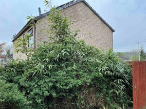
When: scrub, woodland edges, or embankments show sett signs.

Purpose: identify sett activity, territory use and protection requirements.

Timing: most of the year (avoid sett disturbance Feb–June); year-round for scoping (PEA).

Great Crested Newt (GCN) Surveys

When: ponds, ditches or wetlands occur within 250m of proposed works.

Purpose: assess breeding presence, terrestrial use and mitigation needs.

Timing: mid-March–June (eDNA April–June; traditional surveys mid-April–June); year-round for scoping (PEA).

Reptile Surveys

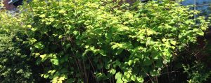
When: rough grassland, brownfield, or sunny scrub provides potential habitat.

Purpose: record presence, population and define proportionate mitigation.

Timing: April–September (weather-dependent); year-round for scoping (PEA).

Bird Surveys

When: vegetation clearance, tree works or demolition overlaps nesting season.

Purpose: confirm nesting activity, inform timing and avoid offence under the Wildlife & Countryside Act.

Timing: nesting activity March–August; year-round for scoping (PEA)

Invertebrate Surveys

When:brownfield mosaics, meadows or wetlands may host notable assemblages.

Purpose: evaluate habitat structure and invertebrate value for BNG and planning.

Timing: May–September (weather-dependent; early scoping reduces BNG risk on high-distinctiveness sites); year-round for scoping (PEA).

Your Next Step

Provide your site details and we will structure the appropriate survey and licensing pathway from the outset.

Protected Species Survey FAQs

What is a protected species in UK planning?

A protected species in UK planning is a plant or animal safeguarded under wildlife legislation. It is unlawful to harm, disturb or damage certain species or their habitats without appropriate survey evidence and, where required, a licence. Planning consent must demonstrate lawful compliance before development begins.

You may need a protected species survey where development could affect habitats used by bats, great crested newts, badgers, breeding birds or reptiles. Local planning authorities require proportionate ecological evidence before determining applications. Identifying survey requirements early allows timing and licensing to be integrated into the programme.

Protected species surveys are required before planning determination where species are likely to be present. Each species has defined seasonal survey windows. Missing these windows can delay submission by several months, which is why early ecological review is critical.

If protected species such as bats, newts or badgers are confirmed, development can usually proceed with appropriate mitigation or licensing. This may include timing restrictions, habitat protection, ecological supervision or species relocation under licence. Addressed early, these measures are structured into the programme rather than imposed unexpectedly.

Yes. In most cases development can proceed lawfully where bats or great crested newts are present, provided survey evidence, mitigation design and any required licence are secured. The focus is structured compliance, not prevention of development.

What is a protected species licence?

A protected species licence permits activities that would otherwise be unlawful, such as disturbing a bat roost or relocating great crested newts. Licences are issued by the statutory authority and require robust survey data and detailed mitigation proposals. Licensing follows confirmed impact — it does not replace survey work.

Most wild birds are legally protected, particularly during the nesting season. It is unlawful to damage or disturb active nests. Breeding bird surveys confirm whether vegetation clearance or demolition can proceed lawfully and at the appropriate time.

Survey validity depends on species and site conditions. Many protected species surveys remain valid for up to two years, provided habitat conditions have not materially changed. Planning authorities may request updates if circumstances differ from the original assessment.

A protected species is safeguarded by law under UK legislation. An endangered species refers to conservation status and does not automatically determine planning requirements. Planning decisions are based on legal protection rather than conservation ranking alone.

Early protected species assessment confirms survey scope, seasonal timing and any licensing requirements before planning submission. This protects programme certainty, supports lawful development and reduces the risk of avoidable delay.

Tree Surveys for Mortgages and Insurance Purposes

Mortgage & Insurance Tree Reports

Clear, defensible tree reports for lenders and insurers — focused assessments that confirm risk, condition and whether intervention is needed. 

Property purchases and insurance queries often raise questions about nearby trees. A Mortgage or Insurance Tree Report provides the evidence lenders and insurers need and gives homeowners a straightforward, proportionate understanding of any real risk. 

When lenders or insurers raise questions, clarity avoids delays

Concerns about tree proximity, size or potential movement can stall a mortgage offer or complicate an insurance claim. 
A focused assessment shows whether the tree poses low risk, manageable risk or requires further action — keeping the process moving. 

What is a Mortgage & Insurance Tree Report?

A Mortgage & Insurance Tree Report evaluates whether trees pose a risk to: 

  • buildings and foundations 
  • driveways, hard surfaces or retaining structures 
  • underground services 
  • drainage systems 
  • structural stability (windthrow, decay, defects) 

The assessment includes: 

  • species, age and condition 
  • vitality and structural integrity 
  • proximity and root protection considerations 
  • soil behaviour (particularly shrink–swell clays) 
  • likelihood of tree-related damage 
  • proportionate recommendations 

Reports are formatted for acceptance by lenders, surveyors, insurers and conveyancers. 

Large tree positioned close to a residential house, indicating the need for a Mortgage Protection Tree Report.

The Mortgage & Insurance Tree Report process

Step Description
1. Initial Review Send the lender or insurer request and property details.
2. Site Assessment Inspection of the tree, its condition and its relationship to structures.
3. Diagnosis Risk classed as low, moderate or high with justification.
4. Recommendations Proportionate maintenance or monitoring guidance.
5. Reporting A lender- and insurer-ready report issued promptly.

We keep guidance clear and planning-ready — supporting predictable project delivery. 

Our Approach

Evidence Based

Clear diagnosis rooted in arboricultural and structural principles.

Measured

Recommendations aligned to real, not hypothetical, risk.

Lender & Insurance Ready

Reports structured for immediate acceptance.

Balanced Outcomes

Tree value, property safety and long-term management all considered.

Why this matters for lending and insurance

Mortgage lenders and insurers assess risk differently from planners. 

They want clear evidence that a tree: 

  • is stable 
  • is unlikely to cause structural issues 
  • will not significantly increase risk over time 
  • can be managed proportionately 
  • does not pose foreseeable hazards 
Without this information, lenders may: 
 
  • reduce loan offers 
  • request further surveys 
  • delay approval 
  • impose conditions 

A clear tree report keeps the process straightforward and predictable. 

Do I Need this Report?

You likely need a mortgage or insurance report if: 

  • a homebuyer survey has flagged “tree proximity” 
  • your lender requests a tree report before issuing an offer 
  • your insurer queries the risk of subsidence or storm failure 
  • a neighbouring tree is raising concern 
  • cracks have appeared and need evidence-based explanation 
  • you are buying or selling a property with mature trees nearby 
  • the property sits on clay soil 

This report provides the clarity lenders and insurers require.

What your Mortgage & Insurance Tree Report includes

A concise, defensible assessment tailored to lender and insurer expectations: 

  • species, age, height and crown spread 
  • proximity to structures and foundations 
  • rooting environment and soil behaviour 
  • vitality, defects, decay indicators and structural stability 
  • risk of direct or indirect damage 
  • realistic maintenance recommendations 
  • clear conclusion on risk level 
  • proportionate next steps 

Case Note

A 1960s brick property on clay soil was flagged by a lender due to a mature willow 7 metres from the rear elevation.
The homebuyer report suggested “possible subsidence risk.” Assessment found no crack patterns associated with shrink–swell behaviour and no drainage defects. Species characteristics and soil indicators were reviewed, with overall risk classed as low. The lender accepted the report, and the mortgage progressed without further conditions.

Your Next Step

Need a Mortgage or Insurance Tree Report? 
Share your details and we’ll confirm exactly what’s required. 

Phone: 0800 494 7479 
Email: [email protected] 

Areas We Cover

We cover many areas across England and Wales. Click below to find out more.

Mortgage & Insurance Tree Report FAQs

What is a tree survey for mortgage or insurance purposes?

A tree survey for mortgage or insurance purposes is a professional assessment of trees on or near a property to identify potential risks to buildings, structures, or land stability. It is typically requested by lenders or insurers to confirm that trees do not pose a subsidence, structural, or safety risk that could affect the property’s value or insurability.

Mortgage lenders request tree surveys to assess risk. Trees located close to buildings can influence soil movement, particularly in clay soils, and may contribute to subsidence or structural damage. A survey provides evidence based conclusions so lenders can make informed decisions before approving finance.

A mortgage related tree survey typically includes:

  • Identification of tree species, size, and condition
  • Distance from buildings and structures
  • Assessment of root influence and soil interaction
  • Risk of subsidence or heave
  • Structural impact on nearby buildings
  • Professional recommendations, such as monitoring or management

The report is prepared in a clear, planning ready format suitable for lenders and insurers.

Yes, in some cases. If a tree presents a clear and unmanaged risk to the property, a lender may delay or decline the mortgage until further investigation or mitigation is completed. However, a professional survey often resolves uncertainty and allows the mortgage to proceed with appropriate recommendations in place.

Tree survey fees are confirmed by quotation following a brief review of the site.

Costs are based on factors such as the property location, number of trees, site size, and the level of detail required for lender or insurer reporting. We provide clear written quotations once we understand the scope of the assessment.

What influences the quotation?
Cost is primarily influenced by:

  • Number of trees to be surveyed
  • Site size and layout complexity
  • Proximity of trees to buildings and structures
  • Requirement for detailed risk or subsidence assessment
  • CAD mapping or plan production, where required
  • Lender or insurer reporting requirements
  • Whether further investigation or specialist input is needed

Where additional services are required, such as more detailed assessments or ongoing monitoring, these are quoted separately.

The site inspection is usually completed within one to two hours for a typical residential property. The full report is normally issued within three to five working days, depending on complexity and whether additional data or analysis is required.

Certain tree species are more commonly associated with subsidence risk, particularly on shrinkable clay soils. These may include:

  • Willow
  • Poplar
  • Oak
  • Elm
  • Ash

Risk is influenced by multiple factors, including soil type, tree size, distance from the building, and foundation depth.

A tree survey is not a universal legal requirement. However, it may be required by a lender or insurer as part of their risk assessment process. In planning contexts, surveys may also be required by Local Planning Authorities where trees could influence development proposals.

For example, validation requirements can be reviewed via local authority guidance such as
https://www.planningportal.co.uk/applications/validation-requirements

What is the difference between a tree survey and a mortgage valuation?

A mortgage valuation is a basic assessment carried out for the lender to confirm property value. It does not provide a detailed analysis of trees or structural risk.
A tree survey is a specialist report prepared by a qualified arboricultural consultant, focusing specifically on tree related risks and recommendations.

There is no fixed rule, but as a general guide:

  • Large trees within 5 to 15 metres of a property may require assessment
  • The level of concern depends on species, soil type, and foundation depth

A professional survey provides site specific guidance rather than relying on generic distances.

Tree surveys are carried out by qualified arboricultural consultants with relevant experience in tree risk, subsidence assessment, and reporting for lenders and insurers. Reports are typically aligned with recognised industry standards and professional guidance.

If a risk is identified, the report will set out clear and proportionate recommendations. These may include:

  • Monitoring over time
  • Pruning or management
  • Root barrier installation
  • In some cases, removal

Recommendations are designed to satisfy lender or insurer requirements while maintaining practical and reasonable tree management.

Not always. In some cases, removing a tree can lead to ground heave, particularly on clay soils. A professional assessment is essential before any action is taken to ensure that the correct solution is applied.

Yes, insurers often require a tree survey when investigating subsidence claims. The survey helps determine whether trees are contributing to movement and supports decisions around liability, remediation, and future risk management.

A tree survey reflects conditions at the time of inspection. For mortgage or insurance purposes, it is typically considered valid for up to 12 months, although this may vary depending on site conditions and whether any changes have occurred.

Related Services

Tree Preservation Orders – Applications and Appeals

TPO Applications & Appeals

Clear, evidence-based support for Tree Preservation Order applications, variations, objections and appeals — structured for planning acceptance. 

TPOs protect trees with recognised amenity value. When works are needed for safety, damage prevention or development, evidence must be strong. Focused arboricultural assessment makes applications clearer, more proportionate and more likely to succeed. 

POs raise questions — evidence provides direction

Whether you’re facing refusal, unclear restrictions or a request for additional justification, a structured TPO assessment explains what’s reasonable, what’s proportionate and how planners will interpret the proposal. A focused AIA shows how your layout interacts with every relevant tree and sets out reasonable, proportionate solutions. 

What is a TPO Application or Appeal?

A TPO Application or Appeal provides the evidence required to: 

  • justify tree works (pruning, removal or management) 
  • demonstrate safety or structural concerns 
  • support development proposals 
  • object to a new or existing TPO 
  • challenge a refusal decision 

This includes: 

  • detailed tree condition assessment 
  • structural, safety or damage analysis 
  • planning context and amenity evaluation 
  • proportionate work recommendations 
  • evidence aligned with LPA decision criteria 

The aim is simple: 
clear, defensible justification that meets the standards LPAs require.

Group of mature, old trees likely to be protected under a Tree Preservation Order (TPO).

The TPO Application & Appeal Process

Step Description
1. Initial Review Send decision notices, photos and the site address.
2. On-Site Assessment Condition, risk, amenity and structural context evaluated.
3. Justification Drafting Clear reasoning supporting works, variation or appeal.
4. Submission or Appeal Guidance on required documentation and next steps.
5. Outcome Support Additional evidence supplied if requested by the LPA.

Our Approach

Evidence First

Every recommendation justified with clear arboricultural reasoning.

Proportionate

Work recommendations matched to real, not perceived, risk.

Planning Led

Reports structured around LPA decision-making frameworks.

Strategic

Approach tailored to raise acceptance likelihood and avoid unnecessary escalation.

Do I need a TPO application or appeal?

You’re likely to need one if: 

  • a tree you want to prune or remove is protected 
  • the LPA has refused previous works 
  • storm damage has created new safety concerns 
  • the tree is causing structural, surface or drainage damage 
  • an objection has been raised to proposed development 
  • you’ve received notice of a new or provisional TPO 
  • a neighbour’s tree affects your property and is under TPO control 

If a tree is protected, any works require formal, well-justified approval. 

What your TPO Application or Appeal includes

A focused, planning-ready package: 

  • full tree condition and safety assessment 
  • structural and physiological evaluation 
  • identification of defects, decay or stability issues 
  • proximity and constraint analysis 
  • justification for pruning or removal 
  • supporting evidence for objections or appeals 
  • amenity assessment aligned with LPA criteria 
  • recommended alternatives (if applicable) 
  • clear, proportionate reasoning 

Why this Matters for Planning

LPAs assess TPO decisions under the Town & Country Planning Act 1990, the Tree Regulations 2012 and established amenity and risk criteria.

They expect clear evidence demonstrating: 

  • condition and structural stability 
  • safety and foreseeable hazards 
  • proportionality of proposed works 
  • impact on public amenity 
  • interaction with built structures 
  • reasonable alternatives 

Weak or ambiguous applications often lead to: 

  • refusals 
  • delayed decisions 
  • repeat submissions 
  • appeals requiring stronger justification 

A clear, technical justification improves acceptance and reduces friction.

Your Next Step

Need help with a TPO Application or Appeal? 
Send your decision notice or photos and we’ll confirm the level of evidence required

Phone: 0800 494 7479 
Email: [email protected] 

Areas We Cover

We cover many areas across England and Wales. Click below to find out more.

Case Note

A TPO-protected lime tree was located 4 metres from a proposed extension, and the LPA refused initial removal due to perceived amenity value.
Detailed assessment identified a significant stem cavity and a history of branch drop. Risk evaluation supported targeted reduction rather than full removal. Revised works were approved, and the extension progressed without further arboricultural objections.

TPO FAQs

What is a Tree Preservation Order (TPO)?

A Tree Preservation Order is a legal protection placed by a Local Planning Authority (LPA) to safeguard trees that provide public amenity value. Once in place, consent is required before carrying out works such as pruning, felling, or root disturbance.

You must apply for consent if any works are proposed to a tree covered by a TPO, including pruning, crown reduction, or removal. Undertaking works without approval can result in enforcement action and significant fines.

Applications are submitted to your Local Planning Authority using the standard TPO application form. Supporting arboricultural justification is typically required to ensure the proposal is valid and can be assessed efficiently by the council.

A valid application will usually include:

  • A clear specification of proposed works
  • A tree location plan
  • Supporting arboricultural reasoning (condition, safety, or management justification)
  • Photographic evidence where appropriate

Providing robust technical justification significantly improves the likelihood of approval.

Local Planning Authorities generally aim to determine TPO applications within 8 weeks. Complex cases or insufficient information may result in delays or requests for further details.

Applications are more likely to be approved where there is clear justification, such as:

  • Tree health decline or structural defects
  • Safety risks to people or property
  • Management of excessive shading or encroachment (with evidence)
  • Good arboricultural practice

Requests based purely on preference or minor inconvenience are less likely to succeed.

Yes, but only in specific circumstances. A TPO can be challenged or modified if it is no longer justified, for example where the tree has declined significantly or no longer contributes to public amenity. This typically requires formal evidence and professional input.

If your application is refused, or approved with conditions you disagree with, you can appeal to the Planning Inspectorate. Appeals must be submitted within a set timeframe and should include robust arboricultural evidence to support your case.

How successful are TPO appeals?

The success of an appeal depends on the strength of technical justification. Appeals supported by clear arboricultural evidence, such as structural defects or management necessity, are more likely to succeed than those based on subjective concerns.

Yes, but only where the tree poses an immediate risk of serious harm. In these cases:

  • Only the minimum necessary work should be undertaken
  • Evidence (such as photographs) should be recorded
  • The Local Planning Authority should be notified as soon as possible

Misuse of this exemption can lead to enforcement action.

Unauthorised works to a protected tree are a criminal offence. Consequences can include:

  • Unlimited fines in serious cases
  • A legal requirement to plant a replacement tree
  • Potential prosecution

Compliance with TPO regulations is essential.

You can check directly with your Local Planning Authority or via their online mapping systems. For example, you can review TPO constraints through your council’s planning portal, such as:
https://www.planningportal.co.uk/permission/common-projects/trees-and-hedges/tree-preservation-orders

Professional arboricultural input can also confirm constraints and advise on next steps.

Yes, TPO applications are subject to consultation. Neighbours and other stakeholders may submit comments, which the Local Planning Authority will consider as part of the decision-making process.

While not mandatory, professional input significantly improves outcomes. A qualified arboricultural consultant can:

  • Provide technical justification
  • Ensure applications are valid and policy-compliant
  • Support appeals with structured evidence

This reduces the risk of refusal and delays.

A TPO provides specific legal protection to individual trees or groups, whereas Conservation Area protection applies to all trees above a certain size within a designated area. Both require formal notification or consent before works are undertaken.

Related Services

Tree Surveys for Planning (BS 5837)

Tree Surveys for Planning

BS 5837 surveys that identify tree constraints, protect your layout and give planners the evidence they need for validation and approval. 

Tree constraints surface early in planning. Root protection areas, canopy spread, shading, retention categories and access routes all influence whether your design is workable. A Tree Survey for Planning sets out the facts clearly, helping your project progress without avoidable redesigns. 

Where trees meet design, clarity avoids delays

Even small projects run into issues if tree constraints aren’t understood early. A planning-ready tree survey shows what can be retained, what can be removed and how your proposal interacts with every relevant tree.

What is a Tree Survey for Planning?

A Tree Survey for Planning establishes baseline arboricultural information under BS 5837, including: 

  • species, height and stem diameter 
  • crown spread, canopy form and condition 
  • root protection areas (RPAs) 
  • retention categories (A, B, C, U) 
  • life expectancy and management considerations 
  • constraints mapping for design teams 

This survey forms the foundation of all BS 5837 planning work, including AIAs and Tree Protection Plans. 

Tree Surveys for Planning

The Planning Tree Survey Process

Step Description
1. Initial Review Send your address, layout (if available) and any LPA notes.
2. On-Site Survey Measurement of all relevant trees and identification of constraints.
3. Mapping & Interpretation RPAs and crown spreads mapped for design reference.
4. Recommendations Guidance for design teams, including constraints and opportunities.
5. Reporting A planning-ready BS 5837 survey suitable for submission or use in an AIA.

We keep guidance clear and planning-ready — supporting predictable project delivery. 

Our Approach

Predictable Delivery

Clear reporting that keeps planning timelines stable.

Design Aware

Constraints explained in a way architects can use immediately.

Planning Focused

Reports designed to answer LPA questions up front.

Technical Clear

Clean, confident evidence aligned with BS 5837.

Do I need a Tree Survey for my application?

You’re likely to need a planning tree survey if: 

  • trees are on or near the development area 
  • access routes, foundations or services cross RPAs 
  • crown spread influences design or shading 
  • your LPA mentions BS 5837 
  • your architect highlights potential conflicts 
  • you’re proposing extensions, new builds or layout changes 
  • your PEA flags arboricultural constraints 

If trees sit anywhere close to your proposal, planners will expect clear BS 5837 evidence. 

Why this Matters for Planning

Trees are a material consideration under the Town & Country Planning Act 1990, and LPAs must ensure development respects BS 5837 guidance. 
Clear evidence is essential for: 

  • validation 
  • retention decisions 
  • layout acceptability 
  • construction access 
  • mitigation requirements 
  • tree protection conditions 

Weak or incomplete data leads to validation delays, requests for additional surveys or redesign. 

Do I need a Tree Survey for my application?

A complete BS 5837 baseline survey: 

  • tree identification and condition assessment 
  • stem diameter, height and crown spread 
  • retention category allocation 
  • root protection area calculations 
  • life expectancy and management notes 
  • above- and below-ground constraints 
  • CAD-ready mapping (where required) 
  • planning-ready summary for decision-makers 

Suitable For:

  • extensions
  • new builds 
  • multi-unit schemes
  • commercial projects 
  • architects
  • planning consultants 
  • property developers

Case Note

A rear extension proposal conflicted with crown spread and the RPA of two category B trees.
Baseline BS 5837 data showed one tree was suitable for retention, while the other had structural defects and limited life expectancy. Clear categorisation justified partial redesign and supported removal of the lower-quality tree. The updated layout was accepted without further arboricultural queries.

Your Next Step

Need a Tree Survey for Planning? Send your site details and we’ll confirm exactly what’s required. 

Phone: 0800 494 7479 
Email: [email protected] 

Areas We Cover

We cover many areas across England and Wales. Click below to find out more.

Tree Survey FAQs

What is a BS5837 tree survey?

A BS5837 tree survey is a detailed assessment of trees on or near a development site, carried out in accordance with British Standard BS5837:2012. It provides essential information on tree quality, constraints, and how trees should be protected during construction to support a planning application.

If there are trees on or adjacent to your site, most Local Planning Authorities will require a BS5837 tree survey to validate your application. This ensures trees are properly considered within the design and that any impacts are clearly assessed.

A typical BS5837 survey includes:

  • Tree identification and categorisation
  • Measurements such as height, crown spread, and stem diameter
  • Tree condition and life expectancy
  • Root Protection Areas
  • Constraints and development implications
  • A Tree Constraints Plan for design teams

A tree survey records baseline tree data, while an Arboricultural Impact Assessment evaluates how a proposed development will affect those trees. Both are usually required together for planning submissions.

The site survey itself is often completed within a few hours for small sites, with the full report typically issued within a few working days depending on site complexity and the number of trees involved.

A Root Protection Area is a calculated zone around a tree that must be protected to ensure its survival during development. It is a key constraint used by architects and planners when designing site layouts.

While it is possible to measure trees yourself, planning authorities require surveys to be carried out by a qualified arboricultural consultant. This ensures the report is accurate, compliant, and suitable for validation.

Removing trees without proper assessment can lead to planning refusal, enforcement action, or legal issues, especially if trees are protected. A BS5837 survey helps avoid these risks by providing a clear, compliant framework.

Are all trees included in a BS5837 survey?

All trees within the site and those within influencing distance of the development are typically included. This ensures any potential impacts, including those from neighbouring land, are properly considered.

BS5837:2012 is the British Standard that sets out how trees should be assessed and managed in relation to construction. Following this standard ensures consistency, protects valuable trees, and supports successful planning outcomes.

No. In fact, submitting a BS5837 survey early helps avoid delays. Applications submitted without the required arboricultural information are often deemed invalid by the Local Planning Authority.

You can review validation requirements directly on your Local Planning Authority website. For example, guidance can be found via the Planning Portal or your local council such as:
https://www.planningportal.co.uk/permission/common-projects/trees-and-hedges

Depending on the project, you may also need:

  • Arboricultural Impact Assessment
  • Tree Protection Plan
  • Arboricultural Method Statement
    These documents work together to demonstrate compliance and protect trees throughout development.

There is no fixed expiry, but surveys are generally considered valid for around 12 months. If site conditions change or significant time has passed, an updated survey may be required.

Yes. A well prepared survey identifies constraints early, allowing designers to work with existing trees rather than against them. This can improve planning outcomes and enhance the overall development value.

Related Services

Bamboo

Legal Reports: Bamboo

Planning-ready bamboo reports that clarify liability, reduce risk and keep disputes contained — delivered nationwide by qualified specialists. 

Do you need a legal report for Bamboo?

You may need a legal bamboo report if bamboo growth has crossed boundaries, caused property damage, or created a nuisance affecting access or valuation. 

These reports provide the independent, proportionate evidence solicitors, insurers and planners rely on to assign liability and guide remediation — structured to meet the evidential standards of the Civil Procedure Rules (CPR) Part 35, the Environment Act 2021, and relevant local planning policy. 

Understanding the problem

While it’s not officially listed as an invasive species in the UK, its aggressive growth can still lead to damage, disputes and costly remediation if unmanaged. 
Common impacts include cracked paving, damaged walls, spread into neighbouring gardens, and interference with underground services. 

Whether you’re a homeowner managing encroachment or a developer preparing land for construction, early expert evidence protects both parties and keeps liability clear. 

Bamboo

What is a Legal Report: Bamboo?

A Legal Report: Bamboo provides expert evidence on the identification, extent and source of bamboo encroachment. It defines the cause, responsibility and remedial requirements, formatted for CPR Part 35 compliance where litigation or insurance claims are active. 

Our legal and technical reports often precede formal removal and remediation, which can be arranged through our specialist partners at Japanese Knotweed Expert, ensuring continuity from evidence to action nationwide. 

Quick check: 
Send your postcode, photographs and a summary of the issue for a fast, accurate recommendation – free of charge. 

Legal compliance & planning risk

Bamboo encroachment sits within both civil and environmental law. 
Authorities, insurers and courts rely on evidence produced by qualified experts under: 

  • Civil Procedure Rules (CPR) Part 35 
  • RICS Practice Statements and Guidance Notes 
  • Wildlife & Countryside Act 1981 (for invasive species controls) 
  • Environment Act 2021 and local SPD policies on invasive vegetation 
  • National Planning Policy Framework Section 15

Bamboo is not currently listed under Schedule 9 of the Wildlife & Countryside Act, but uncontrolled spread can still trigger civil liability, enforcement requests or property devaluation. 

Early alignment with these standards ensures your authority or legal team receives clear, compliant evidence on the first submission — no second rounds required. 

BAM-14510-Joanna-Wilding-Bamboo-Survey-and-Management-Plan1.jpeg

Typical Triggers (signs a legal report may be required)

Category Indicators
Physical Signs
  • Shoots or rhizomes crossing property boundaries
  • Damage to paving, patios, or garden walls
  • Movement in retaining walls or underground services
  • Regrowth after prior removal attempts
Administrative Signs
  • Neighbour disputes over ownership or responsibility
  • Planning or mortgage queries referencing invasive vegetation
  • Property sales delayed by invasive plant declarations
  • Insurance investigations citing vegetation impact

Early instruction prevents liability escalation and evidential delay. 

Who uses our bamboo reports

  • Homeowners and landowners facing encroachment or liability claims 
  • Developers preparing sites where bamboo is present 
  • Solicitors and insurers needing evidence for civil or insurance claims 
  • Estate agents and surveyors requiring disclosure evidence 
  • Local Authorities reviewing vegetation enforcement or compliance 


Bamboo

What we deliver

A practical, proportionate, legally defensible service. 

Service Purpose Outcome
Initial Desktop Review Confirm report scope and evidence level before inspection. Clear confirmation of requirement and cost.
On-Site Assessment Identify bamboo species, extent, and spread mechanism. Independent inspection with photographic mapping.
Formal Legal Report (CPR Part 35 or advisory) Present qualified findings for legal or insurance use. Structured, compliant report ready for disclosure.
Root-Barrier or Remediation Specification Provide proportionate mitigation and containment guidance. Practical plan consistent with liability and cost control.
Expert Witness Instruction (if required) Support legal proceedings with independent opinion. Defensible evidence suitable for cross-examination.

How it works

Scope & Confirm Instruction

Send site details, brief issue description and any prior reports. We confirm the required evidence level..

Inspection & Evidence Collection

A qualified consultant inspects on site, mapping spread, taking photographs and, if necessary, sampling rhizomes.

Report & Submission

We deliver a planning- or court-formatted report with conclusions, legislative context and next steps.

Timing & Delivery

High-potential sites missing these windows often face delays. 

Securing survey capacity early keeps planning timelines predictable. 

Inspection Availability

Year - round

Reports

Within 24 hours

Surveys

Can be booked within 7 working days from the initial call

What You Receive:

  • Independent on-site inspection by a qualified consultant 
  • Photographic and mapped evidence of encroachment 
  • Source and liability assessment 
  • Proportionate remediation recommendations 
  • CPR Part 35 or advisory report formatting 
  • Nationwide delivery and clear communication 

Evidence decision-makers rely on. Reasoning courts and planners trust.

Why Clients Choose ProHort:

  • Experienced in invasive species and legal compliance 
  • Trusted by solicitors, insurers and planning consultants 
  • Detailed but practical recommendations — never over-escalated 
  • Fast, reliable turnaround nationwide 
  • Integrated expertise with our knotweed specialists ensures proportionate remediation where required 

Compliance & Professional Standards

Reports produced in accordance with: 

  • CPR Part 35 and RICS practice standards 
  • Environment Act 2021 and local SPD policy on invasive species 
  • Wildlife & Countryside Act 1981 (Schedule 9 context) 
  • National Planning Policy Framework Section 15 
  • ProHort Quality Assurance and peer review protocols 

Each report is structured for traceability, proportionality and defensible reasoning. 

Your Next Step

Need a Bamboo survey? We’ll confirm what’s required and align survey windows with your programme.

Phone: 0800 494 7479 
Email: [email protected] 

Case Note

A homeowner dispute developed after bamboo from an adjoining garden began lifting patio slabs and damaging a boundary wall. 
A legal bamboo report confirmed the source property, mapped underground spread, and recommended cost-sharing for excavation and root-barrier installation. 
The agreement was finalised before court action, avoiding further cost and delay. 

Bamboo Survey FAQs

What is a bamboo legal report?

A bamboo legal report is a professional, independent assessment of bamboo on or near a property, prepared for legal, insurance, or dispute purposes. It documents the species, extent of spread, risk to structures, and whether the bamboo is causing or likely to cause damage or nuisance. These reports are often used in boundary disputes, property transactions, and formal claims.

A bamboo legal report is typically required where there is a dispute between neighbouring properties, concerns about encroachment, or potential structural impact. It may also be requested during property sales, by solicitors, or as part of formal legal proceedings where evidence needs to be clearly presented and professionally supported.

Yes, bamboo can be considered a legal nuisance if it spreads from one property to another and causes damage, interference, or loss of enjoyment. Running bamboo species, in particular, can spread aggressively through rhizomes and cross boundaries, which can form the basis of a legal claim if not properly managed.

A typical bamboo legal report includes a detailed site inspection, identification of bamboo species, mapping of above and below ground spread, assessment of risk to structures, and an evaluation of legal liability. It also provides clear photographic evidence and professional opinion suitable for use by solicitors or the courts.

Yes, certain types of bamboo, particularly running varieties, can cause damage by spreading underground and exerting pressure on hard surfaces such as patios, paths, and lightweight structures. While it is not typically as destructive as some invasive plants, its impact can still be significant if left unmanaged.

A professional survey will assess the direction of rhizome growth, the age and density of stands, and physical evidence at the boundary. This allows an informed opinion on the likely origin of the bamboo. In legal cases, clear evidence and expert interpretation are essential to support any claim.

Not always, but in some cases it can be beneficial. If bamboo is present and there are concerns about spread or neighbouring impact, a legal report can provide clarity and reassurance to buyers. It can also support accurate disclosure during the conveyancing process and reduce the risk of delays or disputes.

Bamboo is not currently regulated in the same way as certain invasive species. However, property owners still have a legal responsibility to prevent it from causing damage or nuisance to neighbouring land. Failure to manage bamboo appropriately can lead to civil claims.

Can bamboo grow under buildings or foundations?

Bamboo rhizomes can travel beneath surfaces and may extend under lightweight structures or shallow foundations. While they are less likely to penetrate solid building foundations, they can exploit weak points, expansion joints, and cracks, leading to disruption over time.

A bamboo legal report can be used as supporting evidence in disputes relating to encroachment, damage, or negligence. Where required, reports can be prepared in line with formal legal standards, ensuring they are suitable for submission in court and clearly understood by legal professionals.

Responsibility generally lies with the property owner where the bamboo originates. If it spreads into neighbouring land and causes issues, the originating owner may be held liable for failing to manage it. A legal report helps establish this responsibility based on evidence.

Local authorities do not typically intervene in bamboo disputes, as these are usually considered private civil matters. However, guidance on property boundaries and nuisance may be available from your Local Planning Authority. For example, you can review general planning and property guidance via the Planning Portal: https://www.planningportal.co.uk/

A bamboo survey focuses on identifying the plant and assessing its extent and risk. A legal report goes further, providing a structured, evidence based document suitable for disputes or legal proceedings, including professional opinion on liability and impact.

Yes, cutting bamboo alone does not remove it. The underground rhizome network remains active and can continue to spread. This is often a key factor in disputes, as unmanaged bamboo can persist and cause ongoing issues if not properly controlled.

Some surveyors may note the presence of bamboo, but they do not typically provide detailed analysis or legal interpretation. A specialist bamboo report provides a far more detailed assessment, particularly where there is concern about spread, damage, or legal implications.

Related Services

Plants

Legal Reports: Plants

Planning-ready vegetation reports that protect your position and keep cases moving with clarity and control — delivered nationwide by qualified experts. 

Do you need a legal report for plants?

You may need a legal vegetation report if trees, hedges or other plants are linked to property damage, encroachment, subsidence, or planning conditions. 

Reports of this type are often required for land development, planning decisions and legal obligations to establish factual, independent evidence. 

What is a legal report for plants?

A Legal Report: Plants provides an expert, independent assessment of vegetation-related issues such as damage, shading, encroachment, or boundary impact. 
It determines the cause, extent and liability of vegetation effects and supplies CPR Part 35–compliant evidence for planning, conveyancing or legal use. 

Arboricultural Impact Assessments (AIA)

Who uses our plant reports?

  • Developers managing vegetation constraints on design or planning 
  • Planning consultants requiring defensible submissions 
  • Landowners and homeowners resolving boundary disputes 
  • Solicitors and insurers needing independent verification 
  • Local authorities seeking compliant, balanced evidence 
  • Estate agents and surveyors during property transactions 
Hazel-Flower-Fruit.jpg

Signs a legal report may be required:

Early expert involvement clarifies facts, reduces costs and prevents escalation. If any of the following applies to your site, you may need expert instruction.

  • Vegetation causing or suspected of causing property damage or subsidence 
  • Root or branch encroachment across boundaries 
  • Disputes between neighbours or landowners over trees or hedges 
  • Vegetation affecting access, right-of-way or visibility 
  • Planning conditions citing vegetation management or preservation 
  • Protected species (e.g. bluebells, orchids) within the affected area 
  • Invasive species (e.g. Japanese Knotweed, Giant Hogweed, Bamboo) suspected on site 
  • Tree Preservation Orders (TPOs) or Conservation Area restrictions 

Early instruction allows proportionate evidence and avoids escalation. 

What We Deliver

A practical, proportionate, legally robust service. 

Service Purpose Outcome
Initial Desktop Review Clarify report scope and evidence requirements before inspection. Fast confirmation of need and cost.
On-Site Assessment Evaluate vegetation condition, damage and contributing factors. Independent inspection with photographic evidence.
Formal Legal Report (CPR Part 35 or advisory format) Present qualified findings for legal or planning submission. Structured, compliant report ready for disclosure.
Expert Witness Instruction (if required) Provide independent opinion for litigation or mediation. Evidence suitable for cross-examination.
Remediation / Management Advice Define proportionate remedial actions. Practical recommendations consistent with legal duties.

That’s how evidence stays proportionate, disputes stay contained, and your programme keeps moving. 

How it Works

Our process is designed to remove friction and keep decisions moving. 

Scope & Confirm Instruction

Send site details, a short summary of the issue and any existing reports. We confirm the required evidence level.

Inspection & Evidence Collection

A qualified consultant conducts an on-site inspection, recording measurements, photographs and observations.

Report & Submission

We deliver a planning- or court-formatted report with clear findings, legislative context and next steps.

Timing & Delivery

Each week gained here prevents procedural drift and keeps decisions on your side of the schedule. 

Inspection Availability

Year-round

Turnaround

Typically within 10 working days from site visit

Location

Nationwide coverage across England and Wales

Legal compliance & planning risk

Vegetation disputes often overlap planning and legal frameworks. 
Authorities, insurers and courts rely on evidence produced by qualified experts under: 

  • Civil Procedure Rules (CPR) Part 35 
  • RICS Practice Statements and Guidance Notes 
  • Wildlife & Countryside Act 1981 (where protected species are involved) 
  • National Planning Policy Framework Section 15 
  • Environment Act 2021, NERC Act 2006 (S41) and local SPD requirements 
  • BS5837 (2012) for trees in relation to design and construction 
  • Quality Assurance and peer review protocols 

Missing or inadequate evidence can result in: 

  • rejected or inadmissible submissions 
  • validation or legal delays 
  • increased legal and remediation costs 
  • works suspended pending verification 

Early alignment with these standards ensures your authority or legal team receives clear, compliant evidence on the first submission — no second rounds required. 

Our Approach

Each report is structured for transparency, traceability and proportionate reasoning. 

What you receive 

  • Independent site inspection by a qualified expert 
  • Photographic and descriptive evidence 
  • Root-cause and liability analysis 
  • Recommendations proportionate to context 
  • Planning- or court-formatted reporting 
  • Rapid delivery and nationwide service 

Why clients choose ProHort 

  • Experienced in plant ecology and legal compliance 
  • Trusted by planning authorities and professional consultants 
  • Detailed, actionable recommendations 
  • Fast, reliable turnaround 
  • Nationwide coverage 
  • Integration with soil and bamboo report services

Result – evidence decision-makers rely on, and reasoning both courts and planners’ trust. 

How this supports your case?

As part of our nationwide Legal Reports suite, this service supports solicitors, insurers, developers and private clients with independent expert evidence for disputes, claims and compliance. 

Your project will be supported by:

  • Decades of combined experience in horticultural, ecological and environmental evidence 
  • Reports trusted by courts, insurers and planning authorities 
  • Independence, clarity and technical confidence 
  • Seamless communication 
  • Transparent process 

This ensures impartial, transparent and defensible reasoning that stands up in court and supports proportionate resolution. 

Case Insight

A dispute arose between neighbouring properties after a retaining wall cracked beside a mature Leylandii hedge. A legal vegetation report confirmed differential root moisture as the primary cause, supported by soil analysis. Resolution was achieved within ten days, keeping both parties out of court.

Your Next Step

With a short description of your case or issue, we can give you a clear, fast recommendation. Don’t wait. Get legal clarity today.

Phone: 0800 494 7479

Email: [email protected]

FAQ — Legal Reports: Plants

What is a legal report for plants?

A legal report for plants is a professional document prepared by a qualified specialist that assesses vegetation on a site in relation to legal, planning, or dispute matters. It provides clear, evidence based findings that can be relied upon by solicitors, surveyors, insurers, or Local Planning Authorities. The report is written in a structured format suitable for legal use, often including site observations, species identification, impact assessment, and expert opinion.

Legal plant reports are typically required where vegetation is linked to a dispute, planning condition, or potential liability. This may include boundary disputes, nuisance claims, subsidence concerns, or planning enforcement issues. They are also commonly used to support due diligence during property transactions where plant related risks may affect value or mortgageability.

Yes. Legal plant reports can be prepared in a format suitable for court proceedings, including compliance with Part 35 requirements where expert witness evidence is needed. The report must be impartial, clearly reasoned, and based on verifiable site evidence to ensure it can be relied upon in legal settings.

A legal plant report may assess any vegetation relevant to the issue in question. This often includes invasive species, trees affecting structures, boundary planting, and vegetation impacting neighbouring land. The focus is not limited to one species, but on how plant growth interacts with legal responsibilities and site conditions.

A typical report includes a site inspection, plant identification, condition assessment, photographic evidence, and a clear explanation of findings. It will also outline any risks, responsibilities, and professional opinions relevant to the legal matter. Where required, it may include recommendations for management, mitigation, or further investigation.

Plant related disputes are assessed by reviewing the physical relationship between vegetation and the surrounding environment. This includes factors such as root spread, proximity to structures, maintenance responsibility, and historical growth patterns. The report will interpret these findings within the context of relevant legislation and case law where applicable.

Yes. Legal plant reports can support planning applications where vegetation is a constraint or concern. They provide clarity to the Local Planning Authority by identifying risks, confirming species presence, and demonstrating that the proposed development has considered plant related impacts appropriately.

Most Local Planning Authorities will accept a professionally prepared legal plant report where it is relevant to planning or enforcement matters. Requirements can vary by authority, so it is important that the report aligns with local validation criteria. You can check specific requirements directly with your Local Planning Authority here:
https://www.planningportal.co.uk/find-your-local-planning-authority

How do you ensure the report is suitable for legal use?

Reports are prepared using a clear, structured methodology with supporting evidence from site inspections and recognised guidance. The findings are presented objectively, with no bias toward any party. Where the report is intended for legal proceedings, it can be formatted to meet formal expert witness standards.

A legal plant report can provide expert opinion on factors that may influence liability, such as ownership, maintenance responsibility, and foreseeable risk. While the report itself does not determine legal liability, it provides the technical evidence that solicitors and courts use to make informed decisions.

A standard survey typically focuses on identifying plants and providing general advice. A legal plant report goes further by linking those findings to legal context, evidencing risk, and presenting conclusions in a format suitable for disputes, planning, or court use. The level of detail and accountability is significantly higher.

Plant growth and impact are documented through detailed site observations, measurements where required, and photographic records. This may include assessing spread, density, condition, and interaction with structures or boundaries. The aim is to create a clear, evidence based record that can be relied upon over time.

Yes. A well prepared report can help clarify the facts in a dispute by providing an independent assessment of the situation. This often helps parties reach a resolution more quickly by removing uncertainty and providing a professional basis for discussion or legal advice.

Yes, where relevant. Invasive plants can be assessed within a legal report if they form part of the issue being investigated. The report will focus on their presence, extent, and impact in relation to the legal context, rather than acting as a treatment plan or management strategy.

Once completed, the report can be used immediately for its intended purpose, whether that is submission to a solicitor, inclusion in a planning application, or presentation as evidence. The structured format ensures it is ready for professional and legal review without further interpretation.

Related Services

Soil

Legal Reports: Soil

Planning-ready soil reports that clarify cause, liability and next steps — delivered nationwide by qualified environmental consultants. 

Do you need a legal report for soil?

You may need a legal soil report if a dispute, development or insurance claim involves subsidence, contamination, or ground instability. 
These reports provide the independent, data-led evidence lenders, insurers, solicitors and planning authorities require under legislation including CPR Part 35, the Contaminated Land Regulations, the Environment Act 2021 and relevant local policy. 

What is a Legal Report: Soil?

A Legal Report: Soil provides expert, independent evidence on ground composition, contamination, shrink–swell behaviour, or vegetation-related movement. 
It establishes factual cause, scope of risk and remedial pathways — formatted to meet CPR Part 35 or advisory standards depending on the case. 

Soil conditions underpin every stage of land development, valuation and compliance. 
From site design to property transactions, understanding the ground beneath a site prevents costly surprises later. 
Legal soil reports are often required by planning authorities, lenders, insurers and solicitors to verify site suitability and accountability. 

Our legal soil reports frequently lead directly into testing and analysis through our Environmental & Laboratory Testing Services, ensuring continuity from evidence to action nationwide. 

Soil core sample showing varied layers and texture, indicating the need for a professional Soil Report.

Who uses our soil reports?

Clients include:

  • Homeowners and landowners resolving property-damage claims 
  • Developers and planning consultants preparing brownfield or shrink–swell sites 
  • Solicitors and conveyancers managing due diligence or dispute resolution 
  • Insurers and loss adjusters evaluating causation or remediation cost 
  • Local authorities and housing associations overseeing land compliance 
  • Architects and engineers informing design and foundation planning 
  • Environmental and agricultural professionals managing remediation and land grants . 

Early expert involvement clarifies facts, reduces costs and prevents escalation.

Signs a Legal Report may be required

Physical signs 

  • Cracking or movement in walls, drives or hard standings 
  • Vegetation-related subsidence (e.g. clay shrink–swell) 
  • Known contamination or fuel-oil spills 
  • Colour or odour anomalies in excavated soil 
  • Standing water or poor drainage inconsistent with design 

Administrative signs 

  • Insurance claim for ground movement or contamination 
  • Planning request for validation or remediation evidence 
  • Property purchase or sale requiring due diligence 
  • Development on made-ground or ex-industrial sites 
  • Environmental or boundary dispute requiring expert evidence 
  • Application for agricultural grants or remediation funding 
  • Enforcement notice requiring soil verification 

Early instruction prevents duplicated testing, liability ambiguity and delay. 

What We Deliver

A structured, proportionate, legally defensible service. 

Service Purpose Outcome
Desktop Assessment Review available data, history and mapping before sampling. Clarifies scope and identifies risk level.
On-Site Investigation Collect soil samples and record structural or vegetation context. Independent field evidence for analysis.
Laboratory Analysis Determine contamination, moisture or shrink–swell properties. Quantitative data supporting conclusions.
Formal Legal Report (CPR Part 35 or advisory) Present findings for legal, insurance or planning use. Structured, defensible report ready for submission.
Expert Witness Instruction (if required) Provide independent opinion for litigation or mediation. Evidence suitable for cross-examination.

That’s how evidence stays proportionate, design stays stable, and your programme keeps moving. 

How it Works

Our process is designed to remove friction and keep decisions moving. 

Scope & Confirm Instruction

Send project details, summary of the issue and any existing data. We confirm the required evidence level.

Sampling & Evidence Collection

Qualified consultants undertake on-site inspection and sampling to relevant BS standards.

Laboratory Testing & Reporting

Samples analysed through accredited laboratories; results interpreted and presented in a planning- or court-ready format.

Timing & Delivery

Each week gained here prevents procedural drift and keeps decisions on your side of the schedule. 

Inspection Availability

Year-round

Turnaround

Typically within 10 working days of inspection

Location

Nationwide coverage across England and Wales

Compliance & professional standards

Soil-related disputes and obligations sit at the intersection of planning control, insurance liability and environmental law. 
Authorities, insurers and courts rely on evidence produced by qualified experts under: 

  • Civil Procedure Rules (CPR) Part 35 
  • Contaminated Land (England) Regulations 2006 
  • Environment Act 2021 
  • Building Regulations (Part C – Site Preparation and Resistance to Contaminants) 
  • National Planning Policy Framework Sections 15 and 16 

Failing to evidence soil conditions correctly can result in: 

  • rejected or delayed insurance claims 
  • enforcement under contaminated-land provisions 
  • planning refusal or additional conditions 
  • unnecessary foundation redesign or underpinning 
  • liability disputes between landowners, developers or contractors 

Early alignment with these standards ensures your authority, insurer or legal team receives clear, compliant evidence on the first submission — no second rounds required. 

Our Approach

Each report carries a declaration of independence, ensuring it remains impartial, accurate and defensible in any forum.  

What you receive 

  • Independent sampling and assessment 
  • Laboratory analysis by accredited facilities 
  • Clear explanation of cause and liability 
  • Proportionate remediation recommendations 
  • CPR Part 35 or advisory report format 
  • Nationwide delivery and consistent communication 
Moreover, reports are:
  • Written and signed by qualified experts  
  • Reviewed through Quality Assurance and peer review protocols 
  • Formatted for transparency, traceability and evidential clarity 

Evidence decision-makers rely on. 

Reasoning courts and planner’s trust. 

How this supports your case

As part of our nationwide Legal Reports suite, this service supports solicitors, insurers, developers and private clients with independent expert evidence for disputes, claims and compliance. 

Your case will be supported by:

  • Decades of combined experience in horticultural, ecological and environmental evidence 
  • Reports trusted by courts, insurers and planning authorities 
  • Independence, clarity and technical confidence 
  • Seamless communication from instruction to testimony 
  • Transparent process 

Each report includes: 

  • a clear statement of the expert’s qualifications and experience 
  • factual background, methodology, and evidence summary 
  • analysis and conclusions presented in plain, unbiased language 
  • a formal declaration of independence and duty to the court  

This ensures impartial, transparent and defensible reasoning that stands up in court and supports proportionate resolution. 

Case Insight

During a land sale negotiation, soil sampling identified hydrocarbon contamination from historic fuel storage. A legal soil report clarified the contamination source, enabling a balanced remediation agreement between parties. The sale completed on schedule without enforcement or litigation.

Your Next Step

With a short description of your case or issue, we can give you a clear, fast recommendation. Don’t wait. Get legal clarity today.

Phone: 0800 494 7479

Email: [email protected]

FAQ — Legal Report: Soil

Do I need a legal soil report?

Yes, if ground conditions may have caused subsidence, contamination or construction movement. Independent evidence helps define responsibility and reduce dispute duration.

Yes. They can be formatted to CPR Part 35 standards for litigation or advisory use. Most claims resolve once clear data is produced.

Usually within 10 working days, including laboratory analysis. Expedited services are available nationwide.

A postcode or site plan, brief issue description and any previous reports or insurance references.

Sampling is carried out by qualified consultants and accredited labs to maintain chain-of-custody and data integrity.

Can results inform design or planning?

Yes, reports often satisfy planning conditions and support foundation design under Building Regulations.

Yes, our format meets industry standards used by insurers, mortgage lenders and planning authorities.

Yes, moisture and root interaction data can be correlated with vegetation records to evidence cause.

Yes, with consent, we coordinate communication to keep all parties aligned.

Yes. Early soil investigation often resolves uncertainty before legal or insurance costs rise. It gives all parties clear, factual evidence that prevents reactive action later. 

Yes. Findings are interpreted against design standards, construction practices and local conditions to clarify probable cause and responsibility.

Related Services

---