Environmental Impact Assessment (EIA) in Bradford
Will ecology slow down your Bradford development?
An Environmental Impact Assessment (EIA) in Bradford, maintains project control before planning pressure builds.
Fast, Clear, Planning-Ready Support
Fast response
Calls answered in 2 rings, emails replied to within the hour.
Free expert advice
Clear guidance before you commit.
Cost-effective
Working in partnership with clients to ensure planning approval first time
Typical 10-day turnaround
Industry Leading Standard
Expert Team
We stay with you from first call through to submission.
Do you need an Environmental Impact Assessment (EIA) in Bradford?
If your development could significantly affect land, wildlife, water, or landscapes, the council will expect formal ecological evidence in Bradford before it can be approved. Environmental Impact Assessments (EIA) in Bradford span to major housing, infrastructure, commercial and mixed-use developments.
Where an EIA applies, a planning application in Bradford cannot progress without a legally compliant ecology assessment in place.
Bradford’s landscape contains several features that frequently elevate EIA risk:
- Aire Valley corridor through Shipley and Bingley — supports riparian habitats and movement routes that heighten receptor sensitivity.
- South Pennine Moors fringe above Queensbury and Denholme — upland heath and grassland edges frequently trigger enhanced ecological assessment.
- Wooded cloughs around Thornton, Harden and Eldwick — steep valley systems supporting bats, birds and priority habitats.
- Leeds–Liverpool Canal corridor across the district — linear habitat connectivity amplifies cumulative ecological considerations.
- Legacy industrial and mill complexes across Bradford East and Manningham — open mosaic habitats with potential for protected or priority species.
These conditions regularly underpin EIA screening and scoping decisions.
Our Environmental Impact Assessment services support all Bradford Local Planning Authorities, delivering precise ecological data to ensure seamless application processing and regulatory compliance.
Why Planning Authorities Request an EIA in Bradford
Bradford local planning authorities (LPA) are obligated to consider the Wildlife & Countryside Act 1981, the Habitats Regulations, and the NERC Act 2006 in their decision-making process. LPAs use an Environmental Impact Assessment (EIA) to provide a comprehensive evaluation of all potential environmental impacts. These include ecological risks, such as evaluating protected species in Bradford projects, to ensure a holistic understanding of a project’s implications.
Without a detailed EIA in Bradford, applications risk delays due to incomplete environmental assessments, seasonal survey requirements, or additional conditions pending further evidence to address ecological concerns.
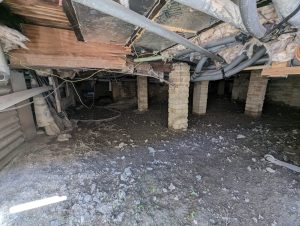
Local Case Insight
What Happens During an Environmental Impact Assessment (EIA) in Bradford?
Environmental Impact Assessments (EIA) in Bradford must be precise, proportionate and defensible under challenge. We scope tightly to legal triggers, match survey effort to real risk, and structure reporting so that planning officers, consultees and inspectors can rely on it without hesitation.
Key Deliverables for Bradford EIA Projects
Our EIA meets the evidence requirements set by Bradford Local Planning Authorities and delivers:
- Full environmental assessment chapter suitable for planning submission and public consultation
- Site-specific baseline surveys and clear impact findings
- Practical mitigation and monitoring strategy that planners can condition and discharge
- Integrated reporting aligned with highways, drainage, landscape and BNG where required
All evidence is prepared for legal scrutiny, committee reporting and public consultation in Bradford.
Step 1
Screening & Scoping
Review of proposal, screening opinion and environmental sensitivities to define ecology scope.
Step 2
Baseline Surveys
Targeted habitat and species surveys using nationwide methods consistent with CIEEM and Natural England.
Step 3
Impact Assessment
Construction and operational effects evaluated with clear significance reasoning.
Step 4
Reporting & Integration
Policy-linked ecology chapter ready for submission within the Environmental Statement.
Next Steps
Need an EIA in Bradford?
We’ll assess your site’s requirements and outline the most efficient path to compliance.
FAQ - Environmental Impact Assessments (EIA) in Bradford
Why is EIA screening frequently required in Bradford?
Bradford’s development patterns combine steep valley corridors, dense urban regeneration, and sensitive landscape edges where effects can accumulate quickly. Proposals are often screened to determine whether combined impacts linked to flood risk, traffic, air quality, habitat connectivity, or landscape change could be significant.
Local screening decisions and validation requirements are set by Bradford Council through its planning service:
https://www.bradford.gov.uk/planning-and-building-control/
When might development along Bradford’s valley corridors and watercourses trigger EIA screening?
Schemes close to valley floors and watercourse networks can interact with flood storage, surface water routing, and riparian habitat value. Larger proposals, phased delivery, or intensification in constrained corridors are commonly screened where effects may extend beyond the site boundary.
How does EIA screening apply to regeneration and brownfield sites in Bradford?
Previously developed land can still carry complex baselines, especially where sites sit within wider ecological networks or hydrological catchments. Screening tests present-day conditions and whether mitigation is realistically deliverable, rather than relying on historic land use assumptions.
Why are major road and rail corridors a screening consideration in Bradford?
Bradford’s transport network can concentrate traffic, noise, and air quality effects in tight corridors. Development near strategic routes is often screened where additional movement, lighting, or junction works could create cumulative impacts alongside nearby land uses.
Can development at settlement edges around Bradford require EIA screening?
Yes. Edge-of-settlement growth can affect landscape character, green corridor function, and ecological connectivity. Screening helps determine whether combined pressures with nearby allocations or infrastructure changes could be significant.
What factors typically influence EIA timescales in Bradford?
Timescales depend on scheme scale, topic scope, survey seasonality, and consultation requirements. Proposals intersecting multiple constraints—such as flood risk, ecology, transport, and landscape—typically need broader baseline evidence, extending programme allowances.