(EIA) Environmental Impact Assessment in Kent

Environmental Impact Assessment (EIA) in Kent

Will ecology slow down your Kent development? 

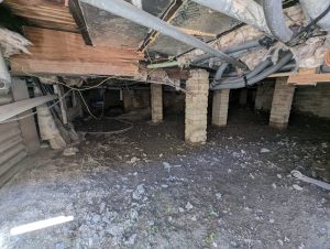
An Environmental Impact Assessment (EIA) in Kent, maintains project control before planning pressure builds. 

Fast, Clear, Planning-Ready Support

Fast response 

Calls answered in 2 rings, emails replied to within the hour.

Free expert advice

Clear guidance before you commit.

Cost-effective

Working in partnership with clients to ensure planning approval first time

Typical 10-day turnaround

Industry Leading Standard

Expert Team

We stay with you from first call through to submission. 

Do you need an Environmental Impact Assessment (EIA) in Kent?

If your development could significantly affect land, wildlife, water, or landscapes, the council will expect formal ecological evidence in Kent before it can be approved. Environmental Impact Assessments (EIA) in Kent span to major housing, infrastructure, commercial and mixed-use developments. 

Where an EIA applies, a planning application in Kent cannot progress without a legally compliant ecology assessment in place.

Kent’s landscape contains several features that frequently elevate EIA risk: 

  • North Downs AONB between Maidstone, Canterbury and Dover — protected chalk grassland and landscape-scale habitat sensitivity 
  • River Medway and River Stour corridors — floodplains and riparian habitats with cumulative downstream impact risk 
  • Romney Marsh and Swale coastal wetlands — internationally designated bird and grazing marsh habitats 
  • Former chalk quarries around Swanscombe and Gravesham — brownfield habitats with elevated ecological value at scale 
  • Ancient woodland belts around Sevenoaks, Tonbridge and Ashford — strict buffer and indirect impact constraints 

These conditions regularly underpin EIA screening and scoping decisions. 

Our Environmental Impact Assessment services support all Kent Local Planning Authorities, delivering precise ecological data to ensure seamless application processing and regulatory compliance.

Why Planning Authorities Request an EIA in Kent

Kent local planning authorities (LPA) are obligated to consider the Wildlife & Countryside Act 1981, the Habitats Regulations, and the NERC Act 2006 in their decision-making process. LPAs use an Environmental Impact Assessment (EIA)  to provide a comprehensive evaluation of all potential environmental impacts. These include ecological risks, such as evaluating protected species in Kent projects, to ensure a holistic understanding of a project’s implications.

Without a detailed EIA in Kent, applications risk delays due to incomplete environmental assessments, seasonal survey requirements, or additional conditions pending further evidence to address ecological concerns.

Local Case Insight

A mixed-use development near Ashford was proposed on former agricultural land close to the River Stour and a series of mature hedgerows. Initial screening identified potential effects on riparian habitats, protected species and downstream hydrology. A full EIA ecology scope was issued, covering habitat loss, construction disturbance and cumulative impacts with nearby schemes. Early baseline surveys allowed mitigation to be built directly into the layout and drainage strategy. The Environmental Statement was accepted without further ecological consultation rounds, avoiding a twelve-month delay linked to missed survey seasons.

What Happens During an Environmental Impact Assessment (EIA) in Kent?

Environmental Impact Assessments (EIA) in Kent must be precise, proportionate and defensible under challenge. We scope tightly to legal triggers, match survey effort to real risk, and structure reporting so that planning officers, consultees and inspectors can rely on it without hesitation. 

Key Deliverables for Kent EIA Projects

Our EIA meets the evidence requirements set by Kent Local Planning Authorities and delivers:

  • Full environmental assessment chapter suitable for planning submission and public consultation 
  • Site-specific baseline surveys and clear impact findings 
  • Practical mitigation and monitoring strategy that planners can condition and discharge 
  • Integrated reporting aligned with highways, drainage, landscape and BNG where required 

All evidence is prepared for legal scrutiny, committee reporting and public consultation in Kent. 

Step 1

Screening & Scoping

Review of proposal, screening opinion and environmental sensitivities to define ecology scope. 

Step 2

Baseline Surveys

Targeted habitat and species surveys using nationwide methods consistent with CIEEM and Natural England. 

Step 3

Impact Assessment

Construction and operational effects evaluated with clear significance reasoning. 

Step 4

Reporting & Integration

Policy-linked ecology chapter ready for submission within the Environmental Statement. 

Next Steps

Need an EIA in Kent?


We’ll assess your site’s requirements and outline the most efficient path to compliance.

FAQ - Environmental Impact Assessments (EIA) in Kent

What is an Environmental Impact Assessment for developments in Kent?

An Environmental Impact Assessment is a process used to assess the likely environmental effects of a development before planning permission is granted. In Kent, this is particularly important due to the scale of development pressure and the presence of sensitive coastal and rural environments.

An EIA may be required where a development is likely to have significant environmental effects. In Kent, this often applies to major housing schemes, infrastructure projects, logistics developments, and schemes located in sensitive areas. A screening opinion will confirm if an assessment is needed.

Kent is a key gateway between the UK and Europe, meaning transport and logistics developments are common. These types of projects may require an EIA to assess impacts on traffic, air quality, noise, and surrounding communities.

Yes, coastal developments in Kent may require an Environmental Impact Assessment due to the sensitivity of coastal habitats, flood risk, and landscape considerations. These developments often require detailed environmental assessment.

Typical factors include ecology, landscape and visual impact, transport, air quality, noise, water environment, and flood risk. The specific scope of the assessment will depend on the location and nature of the development.

How does EIA consider designated environmental sites in Kent?

Kent includes a number of designated environmental sites such as conservation areas and protected habitats. An Environmental Impact Assessment will consider how a development may affect these areas and identify mitigation measures where necessary.

Infrastructure is a key consideration in Kent due to its strategic location. An EIA may assess how developments interact with existing transport networks and infrastructure, particularly for large scale or strategic schemes.

An Environmental Statement includes detailed technical assessments, outlines the likely environmental impacts of the development, and sets out mitigation measures. It forms part of the planning application and supports decision making.

EIA and planning applications are managed by the relevant Local Planning Authority depending on the site location, alongside
Kent County Council
Planning guidance and services can be accessed via:
https://www.kent.gov.uk/

An Environmental Impact Assessment helps identify environmental constraints early, ensures appropriate surveys are completed, and provides clear evidence to support the planning application. This helps reduce risk and supports a smoother planning process.

Related Services

(EIA) Environmental Impact Assessment in Surrey

Environmental Impact Assessment (EIA) in Surrey

Will ecology slow down your Surrey development? 

An Environmental Impact Assessment (EIA) in Surrey, maintains project control before planning pressure builds. 

Fast, Clear, Planning-Ready Support

Fast response 

Calls answered in 2 rings, emails replied to within the hour.

Free expert advice

Clear guidance before you commit.

Cost-effective

Working in partnership with clients to ensure planning approval first time

Typical 10-day turnaround

Industry Leading Standard

Expert Team

We stay with you from first call through to submission. 

Do you need an Environmental Impact Assessment (EIA) in Surrey?

If your development could significantly affect land, wildlife, water, or landscapes, the council will expect formal ecological evidence in Surrey before it can be approved. Environmental Impact Assessments (EIA) in Surrey span to major housing, infrastructure, commercial and mixed-use developments. 

Where an EIA applies, a planning application in Surrey cannot progress without a legally compliant ecology assessment in place.

Surrey’s landscape contains several features that frequently elevate EIA risk: 

  • Thames floodplain through Egham, Staines and Walton-on-Thames — floodplain connectivity, birds and wetland receptors regularly drive EIA screening 
  • Mole Valley and River Wey corridors — riparian habitat networks that elevate cumulative impact and hydrology risk 
  • Surrey Hills AONB around Dorking and Guildford — protected landscapes where landscape and ecology impacts are closely linked 
  • Heathland complex near Woking, Bagshot and Chobham — European-designated habitat influencing EIA thresholds 
  • Mineral extraction zones around Shepperton and Reigate — phased disturbance and restoration schemes commonly trigger EIA ecology 

These conditions regularly underpin EIA screening and scoping decisions. 

Our Environmental Impact Assessment services support all Surrey Local Planning Authorities, delivering precise ecological data to ensure seamless application processing and regulatory compliance.

Why Planning Authorities Request an EIA in Surrey

Surrey local planning authorities (LPA) are obligated to consider the Wildlife & Countryside Act 1981, the Habitats Regulations, and the NERC Act 2006 in their decision-making process. LPAs use an Environmental Impact Assessment (EIA)  to provide a comprehensive evaluation of all potential environmental impacts. These include ecological risks, such as evaluating protected species in Surrey projects, to ensure a holistic understanding of a project’s implications.

Without a detailed EIA in Surrey, applications risk delays due to incomplete environmental assessments, seasonal survey requirements, or additional conditions pending further evidence to address ecological concerns.

Local Case Insight

A mixed-use scheme on the edge of the Thames floodplain near Egham involved redevelopment of former commercial land adjacent to designated wetland. Initial screening assumed no EIA requirement due to the developed nature of the plot. During pre-submission consultation, cumulative impacts on nearby SPA bird interest and hydrology were raised. An EIA ecology scope was commissioned to assess wetland connectivity, bird displacement and construction-phase disturbance. Early survey coordination allowed all baseline data to be captured within one season, preventing a second-year delay and enabling the Environmental Statement to proceed without formal objection.

What Happens During an Environmental Impact Assessment (EIA) in Surrey?

Environmental Impact Assessments (EIA) in Surrey must be precise, proportionate and defensible under challenge. We scope tightly to legal triggers, match survey effort to real risk, and structure reporting so that planning officers, consultees and inspectors can rely on it without hesitation. 

Key Deliverables for Surrey EIA Projects

Our EIA meets the evidence requirements set by Surrey Local Planning Authorities and delivers:

  • Full environmental assessment chapter suitable for planning submission and public consultation 
  • Site-specific baseline surveys and clear impact findings 
  • Practical mitigation and monitoring strategy that planners can condition and discharge 
  • Integrated reporting aligned with highways, drainage, landscape and BNG where required 

All evidence is prepared for legal scrutiny, committee reporting and public consultation in Surrey. 

Step 1

Screening & Scoping

Review of proposal, screening opinion and environmental sensitivities to define ecology scope. 

Step 2

Baseline Surveys

Targeted habitat and species surveys using nationwide methods consistent with CIEEM and Natural England. 

Step 3

Impact Assessment

Construction and operational effects evaluated with clear significance reasoning. 

Step 4

Reporting & Integration

Policy-linked ecology chapter ready for submission within the Environmental Statement. 

Next Steps

Need an EIA in Surrey?


We’ll assess your site’s requirements and outline the most efficient path to compliance.

FAQ - Environmental Impact Assessments (EIA) in Surrey

What is an Environmental Impact Assessment for developments in Surrey?

An Environmental Impact Assessment is a process used to evaluate the likely environmental effects of a development before planning permission is granted. In Surrey, this is particularly relevant for larger developments where environmental constraints and planning sensitivities are often high.

An EIA may be required where a development is likely to have significant environmental effects. In Surrey, this often applies to major residential schemes, commercial developments, and projects within or near environmentally sensitive areas. A screening opinion from the Local Planning Authority will confirm if an assessment is needed.

Surrey contains extensive green belt land, meaning developments in these areas are subject to strict planning controls. While not all proposals require an EIA, larger or more complex developments may need assessment to understand their impact on openness, landscape, and environmental quality.

Key factors often include ecology, landscape and visual impact, transport, noise, air quality, and water environment. Given Surrey’s proximity to London, transport and air quality are often particularly important considerations.

Yes, developments in Surrey that are influenced by London’s growth and infrastructure demands may require an EIA. Larger schemes or those affecting sensitive environments are more likely to require detailed environmental assessment.

How does EIA consider pressure on infrastructure and services?

An Environmental Impact Assessment can assess how a development affects local infrastructure, including roads, public transport, and community services. In Surrey, where demand is often high, this is an important part of understanding the wider impact of a proposal.

An Environmental Statement includes detailed technical assessments, outlines the likely environmental impacts, and explains how those impacts will be managed or mitigated. It supports the planning application and helps inform decision making.

Yes, developments near protected landscapes or designated sites in Surrey may require an EIA due to their environmental sensitivity. This ensures that potential impacts are fully assessed and appropriately managed.

EIA and planning applications are managed by the relevant Local Planning Authority depending on the site location, alongside
Surrey County Council
Planning guidance and services can be accessed via:
https://www.surreycc.gov.uk/

An Environmental Impact Assessment helps identify environmental constraints early, ensures appropriate surveys are completed, and provides clear evidence to support the planning application. This can reduce risk, improve the quality of the submission, and support a smoother planning process.

Related Services

(EIA) Environmental Impact Assessment in Essex

Environmental Impact Assessment (EIA) in Essex

Will ecology slow down your Essex development? 

An Environmental Impact Assessment (EIA) in Essex, maintains project control before planning pressure builds. 

Fast, Clear, Planning-Ready Support

Fast response 

Calls answered in 2 rings, emails replied to within the hour.

Free expert advice

Clear guidance before you commit.

Cost-effective

Working in partnership with clients to ensure planning approval first time

Typical 10-day turnaround

Industry Leading Standard

Expert Team

We stay with you from first call through to submission. 

Do you need an Environmental Impact Assessment (EIA) in Essex?

If your development could significantly affect land, wildlife, water, or landscapes, the council will expect formal ecological evidence in Essex before it can be approved. Environmental Impact Assessments (EIA) in Essex span to major housing, infrastructure, commercial and mixed-use developments. 

Where an EIA applies, a planning application in Essex cannot progress without a legally compliant ecology assessment in place.

Essex’s landscape contains several features that frequently elevate EIA risk: 

• Thames Estuary and Marshes around Tilbury and Canvey Island — internationally designated habitats sensitive to indirect impact

• The Blackwater, Crouch and Colne Estuaries — tidal systems affecting water quality, bird assemblages and coastal processes

• Stansted growth corridor — large-scale infrastructure and logistics repeatedly trigger cumulative impact assessment

• Chelmsford and Braintree arable belts — extensive field systems where scale of habitat change often meets EIA Schedule 2 thresholds

• Coastal grazing marshes near Maldon and Burnham-on-Crouch — floodplain and bird-interest land frequently subject to statutory scrutiny 

These conditions regularly underpin EIA screening and scoping decisions. 

Our Environmental Impact Assessment services support all Essex Local Planning Authorities, delivering precise ecological data to ensure seamless application processing and regulatory compliance.

Why Planning Authorities Request an EIA in Essex

Essex local planning authorities (LPA) are obligated to consider the Wildlife & Countryside Act 1981, the Habitats Regulations, and the NERC Act 2006 in their decision-making process. LPAs use an Environmental Impact Assessment (EIA)  to provide a comprehensive evaluation of all potential environmental impacts. These include ecological risks, such as evaluating protected species in Essex projects, to ensure a holistic understanding of a project’s implications.

Without a detailed EIA in Essex, applications risk delays due to incomplete environmental assessments, seasonal survey requirements, or additional conditions pending further evidence to address ecological concerns.

Local Case Insight

A large logistics scheme near Witham was proposed on former arable land bordering a drainage channel connected to the River Brain catchment. Initial screening underestimated ecological sensitivity due to the site’s maintained appearance. During pre-application consultation, the authority identified potential indirect effects on downstream designated habitats and requested full EIA ecology. Targeted habitat and watercourse surveys were scoped within the same season, allowing assessment to proceed without losing a year. Early corrective action prevented a formal screening refusal and allowed the application to enter determination without statutory consultee objection.

What Happens During an Environmental Impact Assessment (EIA) in Essex?

Environmental Impact Assessments (EIA) in Essex must be precise, proportionate and defensible under challenge. We scope tightly to legal triggers, match survey effort to real risk, and structure reporting so that planning officers, consultees and inspectors can rely on it without hesitation. 

Key Deliverables for Essex EIA Projects

Our EIA meets the evidence requirements set by Essex Local Planning Authorities and delivers:

  • Full environmental assessment chapter suitable for planning submission and public consultation 
  • Site-specific baseline surveys and clear impact findings 
  • Practical mitigation and monitoring strategy that planners can condition and discharge 
  • Integrated reporting aligned with highways, drainage, landscape and BNG where required 

All evidence is prepared for legal scrutiny, committee reporting and public consultation in Essex. 

Step 1

Screening & Scoping

Review of proposal, screening opinion and environmental sensitivities to define ecology scope. 

Step 2

Baseline Surveys

Targeted habitat and species surveys using nationwide methods consistent with CIEEM and Natural England. 

Step 3

Impact Assessment

Construction and operational effects evaluated with clear significance reasoning. 

Step 4

Reporting & Integration

Policy-linked ecology chapter ready for submission within the Environmental Statement. 

Next Steps

Need an EIA in Essex?


We’ll assess your site’s requirements and outline the most efficient path to compliance.

FAQ - Environmental Impact Assessments (EIA) in Essex

What is an Environmental Impact Assessment for developments in Essex?

An Environmental Impact Assessment is a process used to evaluate the likely environmental effects of a development before planning permission is granted. In Essex, this is particularly relevant for large scale developments where environmental constraints such as flood risk, infrastructure demand, and coastal sensitivity need to be carefully considered.

An EIA may be required where a development is likely to have significant environmental effects. In Essex, this often includes major housing schemes, logistics developments, infrastructure projects, and developments in sensitive coastal or rural locations. A screening opinion will confirm if an assessment is needed.

The Thames corridor is a key growth area in Essex, and developments here may require an Environmental Impact Assessment due to their scale and potential impact on infrastructure, flood risk, and surrounding communities. These projects often require detailed environmental analysis.

Yes, coastal developments may require an Environmental Impact Assessment due to the sensitivity of the environment. Considerations can include habitats, flood risk, landscape, and potential impacts on designated coastal areas.

Typical factors include flood risk, ecology, landscape and visual impact, transport, air quality, noise, and water environment. The scope of the assessment will depend on the nature and location of the development.

How does EIA consider flood risk in Essex?

Flood risk is a key consideration, particularly in low lying and coastal areas. An Environmental Impact Assessment may assess how a development interacts with flood risk, including mitigation measures to ensure the development is safe and does not increase risk elsewhere.

Essex has a strong logistics and industrial sector, particularly around key transport corridors. Large scale developments in this sector may require an EIA to assess impacts such as traffic, air quality, noise, and land use.

An Environmental Statement includes detailed assessments of environmental effects, identifies potential impacts, and outlines mitigation measures. It supports the planning application and informs decision making by the Local Planning Authority.

EIA and planning applications are managed by the relevant Local Planning Authority depending on the site location, alongside
Essex County Council
Planning guidance and services can be accessed via:
https://www.essex.gov.uk/

An Environmental Impact Assessment helps identify environmental constraints early, ensures appropriate surveys are completed, and provides clear evidence to support the planning application. This helps reduce planning risk and supports a smoother decision making process.

Related Services

(EIA) Environmental Impact Assessment in Hampshire

Environmental Impact Assessment (EIA) in Hampshire

Will ecology slow down your Hampshire development? 

An Environmental Impact Assessment (EIA) in Hampshire, maintains project control before planning pressure builds. 

Fast, Clear, Planning-Ready Support

Fast response 

Calls answered in 2 rings, emails replied to within the hour.

Free expert advice

Clear guidance before you commit.

Cost-effective

Working in partnership with clients to ensure planning approval first time

Typical 10-day turnaround

Industry Leading Standard

Expert Team

We stay with you from first call through to submission. 

Do you need an Environmental Impact Assessment (EIA) in Hampshire?

If your development could significantly affect land, wildlife, water, or landscapes, the council will expect formal ecological evidence in Hampshire before it can be approved. Environmental Impact Assessments (EIA) in Hampshire span to major housing, infrastructure, commercial and mixed-use developments. 

Where an EIA applies, a planning application in Hampshire cannot progress without a legally compliant ecology assessment in place.

Hampshire’s landscape contains several features that frequently elevate EIA risk: 

• The Solent coastline from Lymington to Portsmouth — internationally designated bird habitat driving severe impact and mitigation thresholds

The New Forest National Park fringe around Lyndhurst and Ringwood — protected heathland and ancient woodland buffers affecting development scale

 The River Test, Itchen and Alre floodplains — SAC river systems with strict hydrological and pollution controls

• South Downs chalk landscapes near Winchester and Petersfield — priority grassland and groundwater-sensitive catchments

• Strategic motorway and rail corridors around Basingstoke and Eastleigh — cumulative ecological effects from staged infrastructure growth 

These conditions regularly underpin EIA screening and scoping decisions. 

Our Environmental Impact Assessment services support all Hampshire Local Planning Authorities, delivering precise ecological data to ensure seamless application processing and regulatory compliance.

Why Planning Authorities Request an EIA in Hampshire

Hampshire local planning authorities (LPA) are obligated to consider the Wildlife & Countryside Act 1981, the Habitats Regulations, and the NERC Act 2006 in their decision-making process. LPAs use an Environmental Impact Assessment (EIA)  to provide a comprehensive evaluation of all potential environmental impacts. These include ecological risks, such as evaluating protected species in Hampshire projects, to ensure a holistic understanding of a project’s implications.

Without a detailed EIA in Hampshire, applications risk delays due to incomplete environmental assessments, seasonal survey requirements, or additional conditions pending further evidence to address ecological concerns.

Local Case Insight

A mixed-use allocation on the edge of Fareham was proposed adjacent to coastal grazing marsh linked to the Solent SPA network. Initial screening underestimated ecological sensitivity due to the site’s previous agricultural use. Following consultation, the authority issued a screening opinion requiring full EIA ecology. The assessment identified wintering bird displacement and hydrological connection risks. Mitigation was integrated into the masterplan before submission, avoiding statutory objection at determination and preventing a second year of consultation delay.

What Happens During an Environmental Impact Assessment (EIA) in Hampshire?

Environmental Impact Assessments (EIA) in Hampshire must be precise, proportionate and defensible under challenge. We scope tightly to legal triggers, match survey effort to real risk, and structure reporting so that planning officers, consultees and inspectors can rely on it without hesitation. 

Key Deliverables for Hampshire EIA Projects

Our EIA meets the evidence requirements set by Hampshire Local Planning Authorities and delivers:

  • Full environmental assessment chapter suitable for planning submission and public consultation 
  • Site-specific baseline surveys and clear impact findings 
  • Practical mitigation and monitoring strategy that planners can condition and discharge 
  • Integrated reporting aligned with highways, drainage, landscape and BNG where required 

All evidence is prepared for legal scrutiny, committee reporting and public consultation in Hampshire. 

Step 1

Screening & Scoping

Review of proposal, screening opinion and environmental sensitivities to define ecology scope. 

Step 2

Baseline Surveys

Targeted habitat and species surveys using nationwide methods consistent with CIEEM and Natural England. 

Step 3

Impact Assessment

Construction and operational effects evaluated with clear significance reasoning. 

Step 4

Reporting & Integration

Policy-linked ecology chapter ready for submission within the Environmental Statement. 

Next Steps

Need an EIA in Hampshire?


We’ll assess your site’s requirements and outline the most efficient path to compliance.

FAQ - Environmental Impact Assessments (EIA) in Hampshire

What is an Environmental Impact Assessment for developments in Hampshire?

An Environmental Impact Assessment is a process used to evaluate the likely environmental effects of a development before planning permission is granted. In Hampshire, this often applies to developments across coastal, urban, and rural areas where environmental sensitivity and planning constraints are high.

An EIA may be required where a development is likely to have significant environmental effects. In Hampshire, this can include large residential schemes, infrastructure projects, and developments in sensitive locations. A screening opinion from the Local Planning Authority will confirm whether an assessment is needed.

Hampshire has an extensive coastline, meaning developments in these areas may require an Environmental Impact Assessment. Coastal schemes often need to consider impacts on habitats, flood risk, landscape, and the marine environment.

Yes, developments located near or within national parks such as the South Downs National Park or New Forest National Park may require an EIA due to their environmental sensitivity. These areas are subject to stricter planning controls and require careful assessment.

Typical factors include ecology, landscape and visual impact, transport, air quality, noise, water environment, and coastal or flood risk where relevant. The scope of the assessment depends on the development and location.

How does EIA consider ports and infrastructure in Hampshire?

Hampshire includes major ports and transport infrastructure. Developments in these areas may require an EIA to assess impacts on traffic, air quality, noise, and surrounding communities, particularly where large scale or strategic development is proposed.

Flood risk is a key consideration, particularly in coastal and low lying areas. An Environmental Impact Assessment may assess how a development interacts with flood risk and ensure that appropriate mitigation measures are in place.

An Environmental Statement includes detailed technical assessments, identifies potential environmental impacts, and outlines mitigation measures. It forms part of the planning application and supports the decision making process.

EIA and planning applications are managed by the relevant Local Planning Authority depending on the site location, alongside
Hampshire County Council
Planning guidance and services can be accessed via:
https://www.hants.gov.uk/

An Environmental Impact Assessment helps identify environmental constraints early, ensures appropriate surveys are completed, and provides clear evidence to support the planning application. This helps reduce risk, improve the quality of the submission, and support a smoother planning process.

Related Services

Environmental Impact Assessment (EIA) in Royal Leamington Spa

Environmental Impact Assessment (EIA) in Royal Lemington Spa

Will ecology slow down your Royal Lemington Spa development? 

An Environmental Impact Assessment (EIA) in Royal Lemington Spa, maintains project control before planning pressure builds. 

Fast, Clear, Planning-Ready Support

Fast response 

Calls answered in 2 rings, emails replied to within the hour.

Free expert advice

Clear guidance before you commit.

Cost-effective

Working in partnership with clients to ensure planning approval first time

Typical 10-day turnaround

Industry Leading Standard

Expert Team

We stay with you from first call through to submission. 

Do you need an Environmental Impact Assessment (EIA) in Royal Lemington Spa?

If your development could significantly affect land, wildlife, water, or landscapes, the council will expect formal ecological evidence in Royal Lemington Spa before it can be approved. Environmental Impact Assessments (EIA) in Royal Lemington Spa span to major housing, infrastructure, commercial and mixed-use developments. 

Where an EIA applies, a planning application in Royal Lemington Spa cannot progress without a legally compliant ecology assessment in place.

Royal Lemington Spa’s landscape contains several features that frequently elevate EIA risk: 

River Leam corridor and floodplain — flood risk sensitivity, riparian habitat value, and downstream cumulative effects

Formal parks, gardens, and riverfront landscapes — high landscape and amenity sensitivity linked to the town’s character

Suburban edge growth zones — gradual transition areas with ecological connectivity importance

Strategic road and rail routes — cumulative traffic, noise, air quality, and access pressures

Historic townscape setting — interaction between development scale, views, and heritage context

These conditions regularly underpin EIA screening and scoping decisions. 

Our Environmental Impact Assessment services support all Royal Lemington Spa Local Planning Authorities, delivering precise ecological data to ensure seamless application processing and regulatory compliance.

Why Planning Authorities Request an EIA in Royal Lemington Spa

Royal Lemington Spa local planning authorities (LPA) are obligated to consider the Wildlife & Countryside Act 1981, the Habitats Regulations, and the NERC Act 2006 in their decision-making process. LPAs use an Environmental Impact Assessment (EIA)  to provide a comprehensive evaluation of all potential environmental impacts. These include ecological risks, such as evaluating protected species in Royal Lemington Spa projects, to ensure a holistic understanding of a project’s implications.

Without a detailed EIA in Royal Lemington Spa, applications risk delays due to incomplete environmental assessments, seasonal survey requirements, or additional conditions pending further evidence to address ecological concerns.

Local Case Insight

A residential-led scheme proposed on the southern edge of Royal Leamington Spa, near the River Leam corridor, progressed to early design without formal EIA screening, relying on site scale and existing suburban context. During pre-application review, cumulative effects linked to floodplain interaction, landscape sensitivity along the river corridor, and increased pressure on local transport routes were identified. The local planning authority subsequently required EIA screening, leading to expanded baseline surveys and revised programme allowances to address flood risk, landscape, and ecological effects before submission.

What Happens During an Environmental Impact Assessment (EIA) in Royal Lemington Spa?

Environmental Impact Assessments (EIA) in Royal Lemington Spa must be precise, proportionate and defensible under challenge. We scope tightly to legal triggers, match survey effort to real risk, and structure reporting so that planning officers, consultees and inspectors can rely on it without hesitation. 

Key Deliverables for Royal Lemington Spa EIA Projects

Our EIA meets the evidence requirements set by Royal Lemington Spa Local Planning Authorities and delivers:

  • Full environmental assessment chapter suitable for planning submission and public consultation 
  • Site-specific baseline surveys and clear impact findings 
  • Practical mitigation and monitoring strategy that planners can condition and discharge 
  • Integrated reporting aligned with highways, drainage, landscape and BNG where required 

All evidence is prepared for legal scrutiny, committee reporting and public consultation in Royal Lemington Spa. 

Step 1

Screening & Scoping

Review of proposal, screening opinion and environmental sensitivities to define ecology scope. 

Step 2

Baseline Surveys

Targeted habitat and species surveys using nationwide methods consistent with CIEEM and Natural England. 

Step 3

Impact Assessment

Construction and operational effects evaluated with clear significance reasoning. 

Step 4

Reporting & Integration

Policy-linked ecology chapter ready for submission within the Environmental Statement. 

Next Steps

Need an EIA in Royal Lemington Spa?


We’ll assess your site’s requirements and outline the most efficient path to compliance.

FAQ - Environmental Impact Assessments (EIA) in Royal Lemington Spa

Why is EIA screening frequently required in Royal Leamington Spa?

Royal Leamington Spa sits within a sensitive planning context shaped by the River Leam corridor, formal parks and gardens, and strong residential-led growth pressure. Development proposals are often screened to assess whether cumulative effects linked to flood risk, landscape and amenity sensitivity, transport demand, or habitat connectivity could result in significant environmental impacts.

Local screening decisions and validation requirements are set by Warwick District Council through its planning service:
https://www.warwickdc.gov.uk/planning

Schemes close to the River Leam can affect floodplain function, surface water behaviour, riparian habitats, and downstream receptors. Larger developments, phased delivery, or intensification along the corridor are commonly screened where combined effects may extend beyond the site boundary.

Residential-led development can generate cumulative effects related to traffic, drainage demand, recreational pressure, and landscape change. Screening helps determine whether these combined impacts, particularly near sensitive riverfront or green space settings, require formal assessment.

Why are parks, gardens, and formal landscapes a screening consideration in this area?

Royal Leamington Spa is characterised by high-quality designed landscapes and valued public open spaces. Development affecting views, setting, or ecological function of these areas is often screened to assess whether changes could result in significant environmental or amenity effects.


Yes. Growth at settlement edges often interacts with open land, river corridors, and ecological networks. Screening helps establish whether landscape change, habitat fragmentation, or cumulative pressure with nearby allocations could be significant.

Timescales depend on scheme scale, proximity to the River Leam and sensitive landscapes, survey seasonality, and consultation scope. Proposals engaging flood risk, ecology, landscape, and transport together typically require broader baseline evidence, extending programme allowances.

Related Services

Environmental Impact Assessment (EIA) in Nuneaton

Environmental Impact Assessment (EIA) in Nuneaton

Will ecology slow down your Nuneaton development? 

An Environmental Impact Assessment (EIA) in Nuneaton, maintains project control before planning pressure builds. 

Fast, Clear, Planning-Ready Support

Fast response 

Calls answered in 2 rings, emails replied to within the hour.

Free expert advice

Clear guidance before you commit.

Cost-effective

Working in partnership with clients to ensure planning approval first time

Typical 10-day turnaround

Industry Leading Standard

Expert Team

We stay with you from first call through to submission. 

Do you need an Environmental Impact Assessment (EIA) in Nuneaton?

If your development could significantly affect land, wildlife, water, or landscapes, the council will expect formal ecological evidence in Nuneaton before it can be approved. Environmental Impact Assessments (EIA) in Nuneaton span to major housing, infrastructure, commercial and mixed-use developments. 

Where an EIA applies, a planning application in Nuneaton cannot progress without a legally compliant ecology assessment in place.

Nuneaton’s landscape contains several features that frequently elevate EIA risk: 

Coventry Canal corridor — strategic east–west ecological connectivity with heightened cumulative impact sensitivity

Established industrial estates — layered historic land use creating brownfield, contamination, and remediation constraints

River Anker floodplain — interaction between drainage design, habitat function, and flood risk policy compliance

Urban fringe housing growth — rapid habitat conversion placing pressure on retained green infrastructure

Rail freight corridors — linear infrastructure driving ecological fragmentation and constrained mitigation routing

These conditions regularly underpin EIA screening and scoping decisions. 

Our Environmental Impact Assessment services support all Nuneaton Local Planning Authorities, delivering precise ecological data to ensure seamless application processing and regulatory compliance.

Why Planning Authorities Request an EIA in Nuneaton

Nuneaton local planning authorities (LPA) are obligated to consider the Wildlife & Countryside Act 1981, the Habitats Regulations, and the NERC Act 2006 in their decision-making process. LPAs use an Environmental Impact Assessment (EIA)  to provide a comprehensive evaluation of all potential environmental impacts. These include ecological risks, such as evaluating protected species in Nuneaton projects, to ensure a holistic understanding of a project’s implications.

Without a detailed EIA in Nuneaton, applications risk delays due to incomplete environmental assessments, seasonal survey requirements, or additional conditions pending further evidence to address ecological concerns.

Local Case Insight

A logistics-led distribution centre proposed near Bermuda Park advanced to planning committee without formal EIA screening, relying on brownfield classification and phased delivery assumptions. Post-determination legal review identified unassessed cumulative effects across the Coventry Canal and River Anker corridors. A retrospective EIA was subsequently required, triggering resubmission, refreshed baseline surveys, and a 14-month delay before construction could proceed.

What Happens During an Environmental Impact Assessment (EIA) in Nuneaton?

Environmental Impact Assessments (EIA) in Nuneaton must be precise, proportionate and defensible under challenge. We scope tightly to legal triggers, match survey effort to real risk, and structure reporting so that planning officers, consultees and inspectors can rely on it without hesitation. 

Key Deliverables for Nuneaton EIA Projects

Our EIA meets the evidence requirements set by Nuneaton Local Planning Authorities and delivers:

  • Full environmental assessment chapter suitable for planning submission and public consultation 
  • Site-specific baseline surveys and clear impact findings 
  • Practical mitigation and monitoring strategy that planners can condition and discharge 
  • Integrated reporting aligned with highways, drainage, landscape and BNG where required 

All evidence is prepared for legal scrutiny, committee reporting and public consultation in Nuneaton. 

Step 1

Screening & Scoping

Review of proposal, screening opinion and environmental sensitivities to define ecology scope. 

Step 2

Baseline Surveys

Targeted habitat and species surveys using nationwide methods consistent with CIEEM and Natural England. 

Step 3

Impact Assessment

Construction and operational effects evaluated with clear significance reasoning. 

Step 4

Reporting & Integration

Policy-linked ecology chapter ready for submission within the Environmental Statement. 

Next Steps

Need an EIA in Nuneaton?


We’ll assess your site’s requirements and outline the most efficient path to compliance.

FAQ - Environmental Impact Assessments (EIA) in Nuneaton

Why is EIA screening commonly applied around rivers and canal corridors in Nuneaton?

Nuneaton sits within a tightly constrained river and canal landscape, where development pressure overlaps with floodplain function, retained habitats, and long-established infrastructure. Proposals near the River Anker or Coventry Canal are frequently screened to assess whether cumulative or indirect effects could be significant.

Local requirements are applied by Nuneaton and Bedworth Borough Council, in line with district planning guidance:
https://www.nuneatonandbedworth.gov.uk/planning

Schemes close to the River Anker can affect flood risk, riparian habitats, and downstream connectivity. Larger developments, phased delivery, or proposals linked to industrial or logistics uses are commonly screened to determine whether these combined effects require a full Environmental Statement.

Nuneaton’s proximity to strategic road and rail corridors has driven significant warehouse and distribution growth. Even on established industrial land, screening is used to test whether scale, traffic generation, lighting, drainage, or ecological effects reach EIA thresholds once considered cumulatively.

Why are rail corridors and transport infrastructure a screening consideration in this area?

Rail freight lines and associated infrastructure create long, linear barriers through the landscape. Development close to these corridors is screened to assess fragmentation effects, constrained mitigation options, and interactions with adjacent habitats and waterways.


Yes. Former industrial sites may have re-established habitats or form part of wider ecological or hydrological networks. Screening allows the council to confirm whether historic land use assumptions remain valid, or whether a full EIA is needed to address current environmental conditions.

Programme length depends on scheme scale, proximity to rivers and infrastructure corridors, survey seasonality, and the range of consultees involved. Developments intersecting multiple constraints often require broader baseline work, which can extend overall determination timescales.

Related Services

Environmental Impact Assessment (EIA) in Warwick

Environmental Impact Assessment (EIA) in Warwick

Will ecology slow down your Warwick development? 

An Environmental Impact Assessment (EIA) in Warwick, maintains project control before planning pressure builds. 

Fast, Clear, Planning-Ready Support

Fast response 

Calls answered in 2 rings, emails replied to within the hour.

Free expert advice

Clear guidance before you commit.

Cost-effective

Working in partnership with clients to ensure planning approval first time

Typical 10-day turnaround

Industry Leading Standard

Expert Team

We stay with you from first call through to submission. 

Do you need an Environmental Impact Assessment (EIA) in Warwick?

If your development could significantly affect land, wildlife, water, or landscapes, the council will expect formal ecological evidence in Warwick before it can be approved. Environmental Impact Assessments (EIA) in Warwick span to major housing, infrastructure, commercial and mixed-use developments. 

Where an EIA applies, a planning application in Warwick cannot progress without a legally compliant ecology assessment in place.

Warwick’s landscape contains several features that frequently elevate EIA risk: 

River Avon corridor and floodplain — flood risk sensitivity, riparian habitats, and cumulative downstream effects

Historic town setting and castle-led views — landscape and townscape sensitivity linked to heritage assets

Open valley farmland and green approaches — transitional landscapes with ecological connectivity importance

Strategic road and rail corridors — cumulative traffic, noise, air quality, and access pressures

Settlement edge growth zones — overlapping development parcels increasing combined environmental change

These conditions regularly underpin EIA screening and scoping decisions. 

Our Environmental Impact Assessment services support all Warwick Local Planning Authorities, delivering precise ecological data to ensure seamless application processing and regulatory compliance.

Why Planning Authorities Request an EIA in Warwick

Warwick local planning authorities (LPA) are obligated to consider the Wildlife & Countryside Act 1981, the Habitats Regulations, and the NERC Act 2006 in their decision-making process. LPAs use an Environmental Impact Assessment (EIA)  to provide a comprehensive evaluation of all potential environmental impacts. These include ecological risks, such as evaluating protected species in Warwick projects, to ensure a holistic understanding of a project’s implications.

Without a detailed EIA in Warwick, applications risk delays due to incomplete environmental assessments, seasonal survey requirements, or additional conditions pending further evidence to address ecological concerns.

Local Case Insight

A mixed-use development proposed on the southern edge of Warwick, close to the River Avon corridor, progressed through early design without formal EIA screening, based on moderate site coverage and proximity to existing infrastructure. During pre-application consultation, cumulative effects linked to floodplain interaction, landscape sensitivity within the historic setting of the town, and increased traffic pressure on surrounding routes were identified. The local planning authority subsequently required EIA screening, resulting in expanded baseline surveys and revised programme allowances to address flood risk, landscape, and ecological impacts before submission.

What Happens During an Environmental Impact Assessment (EIA) in Warwick?

Environmental Impact Assessments (EIA) in Warwick must be precise, proportionate and defensible under challenge. We scope tightly to legal triggers, match survey effort to real risk, and structure reporting so that planning officers, consultees and inspectors can rely on it without hesitation. 

Key Deliverables for Warwick EIA Projects

Our EIA meets the evidence requirements set by Warwick Local Planning Authorities and delivers:

  • Full environmental assessment chapter suitable for planning submission and public consultation 
  • Site-specific baseline surveys and clear impact findings 
  • Practical mitigation and monitoring strategy that planners can condition and discharge 
  • Integrated reporting aligned with highways, drainage, landscape and BNG where required 

All evidence is prepared for legal scrutiny, committee reporting and public consultation in Warwick. 

Step 1

Screening & Scoping

Review of proposal, screening opinion and environmental sensitivities to define ecology scope. 

Step 2

Baseline Surveys

Targeted habitat and species surveys using nationwide methods consistent with CIEEM and Natural England. 

Step 3

Impact Assessment

Construction and operational effects evaluated with clear significance reasoning. 

Step 4

Reporting & Integration

Policy-linked ecology chapter ready for submission within the Environmental Statement. 

Next Steps

Need an EIA in Warwick?


We’ll assess your site’s requirements and outline the most efficient path to compliance.

FAQ - Environmental Impact Assessments (EIA) in Warwick

Why is EIA screening frequently required in Warwick?

Warwick sits within a sensitive planning context shaped by the River Avon corridor, the historic setting of Warwick Castle, and ongoing edge-of-settlement growth. Development proposals are often screened to assess whether cumulative effects linked to flood risk, landscape and townscape sensitivity, transport pressure, or habitat connectivity could result in significant environmental impacts.

Local screening decisions and validation requirements are set by Warwick District Council through its planning service:
https://www.warwickdc.gov.uk/planning

Schemes close to the River Avon can affect floodplain function, water quality, riparian habitats, and downstream receptors. Larger developments, phased delivery, or proposals that intensify land use near the river corridor are commonly screened where combined effects may extend beyond the site boundary.

Development within or close to the town’s historic core or key views can give rise to combined landscape, townscape, and environmental effects. Screening helps determine whether changes to scale, massing, access, or movement patterns could result in significant effects that require formal assessment.

Why are strategic road and rail routes a screening consideration in Warwick?

Strategic routes passing through and around Warwick concentrate traffic, noise, air quality, and lighting effects. Development near these corridors is often screened where additional movement or infrastructure works could create cumulative impacts alongside existing transport pressures.


Yes. Growth at settlement edges often interacts with open land, river corridors, and ecological networks. Screening helps determine whether landscape change, habitat fragmentation, or cumulative pressure with nearby allocations could be significant.

Timescales depend on scheme scale, proximity to the River Avon and sensitive heritage or landscape settings, survey seasonality, and consultation scope. Proposals engaging flood risk, ecology, landscape, heritage, and transport together typically require broader baseline evidence, extending programme allowances.

Related Services

Environmental Impact Assessment (EIA) in Stratford-upon-Avon

Environmental Impact Assessment (EIA) in Stratford-upon-Avon

Will ecology slow down your Stratford-upon-Avon development? 

An Environmental Impact Assessment (EIA) in Stratford-upon-Avon, maintains project control before planning pressure builds. 

Fast, Clear, Planning-Ready Support

Fast response 

Calls answered in 2 rings, emails replied to within the hour.

Free expert advice

Clear guidance before you commit.

Cost-effective

Working in partnership with clients to ensure planning approval first time

Typical 10-day turnaround

Industry Leading Standard

Expert Team

We stay with you from first call through to submission. 

Do you need an Environmental Impact Assessment (EIA) in Stratford-upon-Avon?

If your development could significantly affect land, wildlife, water, or landscapes, the council will expect formal ecological evidence in Stratford-upon-Avon before it can be approved. Environmental Impact Assessments (EIA) in Stratford-upon-Avon span to major housing, infrastructure, commercial and mixed-use developments. 

Where an EIA applies, a planning application in Stratford-upon-Avon cannot progress without a legally compliant ecology assessment in place.

Stratford-upon-Avon’s landscape contains several features that frequently elevate EIA risk: 

River Avon corridor and floodplain — flood risk interaction, riparian habitat sensitivity, and downstream cumulative effects

Open flood meadows and riverside grazing land — high landscape value and ecological function vulnerable to change

Historic town setting and viewsheds — landscape and townscape sensitivity linked to heritage context

Tourism-led movement and seasonal traffic — cumulative transport, air quality, and access pressures

Settlement edge farmland and green approaches — gradual transition zones with habitat connectivity importance

These conditions regularly underpin EIA screening and scoping decisions. 

Our Environmental Impact Assessment services support all Stratford-upon-Avon Local Planning Authorities, delivering precise ecological data to ensure seamless application processing and regulatory compliance.

Why Planning Authorities Request an EIA in Stratford-upon-Avon

Stratford-upon-Avon local planning authorities (LPA) are obligated to consider the Wildlife & Countryside Act 1981, the Habitats Regulations, and the NERC Act 2006 in their decision-making process. LPAs use an Environmental Impact Assessment (EIA)  to provide a comprehensive evaluation of all potential environmental impacts. These include ecological risks, such as evaluating protected species in Stratford-upon-Avon projects, to ensure a holistic understanding of a project’s implications.

Without a detailed EIA in Stratford-upon-Avon, applications risk delays due to incomplete environmental assessments, seasonal survey requirements, or additional conditions pending further evidence to address ecological concerns.

Local Case Insight

A visitor-led mixed-use scheme on the edge of Stratford-upon-Avon progressed to pre-application stage without formal EIA screening, relying on modest building heights and reuse of existing access points. During early consultation, cumulative effects linked to River Avon floodplain interaction, visitor traffic intensification, and landscape sensitivity at the settlement edge were identified. The local planning authority subsequently required EIA screening, leading to widened baseline coverage, additional seasonal surveys, and revised programme allowances to address flood risk, landscape, and ecological effects before submission.

What Happens During an Environmental Impact Assessment (EIA) in Stratford-upon-Avon?

Environmental Impact Assessments (EIA) in Stratford-upon-Avon must be precise, proportionate and defensible under challenge. We scope tightly to legal triggers, match survey effort to real risk, and structure reporting so that planning officers, consultees and inspectors can rely on it without hesitation. 

Key Deliverables for Stratford-upon-Avon EIA Projects

Our EIA meets the evidence requirements set by Stratford-upon-Avon Local Planning Authorities and delivers:

  • Full environmental assessment chapter suitable for planning submission and public consultation 
  • Site-specific baseline surveys and clear impact findings 
  • Practical mitigation and monitoring strategy that planners can condition and discharge 
  • Integrated reporting aligned with highways, drainage, landscape and BNG where required 

All evidence is prepared for legal scrutiny, committee reporting and public consultation in Stratford-upon-Avon. 

Step 1

Screening & Scoping

Review of proposal, screening opinion and environmental sensitivities to define ecology scope. 

Step 2

Baseline Surveys

Targeted habitat and species surveys using nationwide methods consistent with CIEEM and Natural England. 

Step 3

Impact Assessment

Construction and operational effects evaluated with clear significance reasoning. 

Step 4

Reporting & Integration

Policy-linked ecology chapter ready for submission within the Environmental Statement. 

Next Steps

Need an EIA in Stratford-upon-Avon?


We’ll assess your site’s requirements and outline the most efficient path to compliance.

FAQ - Environmental Impact Assessments (EIA) in Stratford-upon-Avon

Why is EIA screening frequently required in Stratford-upon-Avon?

Stratford-upon-Avon sits within a highly sensitive planning context shaped by the River Avon floodplain, historic town setting, and strong visitor-led development pressure. Proposals are often screened to assess whether cumulative effects linked to flood risk, landscape and townscape sensitivity, traffic generation, or habitat connectivity could result in significant environmental impacts.

Local screening decisions and validation requirements are set by Stratford-on-Avon District Council through its planning service:
https://www.stratford.gov.uk/planning

Schemes close to the River Avon can affect floodplain capacity, water quality, riparian habitats, and downstream receptors. Larger developments, phased delivery, or proposals that intensify land use near the river corridor are commonly screened where combined effects may extend beyond the site boundary.

Growth at the town’s edges often interacts with open floodplain land, historic approaches, and sensitive landscape settings. Screening helps determine whether landscape change, ecological fragmentation, or cumulative pressure with nearby allocations could be significant.

Why are visitor-related traffic and movement patterns a screening consideration in this area?

Stratford-upon-Avon experiences seasonal peaks in visitor traffic that can amplify transport, air quality, and noise effects. Development that adds to this movement pressure is often screened to assess cumulative impacts alongside existing tourist activity.


Yes. Open land may form part of wider ecological networks or contribute to the setting of the town and river corridor. Screening is used to assess whether development could result in significant environmental or landscape effects, regardless of current land use intensity.

Timescales depend on scheme scale, proximity to the River Avon and sensitive landscapes, survey seasonality, and consultation scope. Proposals engaging flood risk, ecology, landscape, and transport together typically require broader baseline evidence, extending programme allowances.

Related Services

Environmental Impact Assessment (EIA) in Bedworth

Environmental Impact Assessment (EIA) in Bedworth

Will ecology slow down your Bedworth development? 

An Environmental Impact Assessment (EIA) in Bedworth maintains project control before planning pressure builds. 

Fast, Clear, Planning-Ready Support

Fast response 

Calls answered in 2 rings, emails replied to within the hour.

Free expert advice

Clear guidance before you commit.

Cost-effective

Working in partnership with clients to ensure planning approval first time

Typical 10-day turnaround

Industry Leading Standard

Expert Team

We stay with you from first call through to submission. 

Do you need an Environmental Impact Assessment (EIA) in Bedworth?

If your development could significantly affect land, wildlife, water, or landscapes, the council will expect formal ecological evidence in Bedworth before it can be approved. Environmental Impact Assessments (EIA) in Bedworth span to major housing, infrastructure, commercial and mixed-use developments. 

Where an EIA applies, a planning application in Bedworth cannot progress without a legally compliant ecology assessment in place.

Bedworth’s landscape contains several features that frequently elevate EIA risk: 

Coventry Canal corridor — linear ecological connectivity, water quality sensitivity, and cumulative effects

River Anker catchment influence — downstream flood risk interaction and hydrological connectivity

Urban edge growth zones — overlapping residential allocations increasing combined environmental pressure

Former industrial and mixed-use land — complex baselines with re-established habitats

Rail and road infrastructure interfaces — constrained mitigation routing and cumulative noise and air quality effects

These conditions regularly underpin EIA screening and scoping decisions. 

Our Environmental Impact Assessment services support all Bedworth Local Planning Authorities, delivering precise ecological data to ensure seamless application processing and regulatory compliance.

Why Planning Authorities Request an EIA in Bedworth

Bedworth local planning authorities (LPA) are obligated to consider the Wildlife & Countryside Act 1981, the Habitats Regulations, and the NERC Act 2006 in their decision-making process. LPAs use an Environmental Impact Assessment (EIA)  to provide a comprehensive evaluation of all potential environmental impacts. These include ecological risks, such as evaluating protected species in Bedworth projects, to ensure a holistic understanding of a project’s implications.

Without a detailed EIA in Bedworth, applications risk delays due to incomplete environmental assessments, seasonal survey requirements, or additional conditions pending further evidence to address ecological concerns.

Local Case Insight

A residential-led development proposed on the northern edge of Bedworth progressed through early feasibility without formal EIA screening, relying on site scale and partial brownfield classification. During pre-application review, cumulative effects linked to surface water drainage, proximity to the Coventry Canal, and interaction with adjacent growth sites were identified. The local planning authority subsequently required EIA screening, leading to expanded baseline surveys and revised drainage and access strategies before the scheme could advance to submission.

What Happens During an Environmental Impact Assessment (EIA) in Bedworth?

Environmental Impact Assessments (EIA) in Bedworth must be precise, proportionate and defensible under challenge. We scope tightly to legal triggers, match survey effort to real risk, and structure reporting so that planning officers, consultees and inspectors can rely on it without hesitation. 

Key Deliverables for Bedworth EIA Projects

Our EIA meets the evidence requirements set by Bedworth Local Planning Authorities and delivers:

  • Full environmental assessment chapter suitable for planning submission and public consultation 
  • Site-specific baseline surveys and clear impact findings 
  • Practical mitigation and monitoring strategy that planners can condition and discharge 
  • Integrated reporting aligned with highways, drainage, landscape and BNG where required 

All evidence is prepared for legal scrutiny, committee reporting and public consultation in Bedworth. 

Step 1

Screening & Scoping

Review of proposal, screening opinion and environmental sensitivities to define ecology scope. 

Step 2

Baseline Surveys

Targeted habitat and species surveys using nationwide methods consistent with CIEEM and Natural England. 

Step 3

Impact Assessment

Construction and operational effects evaluated with clear significance reasoning. 

Step 4

Reporting & Integration

Policy-linked ecology chapter ready for submission within the Environmental Statement. 

Next Steps

Need an EIA in Bedworth?


We’ll assess your site’s requirements and outline the most efficient path to compliance.

FAQ - Environmental Impact Assessments (EIA) in Bedworth

Why is EIA screening frequently required in Bedworth?

Bedworth sits within a tightly constrained urban landscape influenced by canal corridors, historic industrial land, and ongoing edge-of-settlement growth. Development proposals are often screened to assess whether cumulative effects linked to drainage, transport pressure, habitat connectivity, or interaction with nearby growth areas could be significant.

Local screening decisions and validation requirements are set by Nuneaton and Bedworth Borough Council through its planning service:
https://www.nuneatonandbedworth.gov.uk/planning

Schemes close to the Coventry Canal or connected watercourse networks can affect ecological connectivity, water quality, and drainage behaviour. Larger developments, phased delivery, or intensification close to these corridors are commonly screened where combined effects may extend beyond the site boundary.

Bedworth includes a mix of former industrial and mixed-use land with complex present-day baselines. Screening is used to test whether historic land use assumptions remain valid, particularly where sites now support established habitats or sit within wider hydrological or transport networks.

Why are rail and road infrastructure interfaces a screening consideration in this area?

Rail corridors and strategic road routes pass close to residential and redevelopment sites. Development near these interfaces is screened to assess cumulative effects linked to traffic growth, noise, air quality, lighting, and constrained mitigation options.


Yes. Development at settlement edges often interacts with open land, canal corridors, and ecological networks. Screening helps determine whether landscape change, habitat fragmentation, or combined pressures with nearby allocations could be significant.

Timescales depend on scheme scale, proximity to canal or infrastructure corridors, survey seasonality, and consultation scope. Proposals engaging multiple topics—such as drainage, ecology, transport, and landscape—typically require broader baseline evidence, extending programme allowances.

Related Services

Environmental Impact Assessment (EIA) in Leeds

Environmental Impact Assessment (EIA) in Leeds

Will ecology slow down your Leeds development? 

An Environmental Impact Assessment (EIA) in Leeds, maintains project control before planning pressure builds. 

Fast, Clear, Planning-Ready Support

Fast response 

Calls answered in 2 rings, emails replied to within the hour.

Free expert advice

Clear guidance before you commit.

Cost-effective

Working in partnership with clients to ensure planning approval first time

Typical 10-day turnaround

Industry Leading Standard

Expert Team

We stay with you from first call through to submission. 

Do you need an Environmental Impact Assessment (EIA) in Leeds?

If your development could significantly affect land, wildlife, water, or landscapes, the council will expect formal ecological evidence in Leeds before it can be approved. Environmental Impact Assessments (EIA) in Leeds span to major housing, infrastructure, commercial and mixed-use developments. 

Where an EIA applies, a planning application in Leeds cannot progress without a legally compliant ecology assessment in place.

Leeds’ landscape contains several features that frequently elevate EIA risk: 

  • River Aire corridor through Holbeck, Hunslet and Woodlesford — extensive riparian habitat and floodplain connectivity often trigger EIA screening for major schemes 
  • Aire Valley and Stourton industrial corridor — brownfield regeneration frequently intersects open mosaic habitat and BNG-relevant ecological networks 
  • Outer Green Belt around Wetherby, Garforth and Morley — large housing allocations here often affect linked farmland, ditches and priority grassland 
  • Rail and motorway infrastructure along the M1 and A63 — linear habitat fragmentation and cumulative ecological effects are commonly scrutinised 
  • Former colliery and spoil landscapes east of the city — elevated invertebrate, reptile and habitat mosaic value on redevelopment sites 

These conditions regularly underpin EIA screening and scoping decisions. 

Our Environmental Impact Assessment services support all Leeds Local Planning Authorities, delivering precise ecological data to ensure seamless application processing and regulatory compliance.

Why Planning Authorities Request an EIA in Leeds

Leeds local planning authorities (LPA) are obligated to consider the Wildlife & Countryside Act 1981, the Habitats Regulations, and the NERC Act 2006 in their decision-making process. LPAs use an Environmental Impact Assessment (EIA)  to provide a comprehensive evaluation of all potential environmental impacts. These include ecological risks, such as evaluating protected species in Leeds projects, to ensure a holistic understanding of a project’s implications.

Without a detailed EIA in Leeds, applications risk delays due to incomplete environmental assessments, seasonal survey requirements, or additional conditions pending further evidence to address ecological concerns.

Local Case Insight

A logistics redevelopment on the edge of Rugeley near the Trent Valley was initially submitted for screening without full environmental assessment. During pre-application review, the council identified potential river corridor impact and cumulative effects from nearby industrial growth. A full environmental assessment was commissioned to address floodplain disturbance, habitat loss and construction effects. The assessment allowed the planning authority to consult statutory bodies in a controlled way and attach proportionate mitigation conditions at determination. The application progressed through committee without referral to deferral or public objection.

What Happens During an Environmental Impact Assessment (EIA) in Leeds?

Environmental Impact Assessments (EIA) in Leeds must be precise, proportionate and defensible under challenge. We scope tightly to legal triggers, match survey effort to real risk, and structure reporting so that planning officers, consultees and inspectors can rely on it without hesitation. 

Key Deliverables for Leeds EIA Projects

Our EIA meets the evidence requirements set by Leeds Local Planning Authorities and delivers:

  • Full environmental assessment chapter suitable for planning submission and public consultation 
  • Site-specific baseline surveys and clear impact findings 
  • Practical mitigation and monitoring strategy that planners can condition and discharge 
  • Integrated reporting aligned with highways, drainage, landscape and BNG where required 

All evidence is prepared for legal scrutiny, committee reporting and public consultation in Leeds. 

Step 1

Screening & Scoping

Review of proposal, screening opinion and environmental sensitivities to define ecology scope. 

Step 2

Baseline Surveys

Targeted habitat and species surveys using nationwide methods consistent with CIEEM and Natural England. 

Step 3

Impact Assessment

Construction and operational effects evaluated with clear significance reasoning. 

Step 4

Reporting & Integration

Policy-linked ecology chapter ready for submission within the Environmental Statement. 

Next Steps

Need an EIA in Leeds?


We’ll assess your site’s requirements and outline the most efficient path to compliance.

FAQ - Environmental Impact Assessments (EIA) in Leeds

Why is EIA screening frequently required in Leeds?

Leeds is a large, fast-growing city with development pressure spread across river corridors, regeneration areas, and settlement edges. Proposals are often screened to assess whether cumulative effects linked to flood risk, transport demand, air quality, habitat connectivity, or landscape change could result in significant environmental impacts.

Local screening decisions and validation requirements are set by Leeds City Council through its planning service:
https://www.leeds.gov.uk/planning

Schemes close to the River Aire and connected waterways can affect floodplain function, drainage capacity, and riparian habitats. Larger developments, phased delivery, or intensification within constrained corridors are commonly screened where combined effects may extend beyond the site boundary.

Leeds contains extensive regeneration and previously developed land, often within complex transport and hydrological networks. Screening is used to test present-day environmental conditions and whether historic land use assumptions remain valid, particularly where sites interact with surrounding sensitive receptors.

Why are major transport routes and infrastructure a screening consideration in Leeds?

Strategic road and rail corridors concentrate traffic, noise, air quality, and lighting effects. Development near these routes is frequently screened where additional movement, junction works, or land-take could create cumulative impacts alongside nearby development.


Yes. Growth at settlement edges often affects open land, landscape character, and ecological connectivity. Screening helps determine whether combined pressures with nearby allocations, infrastructure, or green corridors could be significant.

Timescales depend on scheme scale, topic scope, proximity to river corridors or infrastructure, survey seasonality, and consultation requirements. Proposals engaging multiple topics—such as flood risk, ecology, transport, and air quality—typically require broader baseline evidence, extending programme allowances.

Related Services

---