Preliminary Ecological Appraisal (PEA) in Burton-on-Trent

Preliminary Ecological Appraisal (PEA) in Burton-on-Trent

Do you have the ecological evidence Burton-on-Trent planners require at validation?

We provide the baseline ecological evidence used by  Burton-on-Trent LPA to validate applications and confirm whether further protected species surveys are required.

Fast, Clear, Planning-Ready Support

Fast response 

Calls answered in 2 rings, emails replied to within the hour.

Free expert advice

Clear guidance before you commit.

Cost-effective

Working in partnership with clients to ensure planning approval first time

Typical 10-day turnaround

Industry Leading Standard

Expert Team

We stay with you from first call through to submission. 

Do you need a Preliminary Ecological Appraisal in Burton-on-Trent?

In Burton-on-Trent, a PEA is typically required where development affects previously developed land, riverside corridors, vegetated boundaries, mature trees or structures scheduled for demolition. Both domestic and commercial proposals may trigger this requirement. The appraisal supplies the council with sufficient ecological context to assess potential impacts and decide whether protected species surveys are necessary.

Undertaking a PEA early allows ecological constraints to be understood in advance, supporting smoother planning validation and reducing the likelihood of programme disruption.


Across Burton-on-Trent, certain landscape features repeatedly lead to PEA requests during planning. These include:

  • Trent Valley floodplain around Burton-upon-Trent and nearby settlements — wet ground and riparian habitat often trigger amphibian and bat screening

  • Canal corridors along the Trent & Mersey Canal — linear habitat frequently linked to bats, birds and water-associated species

Former industrial land across Burton-upon-Trent — brownfield mosaic habitats regularly flag invertebrate and reptile potential

Early clarity preserves decision-making control. Late discovery transfers that control to validation officers and consultees.

Our PEA services cover Burton-on-Trent Local Planning Authority, providing the accurate ecological information councils need to progress applications smoothly.

Why Burton-on-Trent planning authorities request PEAs

Planning authorities covering Burton-on-Trent must apply the Wildlife & Countryside Act 1981, the Habitats Regulations and the NERC Act 2006 when assessing development proposals. A Preliminary Ecological Appraisal is the main mechanism used to establish whether ecological risk has been identified and addressed at the correct stage.

Where this evidence is missing or unclear, applications in Burton-on-Trent are often delayed at validation or subject to further survey conditions before consent can progress.
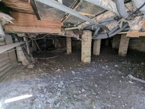
Local Case Insight

A small redevelopment site near Burton-on-Trent involved the removal of a redundant barn within a working agricultural setting, raising initial concerns relating to bat roost potential and adjacent hedgerows. The PEA identified low suitability for bats and confirmed nesting birds as the only material constraint. A straightforward timing restriction was applied to vegetation clearance, allowing the application to be validated at first submission without seasonal delay.

What Happens During a Preliminary Ecological Appraisal?

We carry out Preliminary Ecological Appraisals (PEAs) year-round across Burton-on-Trent. Follow-up species surveys are seasonal; however, a PEA indicates if any are needed, allowing your project to keep moving without unnecessary delays.

Key Deliverables for Burton-on-Trent Projects

Our PEA reflects East Staffordshire Borough Council evidence standards and provides:

  • A comprehensive habitat baseline with identified constraints
  • Protected-species risk appraisal with clear survey recommendations
  • Seasonal timing advice to prevent avoidable delays
  • A validation-ready PEA report for planning submission

This supports confident planning decisions and reduces validation friction.

Step 1

Baseline Established

Boundary and proposed works checked against policy and planning context.

Step 2

Fieldwork

On-site ecological walkover using DEFRA-aligned UKHab methods.

Step 3

Seasonal Survey Roadmap

Bat, bird, reptile, badger and GCN potential identified.

Step 4

Survey Integration & Alignment

BNG, protected species, and EIA surveys coordinated.

Next Steps

Need a PEA in Burton-on-Trent? 
We’ll confirm what your site requires and map the cleanest route through validation. 

FAQ - Preliminary Ecological Appraisals (PEA) in Burton-on-Trent

When is a PEA typically required in Burton-on-Trent?

In Burton-on-Trent, PEAs are often required where development affects brownfield land, river corridors, hedgerows or older buildings.

East Stafford Borough Council – https://www.eaststaffsbc.gov.uk/

Yes. Redevelopment and regeneration sites in Burton-on-Trent frequently trigger PEA requirements.


It allows planners to understand ecological constraints and decide whether further surveys are necessary.


Can a PEA reduce planning risk in Burton-on-Trent?

Yes. A PEA can demonstrate low ecological risk and prevent unexpected survey requirements.


Yes. It provides timing advice to avoid conflicts with nesting birds or other seasonal sensitivities.


Applications may be delayed or conditioned until appropriate ecological evidence is submitted.

Related Services

Preliminary Ecological Appraisal (PEA) in Lichfield

Preliminary Ecological Appraisal (PEA) in Lichfield

Do you have the ecological evidence Lichfield planners require at validation?

We provide the baseline ecological evidence used by Lichfield LPA to validate applications and confirm whether further protected species surveys are required.

Fast, Clear, Planning-Ready Support

Fast response 

Calls answered in 2 rings, emails replied to within the hour.

Free expert advice

Clear guidance before you commit.

Cost-effective

Working in partnership with clients to ensure planning approval first time

Typical 10-day turnaround

Industry Leading Standard

Expert Team

We stay with you from first call through to submission. 

Do you need a Preliminary Ecological Appraisal in Lichfield?

A Preliminary Ecological Appraisal is frequently needed in Lichfield where works include vegetation clearance, demolition, changes to site layout, soil disturbance or interaction with green infrastructure such as hedgerows, watercourses or mature trees. This applies across residential, rural and commercial development types. The PEA provides the evidence base planners require to assess ecological sensitivity and inform proportionate next steps.

By establishing ecological baseline conditions early, a PEA helps prevent uncertainty and ensures any follow-up surveys are identified before they impact delivery timescales.

Across Lichfield, certain landscape features repeatedly lead to PEA requests during planning. These include:

  • River and low-lying land associated with the River Trent catchment — wet ground and riparian habitat often trigger amphibian and bat screening

  • Canal corridors along the Coventry Canal — linear habitat frequently linked to bats, birds and water-associated species

  • Historic cores such as Lichfield city centre and surrounding villages — traditional buildings and mature trees commonly introduce bat and nesting bird risk

Early clarity preserves decision-making control. Late discovery transfers that control to validation officers and consultees.

Our PEA services cover all Lichfield Local Planning Authorities, providing the accurate ecological information councils need to progress applications smoothly.

Why Lichfield planning authorities request PEAs

In Lichfield, planners are legally required to consider the Wildlife & Countryside Act 1981, the Habitats Regulations and the NERC Act 2006 when determining applications. A Preliminary Ecological Appraisal is used to evidence that ecological constraints have been identified in a proportionate and defensible way.

If a PEA is not provided, applications in Lichfield may face validation delays, seasonal survey constraints, or additional ecological conditions later in the process.

Local Case Insight

A modest residential redevelopment close to Lichfield included the demolition of a disused farm outbuilding within an established rural boundary, triggering early consideration of bat roost potential and hedgerow impacts. The PEA confirmed low roost suitability and identified seasonal nesting birds as the only relevant ecological issue. With a brief timing restriction in place, no bat surveys were required and the application validated smoothly at first submission.

What Happens During a Preliminary Ecological Appraisal?

We carry out Preliminary Ecological Appraisals (PEAs) year-round across Lichfield. Follow-up species surveys are seasonal; however, a PEA indicates if any are needed, allowing your project to keep moving without unnecessary delays.

Key Deliverables for Lichfield Projects

Our PEA is aligned with Lichfield District Council expectations and sets out:

  • A full habitat baseline and mapped ecological constraints
  • Protected-species screening with clear guidance on next steps
  • Seasonal advice to keep project timescales on track
  • A PEA report formatted for planning validation

The result is clear ecological context and a more predictable planning outcome.

Step 1

Baseline Established

Boundary and proposed works checked against policy and planning context.

Step 2

Fieldwork

On-site ecological walkover using DEFRA-aligned UKHab methods.

Step 3

Seasonal Survey Roadmap

Bat, bird, reptile, badger and GCN potential identified.

Step 4

Survey Integration & Alignment

BNG, protected species, and EIA surveys coordinated.

Next Steps

Need a PEA in Lichfield? 
We’ll confirm what your site requires and map the cleanest route through validation. 

FAQ - Preliminary Ecological Appraisals (PEA) in Lichfield

When do developments in Lichfield need a PEA?

A PEA is usually required in Lichfield where works affect vegetation, watercourses, mature trees or historic buildings.

Lichfield District Council – https://www.lichfielddc.gov.uk/

Yes. Lichfield District Council often expects a PEA to support validation where ecological risk exists.


Yes. Rural and edge-of-settlement sites around Lichfield frequently require PEAs due to habitat presence.


What information does a PEA provide to Lichfield planners?

It identifies habitats, screens for protected species and advises on further survey needs.


In many cases, yes. A clear PEA can reduce or remove the need for additional conditions.


Planning decisions may be delayed or deferred until sufficient ecological evidence is provided.

Related Services

Preliminary Ecological Appraisal (PEA) in Stafford

Preliminary Ecological Appraisal (PEA) in Stafford

Do you have the ecological evidence Stafford planners require at validation?

We provide the baseline ecological evidence used by Stafford LPA to validate applications and confirm whether further protected species surveys are required.

Fast, Clear, Planning-Ready Support

Fast response 

Calls answered in 2 rings, emails replied to within the hour.

Free expert advice

Clear guidance before you commit.

Cost-effective

Working in partnership with clients to ensure planning approval first time

Typical 10-day turnaround

Industry Leading Standard

Expert Team

We stay with you from first call through to submission. 

Do you need a Preliminary Ecological Appraisal in Stafford?

For developments in Stafford, a PEA is commonly requested where proposals involve demolition, site clearance, earthworks, boundary amendments or contact with habitats such as former industrial land, field margins, streams or established trees. This includes everything from minor residential projects to larger mixed-use schemes. The appraisal enables the council to determine whether protected species could be affected and what further assessment may be required.

Early appraisal provides certainty on ecological risk and helps avoid planning delays caused by unexpected survey requirements later in the process.

Across Stafford, certain landscape features repeatedly lead to PEA requests during planning. These include:

  • River corridors around the River Sow and River Penk — wet ground and riparian habitat often trigger amphibian and bat screening

  • Canal corridors including the Staffordshire & Worcestershire Canal — linear habitat frequently linked to bats, birds and water-associated species

  • Older village centres such as Stone and surrounding rural settlements — traditional buildings and mature trees commonly introduce bat and nesting bird risk

Early clarity preserves decision-making control. Late discovery transfers that control to validation officers and consultees.

Our PEA services cover Stafford Local Planning Authority, providing the accurate ecological information councils need to progress applications smoothly.

Why Stafford planning authorities request PEAs

Planning decisions in Stafford must align with the Wildlife & Countryside Act 1981, the Habitats Regulations and the NERC Act 2006. A Preliminary Ecological Appraisal forms the baseline ecological evidence used by the council to confirm that risks have been identified appropriately.

In the absence of a clear PEA, Stafford applications are commonly delayed at validation, restricted by seasonal survey windows, or conditioned pending further ecological input.

Local Case Insight

A small housing proposal near Stafford involved the demolition of a redundant agricultural structure within an operational farm setting, raising initial concern around bat roost features and vegetation removal. The PEA confirmed low bat roost potential and identified nesting birds as the only material ecological constraint. A limited timing restriction was applied to clearance works, enabling validation at first submission without seasonal hold-up.

What Happens During a Preliminary Ecological Appraisal?

We carry out Preliminary Ecological Appraisals (PEAs) year-round across Stafford. Follow-up species surveys are seasonal; however, a PEA indicates if any are needed, allowing your project to keep moving without unnecessary delays.

Key Deliverables for Stafford Projects

Our PEA meets Stafford Borough Council validation requirements and includes:

  • A complete habitat baseline with ecological constraint mapping
  • Proportionate protected-species screening and survey direction
  • Seasonal timing advice to support programme certainty
  • A planning-ready PEA report for LPA review

This enables clear ecological decisions and a smoother planning process.

Step 1

Baseline Established

Boundary and proposed works checked against policy and planning context.

Step 2

Fieldwork

On-site ecological walkover using DEFRA-aligned UKHab methods.

Step 3

Seasonal Survey Roadmap

Bat, bird, reptile, badger and GCN potential identified.

Step 4

Survey Integration & Alignment

BNG, protected species, and EIA surveys coordinated.

Next Steps

Need a PEA in Stafford? 
We’ll confirm what your site requires and map the cleanest route through validation. 

FAQ - Preliminary Ecological Appraisals (PEA) in Stafford

When is a PEA required for development in Stafford?

A PEA is commonly required in Stafford where demolition, site clearance or ground disturbance is proposed.

East Staffordshire Borough Council – https://www.eaststaffsbc.gov.uk/

Yes. Even modest developments in Stafford can require a PEA if ecological features are present.


It provides proportionate ecological evidence to assess potential impacts and survey needs.


Does a PEA help manage seasonal risk in Stafford?

Yes. It highlights timing constraints linked to nesting birds or protected species activity.


Yes. A PEA may confirm low risk and remove the need for further ecological surveys.


Applications may be held at validation or delayed pending further ecological assessment.

Related Services

Preliminary Ecological Appraisal (PEA) in Cannock

Preliminary Ecological Appraisal (PEA) in Cannock

Do you have the ecological evidence Cannock planners require at validation?

We provide the baseline ecological evidence used by Cannock LPA to validate applications and confirm whether further protected species surveys are required.

Fast, Clear, Planning-Ready Support

Fast response 

Calls answered in 2 rings, emails replied to within the hour.

Free expert advice

Clear guidance before you commit.

Cost-effective

Working in partnership with clients to ensure planning approval first time

Typical 10-day turnaround

Industry Leading Standard

Expert Team

We stay with you from first call through to submission. 

Do you need a Preliminary Ecological Appraisal in Cannock?

In Cannock, a Preliminary Ecological Appraisal is usually required where development affects vegetated land, woodland edges, mature trees, water features, or buildings scheduled for alteration or removal. Both small-scale residential proposals and larger redevelopment sites can trigger this requirement. The PEA gives planners the ecological context needed to assess impacts and decide whether additional surveys are necessary.

By identifying potential ecological constraints at the outset, a PEA supports efficient planning determination and reduces the risk of seasonal or procedural delays.

Across Cannock, certain landscape features repeatedly lead to PEA requests during planning. These include:

  • Former industrial and colliery land across Cannock and Rugeley — brownfield mosaic habitats regularly flag invertebrate and reptile potential

  • Canal corridors including the Cannock Extension Canal and nearby waterways — linear habitat frequently linked to bats, birds and water-associated species

  • Older settlement areas such as Cheslyn Hay and surrounding villages — traditional buildings and mature trees commonly introduce bat and nesting bird risk

Early clarity preserves decision-making control. Late discovery transfers that control to validation officers and consultees.

Our PEA services cover all Cannock Local Planning Authorities, providing the accurate ecological information councils need to progress applications smoothly.

Why Cannock planning authorities request PEAs

In Cannock, planning authorities are required to apply the Wildlife & Countryside Act 1981, the Habitats Regulations and the NERC Act 2006 when reviewing development proposals. A Preliminary Ecological Appraisal is the primary tool used to demonstrate that ecological risk has been identified and scoped correctly.

Where this information is not available, applications in Cannock can be held at validation, delayed by survey timing constraints, or subject to further ecological conditions before approval.

Local Case Insight

A small-scale residential redevelopment in Cannock proposed the removal of an unused outbuilding on land associated with former agricultural use, prompting early consideration of bat roosting risk and boundary vegetation loss. The PEA confirmed low roost suitability and identified nesting birds as the only ecological constraint. A simple timing condition was applied, no bat surveys were required, and the application validated without seasonal delay.

What Happens During a Preliminary Ecological Appraisal?

We carry out Preliminary Ecological Appraisals (PEAs) year-round across Cannock. Follow-up species surveys are seasonal; however, a PEA indicates if any are needed, allowing your project to keep moving without unnecessary delays.

Key Deliverables for Cannock Projects

Our PEA is prepared to satisfy Cannock Chase District Council expectations and delivers:

  • A detailed habitat baseline with mapped constraints
  • Protected-species risk screening with clear survey guidance
  • Seasonal programming advice to avoid delay
  • A validation-ready PEA document for planning submission

The outcome is certainty, clarity and a more streamlined planning process.

Step 1

Baseline Established

Boundary and proposed works checked against policy and planning context.

Step 2

Fieldwork

On-site ecological walkover using DEFRA-aligned UKHab methods.

Step 3

Seasonal Survey Roadmap

Bat, bird, reptile, badger and GCN potential identified.

Step 4

Survey Integration & Alignment

BNG, protected species, and EIA surveys coordinated.

Next Steps

Need a PEA in Cannock? 
We’ll confirm what your site requires and map the cleanest route through validation. 

FAQ - Preliminary Ecological Appraisals (PEA) in Cannock

When do developments in Cannock require a PEA?

In Cannock, a PEA is often required where development affects woodland edges, brownfield land, water features or mature trees.

Cannock Chase Council – https://www.cannockchasedc.gov.uk/

Yes. Former industrial and colliery land in Cannock frequently triggers PEA requirements.


It provides baseline ecological evidence to help planners determine risk and next steps.


Can a PEA prevent planning delays in Cannock?

Early submission of a PEA can avoid validation delays and seasonal survey issues.


Yes. The appraisal screens for protected species and advises whether further surveys are required.


Without a PEA, applications may face validation blocks or additional ecological conditions.

Related Services

Biodiversity Net Gain (BNG) Assessment in Shropshire

Biodiversity Net Gain (BNG) in Shropshire

Planning-ready BNG assessments for Shropshire — verified baselines, Metric 4.0 scoring and proportionate uplift strategies for a predictable planning route.

Do You Need a Biodiversity Net Gain Assessment in Shropshire?

Most developments in Shropshire now require a mandatory 10% biodiversity net gain under the Environment Act 2021.

Local planning authorities expect clear baseline data, a defensible Metric 4.0 calculation and a proportionate uplift strategy before your application can progress. Shropshire’s landscape is shaped by lowland farmland, wet meadow systems, hedgerow-rich pastures, woodland belts, upland edges, and extensive river corridors including the Severn and Teme. These factors strongly influence how LPAs interpret BNG.

Local landscape patterns affecting BNG expectations include:

  • hedgerow and pasture networks across North and Central Shropshire

  • riparian corridors and floodplain meadows along the Severn, Tern and Teme

  • woodland and parkland mosaics in the Shropshire Hills AONB

  • canal-side habitats along the Montgomery and Shropshire Union canals

  • early-successional and restoration habitats on former agricultural and quarry sites

These patterns shape how uplift proposals are evaluated during planning.

We support projects across Shrewsbury, Telford, Oswestry, Bridgnorth, Ludlow, Whitchurch, Market Drayton, Church Stretton and surrounding areas.

Why Shropshire Planners Request BNG Evidence Early

Shropshire LPAs often request BNG evidence early because the county’s diverse mix of grassland, hedgerow networks, riparian corridors and upland edge habitats can lead to condition scores shifting during design development. Early clarity reduces redesign and prevents later uplift recalculation.

Early indicators your Shropshire site may require BNG evidence

BNG Staffordshire Building and land

On the ground, site-level features signal when BNG evidence will be needed:

  • semi-improved grassland or species-rich margins

  • hedgerows linking to wider farm or woodland networks

  • proximity to rivers, streams, wet ditches or floodplain edges

  • pasture or meadow systems with variable condition scores

  • woodland edge transitions or scattered mature trees

  • brownfield or restored land with herb-rich patches

  • layout changes affecting habitat parcels

If any apply, early BNG clarification reduces risk and protects programme certainty.

Local Case Insight

BNG baseline mapping was completed for a small mixed-use scheme near Bridgnorth, where wet meadow margins and connected hedgerows increased uplift requirements. Refining the layout and focusing enhancement within existing ecological corridors delivered the required net gain without reliance on off-site units. Validation progressed smoothly with no requests for metric revision.

Our Approach

BNG must be practical, defensible and proportionate.
We align ecological evidence with real-world design constraints so your metric supports your planning route. We assess habitat condition, distinctiveness and connectivity to identify the most efficient uplift options, whether on-site, off-site or blended. For more detail on methodology, see our Biodiversity Net Gain Assessment service

For schemes requiring integrated landscape design or planting plans, we work alongside our sister company Blue Iris Landscapes to keep proposals aligned with uplift feasibility and LPA expectations.

Every recommendation is shaped for validation, design iteration and planning negotiation.

BNG Requirements — Delivered in a Predictable Sequence

We produce planning-ready BNG Assessments aligned to Staffordshire’s policy expectations.

Key BNG Deliverables for Shropshire Projects

For Shropshire schemes, every planning-ready BNG Assessment includes:

• verified UKHab baseline
• defensible Metric 4.0 calculation
• proportionate, locally-appropriate uplift strategy
• clear validation-ready reporting
• optional HMMP and Biodiversity Gain Plan integration

These deliverables are structured to satisfy Shropshire LPAs while keeping your BNG route proportionate to the scale of development.

Step 1

Habitat baseline surveys

Year-round, with optimal survey seasons

Step 2

Metric 4.0 calculations

 Completed once habitat data is verified. 

Step 3

Uplift strategy development

Aligned with design progression and layout refinement.

Step 4

Integration with Other Surveys

Only if needed. PEA, EIA, and Protected Species surveys 

Next Steps

Contact us and we’ll confirm exactly what your site requires and support a planning-ready, proportionate route forward. 

FAQ - BNG in Shropshire

What is a Biodiversity Net Gain assessment in Shropshire?

A Biodiversity Net Gain assessment measures the existing habitat value of a site using the statutory Biodiversity Metric and calculates how development will affect that value. It determines whether a proposal can achieve at least 10 percent measurable uplift, as required under national legislation.

A BNG assessment is required where development falls within the scope of mandatory Biodiversity Net Gain legislation. This typically includes housing, commercial and agricultural diversification schemes. The assessment is usually prepared at planning application stage to inform layout and design decisions.

The assessment uses the statutory Biodiversity Metric to calculate habitat units based on habitat type, condition, distinctiveness and area. The post development layout is then modelled to confirm whether at least 10 percent uplift is achieved.

An ecological habitat survey is required to classify all habitats on site in accordance with the UK Habitat Classification system. Accurate mapping and condition assessment are essential for reliable metric outputs.

Timescales depend on site size and complexity. Smaller rural sites may be assessed within a few weeks, while larger mixed use schemes require more detailed modelling and may take longer, particularly where seasonal survey constraints apply.

How much does a BNG assessment cost?

Costs vary depending on site size, habitat complexity and design iteration requirements. Rural greenfield sites are typically more straightforward to assess than phased mixed development schemes.

Many agricultural sites can achieve uplift through hedgerow enhancement, woodland planting or meadow creation. However, accurate baseline calculation is critical to avoid overestimating achievable gains.

If on site habitat proposals are insufficient, the assessment will identify the shortfall in biodiversity units. Developers may then secure registered off site biodiversity units to achieve compliance.

Shropshire Council acts as the Local Planning Authority and reviews Biodiversity Net Gain assessments submitted alongside planning applications.

Planning guidance can be accessed at:
https://www.shropshire.gov.uk/planning/

ProHort undertakes detailed habitat surveys and Biodiversity Metric modelling tailored to Shropshire’s rural planning context. We provide clear unit calculations, feasibility advice and practical design recommendations to reduce planning risk and avoid unnecessary unit shortfalls.

Related Services

Biodiversity Net Gain (BNG) Assessment in Telford

Biodiversity Net Gain (BNG) in Telford

Developing or submitting a planning application in Telford and require Biodiversity Net Gain?

BNG is now a mandatory requirement – we specialise in providing compliant reports to achieve planning consent. 

Fast, Clear, Planning-Ready Support

Fast response 

Calls answered in 2 rings, emails replied to within the hour.

Free expert advice

Clear guidance before you commit.

Cost-effective

Working in partnership with clients to ensure planning approval first time

Typical 10-day turnaround

Industry Leading Standard

Expert Team

We stay with you from first call through to submission. 

Do you need a Biodiversity Net Gain Assessment in Telford?

Biodiversity Net Gain is now a mandatory part of the planning system for most developments in Telford. The principle is straightforward: a project must demonstrate that the site will deliver an overall improvement in biodiversity compared with its starting condition. Planning authorities will not validate many applications without clear and correctly presented BNG evidence, and missing information often leads to further delays later in the process.

Planning officers in Telford & Wrekin may request Biodiversity Net Gain (BNG) information where development has the potential to affect important local habitat networks. Common scenarios include:

  • River and stream corridors, particularly those associated with the River Severn and its tributaries
  • Previously developed or regeneration land that has naturally colonised with early-successional habitats
  • Urban green infrastructure, including parks, woodland blocks, buffer strips and open spaces that support wildlife movement
  • Transport corridors and landscape linkages, such as road, rail and valley features that function as ecological connections

Providing clear, proportionate and well-structured BNG evidence is essential, as incomplete or unclear submissions can lead to validation queries or delays in the planning process.

We support development projects across Telford & Wrekin, working within Telford’s urban areas, surrounding settlements, and the wider borough. This includes the town centre and established communities such as Wellington, Oakengates, Dawley, Madeley, Ironbridge, Donnington, Lawley, Hadley, and Newport, as well as adjacent rural locations within the local authority boundary.

Why planning authorities in Telford request a BNG

Telford & Wrekin Council typically expects Biodiversity Net Gain (BNG) considerations to be addressed at an early stage, allowing officers to confirm that a proposal can deliver the mandatory 10% biodiversity uplift before site layouts are fixed. If this cannot be delivered the proof of purchase of off-site units needs to be provided which we can help with.

This approach relies on an agreed habitat baseline, a completed Biodiversity Metric demonstrating the change in biodiversity units, and a clear strategy explaining how gains will be achieved and secured. These elements align with the requirements of NPPF Section 15 and help ensure BNG remains robust throughout the planning process.

Establishing the baseline early reduces the risk of later habitat reclassification and helps safeguard project timescales by avoiding unnecessary planning delays.

Local Case Insight

A Biodiversity Net Gain assessment for a mixed residential scheme on the edge of Telford identified unexpectedly valuable habitats within areas of informal open land bordering a drainage corridor. What initially appeared to be low-value grassland was found to include species-rich hedgerows, developing scrub, and seasonally wet ground associated with a field ditch. By refining the site layout to retain these features and enhancing them through targeted native planting and improved habitat connectivity, the scheme was able to deliver its required biodiversity net gain entirely on-site. This approach supported the ecological function of the wider green network and allowed the planning application to proceed without reliance on off-site units or later design revisions.

How the BNG process works

We produce planning-ready BNG Assessments aligned to Telford’s policy expectations.

Key BNG Deliverables for Telford Projects

For development proposals in Telford & Wrekin, our Biodiversity Net Gain (BNG) assessments provide the key information planning officers typically require. Each assessment includes:

  •  a verified UKHab habitat baseline
  •  a clearly evidenced Biodiversity Metric calculation
  •  a proportionate net gain delivery strategy tailored to the site
  • planning-ready reporting suitable for application validation
  •  optional long-term management and biodiversity gain plan documentation

This structured approach aligns with the expectations of Telford & Wrekin Council and provides a clear, proportionate route to demonstrating BNG across a wide range of development types.

Step 1

Habitat baseline surveys

Year-round, with optimal survey seasons

Step 2

Metric 1.0.4 calculations

 Completed once habitat data is verified. 

Step 3

Uplift strategy development

Aligned with design progression and layout refinement.

Step 4

Integration with Other Surveys

Only if needed. PEA, EIA, and Protected Species surveys 

Next Steps

Contact us, and we’ll confirm exactly what your Telford site requires. We provide a planning-ready, proportionate route forward. 

FAQ - BNG in Telford

Do I need a BNG Assessment for development in Telford?

Yes. Most developments in Telford now require BNG to show a measurable increase in biodiversity. Telford Council will not validate many applications without it.

You can review local planning guidance here: 


As early as possible. Early baseline work prevents redesign later and gives the planning team confidence that the scheme can meet the ten percent uplift.

Sites near canals, river valleys, former industrial land, railway corridors, and urban greenspace commonly need detailed BNG evidence.

Can small sites in Telford be exempt from BNG?

Only in limited situations defined by national policy. Most urban sites still fall within the requirement even when habitat cover is low.

Off site units can be purchased if the 10% cannot be achieved on site. We can assist with this, ensuring you get your planning permission.

Straightforward sites are often completed quickly. More complex urban schemes may require further information or design input.

Related Services

Bat Emergence Survey in Birmingham

Bat Dusk Emergence Surveys in Birmingham

Planning permission deadline looming, and no bat dusk survey arranged for your Birmingham site?

Avoid delays or refusals. Our expert team delivers fast, fully compliant dusk surveys to ensure your project stays on schedule.

Fast, Clear, Planning-Ready Support

Fast response 

Calls answered in 2 rings, emails replied to within the hour.

Free expert advice

Clear guidance before you commit.

Cost-effective

Working in partnership with clients to ensure planning approval first time

Typical 10-day turnaround

Industry Leading Standard

Expert Team

We stay with you from first call through to submission. 

Do You Need a Bat Dusk Emergence Survey in Birmingham?

If you’re a homeowner in Birmingham, a dusk emergence survey is often required when roof works, loft conversions, barn conversions, or demolition affect buildings with potential bat roosts. Birmingham City Council usually requires confirmation that bats are not present before work can start.

For developers in Birmingham, dusk emergence surveys are needed when a Preliminary Roost Assessment (PRA) identifies low, moderate, or high roost potential. Planners need reliable presence/absence evidence to support applications, which commonly affects housing developments, conversions, infrastructure projects, and regeneration sites.

Early surveys protect your project from seasonal delays, redesign costs, and unexpected licensing requirements.

In Birmingham, dusk emergence surveys are often required where development interacts with:

  • Victorian and Edwardian housing districts, with lofts and old brick cavity walls that may support bat roosts.

  • Former industrial zones, including Digbeth, Aston, and Nechells, where warehouses and factories are being converted.

  • City canal networks, such as the Birmingham Canal Navigations through Brindleyplace, Gas Street, and Salford Junction.

  • Urban parks and nature reserves, including Cannon Hill Park, Kings Heath Park, and semi-natural woodland pockets that maintain wildlife corridors.

Bat survey requirements are routinely assessed during planning validation where roost potential exists, helping keep Birmingham projects on schedule and compliant.

Our Bat Dusk Emergence Survey services cover Birmingham, including: Digbeth, Jewellery Quarter, Edgbaston, Moseley, Sutton Coldfield, Cannon Hill Park, and the city’s canal corridors.

Why Birmingham Planning Authorities Request Bat Dusk Emergence Surveys

Birmingham planning authorities require dusk emergence survey evidence wherever buildings or trees present credible roost potential. This ensures compliance with the Wildlife & Countryside Act 1981, the Conservation of Habitats and Species Regulations 2017, and national planning policy. Without seasonal emergence data, planners cannot lawfully confirm that development will avoid disturbance to protected bat roosts.

If your Birmingham project involves demolition, conversion, or structural alteration, dusk emergence survey evidence should be obtained before your application reaches validation.

Local Case Insight

A refurbishment project in Birmingham’s Digbeth district involved alterations to a former industrial building near a canal corridor and mature boundary trees. An initial inspection identified potential roost access points beneath roof tiles. Two dusk emergence surveys conducted during early summer confirmed bat activity along the canal but found no roosts within the building. The resulting report allowed the planning application to validate without seasonal delays, with lighting controls incorporated into the design. Works proceeded on schedule and without disruption.

The Bat Dusk Emergence Survey Process

Our Bat Emergence Surveys in Birmingham provide fully compliant reports accepted by local planning authorities. As a result, your project stays on schedule with fewer seasonal setbacks.

Key Deliverables for Birmingham Projects

Where emergence data is needed to support planning in Birmingham, we provide:

  • A legally defensible dusk emergence survey report

  • Confirmation of the presence or likely absence of roosting bats

  • Assessment of impacts and recommended mitigation where required

  • Licence pathway guidance if disturbance cannot be avoided

  • Documentation structured for Birmingham City Council planning review

The outcome is certainty, not escalation, keeping your project on schedule and compliant.

Step 1

Scoping

Confirm site details, development scope, survey window and roost features from a PRA.

Step 2

Dusk Surveys

Carry out dusk emergence surveys (May–Aug) using licensed ecologists and detectors.

Step 3

Assessment

Interpret results, assess impacts and identify any mitigation or licensing needs.

Step 4

Reporting & Integration

Align findings with PRA, PEA or any other ecological surveys where required

Next Steps

Need to confirm whether your Birmingham site requires a dusk emergence bat survey? 


Send your site details and we’ll confirm exactly what’s required before your application reaches validation. 

FAQ - Bat Dusk Emergence Surveys in Birmingham

Do Birmingham planning authorities require dusk emergence surveys for most roof works?

Yes. If your project involves roof works, loft conversions, or structural alterations in buildings with potential bat roosts, Birmingham City Council will usually request a dusk emergence survey to ensure protected species are not disturbed.

Local planning Authority link:

Birmingham City Councilhttps://www.birmingham.gov.uk/planning

Surveys are most reliable during early summer, when bat activity is highest. Off-season surveys may not provide sufficient evidence for planning validation and could require repeat visits.

If bats are present, we provide guidance on mitigation measures and the necessary licensing process so your project can proceed legally and safely.

Will a dusk emergence survey delay a Birmingham planning application?

If scheduled early, surveys can be completed before submission, allowing the application to validate on time and avoiding seasonal delays.

Survey data is typically considered valid for 2 years, provided no major changes occur to the building, trees, or surrounding habitats.

Not always. A PRA identifies roost potential—if it indicates low, moderate, or high likelihood, a dusk emergence survey is generally required to provide robust evidence for planners.

Related Services

Botanical Surveys in Staffordshire

Botanical Surveys in Staffordshire

Uncertainty around how site vegetation may affect planning and local authority requirements?

A botanical survey removes doubt early, locking in habitat value before it becomes a planning problem.

Fast, Clear, Planning-Ready Support

Fast response 

Calls answered in 2 rings, emails replied to within the hour.

Free expert advice

Clear guidance before you commit.

Cost-effective

Working in partnership with clients to ensure planning approval first time

Typical 10-day turnaround

Industry Leading Standard

Expert Team

We stay with you from first call through to submission. 

Do you need a Botanical Survey in Staffordshire?

If the condition or type of vegetation on your Staffordshire site affects layout, mitigation, or Biodiversity Net Gain, a botanical survey is often the point where uncertainty is removed. These surveys are most relevant where grassland, wet areas, field margins or previously unmanaged land are involved, especially if habitat value could influence what you are allowed to remove, retain or enhance.

For many projects, the issue is not whether development is possible, but whether the habitat will be classed as low value or something that reshapes the scheme. A botanical survey provides that clarity early, before assumptions are built into design or cost plans.

Across Staffordshire, certain landscape patterns frequently elevate the need for botanical evidence at planning stage.

Trent Valley floodplain near Burton upon Trent and Alrewas — grazing marsh, wet grassland, and riparian margins often require condition confirmation

Former industrial land around Stoke-on-Trent, Cannock and Rugeley — open mosaic habitats regularly need botanical verification

Agricultural fringes near Stafford, Lichfield and Uttoxeter — hedgerows, margins, and semi-improved grassland affect habitat scoring

Canal corridors along the Trent & Mersey and Caldon Canals — linear vegetation and unmanaged banks trigger habitat scrutiny

Older pasture and estate land near Eccleshall and Stone — long-established grassland often requires formal classification

These features commonly inform LPA validation checks.

Our Botanical Surveys provide clear, site-specific plant evidence for developments across Staffordshire and the surrounding area.

Why Planning Authorities Request an a Botanical Survey in Staffordshire

Local planning authorities request Botanical Surveys in Staffordshire to meet statutory duties under the Wildlife and Countryside Act 1981, the NERC Act 2006 (Section 41) and national planning policy. Where habitat condition, distinctiveness or classification could influence planning balance or Biodiversity Net Gain calculations, officers must rely on species-level evidence rather than assumption.

Without verified botanical data, Staffordshire LPAs are unable to confirm baseline value, assess proportional mitigation, or sign off BNG metrics. 

Local Case Insight

A residential scheme on former pasture land near Lichfield progressed to planning with an assumed low-value grassland baseline. During validation, the LPA queried habitat condition due to surrounding hedgerow networks and limited management history. A Botanical Survey confirmed the grassland as species-poor and not priority habitat, allowing the BNG baseline to stand without redesign. The application validated without delay and avoided a growing-season resurvey the following year.

What Happens During a Botanical Survey?

Our Botanical Surveys in Staffordshire are built to establish habitat value with accuracy and confidence. Survey effort is focused on the vegetation present and timed to the right season, ensuring plant evidence reflects real site conditions.

Key Deliverables for Staffordshire Botanical Surveys

Defensible habitat classification
Clear identification of habitat types using UKHab or NVC where required, removing uncertainty over distinctiveness or priority status.

Condition evidence that supports BNG scoring
Robust plant data used to justify baseline condition scores and avoid late-stage metric challenges.

Planning-ready habitat mapping
Accurate spatial plans that align with red-line boundaries and feed directly into planning and BNG documentation.

Integration with wider ecology
Botanical findings aligned with PEA outcomes, BNG assessments, and any follow-on habitat or species work to keep evidence consistent.

Step 1

Site Walkover

Plant communities and indicator species recorded. 

Step 2

Habitat Assessment

Focused on areas influencing layout, classification, or BNG outcomes

Step 3

Habitat Extent

Plans matched to red-line boundaries.

Step 4

Reporting & Integration

Integration with wider ecology if necessary.

Next Steps

Unsure how site vegetation affects next steps?


We’ll check what’s on the ground and explain what evidence is required.

FAQ - Botanical Surveys in Staffordshire

What is a botanical survey and when is it required in Staffordshire?

A botanical survey is a professional assessment of plant species and habitats on a site. In Staffordshire, it is typically required to support planning applications where vegetation may be impacted, particularly on undeveloped land, garden plots, or sites near designated ecological areas. Local planning authorities will often expect botanical data to inform biodiversity decisions.

Botanical surveys can range from a habitat walkover to more detailed vegetation classification. Common types include UKHab habitat surveys, National Vegetation Classification (NVC) surveys, and targeted flora surveys for notable or protected plant species. The level of survey depends on the scale and ecological sensitivity of the site.

The optimal survey season is typically between April and September, when plant species are most visible and identifiable. However, early or late season surveys can still be undertaken where necessary, often supplemented with professional interpretation and, if required, follow up visits during peak growing periods.

In many cases, yes. Even small sites in Staffordshire can support habitats of ecological value. If your development involves vegetation clearance, garden land, or semi-natural habitats, a botanical survey may be required to demonstrate biodiversity considerations as part of your planning submission.

A botanical survey report provides a detailed breakdown of habitats present, plant species identified, and an assessment of ecological value. It will also include mapping, photographs, and recommendations for mitigation or enhancement, ensuring the report is suitable for planning validation and decision-making.

How do botanical surveys support Biodiversity Net Gain (BNG)?

Botanical surveys establish the baseline habitat conditions on a site, which is essential for calculating biodiversity value using the DEFRA metric. This baseline informs how development will impact biodiversity and what measures are needed to achieve the required uplift under Biodiversity Net Gain legislation.

Yes. Botanical surveys will identify invasive non-native species such as Japanese knotweed, Himalayan balsam, or giant hogweed if present. Early identification is critical, as these species can affect planning decisions, site management, and long-term development costs.

The on-site survey itself is often completed within a few hours for smaller sites, although larger or more complex sites may take longer. Following this, a detailed report is produced, typically within a few days to a couple of weeks depending on site complexity and survey requirements.

Many local authorities in Staffordshire require ecological information, including botanical data, as part of their validation process. For example, guidance from Staffordshire County Council and local borough councils highlights the need for ecological surveys where habitats may be affected. Providing a robust botanical survey helps avoid delays or requests for further information.

If notable habitats or species are identified, the survey will outline appropriate mitigation or enhancement measures. This may include habitat retention, sensitive site design, or the creation of new habitats. These recommendations help ensure compliance with planning policy and biodiversity requirements.

Related Services

Bat Emergence Survey in Coventry

Bat Dusk Emergence Surveys in Coventry

Planning permission deadline looming, and no bat dusk survey arranged for your Coventry site?

Avoid delays or refusals. Our expert team delivers fast, fully compliant dusk emergence surveys across Coventry to keep your project on track.

Fast, Clear, Planning-Ready Support

Fast response 

Calls answered in 2 rings, emails replied to within the hour.

Free expert advice

Clear guidance before you commit.

Cost-effective

Working in partnership with clients to ensure planning approval first time

Typical 10-day turnaround

Industry Leading Standard

Expert Team

We stay with you from first call through to submission. 

Do You Need a Bat Dusk Emergence Survey in Coventry?

For homeowners in Coventry, a dusk emergence survey is usually required when roof repairs, loft or barn conversions, or demolition could affect buildings with potential bat roosts. Coventry City Council generally requires confirmation that bats are not present before works begin.

For developers in Coventry, surveys are necessary when a Preliminary Roost Assessment (PRA) identifies low, moderate, or high roost potential. Planners need robust presence/absence evidence to support applications, commonly affecting housing projects, conversions, infrastructure upgrades, and regeneration schemes.

Conducting surveys early helps safeguard your project from seasonal delays, redesign costs, and unexpected licensing requirements.

In Coventry, dusk emergence surveys are often required where development interacts with:

  • Historic residential areas, such as Earlsdon and Stoke, with lofts and older brick cavity walls that may provide roosting opportunities.

  • Former industrial zones, including Foleshill, Binley, and Cheylesmore, where warehouses and factories are being repurposed or converted.

  • River and canal corridors, including the Coventry Canal and River Sherbourne, which intersect redevelopment sites.

  • Urban parks and green spaces, such as Coombe Abbey Park, War Memorial Park, and semi-natural woodland pockets that maintain wildlife connectivity.

Bat survey requirements are routinely assessed during planning validation where roost potential exists, helping keep Coventry projects on schedule and compliant.

Our Bat Dusk Emergence Survey services cover Coventry, including: Foleshill, Binley, Cheylesmore, Earlsdon, Stoke, Coombe Abbey Park, and the city’s canal and river corridors.

Why Coventry Planning Authorities Request Bat Dusk Emergence Surveys

Coventry planning authorities require dusk emergence survey evidence wherever buildings or trees present credible roost potential. This ensures compliance with the Wildlife & Countryside Act 1981, the Conservation of Habitats and Species Regulations 2017, and national planning policy. Without seasonal emergence data, planners cannot lawfully confirm that development will avoid disturbance to protected bat roosts.

If your Coventry project involves demolition, conversion, or structural alteration, dusk emergence survey evidence should be obtained before your application reaches validation to keep your project on schedule and compliant.

Local Case Insight

A refurbishment project in Coventry’s Foleshill area involved alterations to a former industrial building adjacent to the Coventry Canal and mature boundary trees. An initial inspection identified potential roost access points beneath roof tiles. Two dusk emergence surveys conducted during early summer confirmed bat activity along the canal but found no roosts within the building. The resulting report allowed the planning application to validate without seasonal delays, with lighting controls incorporated into the design. Works proceeded on schedule and without disruption.

The Bat Dusk Emergence Survey Process

Our Bat Emergence Surveys in Coventry provide fully compliant reports accepted by local planning authorities. As a result, your project stays on schedule with fewer seasonal setbacks.

Key Deliverables for Coventry Projects

Where emergence data is needed to support planning in Coventry, we provide:

  • A legally defensible dusk emergence survey report

  • Confirmation of the presence or likely absence of roosting bats

  • Assessment of impacts and recommended mitigation where required

  • Licence pathway guidance if disturbance cannot be avoided

  • Documentation structured for Coventry City Council planning review

The outcome is certainty, not escalation, keeping your project on schedule and fully compliant.

Step 1

Scoping

Confirm site details, development scope, survey window and roost features from a PRA.

Step 2

Dusk Surveys

Carry out dusk emergence surveys (May–Aug) using licensed ecologists and detectors.

Step 3

Assessment

Interpret results, assess impacts and identify any mitigation or licensing needs.

Step 4

Reporting & Integration

Align findings with PRA, PEA or any other ecological surveys where required

Next Steps

Need to confirm whether your Coventry site requires a dusk emergence bat survey? 


Send your site details and we’ll confirm exactly what’s required before your application reaches validation. 

FAQ - Bat Dusk Emergence Surveys in Coventry

Do Coventry planning authorities require dusk emergence surveys for most roof works?

Yes. If your project involves roof repairs, loft or barn conversions, or structural alterations in buildings with potential bat roosts, Coventry City Council usually requires a dusk emergence survey.

Surveys are most reliable during early summer, when bat activity is highest. Off-season surveys may not provide sufficient evidence for planning validation.

If bats are present, we provide mitigation guidance and support with the licensing process so your project can proceed legally.

Will a dusk emergence survey delay a Coventry planning application?

If scheduled early, surveys can be submitted with your application, allowing Coventry City Council to validate on time and avoid seasonal delays.

Survey data is generally considered valid for 2 years, provided there are no major changes to the building, trees, or surrounding habitats.

Not always. A PRA identifies roost potential—if it indicates low, moderate, or high likelihood, a dusk emergence survey is generally required to provide robust evidence for planners.

Related Services

Biodiversity Net Gain (BNG) Assessment in Shrewsbury

Biodiversity Net Gain (BNG) in Shrewsbury

Developing or submitting a planning application in Shrewsbury and require Biodiversity Net Gain?

BNG is now a mandatory requirement – we specialise in providing compliant reports to achieve planning consent. 

Fast, Clear, Planning-Ready Support

Fast response 

Calls answered in 2 rings, emails replied to within the hour.

Free expert advice

Clear guidance before you commit.

Cost-effective

Working in partnership with clients to ensure planning approval first time

Typical 10-day turnaround

Industry Leading Standard

Expert Team

We stay with you from first call through to submission. 

Do you need a Biodiversity Net Gain Assessment in Shrewsbury?

Biodiversity Net Gain is now a mandatory part of the planning system for most developments in Shrewsbury. The principle is straightforward: a project must demonstrate that the site will deliver an overall improvement in biodiversity compared with its starting condition. Planning authorities will not validate many applications without clear and correctly presented BNG evidence, and missing information often leads to further delays later in the process.

Planning officers in Shrewsbury often request Biodiversity Net Gain (BNG) information where development may impact important habitat networks. Typical situations include:

  • River and canal corridors, particularly along the River Severn and associated tributaries

  • Former industrial or brownfield sites that have naturally developed early-stage habitats

  • Urban greenspaces, including parks, woodland fragments, and hedgerow networks that support local wildlife movement

  • Valley systems and transport corridors, which function as ecological linkages across the town

Providing clear, well-structured BNG evidence is essential, as incomplete or unclear submissions can lead to validation issues or delays in the planning process.

We support development projects across Shrewsbury and the surrounding area, including the town centre, Abbey Foregate, Meole Brace, Belle Vue, Harlescott, Monkmoor, Sutton Farm, Castlefields, and Radbrook, as well as neighbouring villages within the Shropshire Council boundary.

Why planning authorities in Shrewsbury request a BNG

Councils in Shrewsbury look for BNG information at an early stage so they can be confident that your scheme will achieve the required ten percent increase in biodiversity before the layout is finalised. To satisfy this, they need a verified baseline, a completed Metric that shows the change in biodiversity units, and a clear approach for how the gain will be delivered and secured. These steps follow the expectations of NPPF Section 15 and ensure your BNG position is robust during planning.

Having the baseline confirmed early removes the risk of later reclassification and helps protect your programme from avoidable delays.

Local Case Insight

An early biodiversity assessment for a mixed use development on the edge of Shrewsbury identified overlooked habitat value along a disused rail corridor and adjacent rough ground. Areas initially assumed to be of limited interest supported regenerating scrub, semi natural grassland and damp hollows connected to the wider River Severn landscape. By adjusting the site layout to retain these features and targeting new planting to reinforce existing green corridors, the scheme achieved its required biodiversity net gain on site. This approach avoided the need for off site units and allowed the planning application to progress without redesign or delay.

How the BNG process works

We produce planning-ready BNG Assessments aligned to Shrewsbury policy expectations.

Key BNG Deliverables for Shrewsbury Projects

For developments in Shrewsbury, our Biodiversity Net Gain (BNG) assessments provide the key information that planning officers typically require. Each assessment includes:

  • a verified UKHab habitat baseline

  • a clearly evidenced Biodiversity Metric calculation

  • a practical net gain delivery strategy tailored to the site

  • planning-ready reporting suitable for application validation

  • optional long-term management and biodiversity gain plan documentation

This structured approach aligns with the expectations of Shropshire Council and offers a proportionate, site-specific route to demonstrating BNG for a wide range of development types.

Step 1

Habitat baseline surveys

Year-round, with optimal survey seasons

Step 2

Metric 1.0.4 calculations

 Completed once habitat data is verified. 

Step 3

Uplift strategy development

Aligned with design progression and layout refinement.

Step 4

Integration with Other Surveys

Only if needed. PEA, EIA, and Protected Species surveys 

Next Steps

Contact us, and we’ll confirm exactly what your Shrewsbury site requires. We provide a planning-ready, proportionate route forward. 

FAQ - BNG in Greater Shrewsbury

Do I need a BNG Assessment for development in Shrewsbury?

Yes. Most developments in Shrewsbury now require BNG to show a measurable increase in biodiversity. Shrewsbury Council will not validate many applications without it.

You can review local planning guidance here: 

As early as possible. Early baseline work prevents redesign later and gives the planning team confidence that the scheme can meet the ten percent uplift.

Sites near canals, river valleys, former industrial land, railway corridors, and urban greenspace commonly need detailed BNG evidence.

Can small sites in Shrewsbury be exempt from BNG?

Only in limited situations defined by national policy. Most urban sites still fall within the requirement even when habitat cover is low.

Off site units can be purchased if the 10% cannot be achieved on site. We can assist with this, ensuring you get your planning permission.

Straightforward sites are often completed quickly. More complex urban schemes may require further information or design input.

Related Services

---