Bat Emergence Survey in Wolverhampton

Bat Dusk Emergence Surveys in Wolverhampton

Planning permission deadline approaching, and no bat dusk survey arranged for your Wolverhampton site?

Don’t risk delays or refusal. Our expert team provides fast, fully compliant dusk emergence surveys across Wolverhampton to keep your project on schedule.

Fast, Clear, Planning-Ready Support

Fast response 

Calls answered in 2 rings, emails replied to within the hour.

Free expert advice

Clear guidance before you commit.

Cost-effective

Working in partnership with clients to ensure planning approval first time

Typical 10-day turnaround

Industry Leading Standard

Expert Team

We stay with you from first call through to submission. 

Do You Need a Bat Dusk Emergence Survey in Wolverhampton?

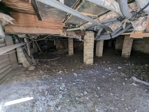
For homeowners in Wolverhampton, a dusk emergence survey is typically required when roof repairs, loft or barn conversions, or demolition could impact buildings with potential bat roosts. Wolverhampton City Council usually requires confirmation that bats are not present before work can begin.

For developers in Wolverhampton, surveys are necessary when a Preliminary Roost Assessment (PRA) identifies low, moderate, or high roost potential. Planners require robust presence/absence evidence to support applications, commonly affecting housing developments, conversions, infrastructure projects, and regeneration schemes.

Conducting surveys early protects your project from seasonal delays, redesign costs, and unexpected licensing requirements.

In Wolverhampton, dusk emergence surveys are often required where development interacts with:

  • Historic residential areas, such as Tettenhall, Penn, and Chapel Ash, with lofts and older brick cavity walls that may provide bat roosting opportunities.

  • Former industrial zones, including Bilston, Blakenhall, and Wednesfield, where warehouses and factories are being repurposed or converted.

  • River and canal corridors, including the Staffordshire & Worcestershire Canal and the River Stour, which intersect redevelopment sites.

  • Urban parks and green spaces, such as West Park, Bantock Park, and semi-natural woodland pockets that maintain wildlife connectivity.

Bat survey requirements are routinely assessed during planning validation where roost potential exists, helping keep Wolverhampton projects on schedule and compliant.

Our Bat Dusk Emergence Survey services cover Wolverhampton, including: Tettenhall, Penn, Chapel Ash, Bilston, Blakenhall, West Park, Bantock Park, and the city’s canal and river corridors.

Why Wolverhampton Planning Authorities Request Bat Dusk Emergence Surveys

Wolverhampton planning authorities require dusk emergence survey evidence wherever buildings or trees present credible roost potential. This ensures compliance with the Wildlife & Countryside Act 1981, the Conservation of Habitats and Species Regulations 2017, and national planning policy. Without seasonal emergence data, planners cannot lawfully confirm that development will avoid disturbance to protected bat roosts.

If your Wolverhampton project involves demolition, conversion, or structural alteration, dusk emergence survey evidence should be obtained before your application reaches validation to keep your project on schedule and compliant.

Local Case Insight

A refurbishment project in Wolverhampton’s Bilston area involved alterations to a former industrial building near the Staffordshire & Worcestershire Canal and mature boundary trees. An initial inspection identified potential roost access points beneath roof tiles. Two dusk emergence surveys conducted during early summer confirmed bat activity along the canal but found no roosts within the building. The resulting report allowed the planning application to validate without seasonal delays, with lighting controls incorporated into the design. Works proceeded on schedule and without disruption.

The Bat Dusk Emergence Survey Process

Our Bat Emergence Surveys in Wolverhampton provide fully compliant reports accepted by local planning authorities. As a result, your project stays on schedule with fewer seasonal setbacks.

Key Deliverables for Wolverhampton Projects

Where emergence data is needed to support planning in Wolverhampton, we provide:

  • A legally defensible dusk emergence survey report

  • Confirmation of the presence or likely absence of roosting bats

  • Assessment of impacts and recommended mitigation where required

  • Licence pathway guidance if disturbance cannot be avoided

  • Documentation structured for Wolverhampton City Council planning review

The outcome is certainty, not escalation, keeping your project on schedule and fully compliant.

Step 1

Scoping

Confirm site details, development scope, survey window and roost features from a PRA.

Step 2

Dusk Surveys

Carry out dusk emergence surveys (May–Aug) using licensed ecologists and detectors.

Step 3

Assessment

Interpret results, assess impacts and identify any mitigation or licensing needs.

Step 4

Reporting & Integration

Align findings with PRA, PEA or any other ecological surveys where required

Next Steps

Need to confirm whether your Wolverhampton site requires a dusk emergence bat survey? 


Send your site details and we’ll confirm exactly what’s required before your application reaches validation. 

FAQ - Bat Dusk Emergence Surveys in Wolverhampton

Which types of Wolverhampton properties most commonly require a dusk emergence survey?

Properties with lofts, older brick cavity walls, barns, or historic structures—particularly in residential, industrial, or canal-side areas—often require surveys before roof works, conversions, or demolition.

Planners rely on a Preliminary Roost Assessment (PRA) to identify low, moderate, or high roost potential. If potential exists, a dusk emergence survey is usually requested to confirm presence or absence of bats.

Yes. Surveys can be coordinated with ecological impact assessments, tree surveys, or habitat appraisals, saving time and ensuring planning submissions are complete.

How soon should a dusk emergence survey be scheduled before submitting a Wolverhampton planning application?

Surveys should be scheduled well before submission, ideally during early summer, to provide timely evidence for Wolverhampton City Council and avoid seasonal delays.

Mitigation may include timed work schedules, exclusion measures, roost enhancements, or lighting controls, with guidance on any required licensing to ensure legal compliance.

Yes. Surveys are especially important near canal corridors, rivers, urban parks, and semi-natural woodlands, such as West Park, Bantock Park, and areas along the Staffordshire & Worcestershire Canal.

Related Services

Bat Emergence Survey in Dudley

Bat Dusk Emergence Surveys in Dudley

Planning submission approaching and no bat dusk emergence survey in place for your Dudley site?

Avoid setbacks at validation. Our experienced ecologists deliver prompt, fully compliant dusk emergence surveys across Dudley, helping your application progress smoothly and lawfully.

Fast, Clear, Planning-Ready Support

Fast response 

Calls answered in 2 rings, emails replied to within the hour.

Free expert advice

Clear guidance before you commit.

Cost-effective

Working in partnership with clients to ensure planning approval first time

Typical 10-day turnaround

Industry Leading Standard

Expert Team

We stay with you from first call through to submission. 

Do You Need a Bat Dusk Emergence Survey in Dudley?

For homeowners in Dudley, a bat dusk emergence survey is often required where roof alterations, loft or barn conversions, or demolition could affect buildings with features suitable for bat roosting. Dudley Metropolitan Borough Council typically expects confirmation that protected species will not be disturbed before works proceed.

For developers working in Dudley, surveys are required where a Preliminary Roost Assessment (PRA) identifies any level of roost potential. Planning officers rely on clear presence or likely absence evidence to support applications, particularly for redevelopment schemes, building conversions, infrastructure works, and brownfield regeneration sites.

Undertaking surveys at an early stage helps prevent seasonal constraints, late design changes, and unexpected licensing obligations, keeping projects moving forward with confidence.

In Dudley, dusk emergence surveys are commonly required where development interacts with:

  • Older residential neighbourhoods, including Sedgley, Gornal, and Netherton, where traditional housing stock often contains roof voids and masonry features suitable for bat roosts.

  • Former industrial and quarry sites, such as those around Brierley Hill and Pensnett, where mills, workshops, and redundant structures are being redeveloped or converted.

  • Canal and watercourse corridors, including sections of the Dudley Canal and local tributaries, which form key commuting routes for bats through redevelopment areas.

  • Parks, woodlands, and limestone landscapes, including Wrens Nest, Saltwells Nature Reserve, and surrounding semi-natural habitats that support strong ecological connectivity.

Bat survey requirements are routinely examined at planning validation where roost potential exists, helping Dudley projects proceed with clarity and compliance.

Our Bat Dusk Emergence Survey services cover Dudley, including: Sedgley, Gornal, Netherton, Brierley Hill, Kingswinford, Wrens Nest, Saltwells Nature Reserve, and the borough’s canal and watercourse corridors.

Why Dudley Planning Authorities Request Bat Dusk Emergence Surveys

Dudley planning authorities require dusk emergence survey evidence wherever buildings or trees show credible potential to support bat roosts. This is necessary to demonstrate compliance with the Wildlife & Countryside Act 1981, the Conservation of Habitats and Species Regulations 2017, and national planning policy. Without seasonally appropriate emergence data, planners cannot lawfully confirm that development proposals will avoid harm to protected bat roosts.

If your Dudley project includes demolition, conversion, or significant structural alteration, dusk emergence survey evidence should be secured ahead of planning validation to reduce risk of delay and maintain programme certainty.

Local Case Insight

A refurbishment scheme in Brierley Hill, Dudley involved alterations to a former industrial building close to the Dudley Canal and established boundary vegetation. An initial ecological inspection identified several features with potential to support bat roosting beneath roof coverings. Two dusk emergence surveys were completed during suitable early-summer conditions. These confirmed bat commuting activity along the canal corridor but recorded no roosting within the building structure. The resulting report enabled the planning application to validate without seasonal conditions, with proportionate lighting controls incorporated at design stage. Construction works commenced without programme disruption.

The Bat Dusk Emergence Survey Process

Our Bat Emergence Surveys in Dudley provide fully compliant reports accepted by local planning authorities. As a result, your project stays on schedule with fewer seasonal setbacks.

Key Deliverables for Dudley Projects

Where dusk emergence data is required to support planning in Dudley, we provide:

  • A legally robust dusk emergence survey report

  • Clear confirmation of the presence or likely absence of roosting bats

  • Impact evaluation with proportionate mitigation where necessary

  • Guidance on licensing routes if disturbance cannot be avoided

  • Documentation prepared for Dudley Metropolitan Borough Council planning review

The outcome is clarity, not escalation, allowing your project to progress confidently and in full compliance.

Step 1

Scoping

Confirm site details, development scope, survey window and roost features from a PRA.

Step 2

Dusk Surveys

Carry out dusk emergence surveys (May–Aug) using licensed ecologists and detectors.

Step 3

Assessment

Interpret results, assess impacts and identify any mitigation or licensing needs.

Step 4

Reporting & Integration

Align findings with PRA, PEA or any other ecological surveys where required

Next Steps

Need to confirm whether your Dudley site requires a dusk emergence bat survey? 


Send your site details and we’ll confirm exactly what’s required before your application reaches validation. 

FAQ - Bat Dusk Emergence Surveys in Dudley

Why are bat dusk emergence surveys commonly requested in Dudley?

Dudley has a mix of older housing, former industrial buildings, canals, and limestone landscapes that provide suitable bat habitat. Where development may affect these features, planners often require dusk emergence evidence.

Yes. Canal corridors and historic quarry landscapes are important commuting and foraging routes for bats, and developments nearby are frequently screened for roost potential.

If roost potential has been identified, applications submitted without seasonal emergence evidence are likely to be delayed or deemed invalid until surveys are completed.

How many dusk emergence survey visits are usually required in Dudley?

This depends on the level of roost potential identified during the Preliminary Roost Assessment. Typically, one or two survey evenings are required, with more where higher potential exists.

Where bats are active in the surrounding area but not roosting in the structure, planners may accept the findings with proportionate mitigation, such as sensitive lighting design.

Yes. Early confirmation of bat absence or low impact can prevent unnecessary licensing, redesign, or construction delays later in the project.

Related Services

Bat Emergence Survey in Walsall

Bat Dusk Emergence Surveys in Walsall

Planning submission approaching and no bat dusk emergence survey arranged for your Walsall site?

Avoid delays or refusal. Our expert ecologists provide fast, fully compliant dusk emergence surveys across Walsall, helping your project stay on track and meet planning requirements.

Fast, Clear, Planning-Ready Support

Fast response 

Calls answered in 2 rings, emails replied to within the hour.

Free expert advice

Clear guidance before you commit.

Cost-effective

Working in partnership with clients to ensure planning approval first time

Typical 10-day turnaround

Industry Leading Standard

Expert Team

We stay with you from first call through to submission. 

Do You Need a Bat Dusk Emergence Survey in Walsall?

For homeowners in Walsall, a bat dusk emergence survey is usually required when roof repairs, loft or barn conversions, or demolition could affect buildings with features that may support bat roosts. Walsall Council generally requires confirmation that protected species will not be disturbed before works begin.

For developers in Walsall, surveys are necessary when a Preliminary Roost Assessment (PRA) identifies low, moderate, or high roost potential. Planners rely on clear presence or likely absence evidence to support applications, commonly for housing projects, conversions, infrastructure upgrades, and brownfield regeneration schemes.

Scheduling surveys early helps avoid seasonal restrictions, redesign costs, and unexpected licensing requirements, keeping your Walsall project on track.

In Walsall, dusk emergence surveys are often required where development interacts with:

  • Older residential areas, such as Willenhall, Darlaston, and Palfrey, where lofts and older masonry may provide potential bat roosts.

  • Former industrial and mining sites, including Wednesbury, Pleck, and Pelsall, where warehouses, factories, and redundant structures are being repurposed.

  • Canal and river corridors, such as the Wyrley & Essington Canal and River Tame, which serve as key commuting and foraging routes for bats.

  • Parks, green spaces, and semi-natural woodlands, including Walsall Arboretum, Delves Park, and Rough Wood, maintaining ecological connectivity across the urban landscape.

Bat survey requirements are routinely assessed during planning validation where roost potential exists, helping Walsall projects remain compliant and on schedule.

Our Bat Dusk Emergence Survey services cover Walsall, including: Willenhall, Darlaston, Palfrey, Wednesbury, Pleck, Walsall Arboretum, Rough Wood, and the borough’s canal and river corridors.

Why Walsall Planning Authorities Request Bat Dusk Emergence Surveys

Walsall planning authorities require dusk emergence survey evidence wherever buildings or trees have credible potential to support bat roosts. This ensures compliance with the Wildlife & Countryside Act 1981, the Conservation of Habitats and Species Regulations 2017, and national planning policy. Without appropriately timed emergence data, planners cannot lawfully confirm that development proposals will avoid disturbance to protected bats.

If your Walsall project involves demolition, conversion, or significant structural changes, dusk emergence survey evidence should be obtained prior to planning validation to prevent delays and keep your project on schedule.

Local Case Insight

A refurbishment project in Palfrey, Walsall involved alterations to a former industrial building near the Wyrley & Essington Canal and mature boundary trees. An initial ecological inspection identified several features with potential to support bat roosts beneath the roof and wall structures. Two dusk emergence surveys conducted during early summer confirmed bat commuting activity along the canal corridor, but recorded no roosts within the building itself. The resulting report allowed the planning application to validate without seasonal delays, with appropriate lighting controls incorporated at the design stage. Works proceeded on schedule and without disruption.

The Bat Dusk Emergence Survey Process

Our Bat Emergence Surveys in Walsall provide fully compliant reports accepted by local planning authorities. As a result, your project stays on schedule with fewer seasonal setbacks.

Key Deliverables for Walsall Projects

Where dusk emergence data is needed to support planning in Walsall, we provide:

  • A legally robust dusk emergence survey report

  • Clear confirmation of the presence or likely absence of roosting bats

  • Impact assessment with proportionate mitigation where necessary

  • Guidance on licensing routes if disturbance cannot be avoided

  • Documentation prepared for Walsall Council planning review

The outcome is certainty, not escalation, helping your project progress confidently and remain fully compliant.

Step 1

Scoping

Confirm site details, development scope, survey window and roost features from a PRA.

Step 2

Dusk Surveys

Carry out dusk emergence surveys (May–Aug) using licensed ecologists and detectors.

Step 3

Assessment

Interpret results, assess impacts and identify any mitigation or licensing needs.

Step 4

Reporting & Integration

Align findings with PRA, PEA or any other ecological surveys where required

Next Steps

Need to confirm whether your Walsall site requires a dusk emergence bat survey? 


Send your site details and we’ll confirm exactly what’s required before your application reaches validation. 

FAQ - Bat Dusk Emergence Surveys in Walsall

Which properties in Walsall usually require a dusk emergence survey?

Properties with lofts, older brickwork, barns, or historic structures, particularly in residential, industrial, or canal-side areas, often require surveys before roof works, conversions, or demolition.

Planners rely on a Preliminary Roost Assessment (PRA) to identify low, moderate, or high potential. If potential exists, a dusk emergence survey is typically requested.

Yes. Surveys can be combined with ecological impact assessments, tree surveys, or habitat appraisals, streamlining submissions and saving time.

When should a dusk emergence survey be scheduled before submitting a Walsall planning application?

Surveys should be undertaken well before submission, ideally in early summer, to provide timely evidence for Walsall Council and avoid seasonal delays.

Mitigation may include timed work schedules, exclusion measures, roost enhancements, or lighting controls, with guidance on any required licensing to ensure legal compliance..

Yes. Surveys are particularly important near canals, rivers, urban parks, and semi-natural woodlands, such as Walsall Arboretum, Delves Park, and Rough Wood, where bats frequently commute and forage.

Related Services

Bat Emergence Survey in Sandwell

Bat Dusk Emergence Surveys in Sandwell

Planning submission approaching and no bat dusk emergence survey arranged for your Sandwell site?

Don’t risk delays or refusal. Our experienced ecologists deliver prompt, fully compliant dusk emergence surveys across Sandwell, ensuring your project progresses smoothly and meets planning requirements.

Fast, Clear, Planning-Ready Support

Fast response 

Calls answered in 2 rings, emails replied to within the hour.

Free expert advice

Clear guidance before you commit.

Cost-effective

Working in partnership with clients to ensure planning approval first time

Typical 10-day turnaround

Industry Leading Standard

Expert Team

We stay with you from first call through to submission. 

Do You Need a Bat Dusk Emergence Survey in Sandwell?

For homeowners in Sandwell, a bat dusk emergence survey is typically required when roof repairs, loft or barn conversions, or demolition could affect buildings with features suitable for bat roosts. Sandwell Metropolitan Borough Council generally requires confirmation that protected species will not be disturbed before work can commence.

For developers in Sandwell, surveys are needed where a Preliminary Roost Assessment (PRA) identifies low, moderate, or high roost potential. Planning officers rely on clear presence or likely absence evidence to support applications, particularly for housing developments, conversions, infrastructure projects, and brownfield regeneration schemes.

Conducting surveys early helps prevent seasonal delays, redesign costs, and unexpected licensing obligations, keeping your Sandwell project on schedule.

In Sandwell, dusk emergence surveys are often required where development interacts with:

  • Older residential areas, such as Smethwick, Oldbury, and Tipton, where lofts, roof voids, and brickwork may provide potential bat roosts.

  • Former industrial and canal-side sites, including West Bromwich, Rowley Regis, and Greets Green, where factories, warehouses, and redundant structures are being converted or redeveloped.

  • Canal and river corridors, such as the Birmingham Canal Navigations and River Tame, which serve as important commuting and foraging routes for bats.

  • Parks, green spaces, and semi-natural habitats, including Sandwell Valley Country Park, Dartmouth Park, and local woodland pockets, which maintain ecological connectivity across the borough.

Bat survey requirements are routinely considered during planning validation where roost potential exists, helping Sandwell projects stay compliant and on schedule.

Our Bat Dusk Emergence Survey services cover Sandwell, including: Smethwick, Oldbury, Tipton, West Bromwich, Rowley Regis, Greets Green, Sandwell Valley Country Park, and the borough’s canal and river corridors.

Why Sandwell Planning Authorities Request Bat Dusk Emergence Surveys

Sandwell planning authorities require dusk emergence survey evidence wherever buildings or trees show credible potential to support bat roosts. This ensures compliance with the Wildlife & Countryside Act 1981, the Conservation of Habitats and Species Regulations 2017, and national planning policy. Without seasonally appropriate emergence data, planners cannot lawfully confirm that development proposals will avoid disturbance to protected bats.

If your Sandwell project involves demolition, conversion, or significant structural changes, dusk emergence survey evidence should be obtained ahead of planning validation to prevent delays and keep your project on schedule.

Local Case Insight

A refurbishment project in Oldbury, Sandwell involved alterations to a former industrial building adjacent to the Birmingham Canal Navigations and mature boundary vegetation. An initial ecological inspection identified multiple features with potential to support bat roosts beneath roof and wall structures. Two dusk emergence surveys conducted during early summer confirmed bat commuting activity along the canal corridor, but recorded no roosts within the building itself. The resulting report enabled the planning application to validate without seasonal delays, with suitable lighting controls incorporated at the design stage. Construction works proceeded on schedule and without disruption.

The Bat Dusk Emergence Survey Process

Our Bat Emergence Surveys in Sandwell provide fully compliant reports accepted by local planning authorities. As a result, your project stays on schedule with fewer seasonal setbacks.

Key Deliverables for Sandwell Projects

Where dusk emergence data is required to support planning in Sandwell, we provide:

  • A legally robust dusk emergence survey report

  • Clear confirmation of the presence or likely absence of roosting bats

  • Impact assessment with proportionate mitigation where necessary

  • Guidance on licensing pathways if disturbance cannot be avoided

  • Documentation prepared for Sandwell Council planning review

The outcome is certainty, not escalation, helping your project progress confidently and remain fully compliant.

Step 1

Scoping

Confirm site details, development scope, survey window and roost features from a PRA.

Step 2

Dusk Surveys

Carry out dusk emergence surveys (May–Aug) using licensed ecologists and detectors.

Step 3

Assessment

Interpret results, assess impacts and identify any mitigation or licensing needs.

Step 4

Reporting & Integration

Align findings with PRA, PEA or any other ecological surveys where required

Next Steps

Need to confirm whether your Sandwell site requires a dusk emergence bat survey? 


Send your site details and we’ll confirm exactly what’s required before your application reaches validation. 

FAQ - Bat Dusk Emergence Surveys in Sandwell

How do weather conditions affect dusk emergence surveys in Sandwell?

Survey accuracy depends on mild, dry evenings with low wind. Rain, strong winds, or cold temperatures can reduce bat activity, so surveys are scheduled during suitable conditions.

Yes. Our ecologists can cover large-scale sites, including warehouses, factories, and industrial estates, identifying potential roost features and recording bat activity effectively.

Yes. Early summer (May–August) is the optimal season for dusk emergence surveys, when bat activity is highest and data is most reliable for planning purposes.

How are lighting and landscaping plans reviewed in Sandwell for bat protection?

Surveys provide guidance on lighting design and landscaping, ensuring that development plans do not disturb commuting or foraging bats along canals, rivers, or woodland corridors.

Planners require a legally robust report documenting survey methods, observed activity, presence or likely absence of roosts, and recommended mitigation measures.

Yes. Dusk emergence surveys can inform mitigation and enhancement measures, supporting biodiversity net gain objectives and demonstrating compliance with local and national planning policy..

Related Services

Bat Emergence Survey in Solihull

Bat Dusk Emergence Surveys in Solihull

Planning submission approaching and no bat dusk emergence survey arranged for your Solihull site?

Avoid delays or refusal. Our expert ecologists provide fast, fully compliant dusk emergence surveys across Solihull, helping your project stay on schedule and meet planning requirements.

Fast, Clear, Planning-Ready Support

Fast response 

Calls answered in 2 rings, emails replied to within the hour.

Free expert advice

Clear guidance before you commit.

Cost-effective

Working in partnership with clients to ensure planning approval first time

Typical 10-day turnaround

Industry Leading Standard

Expert Team

We stay with you from first call through to submission. 

Do You Need a Bat Dusk Emergence Survey in Solihull?

For homeowners in Solihull, a bat dusk emergence survey is often required when roof repairs, loft or barn conversions, or demolition could affect buildings with features that may support bat roosts. Solihull Council generally expects confirmation that protected species will not be disturbed before works begin.

For developers in Solihull, surveys are necessary where a Preliminary Roost Assessment (PRA) identifies low, moderate, or high roost potential. Planning officers rely on clear presence or likely absence evidence to support applications, particularly for housing schemes, conversions, infrastructure projects, and brownfield regeneration developments.

Scheduling surveys early helps avoid seasonal constraints, redesign costs, and unexpected licensing requirements, keeping your Solihull project on track.

In Solihull, dusk emergence surveys are often required where development interacts with:

  • Older residential areas, such as Shirley, Knowle, and Olton, where lofts, roof voids, and traditional brickwork may provide potential bat roosts.

  • Former agricultural or industrial sites, including Hampton-in-Arden, Bickenhill, and Elmdon, where barns, farm buildings, or redundant structures are being converted or redeveloped.

  • Canal and river corridors, such as the Grand Union Canal and River Blythe, which act as key commuting and foraging routes for bats.

  • Parks, green spaces, and semi-natural woodlands, including Malvern and Brueton Parks, and local woodland pockets, which maintain ecological connectivity across the borough.

Bat survey requirements are routinely considered during planning validation where roost potential exists, helping Solihull projects remain compliant and on schedule.

Our Bat Dusk Emergence Survey services cover Solihull, including: Shirley, Knowle, Olton, Hampton-in-Arden, Bickenhill, Elmdon, Malvern and Brueton Parks, and the borough’s canal and river corridors.

Why Solihull Planning Authorities Request Bat Dusk Emergence Surveys

Solihull planning authorities require dusk emergence survey evidence wherever buildings or trees have credible potential to support bat roosts. This ensures compliance with the Wildlife & Countryside Act 1981, the Conservation of Habitats and Species Regulations 2017, and national planning policy. Without seasonally appropriate emergence data, planners cannot lawfully confirm that development proposals will avoid disturbance to protected bats.

If your Solihull project involves demolition, conversion, or significant structural alterations, dusk emergence survey evidence should be obtained before planning validation to prevent delays and keep your project on schedule.

Local Case Insight

A refurbishment project in Shirley, Solihull involved alterations to a former agricultural building near the Grand Union Canal and mature boundary trees. An initial ecological inspection identified multiple features with potential to support bat roosts beneath roof and wall structures. Two dusk emergence surveys conducted during early summer confirmed bat commuting activity along the canal corridor, but recorded no roosts within the building itself. The resulting report allowed the planning application to validate without seasonal delays, with appropriate lighting controls incorporated at the design stage. Construction works proceeded on schedule and without disruption.

The Bat Dusk Emergence Survey Process

Our Bat Emergence Surveys in Solihull provide fully compliant reports accepted by local planning authorities. As a result, your project stays on schedule with fewer seasonal setbacks.

Key Deliverables for Solihull Projects

Where dusk emergence data is required to support planning in Solihull, we provide:

  • A legally robust dusk emergence survey report

  • Clear confirmation of the presence or likely absence of roosting bats

  • Impact assessment with proportionate mitigation where necessary

  • Guidance on licensing pathways if disturbance cannot be avoided

  • Documentation prepared for Solihull Council planning review

The outcome is certainty, not escalation, helping your project progress confidently and remain fully compliant.

Step 1

Scoping

Confirm site details, development scope, survey window and roost features from a PRA.

Step 2

Dusk Surveys

Carry out dusk emergence surveys (May–Aug) using licensed ecologists and detectors.

Step 3

Assessment

Interpret results, assess impacts and identify any mitigation or licensing needs.

Step 4

Reporting & Integration

Align findings with PRA, PEA or any other ecological surveys where required

Next Steps

Need to confirm whether your Solihull site requires a dusk emergence bat survey? 


Send your site details and we’ll confirm exactly what’s required before your application reaches validation. 

FAQ - Bat Dusk Emergence Surveys in Solihull

Do bat dusk emergence surveys in Solihull include tree roost assessments?

Yes. Surveys consider both buildings and mature trees, especially those near waterways, parks, or woodland corridors where bats may roost.

Surveys are timed around dusk, but may vary depending on site size and complexity.

Absolutely. Surveys are suitable for residential, commercial, and mixed-use sites, including large industrial units or redevelopment areas.

What happens if bats are detected during pre-commencement checks in Solihull?

If bats are detected, we provide practical mitigation recommendations and advise on licensing requirements, allowing works to proceed legally.

Survey results can be valid for up to two years, depending on site changes and seasonal activity, but planners may request updated surveys if conditions change.

Yes. Survey reports include guidance on lighting placement and intensity to minimise disturbance to bats commuting or foraging across the site.

Related Services

Environmental Impact Assessment (EIA) in Rugby

Environmental Impact Assessment (EIA) in Rugby

Will ecology slow down your Rugby development? 

An Environmental Impact Assessment (EIA) in Rugby, maintains project control before planning pressure builds. 

Fast, Clear, Planning-Ready Support

Fast response 

Calls answered in 2 rings, emails replied to within the hour.

Free expert advice

Clear guidance before you commit.

Cost-effective

Working in partnership with clients to ensure planning approval first time

Typical 10-day turnaround

Industry Leading Standard

Expert Team

We stay with you from first call through to submission. 

Do you need an Environmental Impact Assessment (EIA) in Rugby?

If your development could significantly affect land, wildlife, water, or landscapes, the council will expect formal ecological evidence in Rugby before it can be approved. Environmental Impact Assessments (EIA) in Rugby span to major housing, infrastructure, commercial and mixed-use developments. 

Where an EIA applies, a planning application in Rugby cannot progress without a legally compliant ecology assessment in place.

Rugby’s landscape contains several features that frequently elevate EIA risk: 

River Avon corridor and floodplain — flood risk interaction, riparian habitat sensitivity, and cumulative downstream effects

Strategic rail infrastructure and logistics interfaces — linear fragmentation, noise, lighting, and constrained mitigation routing

M45 / A45 / M6 corridor influence — cumulative traffic, air quality, and access impacts linked to strategic movement routes

Open arable farmland and settlement edge expansion — gradual landscape change with ecological connectivity implications

Former industrial and employment land — complex baselines with residual constraints and re-established habitats

These conditions regularly underpin EIA screening and scoping decisions. 

Our Environmental Impact Assessment services support all Rugby Local Planning Authorities, delivering precise ecological data to ensure seamless application processing and regulatory compliance.

Why Planning Authorities Request an EIA in Rugby

Rugby local planning authorities (LPA) are obligated to consider the Wildlife & Countryside Act 1981, the Habitats Regulations, and the NERC Act 2006 in their decision-making process. LPAs use an Environmental Impact Assessment (EIA)  to provide a comprehensive evaluation of all potential environmental impacts. These include ecological risks, such as evaluating protected species in Rugby projects, to ensure a holistic understanding of a project’s implications.

Without a detailed EIA in Rugby, applications risk delays due to incomplete environmental assessments, seasonal survey requirements, or additional conditions pending further evidence to address ecological concerns.

Local Case Insight

A logistics-led development proposed on the eastern edge of Rugby, close to the strategic rail and motorway network, progressed to pre-application stage without formal EIA screening, relying on phased delivery and the site’s employment land allocation. During technical review, cumulative effects linked to traffic growth, floodplain interaction along the River Avon catchment, and habitat fragmentation across adjacent parcels were identified. The local planning authority subsequently required EIA screening, leading to expanded baseline surveys, revised transport and drainage testing, and extended programme allowances before the scheme could advance.

What Happens During an Environmental Impact Assessment (EIA) in Rugby?

Environmental Impact Assessments (EIA) in Rugby must be precise, proportionate and defensible under challenge. We scope tightly to legal triggers, match survey effort to real risk, and structure reporting so that planning officers, consultees and inspectors can rely on it without hesitation. 

Key Deliverables for Rugby EIA Projects

Our EIA meets the evidence requirements set by Rugby Local Planning Authorities and delivers:

  • Full environmental assessment chapter suitable for planning submission and public consultation 
  • Site-specific baseline surveys and clear impact findings 
  • Practical mitigation and monitoring strategy that planners can condition and discharge 
  • Integrated reporting aligned with highways, drainage, landscape and BNG where required 

All evidence is prepared for legal scrutiny, committee reporting and public consultation in Rugby. 

Step 1

Screening & Scoping

Review of proposal, screening opinion and environmental sensitivities to define ecology scope. 

Step 2

Baseline Surveys

Targeted habitat and species surveys using nationwide methods consistent with CIEEM and Natural England. 

Step 3

Impact Assessment

Construction and operational effects evaluated with clear significance reasoning. 

Step 4

Reporting & Integration

Policy-linked ecology chapter ready for submission within the Environmental Statement. 

Next Steps

Need an EIA in Rugby?


We’ll assess your site’s requirements and outline the most efficient path to compliance.

FAQ - Environmental Impact Assessments (EIA) in Rugby

Why is EIA screening frequently required in Rugby?

Rugby sits at the intersection of strategic transport corridors, logistics-led growth, and sensitive river catchments. Development proposals are often screened to assess whether cumulative effects linked to traffic generation, flood risk, habitat connectivity, or land-use change could result in significant environmental impacts.

Local screening decisions and validation requirements are set by Rugby Borough Council through its planning service:
https://www.rugby.gov.uk/planning

Schemes close to the River Avon and its floodplain can affect flood risk, drainage behaviour, riparian habitats, and downstream receptors. Larger developments, phased delivery, or intensification near the corridor are commonly screened where combined effects may extend beyond the site boundary.


Logistics and employment-led schemes can generate cumulative effects linked to traffic volumes, lighting, noise, and land-take. Screening is often used to assess whether these effects, particularly where sites cluster near rail or motorway infrastructure, reach EIA thresholds once considered together.

Why are rail and motorway corridors a screening consideration in this area?

Rugby is influenced by major rail lines and the M45, A45, and M6 corridors. Development near these routes is screened to assess cumulative impacts related to transport emissions, noise, lighting, and constrained mitigation opportunities alongside existing infrastructure pressures.


Yes. Open or agricultural land may form part of wider ecological or hydrological networks or sit at settlement edges under development pressure. Screening helps determine whether landscape change, habitat loss, or cumulative interaction with nearby schemes could be significant.

Timescales depend on scheme scale, proximity to the River Avon or strategic infrastructure, survey seasonality, and consultation scope. Proposals engaging multiple topics—such as flood risk, transport, ecology, and landscape—typically require broader baseline evidence, extending programme allowances.

Related Services

Environmental Impact Assessment (EIA) in Stoke-on-Trent

Environmental Impact Assessment (EIA) in Stoke-on-Trent

Will ecology slow down your Stoke-on-Trent development? 

An EIA maintains project control before planning pressure builds. 

Fast, Clear, Planning-Ready Support

Fast response 

Calls answered in 2 rings, emails replied to within the hour.

Free expert advice

Clear guidance before you commit.

Cost-effective

Working in partnership with clients to ensure planning approval first time

Typical 10-day turnaround

Industry Leading Standard

Expert Team

We stay with you from first call through to submission. 

Do you need an EIA in Stoke-on-Trent?

Where a proposal in Stoke-on-Trent has the potential to materially impact land, habitats, water environments or wider landscape character, the Local Planning Authority will expect robust ecological assessment before determining the application. Environmental Impact Assessment (EIA) requirements in Stoke-on-Trent are most often triggered by large-scale housing growth, strategic regeneration, infrastructure projects and major mixed-use schemes.

Once an EIA threshold is met, planning approval in Stoke-on-Trent cannot be lawfully issued without compliant ecological evidence forming part of the Environmental Statement.

Stoke-on-Trent’s landscape contains several features that frequently elevate EIA risk:

  • Former colliery and industrial land across Stoke, Burslem and Tunstall — brownfield habitat mosaics often trigger complex ecological assessment
  • Canal corridors including the Trent & Mersey Canal and Caldon Canal — continuous wildlife movement routes sensitive to redevelopment
  • River corridors linked to the River Trent and local brooks — floodplain and riparian habitats raise cumulative impact concerns
  • Urban fringe farmland around Trentham, Milton and Meir — hedgerows, ponds and field margins commonly support protected species

These factors regularly inform EIA screening and scoping decisions.

Our Environmental Impact Assessment services support all Stoke-on-Trent Local Planning Authority, delivering precise ecological data to ensure seamless application processing and regulatory compliance.

Why Planning Authorities Request an EIA in Stoke-on-Trent

Stoke-on-Trent City Council is required to apply the Wildlife & Countryside Act 1981, the Habitats Regulations and the NERC Act 2006 when determining planning applications. Where Environmental Impact Assessment (EIA) applies, it is used to examine the full range of environmental effects, including potential impacts on protected species and ecological networks within Stoke-on-Trent.

In the absence of a robust EIA, applications in Stoke-on-Trent can be delayed due to incomplete environmental evidence, seasonal survey requirements or additional conditions being imposed to address unresolved ecological issues.

Local Case Insight

A mixed-use regeneration proposal on the outskirts of Stoke-on-Trent was initially put forward for EIA screening without full environmental assessment. During early consultation, the council identified potential impacts on canal corridors and cumulative effects linked to surrounding regeneration activity. A full environmental assessment was subsequently commissioned to address habitat loss, water environment effects and construction impacts. This enabled statutory consultees to be engaged in a structured way, with proportionate mitigation secured at determination. The application proceeded to committee without deferral or significant objection.

What Happens During an Environmental Impact Assessment (EIA) in Stoke-on-Trent?

Environmental Impact Assessments (EIA) in Stoke-on-Trent must be precise, proportionate and defensible under challenge. We scope tightly to legal triggers, match survey effort to real risk, and structure reporting so that planning officers, consultees and inspectors can rely on it without hesitation. 

Key Deliverables for Stoke-on-Trent​ EIA Projects

Our EIA is prepared to meet the evidence standards applied by Stoke-on-Trent City Council and provides:

  • A comprehensive Environmental Statement chapter suitable for planning submission and public consultation
  • Site-specific baseline surveys with clearly defined environmental effects
  • Targeted mitigation and monitoring measures that can be secured through planning conditions
  • Coordinated reporting aligned with highways, drainage, landscape and Biodiversity Net Gain where required

All documentation is produced to withstand legal scrutiny, committee review and public consultation in Stoke-on-Trent.

Step 1

Screening & Scoping

Review of proposal, screening opinion and environmental sensitivities to define ecology scope. 

Step 2

Baseline Surveys

Targeted habitat and species surveys using nationwide methods consistent with CIEEM and Natural England. 

Step 3

Impact Assessment

Construction and operational effects evaluated with clear significance reasoning. 

Step 4

Reporting & Integration

Policy-linked ecology chapter ready for submission within the Environmental Statement. 

Next Steps

Need an EIA in Stoke-on-Trent?


We’ll assess your site’s requirements and outline the most efficient path to compliance.

FAQ - Environmental Impact Assessments (EIA) in Stoke-on-Trent

When is an Environmental Impact Assessment required in Stoke-on-Trent?

An EIA is required in Stoke-on-Trent where development is likely to result in significant effects on land, ecology, water environments or surrounding communities, particularly for large regeneration or infrastructure schemes.

Stoke-on-Trent City Council –https://www.stoke.gov.uk/homepage/90/search_planning_applications

Major housing growth, strategic regeneration sites, transport-related development and large mixed-use schemes are most likely to require EIA.


Yes. Ecological assessment, including protected species and habitat impacts, forms a core part of the EIA process in Stoke-on-Trent.


Can an application progress in Stoke-on-Trent without an EIA if one is required?

No. Where EIA applies, planning determination cannot proceed until compliant environmental assessment evidence is submitted.


It provides a transparent, structured assessment that allows impacts and mitigation to be clearly understood by officers, members and consultees.


Applications may be delayed, deferred at committee or subject to further information requests before determination.

Related Services

Environmental Impact Assessment (EIA) in Tamworth

Environmental Impact Assessment (EIA) in Tamworth

Will ecology slow down your Tamworth development? 

An EIA maintains project control before planning pressure builds. 

Fast, Clear, Planning-Ready Support

Fast response 

Calls answered in 2 rings, emails replied to within the hour.

Free expert advice

Clear guidance before you commit.

Cost-effective

Working in partnership with clients to ensure planning approval first time

Typical 10-day turnaround

Industry Leading Standard

Expert Team

We stay with you from first call through to submission. 

Do you need an EIA in Tamworth?

In Tamworth, developments capable of creating significant effects on ecology, watercourses or landscape features are subject to formal environmental scrutiny before planning consent can be considered. Environmental Impact Assessment-level ecology in Tamworth typically applies to substantial residential allocations, employment land, transport-related schemes and mixed-use proposals.

Where an EIA is required, ecological assessment is not optional — applications cannot advance through determination without legally sound environmental evidence in place.

Tamworth’s landscape contains several features that frequently elevate EIA risk:

  • Trent Valley floodplain around Tamworth and Hopwas — wet grassland and riparian habitats raise cumulative impact considerations
  • River Tame corridor and connected watercourses — linear ecological networks sensitive to infrastructure and housing growth
  • Agricultural fringes around Dosthill and Polesworth — hedgerow systems and ponds linked to protected species
  • Former industrial land near transport routes — brownfield habitats requiring detailed ecological appraisal

These factors regularly inform EIA screening and scoping decisions.

Our Environmental Impact Assessment services support all Tamworth Local Planning Authority, delivering precise ecological data to ensure seamless application processing and regulatory compliance.

Why Planning Authorities Request an EIA in Tamworth

Tamworth Borough Council must consider national wildlife legislation, including the Wildlife & Countryside Act 1981, the Habitats Regulations and the NERC Act 2006, as part of the planning process. Environmental Impact Assessment (EIA) provides the mechanism for assessing the full scope of environmental effects, including ecological and protected species risk associated with development in Tamworth.

Where an EIA is insufficient or absent, planning applications in Tamworth may face delay through validation queries, further survey requests or conditions pending additional ecological evidence.

Local Case Insight

A commercial development on the edge of Tamworth, close to the River Tame corridor, was first submitted for screening without a comprehensive environmental assessment. Pre-application feedback highlighted potential river-related impacts and cumulative effects from nearby growth. A full environmental assessment was undertaken to address floodplain interaction, habitat change and construction-phase impacts. This allowed the planning authority to manage consultation effectively and apply targeted mitigation conditions, enabling the application to progress without delay or referral.

What Happens During an Environmental Impact Assessment (EIA) in Tamworth?

Environmental Impact Assessments (EIA) in Tamworth must be precise, proportionate and defensible under challenge. We scope tightly to legal triggers, match survey effort to real risk, and structure reporting so that planning officers, consultees and inspectors can rely on it without hesitation. 

Key Deliverables for Tamworth EIA Projects

Our EIA aligns with the evidence requirements used by Tamworth Borough Council and delivers:

  • A full environmental assessment chapter ready for submission and public consultation
  • Robust baseline survey data and transparent impact assessment
  • Deliverable mitigation and monitoring proposals capable of being conditioned and discharged
  • Integrated reporting coordinated with highways, drainage, landscape and BNG inputs where applicable

All evidence is structured for validation, committee reporting and public examination in Tamworth.

Step 1

Screening & Scoping

Review of proposal, screening opinion and environmental sensitivities to define ecology scope. 

Step 2

Baseline Surveys

Targeted habitat and species surveys using nationwide methods consistent with CIEEM and Natural England. 

Step 3

Impact Assessment

Construction and operational effects evaluated with clear significance reasoning. 

Step 4

Reporting & Integration

Policy-linked ecology chapter ready for submission within the Environmental Statement. 

Next Steps

Need an EIA in Tamworth?


We’ll assess your site’s requirements and outline the most efficient path to compliance.

FAQ - Environmental Impact Assessments (EIA) in Tamworth

When is an EIA required for development in Tamworth?

An EIA is required in Tamworth where proposals may cause significant environmental effects, including impacts on river corridors, habitats or landscape character.

Tamworth Borough Council – https://tamworth.gov.uk/

Large residential schemes, employment land, infrastructure projects and mixed-use developments commonly trigger EIA screening.


Yes. Ecology forms a key component of the EIA, ensuring protected species and habitats are properly assessed.


Can planning be approved in Tamworth without EIA where it applies?

No. Where EIA is required, planning consent cannot be issued without a compliant Environmental Statement.


It identifies impacts early, allowing mitigation to be agreed and conditioned without late-stage objections or delays.


Applications may face validation delays, requests for further surveys or postponement at determination.

Related Services

Environmental Impact Assessment (EIA) in Burton-on-Trent

Environmental Impact Assessment (EIA) in Burton-on-Trent

Will ecology slow down your Burton-on-Trent development? 

An EIA maintains project control before planning pressure builds. 

Fast, Clear, Planning-Ready Support

Fast response 

Calls answered in 2 rings, emails replied to within the hour.

Free expert advice

Clear guidance before you commit.

Cost-effective

Working in partnership with clients to ensure planning approval first time

Typical 10-day turnaround

Industry Leading Standard

Expert Team

We stay with you from first call through to submission. 

Do you need an EIA in Burton-on-Trent?

Projects in Burton-on-Trent that may materially influence land quality, biodiversity or the river environment are likely to attract Environmental Impact Assessment requirements at the planning stage. This commonly affects large housing developments, riverside regeneration, infrastructure upgrades and major commercial schemes.

If an EIA applies, ecological assessment must be completed and submitted as part of the Environmental Statement before the planning process can proceed.

Burton-on-Trent’s landscape contains several features that frequently elevate EIA risk:

  • Trent Valley floodplain between Burton-on-Trent and Alrewas — floodplain habitats and wet ground conditions raise cumulative impacts
  • Trent & Mersey Canal corridor — linear wildlife movement routes affected by redevelopment and infrastructure works
  • Historic industrial and brewery land — brownfield habitat complexity requiring detailed assessment
  • Agricultural edges surrounding the town — hedgerows and water features linked to protected species

These factors regularly inform EIA screening and scoping decisions.

Our Environmental Impact Assessment services support all Burton-on-Trent Local Planning Authority, delivering precise ecological data to ensure seamless application processing and regulatory compliance.

Why Planning Authorities Request an EIA in Burton-on-Trent

In Burton-on-Trent, planning decisions are made with reference to the Wildlife & Countryside Act 1981, the Habitats Regulations and the NERC Act 2006. Environmental Impact Assessment (EIA) is used to ensure all likely environmental effects are fully examined, including impacts on biodiversity and protected species linked to development proposals.

Without a compliant EIA, applications in Burton-on-Trent are at risk of delay due to gaps in environmental evidence, seasonal survey constraints or additional ecological conditions.

Local Case Insight

A logistics-led redevelopment near the Trent Valley on the outskirts of Burton-on-Trent was initially screened without full environmental assessment. During early review, the council identified potential impacts on floodplain habitats and cumulative effects associated with surrounding industrial land. A full environmental assessment was commissioned to assess habitat loss, hydrological effects and construction disturbance. The assessment supported structured consultation and proportionate conditions at determination, allowing the application to move through committee without deferral.

What Happens During an Environmental Impact Assessment (EIA) in Burton-on-Trent?

Environmental Impact Assessments (EIA) in Burton-on-Trent must be precise, proportionate and defensible under challenge. We scope tightly to legal triggers, match survey effort to real risk, and structure reporting so that planning officers, consultees and inspectors can rely on it without hesitation. 

Key Deliverables for Burton-on-Trent EIA Projects

Our EIA meets the assessment standards applied by East Staffordshire Borough Council and includes:

  • A complete Environmental Statement chapter suitable for planning submission and consultation
  • Detailed baseline surveys with clearly explained impact conclusions
  • Practical mitigation and monitoring strategies that planners can condition with confidence
  • Integrated reporting aligned with highways, drainage, landscape and Biodiversity Net Gain where required

All material is prepared for legal review, committee consideration and public consultation in Burton-on-Trent.

Step 1

Screening & Scoping

Review of proposal, screening opinion and environmental sensitivities to define ecology scope. 

Step 2

Baseline Surveys

Targeted habitat and species surveys using nationwide methods consistent with CIEEM and Natural England. 

Step 3

Impact Assessment

Construction and operational effects evaluated with clear significance reasoning. 

Step 4

Reporting & Integration

Policy-linked ecology chapter ready for submission within the Environmental Statement. 

Next Steps

Need an EIA in Burton-on-Trent?


We’ll assess your site’s requirements and outline the most efficient path to compliance.

FAQ - Environmental Impact Assessments (EIA) in Burton-on-Trent

When is an Environmental Impact Assessment required in Burton-on-Trent?

An EIA is required where development may significantly affect floodplain land, river corridors, habitats or surrounding uses.

Burton-on-Trent Council – https://www.eaststaffsbc.gov.uk/

Strategic housing, riverside regeneration, logistics, infrastructure and large commercial development are typical triggers.


Yes. Ecology and biodiversity impacts are assessed as part of the Environmental Statement.


Can planning progress in Burton-on-Trent without EIA where it applies?

No. Planning authorities cannot lawfully determine applications without the required environmental evidence.


It provides a clear evidence base for statutory consultees, reducing uncertainty and late objections.


Further information may be requested, potentially delaying determination or committee consideration.

Related Services

Environmental Impact Assessment (EIA) in Lichfield

Environmental Impact Assessment (EIA) in Lichfield

Will ecology slow down your Lichfield development? 

An EIA maintains project control before planning pressure builds. 

Fast, Clear, Planning-Ready Support

Fast response 

Calls answered in 2 rings, emails replied to within the hour.

Free expert advice

Clear guidance before you commit.

Cost-effective

Working in partnership with clients to ensure planning approval first time

Typical 10-day turnaround

Industry Leading Standard

Expert Team

We stay with you from first call through to submission. 

Do you need an EIA in Lichfield?

In Lichfield, proposals with the potential for significant environmental effects — including impacts on habitats, water bodies or rural landscapes — are assessed under Environmental Impact Assessment regulations where relevant thresholds are met. This is most common on strategic housing sites, edge-of-settlement expansion and major mixed-use development.

Where EIA is triggered, planning applications cannot move forward without a compliant ecological assessment informing the decision-making process.

Lichfield’s landscape contains several features that frequently elevate EIA risk:

  • Agricultural fringes around Lichfield and Fradley — hedgerow networks and pond systems associated with protected species
  • Woodland blocks and connected green corridors — bat commuting and foraging routes
  • River corridors linked to the River Trent and local brooks — riparian habitats increasing ecological sensitivity
  • Historic land use patterns around village edges — mature trees and traditional boundaries introducing ecological constraints

These factors regularly inform EIA screening and scoping decisions.

Our Environmental Impact Assessment services support all Lichfield Local Planning Authority, delivering precise ecological data to ensure seamless application processing and regulatory compliance.

Why Planning Authorities Request an EIA in Lichfield

Lichfield District Council is required to apply relevant environmental legislation, including the Wildlife & Countryside Act 1981, the Habitats Regulations and the NERC Act 2006, when determining planning applications. Where EIA is required, it provides a comprehensive framework for assessing environmental impacts, including ecological risk and protected species considerations.

If EIA evidence is incomplete or missing, applications in Lichfield may be delayed by requests for further surveys, seasonal constraints or additional planning conditions.

Local Case Insight

A strategic employment proposal near the rural fringe of Lichfield was submitted for screening without a full environmental assessment. During pre-application discussions, the council raised concerns regarding landscape sensitivity, habitat connectivity and cumulative effects from nearby development. A comprehensive environmental assessment was undertaken to address these issues, enabling statutory consultees to be engaged efficiently and mitigation to be secured through planning conditions. The application progressed through determination without referral or objection.

What Happens During an Environmental Impact Assessment (EIA) in Lichfield?

Environmental Impact Assessments (EIA) in Lichfield must be precise, proportionate and defensible under challenge. We scope tightly to legal triggers, match survey effort to real risk, and structure reporting so that planning officers, consultees and inspectors can rely on it without hesitation. 

Key Deliverables for Lichfield EIA Projects

Our EIA is designed to meet the evidential expectations of Lichfield District Council and provides:

  • A comprehensive environmental assessment chapter appropriate for planning submission and consultation
  • Site-specific baseline surveys and clear assessment of likely effects
  • Mitigation and monitoring measures capable of being secured through planning conditions
  • Integrated reporting aligned with highways, drainage, landscape and BNG requirements where relevant

All documentation is prepared to support lawful determination, committee reporting and public consultation in Lichfield.

Step 1

Screening & Scoping

Review of proposal, screening opinion and environmental sensitivities to define ecology scope. 

Step 2

Baseline Surveys

Targeted habitat and species surveys using nationwide methods consistent with CIEEM and Natural England. 

Step 3

Impact Assessment

Construction and operational effects evaluated with clear significance reasoning. 

Step 4

Reporting & Integration

Policy-linked ecology chapter ready for submission within the Environmental Statement. 

Next Steps

Need an EIA in Lichfield?


We’ll assess your site’s requirements and outline the most efficient path to compliance.

FAQ - Environmental Impact Assessments (EIA) in Lichfield

When is an EIA required for development in Lichfield?

An EIA is required where proposals could have significant effects on rural landscapes, habitats, watercourses or settlement edges.

Lichfield District Council – https://www.lichfielddc.gov.uk/

Strategic housing allocations, edge-of-settlement growth and major mixed-use schemes commonly fall within EIA scope.


Yes. Ecological impacts, including protected species and habitat loss, form a central part of EIA assessment.


Can planning applications in Lichfield proceed without EIA where required?

No. Without a compliant EIA, applications cannot progress to determination.


It provides a structured assessment of effects and mitigation, supporting proportionate planning decisions.


Applications may be delayed, deferred or conditioned pending further environmental information.

Related Services

---