
Biodiversity Net Gain Assessment in Staffordshire

Biodiversity Net Gain (BNG) in Staffordshire

Planning-ready BNG assessments for Staffordshire — clear metrics, proportionate uplift strategies and predictable progress through planning.

Request a Biodiversity Net Gain Assessment

Request a Biodiversity Net Gain Assessment

Maximum file size: 8.39MB

Fast, Clear, Planning-Ready Support

Fast response 

Calls answered in 2 rings, emails replied to within the hour.

Free expert advice

Clear guidance before you commit.

Cost-effective

Working in partnership with clients to ensure planning approval first time

Typical 10-day turnaround

Industry Leading Standard

Expert Team

We stay with you from first call through to submission. 

BNG Requirements in Staffordshire 

Most developments in Staffordshire now require a mandatory 10% biodiversity net gain under the Environment Act 2021.

Local planning authorities expect clear baseline data, a defensible Metric 4.0 calculation and a proportionate uplift strategy before your application can progress. 

Across the county, several landscape patterns influence the level of evidence planners request: 

  • river corridors and wet meadows along the Trent Valley 
  • brownfield regeneration zones across the Potteries 
  • hedgerow-rich farmland in South Staffordshire 
  • woodland and pasture mosaics near Cannock Chase 
  • canal networks with high ecological connectivity 
  • greenfield expansion areas around Stafford, Stone, Lichfield and Uttoxeter 

Whatever your location, early clarity on baseline and uplift feasibility keeps your planning route predictable and defensible.

We support projects across Stafford, Stoke-on-Trent, Lichfield, Tamworth, Cannock, Rugeley, Burton-upon-Trent, Newcastle-under-Lyme and all surrounding villages.

Why planning officers in Staffordshire request BNG Assessments 

Staffordshire LPAs request BNG evidence early because many developments sit close to watercourses, settlement edges or regeneration land, where small layout changes can noticeably affect habitat value and connectivity.

Officers want verified baseline habitats and clear Metric 4.0 scoring before designs progress, so uplift options can be understood without late-stage compromise. The county’s focus on canal corridors, historic field patterns and woodland-edge mosaics also means uplift feasibility needs to be established upfront.

Early Indicators Your Staffordshire Site May Need BNG Evidence
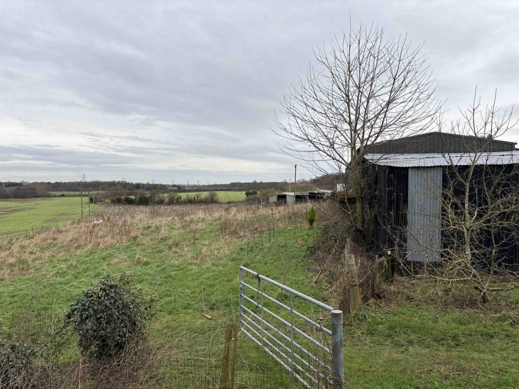
BNG Staffordshire Building and land

On the ground, site-level features signal when BNG evidence will be needed:

  • semi-improved grassland or species-rich margins 
  • hedgerows that link into wider networks 
  • wet ditches, streams or floodplain edges 
  • brownfield mosaics with herb-rich patches 
  • woodland edges or scattered trees 
  • PEA recommendations for botanical verification 
  • layout changes affecting habitat parcels 

Providing this clarity early prevents validation queries, redesign instructions and delays during casework. 

BNG Requirements — Delivered in a Predictable Sequence

We produce planning-ready BNG Assessments aligned to Staffordshire’s policy expectations.

Case Insight

BNG baseline mapping was completed for a mixed-use scheme south of Stafford, where hedgerow networks and wet ditches increased uplift expectations. By aligning habitat baselines with the landscape plan, the design achieved 11.2% net gain without requiring off-site units.

What We Deliver for Staffordshire Projects

 Every report includes:

  • verified UKHab habitat mapping

  • defensible condition and distinctiveness scoring

  • full DEFRA Metric 4.0 calculation

  • uplift strategy shaped around LPA priorities

  • integration with layout, drainage and protected species

  • clear, structured reporting for validation and negotiation

Step 1

Habitat baseline surveys

Year-round, with botanical elements best May–September.

Step 2

Metric 4.0 calculations

 Completed once habitat data is verified.


Step 3

Uplift strategy development

Aligned with design progression and layout refinement.


Step 4

Integration with PEA, EIA or protected species

Used where additional clarity is needed around baseline or constraints.

Our approach keeps evidence proportionate, technically robust and predictable through the full planning sequence.

Next Steps

Contact us and we’ll confirm exactly what your site requires and support a planning-ready, proportionate route forward. 

FAQ - BNG in Staffordshire

What is a Biodiversity Net Gain assessment in Staffordshire?

A Biodiversity Net Gain assessment establishes the ecological baseline of a site using the statutory Biodiversity Metric and models the proposed development to confirm whether at least 10 percent measurable uplift can be achieved in accordance with national legislation.

Yes. Development near sensitive landscapes such as Cannock Chase must comply with statutory Biodiversity Net Gain legislation. Baseline habitats must be accurately surveyed and quantified before modelling development proposals.

Previously developed land may support grassland, scrub or mosaic habitats. A detailed habitat survey is required to establish the true baseline ecological value before calculating biodiversity units.

Sites near the River Trent may include floodplain grassland or riparian habitats. The assessment must classify and quantify these habitats accurately within the Biodiversity Metric.

A BNG assessment is required where development falls within the statutory scope of mandatory Biodiversity Net Gain legislation, including residential, commercial and mixed use schemes.

Can edge of market town housing schemes achieve 10 percent uplift?

Many edge of settlement schemes can achieve uplift through meadow creation, hedgerow strengthening and sustainable drainage features. Early feasibility modelling is important to confirm compliance.

Arable land and improved grassland are mapped and assessed for condition. Although often lower distinctiveness habitats, baseline accuracy is essential to avoid over or under estimating achievable uplift.

If modelling identifies a biodiversity unit shortfall, the applicant may secure registered off site biodiversity units to meet statutory requirements.

Depending on site location, Biodiversity Net Gain assessments are reviewed by authorities such as Stafford Borough Council, South Staffordshire Council, Lichfield District Council, Newcastle under Lyme Borough Council or Staffordshire Moorlands District Council.

Planning guidance for Stafford Borough Council can be accessed at:
https://www.staffordbc.gov.uk/planning

ProHort undertakes detailed habitat surveys and robust Biodiversity Metric modelling tailored to Staffordshire’s mixed rural, brownfield and river corridor context. We provide early feasibility advice, accurate unit calculations and defensible planning documentation to minimise biodiversity compliance risk.
Related Services

Still have questions?

Still have questions?

Biodiversity Net Gain – BNG Assessment in Cheshire

Biodiversity Net Gain (BNG) in Cheshire

Planning-ready BNG assessments for Cheshire — verified baselines, Metric 4.0 scoring and proportionate uplift strategies for a predictable planning route.

Request a Biodiversity Net Gain Assessment

Request a Biodiversity Net Gain Assessment

Maximum file size: 8.39MB

Do You Need a Biodiversity Net Gain Assessment in Cheshire?

Most developments in Cheshire now require a mandatory 10% biodiversity net gain under the Environment Act 2021.

Local planning authorities expect clear baseline data, a defensible Metric 4.0 calculation and a proportionate uplift strategy before your application can progress. Cheshire’s landscape combines lowland farmland, river valleys, peat soils, woodland belts and a dense canal network. These features shape how LPAs interpret BNG.

Local landscape patterns influencing uplift feasibility include:

  • hedgerow and pasture systems in East Cheshire

  • wet meadows and river corridors along the Weaver and Dane valleys

  • canal-side habitats along the Shropshire Union and Trent & Mersey canals

  • lowland farmland and woodland belts west of Chester

  • peat-influenced habitats near Delamere and former mossland areas

These patterns inform how LPAs evaluate BNG proposals and uplift justification.

We support projects across:
Chester, Crewe, Macclesfield, Northwich, Ellesmere Port, Winsford, Nantwich, Wilmslow, Knutsford, Sandbach, Congleton and surrounding areas.

Why Cheshire Planners Request BNG Evidence Early

Cheshire LPAs prioritise accurate early-stage baselines because local habitats can shift condition scores quickly. Early evidence clarifies feasibility, prevents redesign, and avoids uplift recalculation later in the planning cycle.

Early indicators your Cheshire site may require BNG evidence

Waterlogged grass field with areas of exposed mud and standing water, bordered by post and rail fencing, mature trees and nearby agricultural buildings.

On the ground, site-level features signal when BNG evidence will be needed:

  • semi-improved grassland or improved pasture with distinct species patches

  • hedgerows that connect to wider farm or woodland networks

  • proximity to canals, ponds, brooks or drainage ditches

  • brownfield areas with herb-rich sections or early succession habitats

  • woodland edge transitions or scattered mature trees

  • any PEA recommendation for botanical confirmation

  • layout changes affecting parcel boundaries

If any apply, early BNG clarification reduces risk and protects programme certainty.

Local Case Insight (Cheshire)

BNG baseline mapping was completed for a residential scheme near Northwich, where hedgerow connectivity and wet field margins required strategic uplift. By refining the landscape layout and focusing habitat enhancement within existing corridors, the project achieved the required net gain without off-site units. Validation was secured on the first submission.

Our Approach

BNG must be practical, defensible and proportionate.
We align ecological evidence with real-world design constraints so your metric supports your planning route. We assess habitat condition, distinctiveness and connectivity to identify the most efficient uplift options, whether on-site, off-site or blended.

Every recommendation is shaped for validation, design iteration and planning negotiation.

BNG Requirements — Delivered in a Predictable Sequence

We produce planning-ready BNG Assessments aligned to Staffordshire’s policy expectations.

Core Deliverables for Staffordshire Projects

A planning-ready, proportionate BNG package:

  • verified UKHab baseline

  • defensible Metric 4.0 calculation

  • proportionate, locally-appropriate uplift strategy

  • clear validation-ready reporting

  • optional HMMP and Gain Plan integration

Step 1

Habitat baseline surveys

Year-round, with botanical elements best May–September.

Step 2

Metric 4.0 calculations

 Completed once habitat data is verified.


Step 3

Uplift strategy development

Aligned with design progression and layout refinement.


Step 4

Integration with PEA, EIA or protected species

Used where additional clarity is needed around baseline or constraints.

These steps align with national requirements under NPPF Section 15 and ensure the BNG route remains defensible at planning. Early baseline clarity locks in feasible uplift routes, prevents late-stage reclassification, and keeps your planning programme on track. 

Next Steps

Contact us and we’ll confirm exactly what your site requires and support a planning-ready, proportionate route forward. 

FAQ - BNG in Cheshire

What is a Biodiversity Net Gain assessment in Cheshire?

A Biodiversity Net Gain assessment measures the ecological value of a site using the statutory Biodiversity Metric and calculates how development will change that value. It confirms whether at least 10 percent measurable uplift can be achieved in accordance with national legislation.

A BNG assessment is required where development falls within the scope of mandatory Biodiversity Net Gain legislation. This typically includes housing, employment and mixed use schemes across both rural and settlement edge locations.

On rural Cheshire sites, baseline habitats such as improved grassland, arable land and hedgerows are mapped and assessed for condition. The proposed layout is then modelled within the Biodiversity Metric to confirm whether the 10 percent uplift requirement is met.

Hedgerows are common features across Cheshire’s farmland. They are assessed separately within the Biodiversity Metric and can contribute significantly to baseline and post development unit totals if properly measured and enhanced.

Yes. Industrial and employment developments near motorway corridors are not exempt. The BNG assessment must quantify habitat losses and demonstrate compliant uplift before planning permission is granted.

How long does a BNG assessment take for a Cheshire site?

Timescales depend on site size and complexity. Smaller residential schemes may be completed within weeks, while larger land promotion or employment sites may require iterative modelling alongside masterplanning.

Many sites can achieve uplift through meadow creation, woodland planting, hedgerow enhancement and sustainable drainage features. However, feasibility depends on realistic baseline calculations and design constraints.

If the BNG assessment identifies a shortfall in biodiversity units, developers may secure registered off site biodiversity units to achieve compliance with statutory requirements.

Depending on site location, Biodiversity Net Gain assessments are reviewed by authorities such as Cheshire East Council, Cheshire West and Chester Council or Warrington Borough Council.

Planning guidance for Cheshire East Council can be accessed at:
https://www.cheshireeast.gov.uk/planning/

ProHort provides detailed habitat surveys and Biodiversity Metric modelling tailored to Cheshire’s rural and Green Belt planning context. We offer early stage feasibility advice to help landowners and developers optimise layouts and avoid unexpected biodiversity unit deficits.

Related Services

Still have questions?

Still have questions?

Biodiversity Net Gain BNG Assessment in Shropshire

Biodiversity Net Gain (BNG) in Shropshire

Planning-ready BNG assessments for Shropshire — verified baselines, Metric 4.0 scoring and proportionate uplift strategies for a predictable planning route.

Do You Need a Biodiversity Net Gain Assessment in Shropshire?

Most developments in Shropshire now require a mandatory 10% biodiversity net gain under the Environment Act 2021.

Local planning authorities expect clear baseline data, a defensible Metric 4.0 calculation and a proportionate uplift strategy before your application can progress. Shropshire’s landscape is shaped by lowland farmland, wet meadow systems, hedgerow-rich pastures, woodland belts, upland edges, and extensive river corridors including the Severn and Teme. These factors strongly influence how LPAs interpret BNG.

Local landscape patterns affecting BNG expectations include:

  • hedgerow and pasture networks across North and Central Shropshire

  • riparian corridors and floodplain meadows along the Severn, Tern and Teme

  • woodland and parkland mosaics in the Shropshire Hills AONB

  • canal-side habitats along the Montgomery and Shropshire Union canals

  • early-successional and restoration habitats on former agricultural and quarry sites

These patterns shape how uplift proposals are evaluated during planning.

We support projects across Shrewsbury, Telford, Oswestry, Bridgnorth, Ludlow, Whitchurch, Market Drayton, Church Stretton and surrounding areas.

Why Shropshire Planners Request BNG Evidence Early

Shropshire LPAs often request BNG evidence early because the county’s diverse mix of grassland, hedgerow networks, riparian corridors and upland edge habitats can lead to condition scores shifting during design development. Early clarity reduces redesign and prevents later uplift recalculation.

Early indicators your Shropshire site may require BNG evidence

BNG Staffordshire Building and land

On the ground, site-level features signal when BNG evidence will be needed:

  • semi-improved grassland or species-rich margins

  • hedgerows linking to wider farm or woodland networks

  • proximity to rivers, streams, wet ditches or floodplain edges

  • pasture or meadow systems with variable condition scores

  • woodland edge transitions or scattered mature trees

  • brownfield or restored land with herb-rich patches

  • layout changes affecting habitat parcels

If any apply, early BNG clarification reduces risk and protects programme certainty.

Local Case Insight

BNG baseline mapping was completed for a small mixed-use scheme near Bridgnorth, where wet meadow margins and connected hedgerows increased uplift requirements. Refining the layout and focusing enhancement within existing ecological corridors delivered the required net gain without reliance on off-site units. Validation progressed smoothly with no requests for metric revision.

Our Approach

BNG must be practical, defensible and proportionate.
We align ecological evidence with real-world design constraints so your metric supports your planning route. We assess habitat condition, distinctiveness and connectivity to identify the most efficient uplift options, whether on-site, off-site or blended. For more detail on methodology, see our Biodiversity Net Gain Assessment service. 

For schemes requiring integrated landscape design or planting plans, we work alongside our sister company Blue Iris Landscapes to keep proposals aligned with uplift feasibility and LPA expectations.

Every recommendation is shaped for validation, design iteration and planning negotiation.

BNG Requirements — Delivered in a Predictable Sequence

We produce planning-ready BNG Assessments aligned to Staffordshire’s policy expectations.

Key BNG Deliverables for Shropshire Projects

For Shropshire schemes, every planning-ready BNG Assessment includes:

• verified UKHab baseline
• defensible Metric 4.0 calculation
• proportionate, locally-appropriate uplift strategy
• clear validation-ready reporting
• optional HMMP and Biodiversity Gain Plan integration

These deliverables are structured to satisfy Shropshire LPAs while keeping your BNG route proportionate to the scale of development.

Step 1

Habitat baseline surveys

Year-round, with optimal survey seasons

Step 2

Metric 4.0 calculations

 Completed once habitat data is verified. 

Step 3

Uplift strategy development

Aligned with design progression and layout refinement.

Step 4

Integration with Other Surveys

Only if needed. PEA, EIA, and Protected Species surveys 

Next Steps

Contact us and we’ll confirm exactly what your site requires and support a planning-ready, proportionate route forward. 

FAQ - BNG in Shropshire

Do Shropshire planning authorities apply BNG differently?

Expectations are broadly aligned, but each LPA focuses on different habitat pressures—riparian corridors, pasture transitions, hedgerow connectivity and meadow systems are commonly scrutinised.
Review local guidance:

LPAs typically expect a verified UKHab baseline, a clean Metric 4.0 calculation and a proportionate uplift strategy. Missing or incomplete condition verification is a common cause of validation queries.

Can uplift be delivered off-site in Shropshire?

Yes — off-site units are accepted, but LPAs require justification showing why on-site uplift is constrained and that the chosen off-site option is legitimate, available and registered. Early clarity strengthens your planning position.

Yes — where uplift relies on habitat creation or enhancement, a compliant Habitat Management & Monitoring Plan (HMMP) and BNG Gain Plan can be integrated into your package to meet long-term statutory obligations.

Related Services

Biodiversity Net Gain Assessment in Warwickshire

Biodiversity Net Gain (BNG) in Warwickshire

Planning-ready BNG assessments for Shropshire — verified baselines, Metric 4.0 scoring and proportionate uplift strategies for a predictable planning route.

Request a Biodiversity Net Gain Assessment

Request a Biodiversity Net Gain Assessment

Maximum file size: 8.39MB

Fast, Clear, Planning-Ready Support

Fast response 

Calls answered in 2 rings, emails replied to within the hour.

Free expert advice

Clear guidance before you commit.

Cost-effective

Working in partnership with clients to ensure planning approval first time

Typical 10-day turnaround

Industry Leading Standard

Expert Team

We stay with you from first call through to submission. 

Do You Need a Biodiversity Net Gain Assessment in Warwickshire?

Most developments in Warwickshire must now demonstrate a mandatory 10% Biodiversity Net Gain under the Environment Act 2021. Local planning authorities expect clear baseline data, a clean Metric 4.0 calculation and an uplift strategy aligned to real site constraints.

Warwickshire’s landscape brings a distinct ecological character — a combination of river corridors, clay farmland, historic parkland, woodland belts and canal networks. These wider patterns influence how LPAs interpret BNG and what they expect before validation.

Local landscape patterns affecting BNG expectations across Warwickshire include:

  • clay farmland, hedgerow networks and plateau landscapes across North Warwickshire and Nuneaton & Bedworth

  • floodplain meadows and riparian corridors along the Avon, Leam, Anker and Tame

  • woodland and parkland mosaics surrounding Warwick, Leamington Spa and Kenilworth

  • canal-side habitats along the Oxford Canal and Coventry Canal

  • restored mineral sites and early-successional land around Rugby and Central Warwickshire

These landscape patterns shape how uplift proposals are evaluated during planning.

We support projects across:
Warwick, Leamington Spa, Rugby, Nuneaton, Bedworth, Kenilworth, Stratford-upon-Avon, Atherstone, Coleshill and surrounding areas.

Why Warwickshire Planners Request BNG Evidence Early

Warwickshire LPAs request BNG evidence early because habitat condition and distinctiveness can vary significantly across short distances, especially in areas shaped by river systems, parkland edges and restored mineral land. Planners need clarity before design work becomes fixed, ensuring uplift is achievable and proportionate.

Early evidence prevents redesign cycles, avoids validation delays and reduces the risk of uplift recalculation later in the programme.

Early indicators your Warwickshire site may require BNG evidence

BNG Staffordshire Building and land

Common site-level features that trigger early BNG requirements include:

• semi-improved or species-rich grassland
• hedgerows feeding into wider ecological networks
• wet ditches, brooks or floodplain features
• brownfield or early-successional habitat patches
• woodland edges, scattered trees or parkland transitions
• PEA recommendations for botanical verification
• layout changes that alter habitat parcels

If any apply, early clarification keeps planning predictable and prevents disruption later.

Local Case Insight

BNG baseline work for a rural scheme near Kenilworth identified species-rich grassland pockets and hedgerow connectivity that significantly influenced uplift feasibility. By refining the layout and targeting enhancement within existing corridors, the project achieved 11% net gain on-site without off-site units, enabling a smooth validation process.Validation progressed smoothly with no requests for metric revision.

Our Approach

BNG must be practical, defensible and proportionate.
We align ecological evidence with real-world design constraints so your metric supports your planning route. We assess habitat condition, distinctiveness and connectivity to identify the most efficient uplift options, whether on-site, off-site or blended. For more detail on methodology, see our Biodiversity Net Gain Assessment service. 

For schemes requiring integrated landscape design or planting plans, we work alongside our sister company Blue Iris Landscapes to keep proposals aligned with uplift feasibility and LPA expectations.

Every recommendation is shaped for validation, design iteration and planning negotiation.

BNG Requirements — Delivered in a Predictable Sequence

We produce planning-ready BNG Assessments aligned to Warwickshire’s policy expectations.

Key BNG Deliverables for Warwickshire Projects

For Warwickshire schemes, every planning-ready BNG Assessment includes:

• verified UKHab baseline
• defensible Metric 4.0 calculation
• proportionate, locally-appropriate uplift strategy
• clear validation-ready reporting
• optional HMMP and Biodiversity Gain Plan integration
 

These deliverables are structured to satisfy Warwickshire LPAs while keeping your BNG route proportionate to the scale of development.

Step 1

Habitat baseline surveys

Year-round, with optimal survey seasons

Step 2

Metric 4.0 calculations

 Completed once habitat data is verified. 

Step 3

Uplift strategy development

Aligned with design progression and layout refinement.

Step 4

Integration with Other Surveys

Only if needed. PEA, EIA, and Protected Species surveys 

How this supports your project

These steps align with national requirements under NPPF Section 15 and ensure the BNG route remains defensible at planning. Early baseline clarity locks in feasible uplift routes, prevents late-stage reclassification, and keeps your planning programme on track. 

Next Steps

Contact us and we’ll confirm exactly what your site requires and support a planning-ready, proportionate route forward. 

FAQ - BNG in Warwickshire

What is a Biodiversity Net Gain assessment in Warwickshire?

A Biodiversity Net Gain assessment measures the existing ecological value of a site using the statutory Biodiversity Metric and calculates how proposed development will change that value. It confirms whether at least 10 percent measurable uplift can be achieved in accordance with national legislation.

A BNG assessment is required where development falls within the scope of mandatory Biodiversity Net Gain legislation. This typically includes housing schemes, mixed use allocations and employment developments across Warwickshire.

On greenfield or edge of settlement land, the assessment calculates baseline habitat units using habitat type, condition and area. The proposed layout is then modelled within the Biodiversity Metric to confirm whether at least 10 percent uplift is achieved.

A habitat survey in accordance with UK Habitat Classification is required to map and assess site habitats. Accurate condition assessment is critical to avoid over or under estimating baseline biodiversity units.

Sites near the River Avon may contain riparian habitats or floodplain grassland. The assessment must accurately classify these habitats and ensure any proposed enhancements are realistic and deliverable.

How long does a BNG assessment take for strategic housing sites?

Larger allocations often require iterative modelling alongside masterplanning. Depending on complexity, this may involve multiple metric scenarios to optimise layout and biodiversity outcomes.

Costs vary depending on site size, habitat diversity and the level of design iteration required. Straightforward sites are typically less complex than phased strategic schemes with multiple land parcels.

Many sites can achieve uplift through meadow creation, hedgerow enhancement, woodland planting and sustainable drainage features. However, feasibility depends on realistic baseline calculations and layout constraints.

The relevant Local Planning Authority reviews Biodiversity Net Gain assessments. This may include Warwick District Council, Stratford on Avon District Council, Rugby Borough Council or Nuneaton and Bedworth Borough Council depending on site location.

Planning guidance for Warwick District Council can be accessed at:
https://www.warwickdc.gov.uk/planning

ProHort provides detailed habitat surveys, Biodiversity Metric modelling and feasibility advice tailored to Warwickshire’s strategic growth context. We help developers and land promoters understand early stage risk, optimise layouts and avoid unexpected biodiversity unit shortfalls.

Related Services

Still have questions?

Still have questions?

(BNG) Biodiversity Net Gain Assessment in Derbyshire

Biodiversity Net Gain (BNG) in Derbyshire

Planning-ready BNG assessments for Derbyshire— verified baselines, Metric 4.0 scoring and proportionate uplift strategies for a predictable planning route.

Request a Biodiversity Net Gain Assessment

Request a Biodiversity Net Gain Assessment

Maximum file size: 8.39MB

Fast, Clear, Planning-Ready Support

Fast response 

Calls answered in 2 rings, emails replied to within the hour.

Free expert advice

Clear guidance before you commit.

Cost-effective

Working in partnership with clients to ensure planning approval first time

Typical 10-day turnaround

Industry Leading Standard

Expert Team

We stay with you from first call through to submission. 

Do You Need a Biodiversity Net Gain Assessment in Derbyshire?

Most developments in Derbyshire now require a mandatory 10% biodiversity net gain under the Environment Act 2021.

Local planning authorities expect clear baseline data, a defensible Metric 4.0 calculation and a proportionate uplift strategy before your application can progress. Derbyshire’s varied landscape — a mix of upland valleys, lowland farmland, historic mining land, river systems and the influence of the Peak District — shapes how local councils interpret BNG and what they expect from applicants. These factors strongly influence how LPAs interpret BNG.

Local landscape patterns affecting BNG expectations include:

• upland pasture, woodland edges and valley systems along the Peak District fringe
• riparian corridors and wetlands connected to the Derwent, Dove and Erewash
• former colliery and industrial restoration land across the Erewash and Amber valleys
• hedgerow-rich mixed farmland across South Derbyshire
• canal-side and towpath habitats along the Cromford, Chesterfield and Trent & Mersey canals

These patterns shape how uplift proposals are evaluated during planning.

We support projects across:
Derby, Chesterfield, Matlock, Buxton, Swadlincote, Ashbourne, Ripley, Ilkeston, Long Eaton, Belper, Glossop and all surrounding towns and villages.

Why Derbyshire Planners Request BNG Evidence Early

Derbyshire LPAs ask for BNG evidence early because the county’s mix of upland valleys, floodplain systems and former industrial land means baseline condition can vary sharply across short distances.
Planners need clarity on habitat quality, distinctiveness and feasibility before design work becomes fixed — especially where riparian corridors, Peak District fringe habitats or restoration land could influence uplift scoring.

Early evidence prevents redesign loops, avoids validation delays and helps planners confirm that uplift is both achievable and proportionate for the setting.

Early indicators your Derbyshire site may require BNG evidence

Wildlife pond surrounded by managed grassland, ornamental trees and boundary hedgerows, with a rural landscape and overcast sky in the background.

On the ground, site-level features signal when BNG evidence will be needed:

• semi-improved or species-rich grassland
• hedgerows feeding into wider landscape networks
• wet ditches, brooks or floodplain features
• brownfield mosaics with early-successional habitat
• woodland edges, scattered trees or parkland transitions
• PEA recommendations for botanical verification
• layout changes affecting habitat parcels

If any apply, early BNG clarification reduces risk and protects programme certainty.

Local Case Insight

BNG baseline mapping was completed for a mixed-use scheme near Matlock where wet grassland and hedgerow connectivity triggered higher uplift requirements. By adjusting the landscape plan and focusing enhancement within existing corridors, a 10.8% net gain was achieved on-site without resorting to off-site units. The proposal passed validation on first submission.

Our Approach

BNG must be practical, defensible and proportionate.
We align ecological evidence with real-world design constraints so your metric supports your planning route. We assess habitat condition, distinctiveness and connectivity to identify the most efficient uplift options, whether on-site, off-site or blended. For more detail on methodology, see our Biodiversity Net Gain Assessment service. 

For schemes requiring integrated landscape design or planting plans, we work alongside our sister company Blue Iris Landscapes to keep proposals aligned with uplift feasibility and LPA expectations.

Every recommendation is shaped for validation, design iteration and planning negotiation.

BNG Requirements — Delivered in a Predictable Sequence

We produce planning-ready BNG Assessments aligned to Derbyshire’s policy expectations.

Key BNG Deliverables for Derbyshire Projects

For Derbyshire schemes, every planning-ready BNG Assessment includes:

• verified UKHab baseline
• defensible Metric 4.0 calculation
• proportionate, locally-appropriate uplift strategy
• clear validation-ready reporting
• optional HMMP and Biodiversity Gain Plan integration

These deliverables are structured to satisfy Derbyshire LPAs while keeping your BNG route proportionate to the scale of development.

Step 1

Habitat baseline surveys

Year-round, with optimal survey seasons

Step 2

Metric 4.0 calculations

 Completed once habitat data is verified. 

Step 3

Uplift strategy development

Aligned with design progression and layout refinement.

Step 4

Integration with Other Surveys

Only if needed. PEA, EIA, and Protected Species surveys 

How this supports your project

These steps align with national requirements under NPPF Section 15 and ensure the BNG route remains defensible at planning. Early baseline clarity locks in feasible uplift routes, prevents late-stage reclassification, and keeps your planning programme on track. 

Next Steps

Contact us and we’ll confirm exactly what your site requires and support a planning-ready, proportionate route forward. 

FAQ - BNG in Derbyshire

What does a Biodiversity Net Gain assessment involve in Derbyshire?

A Biodiversity Net Gain assessment establishes the baseline ecological value of a site using the statutory Biodiversity Metric and models the proposed development to confirm whether at least 10 percent measurable uplift can be achieved. It forms part of the planning submission evidence.

On upland or pasture sites, habitats such as semi improved grassland, rough grazing or moorland fringe are mapped and assessed for condition. Accurate classification is critical, as upland habitats can carry higher distinctiveness values than improved farmland.

Yes. Redevelopment of former mineral or quarry land is not automatically exempt. A detailed habitat survey must establish baseline conditions before modelling any proposed restoration or development scenario within the Biodiversity Metric.

A BNG assessment is required where development falls within the statutory scope of mandatory Biodiversity Net Gain legislation. This includes housing, tourism, employment and mixed use proposals.

Steep slopes and uneven terrain can limit usable habitat areas and influence realistic enhancement proposals. The assessment must reflect genuine deliverability rather than theoretical layout capacity.

Can tourism or visitor developments achieve 10 percent uplift?

Yes, provided habitat enhancements are carefully designed and realistically deliverable. Meadow creation, woodland planting and riparian improvements can contribute to uplift, but early feasibility modelling is essential.

Timescales depend on site scale and habitat complexity. Larger rural or upland sites may require more detailed mapping and condition assessment, particularly where habitats are variable.

If the Biodiversity Metric identifies a shortfall in habitat units, developers may secure registered off site biodiversity units to meet statutory requirements.

Depending on location, assessments are reviewed by authorities such as Derbyshire Dales District Council, High Peak Borough Council, Amber Valley Borough Council or other district councils.

Planning guidance for Derbyshire Dales District Council can be accessed at:
https://www.derbyshiredales.gov.uk/planning

ProHort provides detailed habitat surveys and robust Biodiversity Metric modelling tailored to Derbyshire’s upland and rural context. We help landowners and developers understand baseline value, test feasibility early and reduce unexpected biodiversity unit deficits.

Related Services

Still have questions?

Still have questions?

BNG in the West Midlands – Biodiversity Net Gain Assessment

Biodiversity Net Gain (BNG) in the West Midlands

Planning-ready BNG assessments for the West Midlands — verified baselines, Metric 4.0 scoring and proportionate uplift strategies for a predictable planning route.

Request a Biodiversity Net Gain Assessment

Request a Biodiversity Net Gain Assessment

Maximum file size: 8.39MB

Do You Need a Biodiversity Net Gain Assessment in the West Midlands?

Most developments in the West Midlands now require a mandatory 10% biodiversity net gain under the Environment Act 2021.

Local planning authorities expect clear baseline data, a defensible Metric 1.0.4 calculation and a proportionate uplift strategy before your application can progress. The West Midlands County includes some of the UK’s most varied urban–ecological interfaces. Former industrial land, canal infrastructure, transport corridors, urban green networks and peri-urban farmland all shape how councils interpret BNG and what evidence they request. These factors strongly influence how LPAs interpret BNG.

Local landscape patterns affecting BNG expectations across the West Midlands include: 

  • canal corridors, towpaths and riparian edges throughout Birmingham, Wolverhampton and Dudley 
  • brownfield mosaics, regeneration sites and early-successional land across the Black Country 
  • urban parks, woodland remnants and green wedges around Solihull 
  • farmland, estate edges and settlement fringes around Coventry and the eastern boundary 
  • railway cuttings, embankments and linear green infrastructure through Walsall and Sandwell 

These broader landscape conditions influence how uplift proposals are evaluated. 

We support projects across: 
Birmingham, Wolverhampton, Walsall, Sandwell, Dudley, Solihull, Coventry and all surrounding areas. 

Why West Midlands Planners Request BNG Evidence Early

West Midlands councils request BNG evidence early because habitat condition can shift significantly across short distances, especially on brownfield, regenerated or fragmented urban edges. 
LPAs need clarity before design progression to confirm that uplift is both achievable and proportionate, particularly where canal corridors, former industrial plots or urban green networks could influence conditions. 

Early confirmation prevents redesign cycles, avoids validation delays and keeps programme risk low. 

Early indicators your West Midlands site may require BNG evidence

BNG Staffordshire Building and land

Site-level features that commonly trigger BNG requirements include:

  • brownfield orearly-successionalhabitat patches
  •  semi-improved grassland or herb-rich strips on vacant or edge plots
  • hedgerows or scrub linking into wider green networks
  • wet ditches, canalside edges or drainage features
  • scattered trees, woodland fringes or parkland transitions
  • PEA findings recommending botanical verification
  • layout changes affecting habitat parcels 

If any of these apply, early assessment keeps planning predictable and prevents uplift recalculation later. 

Local Case Insight

BNG baseline work for a regeneration plot in Sandwell identified unexpectedly high habitat distinctiveness within early-successional brownfield patches. By refining the layout and targeting uplift within retained corridors, the scheme achieved 10% net gain without off-site units and passed validation on first submission.

Our Approach

BNG must be practical, defensible and proportionate.
We align ecological evidence with real-world design constraints so your metric supports your planning route. We assess habitat condition, distinctiveness and connectivity to identify the most efficient uplift options, whether on-site, off-site or blended. For more detail on methodology, see our Biodiversity Net Gain Assessment service. 

For schemes requiring integrated landscape design or planting plans, we work alongside our sister company Blue Iris Landscapes to keep proposals aligned with uplift feasibility and LPA expectations.

Every recommendation is shaped for validation, design iteration and planning negotiation.

BNG Requirements — Delivered in a Predictable Sequence

We produce planning-ready BNG Assessments aligned to the West Midlands policy expectations.

Key BNG Deliverables for the West Midlands

For the West Midlands schemes, every planning-ready BNG Assessment includes:

• verified UKHab baseline
• defensible Metric 4.0 calculation
• proportionate, locally-appropriate uplift strategy
• clear validation-ready reporting
• optional HMMP and Biodiversity Gain Plan integration
 

These deliverables are structured to satisfy the West Midlands LPAs while keeping your BNG route proportionate to the scale of development.

Step 1

Habitat baseline surveys

Year-round, with optimal survey seasons

Step 2

Metric 4.0 calculations

 Completed once habitat data is verified. 

Step 3

Uplift strategy development

Aligned with design progression and layout refinement.

Step 4

Integration with Other Surveys

Only if needed. PEA, EIA, and Protected Species surveys 

How this supports your project

These steps align with national requirements under NPPF Section 15 and ensure the BNG route remains defensible at planning. Early baseline clarity locks in feasible uplift routes, prevents late-stage reclassification, and keeps your planning programme on track. 

Next Steps

Contact us and we’ll confirm exactly what your site requires and support a planning-ready, proportionate route forward. 

FAQ - BNG in the West Midlands

What is a Biodiversity Net Gain assessment in the West Midlands?

A Biodiversity Net Gain assessment establishes the existing habitat value of a site using the statutory Biodiversity Metric and models the proposed development layout to confirm whether at least 10 percent measurable uplift can be achieved. It forms part of the planning application evidence base.

No. Former industrial and factory land often supports mosaic habitats, scrub or grassland that can carry measurable biodiversity value. A detailed habitat survey is required to establish an accurate baseline before development modelling.

The West Midlands has an extensive canal network which often functions as an ecological corridor. Habitat along canal edges must be properly classified and assessed for condition. Development proposals must avoid severing connectivity or reducing riparian value.

A BNG assessment is required where development falls within the statutory scope of mandatory Biodiversity Net Gain legislation. This commonly includes mixed use regeneration, residential redevelopment and employment led schemes.

The Biodiversity Metric calculates baseline habitat units based on type, condition, distinctiveness and area. The post development scenario is then modelled to determine whether design measures such as green roofs, tree pits or sustainable drainage can achieve the required uplift.

Can green roofs and podium planting count towards biodiversity net gain?

Yes, if they meet the criteria within the Biodiversity Metric. Substrate depth, planting composition and long term viability must be realistic. Overestimation of roof habitat performance is a common technical error.

Urban regeneration projects often require iterative modelling alongside architectural design. Timescales depend on site size, habitat complexity and the number of layout revisions required to achieve compliance.

If modelling demonstrates a shortfall in biodiversity units, developers may secure registered off site biodiversity units to reach the statutory requirement. The shortfall must be clearly quantified within the assessment.

Biodiversity Net Gain assessments are reviewed by the relevant Local Planning Authority, such as Birmingham City Council, Coventry City Council, Wolverhampton City Council or Sandwell Metropolitan Borough Council depending on site location.

Planning guidance for Birmingham City Council can be accessed at:
https://www.birmingham.gov.uk/planning

ProHort undertakes detailed habitat surveys and robust Biodiversity Metric modelling tailored to high density regeneration contexts. We work alongside design teams to optimise layouts, reduce biodiversity unit deficits and provide clear, defensible calculations for planning submission.

Related Services

Still have questions?

Still have questions?

(BNG) Biodiversity Net Gain Assessment in Hampshire

Biodiversity Net Gain (BNG) in Hampshire

Planning-ready BNG assessments for Hampshire— verified baselines, Metric 4.0 scoring and proportionate uplift strategies for a predictable planning route.

Request a Biodiversity Net Gain Assessment

Request a Biodiversity Net Gain Assessment

Maximum file size: 8.39MB

Fast, Clear, Planning-Ready Support

Fast response 

Calls answered in 2 rings, emails replied to within the hour.

Free expert advice

Clear guidance before you commit.

Cost-effective

Working in partnership with clients to ensure planning approval first time

Typical 10-day turnaround

Industry Leading Standard

Expert Team

We stay with you from first call through to submission. 

Do You Need a Biodiversity Net Gain Assessment in Hampshire?

Most developments in Hampshire now require a mandatory 10% biodiversity net gain under the Environment Act 2021.

Local planning authorities expect clear baseline data, a defensible Metric 4.0 calculation and a proportionate uplift strategy before your application can progress. Shropshire’s landscape is shaped by lowland farmland, wet meadow systems, hedgerow-rich pastures, woodland belts, upland edges, and extensive river corridors including the Severn and Teme. These factors strongly influence how LPAs interpret BNG.

Local landscape features affecting BNG expectations across Hampshire include: 

  • chalk grassland and downland around Winchester, Test Valley and East Hampshire 
  • coastal, tidal and estuarine habitats along Portsmouth, Southampton and the Solent 
  • woodland networks across the New Forest and northern Hampshire 
  • lowland heathland systems across the northeast (e.g., Yateley, Bordon, Farnborough fringe) 
  • river valleys along the Test, Itchen, Avon and Loddon 

These patterns influence how uplift proposals are evaluated during planning. 

We support projects across: Winchester, Southampton, Portsmouth, Basingstoke, Eastleigh, Fareham, Gosport, Andover, Havant, Ringwood, New Forest and all surrounding areas. 

Why Hampshire Planners Request BNG Evidence Early

Hampshire LPAs often request BNG evidence early because the county’s diverse mix of grassland, hedgerow networks, riparian corridors and upland edge habitats can lead to condition scores shifting during design development. Early clarity reduces redesign and prevents later uplift recalculation.

Local Case Insight

BNG baseline work for a housing development outside Winchester identified higher-condition chalk grassland along a slope than initially assumed. By refining the layout and enhancing retained habitat, the project secured on-site net gain exceeding 10%, avoiding off-site units and passing validation without metric revision.

BNG Requirements — Delivered in a Predictable Sequence

We produce planning-ready BNG Assessments aligned to Hampshire’s policy expectations.

Key BNG Deliverables for Hampshire Projects

For Hampshire schemes, every planning-ready BNG Assessment includes:

• verified UKHab baseline
• defensible Metric 4.0 calculation
• proportionate, locally-appropriate uplift strategy
• clear validation-ready reporting
• optional HMMP and Biodiversity Gain Plan integration

These deliverables are structured to satisfy Hampshire LPAs while keeping your BNG route proportionate to the scale of development.

Step 1

Habitat baseline surveys

Year-round, with optimal survey seasons

Step 2

Metric 4.0 calculations

 Completed once habitat data is verified. 

Step 3

Uplift strategy development

Aligned with design progression and layout refinement.

Step 4

Integration with Other Surveys

Only if needed. PEA, EIA, and Protected Species surveys 

Next Steps

Contact us and we’ll confirm exactly what your site requires and support a planning-ready, proportionate route forward. 

FAQ - BNG in Hampshire

What is a Biodiversity Net Gain assessment in Hampshire?

A Biodiversity Net Gain assessment establishes the baseline ecological value of a site using the statutory Biodiversity Metric and models the proposed development to confirm whether at least 10 percent measurable uplift can be achieved in accordance with national legislation.

Yes. Development within or near sensitive landscapes must still comply with statutory Biodiversity Net Gain requirements. The assessment must accurately quantify baseline habitats and demonstrate compliant uplift.

Sites near the River Test, River Itchen or other chalk streams may contain riparian habitats of higher ecological value. The baseline must be carefully surveyed and quantified to ensure realistic modelling within the Biodiversity Metric.

A BNG assessment is required where development falls within the statutory scope of mandatory Biodiversity Net Gain legislation. This includes residential, commercial, mixed use and strategic allocation sites.

Where sites are influenced by coastal habitats, the assessment must correctly classify and quantify grassland, scrub or wetland habitats before modelling development proposals.

Can large strategic housing sites achieve 10 percent uplift on site?

Many strategic allocations can achieve uplift through woodland planting, meadow creation and sustainable drainage features. However, early feasibility modelling is critical to confirm that the required uplift is realistically deliverable.

Timescales depend on site size and habitat complexity. Larger mixed use or strategic sites often require iterative modelling alongside masterplanning to achieve compliant outcomes.

If modelling identifies a biodiversity unit shortfall, the applicant may secure registered off site biodiversity units to meet statutory requirements.

Depending on site location, Biodiversity Net Gain assessments are reviewed by authorities such as Winchester City Council, Basingstoke and Deane Borough Council, East Hampshire District Council or Southampton City Council.

Planning guidance for Winchester City Council can be accessed at:
https://www.winchester.gov.uk/planning

ProHort undertakes detailed habitat surveys and robust Biodiversity Metric modelling tailored to Hampshire’s chalk stream and coastal influenced context. We provide early feasibility advice, clear unit calculations and defensible planning documentation.

Related Services

Still have questions?

Still have questions?

(BNG) Biodiversity Net Gain Assessment in Yorkshire

Biodiversity Net Gain (BNG) in Yorkshire

Planning-ready BNG assessments for Yorkshire — verified baselines, Metric 4.0 scoring and proportionate uplift strategies for a predictable planning route.

Request a Biodiversity Net Gain Assessment

Request a Biodiversity Net Gain Assessment

Maximum file size: 8.39MB

Fast, Clear, Planning-Ready Support

Fast response 

Calls answered in 2 rings, emails replied to within the hour.

Free expert advice

Clear guidance before you commit.

Cost-effective

Working in partnership with clients to ensure planning approval first time

Typical 10-day turnaround

Industry Leading Standard

Expert Team

We stay with you from first call through to submission. 

Do You Need a Biodiversity Net Gain Assessment in Yorkshire?

Most developments in Yorkshire now require a mandatory 10% biodiversity net gain under the Environment Act 2021.

Local planning authorities expect clear baseline data, a defensible Metric 4.0 calculation and a proportionate uplift strategy before your application can progress. West Yorkshire combines dense urban centres, river valleys, canal corridors, former industrial land and Pennine fringe slopes. These patterns influence how councils interpret BNG and what level of evidence they expect at validation. These factors strongly influence how LPAs interpret BNG.

Local landscape patterns affecting BNG expectations across Yorkshire include: 

  • valley settlements, river corridors and urban fringes along the Aire, Calder and Wharfe 
  • upland pasture, moorland edges and wooded cloughs on the Pennine fringe around Calderdale and Kirklees 
  • canal-side habitats along the Leeds & Liverpool Canal, Calder & Hebble Navigation and Aire & Calder Navigation 
  • former industrial and regeneration land through Leeds, Bradford and Wakefield 
  • urban parks, green wedges and woodland fragments within and around major towns 

These wider patterns shape how uplift proposals are evaluated across the county. 

We support projects across: 
Leeds, Bradford, Wakefield, Huddersfield, Halifax, Castleford, Dewsbury, Keighley, Pontefract and surrounding areas. 

Why Yorkshire Planners Request BNG Evidence Early

Yorkshire LPAs request BNG evidence early because habitat condition and distinctiveness can change sharply over short distances, especially where valley systems, upland edges and regeneration land intersect. Planners want clarity before design work becomes fixed, so uplift is achievable and proportionate from the outset. 

Early BNG evidence reduces redesign, prevents validation queries and keeps programme risk under control. 

Early indicators your Yorkshire site may require BNG evidence

BNG Staffordshire Building and land

Site-level features that commonly trigger BNG requirements in Yorkshire include: 

  • brownfield or early-successional habitat on former industrial or mill sites 
  • semi-improved grassland, herb-rich banks or unmanaged strips around plot edges 
  • hedgerows, scrub or treelines linking into wider valley or hillside networks 
  • proximity to rivers, becks, canals or drainage channels on or adjacent to the site 
  • woodland edges, scattered mature trees or small copses influencing layout 
  • PEA recommendations for botanical verification or more detailed habitat assessment 
  • layout changes that alter, remove or fragment existing habitat parcels 

If any of these apply, early BNG assessment keeps the planning route predictable and avoids uplift recalculation later in the programme. 

Local Case Insight

BNG baseline work for a mixed-use site on the edge of Leeds identified higher distinctiveness grassland and scrub within former yard areas than originally assumed. By refining the layout to retain and enhance key habitat blocks, the scheme achieved over 10% net gain on-site, avoiding off-site units and clearing validation without requests for metric revision.

Our Approach

BNG must be practical, defensible and proportionate.
We align ecological evidence with real-world design constraints so your metric supports your planning route. We assess habitat condition, distinctiveness and connectivity to identify the most efficient uplift options, whether on-site, off-site or blended. For more detail on methodology, see our Biodiversity Net Gain Assessment service. 

For schemes requiring integrated landscape design or planting plans, we work alongside our sister company Blue Iris Landscapes to keep proposals aligned with uplift feasibility and LPA expectations.

Every recommendation is shaped for validation, design iteration and planning negotiation.

BNG Requirements — Delivered in a Predictable Sequence

We produce planning-ready BNG Assessments aligned to Staffordshire’s policy expectations.

Key BNG Deliverables for Yorkshire Projects

For Yorkshire schemes, every planning-ready BNG Assessment includes:

• verified UKHab baseline
• defensible Metric 4.0 calculation
• proportionate, locally-appropriate uplift strategy
• clear validation-ready reporting
• optional HMMP and Biodiversity Gain Plan integration
 

These deliverables are structured to satisfy Yorkshire LPAs while keeping your BNG route proportionate to the scale of development.

Step 1

Habitat baseline surveys

Year-round, with optimal survey seasons

Step 2

Metric 4.0 calculations

 Completed once habitat data is verified. 

Step 3

Uplift strategy development

Aligned with design progression and layout refinement.

Step 4

Integration with Other Surveys

Only if needed. PEA, EIA, and Protected Species surveys 

How this supports your project

These steps align with national requirements under NPPF Section 15 and ensure the BNG route remains defensible at planning. Early baseline clarity locks in feasible uplift routes, prevents late-stage reclassification, and keeps your planning programme on track. 

Next Steps

Contact us and we’ll confirm exactly what your site requires and support a planning-ready, proportionate route forward. 

FAQ - BNG in Yorkshire

Why do developments in Yorkshire require a Biodiversity Net Gain assessment?

Where a proposal falls within the scope of mandatory Biodiversity Net Gain legislation, the applicant must demonstrate at least 10 percent measurable uplift using the statutory Biodiversity Metric. The assessment forms part of the planning evidence.

Yes. Yorkshire includes urban centres, lowland farmland and moorland fringe habitats. Baseline habitat classification and condition assessment must reflect local ecological character to avoid inaccurate metric outputs.

For strategic sites, baseline habitats are mapped across the entire red line boundary and modelled against the masterplan layout. Multiple metric scenarios are often tested to optimise biodiversity performance.

Not necessarily. While rural sites may offer more land for enhancement, baseline habitat values can also be higher. Accurate early stage modelling is essential to confirm feasibility.

Sites near rivers such as the Aire, Don or Ouse may contain riparian habitats that carry higher distinctiveness values. The BNG assessment must correctly classify and quantify these features within the Biodiversity Metric.

What surveys are required before completing the metric?

A habitat survey using UK Habitat Classification is required to map all habitat parcels and assess condition. Without reliable field data, metric outputs cannot be considered robust.

Timescales vary depending on site scale and complexity. Large mixed use allocations may require iterative modelling alongside design teams, while smaller schemes can often be assessed more quickly.

If modelling identifies a biodiversity unit shortfall, the applicant may secure registered off site biodiversity units to meet statutory requirements.

Yorkshire contains multiple Local Planning Authorities, including Leeds City Council, Sheffield City Council, City of York Council and North Yorkshire Council. The relevant authority reviews the BNG assessment submitted with the planning application.

Planning guidance for Leeds City Council can be accessed at:
https://www.leeds.gov.uk/planning

ProHort undertakes detailed habitat surveys and comprehensive Biodiversity Metric modelling tailored to Yorkshire’s varied planning context. We support land promoters and developers with feasibility testing, layout optimisation and clear unit calculations for planning submission.

Related Services

Still have questions?

Still have questions?

(BNG) Biodiversity Net Gain Assessment in Essex

Biodiversity Net Gain (BNG) in Essex

Planning-ready BNG assessments for Essex — verified baselines, Metric 4.0 scoring and proportionate uplift strategies for a predictable planning route.

Request a Biodiversity Net Gain Assessment

Request a Biodiversity Net Gain Assessment

Maximum file size: 8.39MB

Fast, Clear, Planning-Ready Support

Fast response 

Calls answered in 2 rings, emails replied to within the hour.

Free expert advice

Clear guidance before you commit.

Cost-effective

Working in partnership with clients to ensure planning approval first time

Typical 10-day turnaround

Industry Leading Standard

Expert Team

We stay with you from first call through to submission. 

Do You Need a Biodiversity Net Gain Assessment in Essex?

Most developments in Essex now require a mandatory 10% biodiversity net gain under the Environment Act 2021.

Local planning authorities expect clear baseline data, a defensible Metric 4.0 calculation and a proportionate uplift strategy before your application can progress. Shropshire’s landscape is shaped by lowland farmland, wet meadow systems, hedgerow-rich pastures, woodland belts, upland edges, and extensive river corridors including the Severn and Teme. These factors strongly influence how LPAs interpret BNG.

Local landscape features affecting BNG expectations across Essex include: 

  • coastal, saltmarsh and estuarine habitats along the Thames Estuary, Crouch and Blackwater 
  • river corridors along the Chelmer, Colne, Stour, Crouch and Roding 
  • arable farmland, hedgerow networks and grazing marsh across mid and north Essex 
  • woodland belts and ancient woodland fragments in Epping Forest, Brentwood and Uttlesford 
  • urban regeneration corridors around Chelmsford, Basildon, Southend and Harlow 

These features strongly influence how uplift proposals are evaluated during planning. 

We support projects across: Chelmsford, Colchester, Basildon, Southend, Harlow, Braintree, Witham, Clacton, Maldon, Brentwood, Epping, Thurrock and all surrounding areas. 

Why Essex Planners Request BNG Evidence Early

Essex LPAs often request BNG evidence early because the county’s diverse mix of grassland, hedgerow networks, riparian corridors and upland edge habitats can lead to condition scores shifting during design development. Early clarity reduces redesign and prevents later uplift recalculation.

Local Case Insight

BNG baseline mapping for a regeneration site in Chelmsford revealed higher distinctiveness scrub and grassland blocks along a rail corridor than expected. By refining access routes and enhancing retained habitat, the scheme achieved over 10% uplift on-site, eliminating the need for off-site units and clearing validation without metric revision.

BNG Requirements — Delivered in a Predictable Sequence

We produce planning-ready BNG Assessments aligned to Essex’s policy expectations.

Key BNG Deliverables for Essex Projects

For Essex schemes, every planning-ready BNG Assessment includes:

• verified UKHab baseline
• defensible Metric 4.0 calculation
• proportionate, locally-appropriate uplift strategy
• clear validation-ready reporting
• optional HMMP and Biodiversity Gain Plan integration

These deliverables are structured to satisfy Essex LPAs while keeping your BNG route proportionate to the scale of development.

Step 1

Habitat baseline surveys

Year-round, with optimal survey seasons

Step 2

Metric 4.0 calculations

 Completed once habitat data is verified. 

Step 3

Uplift strategy development

Aligned with design progression and layout refinement.

Step 4

Integration with Other Surveys

Only if needed. PEA, EIA, and Protected Species surveys 

Next Steps

Contact us and we’ll confirm exactly what your site requires and support a planning-ready, proportionate route forward. 

FAQ - BNG in Essex

What is a Biodiversity Net Gain assessment in Essex?

A Biodiversity Net Gain assessment establishes the ecological baseline of a site using the statutory Biodiversity Metric and models proposed development to confirm whether at least 10 percent measurable uplift can be achieved in accordance with national legislation.

Yes. Development near estuarine or coastal habitats must comply with statutory Biodiversity Net Gain requirements. Baseline habitats such as grazing marsh, scrub or grassland must be accurately classified and quantified within the Biodiversity Metric.

For new settlements or major allocations, baseline habitats are mapped across the entire site and multiple metric scenarios may be modelled alongside masterplanning to optimise biodiversity performance.

Not automatically. While arable or improved grassland may have lower baseline distinctiveness, realistic enhancement proposals and accurate condition assessment remain essential to achieve compliant uplift.

Yes. Warehousing and employment schemes must demonstrate measurable biodiversity uplift. The BNG assessment quantifies baseline habitat value and models the post development scenario accordingly.

How are drainage features treated within the Biodiversity Metric?

Sustainable drainage systems may contribute to biodiversity units if they meet the criteria within the Biodiversity Metric. The assessment must reflect realistic habitat creation rather than purely engineered features.

Timescales vary depending on site size and habitat complexity. Strategic allocations and phased schemes often require iterative modelling before final metric outputs are confirmed.

If the Biodiversity Metric identifies a shortfall in habitat units, the applicant may secure registered off site biodiversity units to meet statutory requirements.

Biodiversity Net Gain assessments are reviewed by the relevant Local Planning Authority, such as Chelmsford City Council, Colchester City Council, Basildon Borough Council or Uttlesford District Council depending on site location.

Planning guidance for Chelmsford City Council can be accessed at:
https://www.chelmsford.gov.uk/planning/

ProHort undertakes detailed habitat surveys and robust Biodiversity Metric modelling tailored to Essex’s estuarine and strategic growth context. We provide early feasibility advice, accurate unit calculations and clear planning documentation to minimise biodiversity compliance risk.
Related Services

Still have questions?

Still have questions?

Biodiversity Net Gain Assessment in Surrey

Biodiversity Net Gain (BNG) in Surrey

Planning-ready BNG assessments for Surrey — verified baselines, Metric 4.0 scoring and proportionate uplift strategies for a predictable planning route.

Request a Biodiversity Net Gain Assessment

Request a Biodiversity Net Gain Assessment

Maximum file size: 8.39MB

Fast, Clear, Planning-Ready Support

Fast response 

Calls answered in 2 rings, emails replied to within the hour.

Free expert advice

Clear guidance before you commit.

Cost-effective

Working in partnership with clients to ensure planning approval first time

Typical 10-day turnaround

Industry Leading Standard

Expert Team

We stay with you from first call through to submission. 

Do You Need a Biodiversity Net Gain Assessment in Surrey?

Most developments in Surrey now require a mandatory 10% biodiversity net gain under the Environment Act 2021.

Local planning authorities expect clear baseline data, a defensible Metric 4.0 calculation and a proportionate uplift strategy before your application can progress. Surrey’s landscape includes extensive woodland, lowland heath, chalk slopes, river corridors and dense commuter settlements, all influencing how LPAs interpret BNG requirements.  These factors strongly influence how LPAs interpret BNG.

Local landscape patterns affecting BNG expectations across Surrey include: 

  • extensive woodland networks around Mole Valley, Guildford and Waverley 
  • lowland heathland systems across Woking, Surrey Heath and the Thames Basin Heaths 
  • chalk slopes and grassland along the North Downs 
  • river corridors along the Wey, Mole and Thames 
  • green belt edges and settlement boundaries with mixed farmland 

These broader patterns shape how uplift opportunities and constraints are evaluated during planning. 

We support projects across: 
Guildford, Woking, Reigate, Redhill, Epsom, Ewell, Farnham, Godalming, Dorking, Camberley, Horley and all surrounding villages. 

Why Surrey Planners Request BNG Evidence Early

Surrey LPAs request BNG evidence at an early stage because habitat distinctiveness and condition shift significantly in woodland-edge, heathland, chalk grassland and green belt transition zones. Even small design adjustments can alter metric outcomes or uplift feasibility. 

Getting BNG right early prevents validation delays, redesign loops and late-stage uplift recalculation. 

Early indicators your Surrey site may require BNG evidence

BNG Staffordshire Building and land

Common site-level triggers for BNG assessment in Surrey include: 

  • proximity to woodland edges, mature trees or ancient woodland buffers 
  • heathland fragments or acid grassland near the Thames Basin Heaths 
  • semi-improved grassland or herb-rich margins 
  • drainage channels, ditches or rivers (Mole, Wey, Thames) crossing or bordering the site 
  • brownfield mosaics with early-successional or scrub habitats 
  • PEA recommendations for botanical or condition-verification surveys 
  • layout changes that affect habitat parcels or green belt boundaries 

If these apply, early metric work keeps the planning route predictable and reduces programme risk. 

Local Case Insight

BNG baseline work for a redevelopment site near Dorking identified higher-condition grassland along a woodland boundary than expected. By refining the layout and adjusting open-space connections, the scheme secured 10% net gain on-site, avoiding off-site units and clearing validation with no requests for metric revision.

Our Approach

BNG must be practical, defensible and proportionate.
We align ecological evidence with real-world design constraints so your metric supports your planning route. We assess habitat condition, distinctiveness and connectivity to identify the most efficient uplift options, whether on-site, off-site or blended. For more detail on methodology, see our Biodiversity Net Gain Assessment service. 

For schemes requiring integrated landscape design or planting plans, we work alongside our sister company Blue Iris Landscapes to keep proposals aligned with uplift feasibility and LPA expectations.

Every recommendation is shaped for validation, design iteration and planning negotiation.

BNG Requirements — Delivered in a Predictable Sequence

We produce planning-ready BNG Assessments aligned to Surrey’s policy expectations.

Key BNG Deliverables for Surrey's Projects

For Surrey’s schemes, every planning-ready BNG Assessment includes:

• verified UKHab baseline
• defensible Metric 4.0 calculation
• proportionate, locally-appropriate uplift strategy
• clear validation-ready reporting
• optional HMMP and Biodiversity Gain Plan integration
 

These deliverables are structured to satisfy Surrey’s LPAs while keeping your BNG route proportionate to the scale of development.

Step 1

Habitat baseline surveys

Year-round, with optimal survey seasons

Step 2

Metric 4.0 calculations

 Completed once habitat data is verified. 

Step 3

Uplift strategy development

Aligned with design progression and layout refinement.

Step 4

Integration with Other Surveys

Only if needed. PEA, EIA, and Protected Species surveys 

How this supports your project

These steps align with national requirements under NPPF Section 15 and ensure the BNG route remains defensible at planning. Early baseline clarity locks in feasible uplift routes, prevents late-stage reclassification, and keeps your planning programme on track. 

Next Steps

Contact us and we’ll confirm exactly what your site requires and support a planning-ready, proportionate route forward. 

FAQ - BNG in Surrey

Is a Biodiversity Net Gain assessment required for developments in Surrey?

Yes. Where a proposal falls within the statutory scope of Biodiversity Net Gain legislation, the applicant must demonstrate at least 10 percent measurable uplift using the statutory Biodiversity Metric as part of the planning submission.

Sites within or near the Thames Basin Heaths SPA may face additional ecological constraints. While the SPA relates to protected bird species, the Biodiversity Net Gain assessment must still accurately calculate baseline habitat units and demonstrate compliant uplift.

No. Green Belt designation does not remove the statutory requirement for Biodiversity Net Gain. Any permitted development must still demonstrate measurable uplift in biodiversity units.

Woodland and heathland habitats often carry higher distinctiveness values within the Biodiversity Metric. Accurate classification and condition assessment are essential to avoid underestimating baseline habitat value.

Yes, but feasibility depends on site constraints. On smaller plots, space for enhancement may be limited, making early stage modelling critical to confirm whether on site measures are sufficient.

How are river corridor sites, such as those near the River Thames, assessed?

Sites adjacent to rivers may include riparian habitats that must be properly classified and quantified. The assessment must ensure development proposals do not reduce ecological connectivity.

Timescales vary depending on site size and habitat complexity. High value residential sites may require iterative modelling alongside design revisions to achieve compliant uplift.

If the Biodiversity Metric identifies a shortfall in habitat units, the applicant may secure registered off site biodiversity units to meet the statutory 10 percent requirement.

Biodiversity Net Gain assessments are reviewed by the relevant Local Planning Authority, such as Guildford Borough Council, Woking Borough Council, Elmbridge Borough Council or Reigate and Banstead Borough Council depending on site location.

Planning guidance for Guildford Borough Council can be accessed at:
https://www.guildford.gov.uk/planning

ProHort undertakes detailed habitat surveys and robust Biodiversity Metric modelling tailored to Surrey’s Green Belt and heathland context. We provide early feasibility advice, accurate unit calculations and clear planning documentation to minimise biodiversity compliance risk.

Related Services

Still have questions?

Still have questions?

---