Bat Emergence Survey in Essex

Bat Dusk Emergence Surveys in Essex

Planning deadline approaching and no bat dusk survey in place for your Essex project?

Don’t risk planning refusal. We provide fast, fully compliant dusk surveys to keep your project on track.

Fast, Clear, Planning-Ready Support

Fast response 

Calls answered in 2 rings, emails replied to within the hour.

Free expert advice

Clear guidance before you commit.

Cost-effective

Working in partnership with clients to ensure planning approval first time

Typical 10-day turnaround

Industry Leading Standard

Expert Team

We stay with you from first call through to submission. 

Do you Need a Bat Dusk Emergence Survey in Essex?

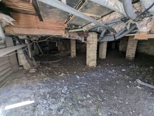
If you’re a homeowner in Essex, a dusk emergence survey is typically required when roof works, loft conversions, barn conversions or demolition affect buildings with potential bat roost features. Staffordshire councils will usually seek confirmation that bats are not using the structure before works proceed. 

For developers in Essex, dusk emergence surveys are required where a Preliminary Roost Assessment (PRA) identifies low, moderate or high roost potential and planners need robust presence/absence evidence to validate the application. This commonly affects housing schemes, conversions, infrastructure upgrades and regeneration sites. 

Early confirmation protects your programme from seasonal delay, redesign and unexpected licensing. 

Across Essex, dusk emergence surveys are frequently required where development interacts with: 

  • coastal towns and estuarine villages such as Southend-on-Sea and Maldon with historic housing stock

  • agricultural barns and silos in rural Tendring and Uttlesford under conversion

  • river valleys along the Stour, Blackwater, and Crouch intersecting new residential areas

  • green wedges and ancient woodlands on the fringes of Chelmsford and Colchester where commuting wildlife persists

Bat survey requirements are routinely tested at validation where roost potential exists. 

Our Bat Dusk Emergence Survey services cover the whole of Essex, from urban centres to rural landscapes.

Why Essex Planning Authorities Request Bat Dusk Emergence Surveys

Essex planning authorities require dusk emergence survey evidence wherever buildings or trees present credible roost potential, to ensure compliance with the Wildlife & Countryside Act 1981, the Conservation of Habitats and Species Regulations 2017 and national planning policy. Without seasonal emergence data, planners cannot lawfully confirm that development will avoid disturbance to protected roosts. 

If your Essex project involves demolition, conversion or structural alteration, bat emergence evidence should be confirmed before your application reaches validation. 

Local Case Insight

A residential redevelopment on the fringes of Maldon involved the conversion of a former agricultural structure positioned between hedgerows and a drainage corridor feeding into the Blackwater Estuary. Initial scoping identified multiple access features beneath the tiled roof and soffits. Two dusk emergence surveys were carried out during settled early-summer conditions, confirming that bats were commuting along the boundary hedge but not roosting within the building itself. The emergence report enabled the planning application to validate without seasonal conditions, with low-level lighting controls added at design stage. The scheme entered construction without licensing delay.

The Bat Dusk Emergence Survey Process

Our Bat Emergence Surveys in Essex provide fully compliant reports accepted by local planning authorities. As a result, your project stays on schedule with fewer seasonal setbacks.

Key Deliverables for Essex Projects

Where emergence data is required to unlock planning in Essex, we provide: 

  • A legally defensible dusk emergence survey report 
  • Confirmed presence or likely absence of roosting bats 
  • Classification of impacts and mitigation where required 
  • Licence pathway advice if disturbance cannot be avoided 
  • Documentation structured for Essex LPA review 

The outcome is certainty, not escalation. 

Step 1

Scoping

Confirm site details, development scope, survey window and roost features from a PRA.

Step 2

Dusk Surveys

Carry out dusk emergence surveys (May–Aug) using licensed ecologists and detectors.

Step 3

Assessment

Interpret results, assess impacts and identify any mitigation or licensing needs.

Step 4

Reporting & Integration

Align findings with PRA, PEA or any other ecological surveys where required

Next Steps

Need to confirm whether your Essex site requires a dusk emergence bat survey? 


Send your site details and we’ll confirm exactly what’s required before your application reaches validation. 

FAQ - Bat Dusk Emergence Surveys in Essex

What is a bat emergence survey in Essex?

A bat emergence survey is an ecological survey undertaken at dusk or dawn to confirm whether bats are roosting within a building. Ecologists observe the structure at sunset or sunrise to record bats leaving or returning to potential roost features.

Bat emergence surveys are usually required where a Preliminary Roost Assessment identifies moderate or high bat roost potential within a structure. Planning authorities require this survey evidence before determining development proposals.

Planning guidance for Chelmsford City Council can be accessed at:
https://www.chelmsford.gov.uk/planning/

They can be. Coastal environments and estuaries often support strong bat foraging activity, which can increase the likelihood that nearby buildings may contain roosts.

Yes. Farm buildings such as barns, sheds or storage structures may contain roof cavities and structural gaps that can support bat roosts.

They can be. Many redevelopment projects involve altering or demolishing older buildings that may contain potential roost features.

Can buildings near marshland habitats require bat surveys?

Yes. Wetland and grazing marsh landscapes often support high levels of insect activity, which attracts bats and increases the likelihood of nearby roosts.

During the survey, ecologists observe the building at dusk or dawn and record bats emerging from or returning to specific locations on the structure.

Yes. The results of the bat emergence survey are documented within a report which is submitted to the planning authority as part of the ecological assessment.

They can. If bats are confirmed to be roosting within a building, development proposals may need to include mitigation measures to ensure bats remain protected.

ProHort provides professional bat emergence surveys across Essex. Our ecologists deliver surveys that meet national ecological guidance and local planning authority requirements, helping planning applications progress efficiently.

Related Services

Bat Emergence Survey in Hampshire

Bat Dusk Emergence Surveys in Hampshire

Planning deadline approaching and no Bat Emergence Survey in place for your Hampshire project?

Don’t risk planning refusal. We provide fast, fully compliant dusk surveys to keep your project on track.

Fast, Clear, Planning-Ready Support

Fast response 

Calls answered in 2 rings, emails replied to within the hour.

Free expert advice

Clear guidance before you commit.

Cost-effective

Working in partnership with clients to ensure planning approval first time

Typical 10-day turnaround

Industry Leading Standard

Expert Team

We stay with you from first call through to submission. 

Do you Need a Bat Dusk Emergence Survey in Hampshire?

If you’re a homeowner in Hampshire, a dusk emergence survey is typically required when roof works, loft conversions, barn conversions or demolition affect buildings with potential bat roost features. Staffordshire councils will usually seek confirmation that bats are not using the structure before works proceed. 

For developers in Hampshire, dusk emergence surveys are required where a Preliminary Roost Assessment (PRA) identifies low, moderate or high roost potential and planners need robust presence/absence evidence to validate the application. This commonly affects housing schemes, conversions, infrastructure upgrades and regeneration sites. 

Early confirmation protects your programme from seasonal delay, redesign and unexpected licensing. 

Across Hampshire, dusk emergence surveys are frequently required where development interacts with: 

  • historic market towns such as Winchester and Alton with older brick and timber buildings

  • agricultural outbuildings and former military sites being repurposed across Test Valley and New Forest

  • river and stream corridors along the Test, Itchen, and Meon intersecting housing or infrastructure projects

  • urban fringe woodlands and commons near Basingstoke and Fareham where connectivity for bats and birds is retained

Bat survey requirements are routinely tested at validation where roost potential exists. 

Our Bat Dusk Emergence Survey services cover the whole of Hampshire, from urban centres to rural landscapes.

Why Hampshire Planning Authorities Request Bat Dusk Emergence Surveys

Hampshire planning authorities require dusk emergence survey evidence wherever buildings or trees present credible roost potential, to ensure compliance with the Wildlife & Countryside Act 1981, the Conservation of Habitats and Species Regulations 2017 and national planning policy. Without seasonal emergence data, planners cannot lawfully confirm that development will avoid disturbance to protected roosts. 

If your Hampshire project involves demolition, conversion or structural alteration, bat emergence evidence should be confirmed before your application reaches validation. 

Local Case Insight

A residential conversion near Petersfield involved the redevelopment of a timber-framed outbuilding set within hedgerows linking to the South Downs corridor. Initial inspection identified multiple lifted tiles and ridge gaps offering credible roost potential. Two dusk emergence surveys were completed during optimal early-season conditions, confirming active foraging nearby but no roost use within the structure. The resulting report allowed the planning application to validate without seasonal conditions, with lighting controls incorporated at design stage. Works proceeded to programme without licensing delay or post-consent restrictions.

The Bat Dusk Emergence Survey Process

Our Bat Emergence Surveys in Hampshire provide fully compliant reports accepted by local planning authorities. As a result, your project stays on schedule with fewer seasonal setbacks.

Key Deliverables for Hampshire Projects

Where emergence data is required to unlock planning in Hampshire, we provide: 

  • A legally defensible dusk emergence survey report 
  • Confirmed presence or likely absence of roosting bats 
  • Classification of impacts and mitigation where required 
  • Licence pathway advice if disturbance cannot be avoided 
  • Documentation structured for Hampshire LPA review 

The outcome is certainty, not escalation. 

Step 1

Scoping

Confirm site details, development scope, survey window and roost features from a PRA.

Step 2

Dusk Surveys

Carry out dusk emergence surveys (May–Aug) using licensed ecologists and detectors.

Step 3

Assessment

Interpret results, assess impacts and identify any mitigation or licensing needs.

Step 4

Reporting & Integration

Align findings with PRA, PEA or any other ecological surveys where required

Next Steps

Need to confirm whether your Hampshire site requires a dusk emergence bat survey? 


Send your site details and we’ll confirm exactly what’s required before your application reaches validation. 

FAQ - Bat Dusk Emergence Surveys in Hampshire

What is a bat emergence survey in Hampshire?

A bat emergence survey is an ecological survey carried out at dusk or dawn to determine whether bats are roosting within a building. Ecologists observe the structure at sunset or sunrise to record bats leaving or returning to potential roost locations.

Bat emergence surveys are usually required where a Preliminary Roost Assessment identifies moderate or high bat roost potential within a building. Planning authorities require this survey evidence before determining development proposals.

Planning guidance for Winchester City Council can be accessed at:
https://www.winchester.gov.uk/planning

They can be. Hampshire contains extensive woodland and heathland habitats that support active bat populations, which can increase the likelihood that nearby buildings may contain roosts.

Yes. Development proposals within or near the New Forest often require careful ecological assessment, including bat surveys where buildings have potential roost features.

In some cases they are. Buildings located near the Solent or other coastal habitats may require surveys where development could affect potential bat roosts.

Do rural cottages and estate buildings require bat surveys?

They can. Older buildings often contain roof voids, timber beams and crevices that may provide suitable roosting features for bats.

Ecologists monitor the building at dusk or dawn and record where bats enter or leave the structure. This allows the survey to confirm whether a roost is present and where it is located.

The report typically includes survey dates, bat activity observations, species recorded and an assessment of whether the building supports a bat roost.

They can. Surveys must be undertaken during the bat activity season, usually between May and September, meaning project timelines may need to account for seasonal survey windows.

ProHort provides professional bat emergence surveys across Hampshire. Our ecologists deliver surveys that meet national ecological guidance and local planning authority requirements, helping projects proceed with reliable ecological evidence.

Related Services

Bat Emergence Survey in the West Midlands

Bat Dusk Emergence Surveys in the West Midlands

Planning deadline approaching and no bat dusk survey in place for your West Midlands project?

Don’t risk planning refusal. We provide fast, fully compliant dusk surveys to keep your project on track.

Fast, Clear, Planning-Ready Support

Fast response 

Calls answered in 2 rings, emails replied to within the hour.

Free expert advice

Clear guidance before you commit.

Cost-effective

Working in partnership with clients to ensure planning approval first time

Typical 10-day turnaround

Industry Leading Standard

Expert Team

We stay with you from first call through to submission. 

Do you Need a Bat Dusk Emergence Survey in the West Midlands?

If you’re a homeowner in the West Midlands, a dusk emergence survey is typically required when roof works, loft conversions, barn conversions or demolition affect buildings with potential bat roost features. Staffordshire councils will usually seek confirmation that bats are not using the structure before works proceed. 

For developers in the West Midlands, dusk emergence surveys are required where a Preliminary Roost Assessment (PRA) identifies low, moderate or high roost potential and planners need robust presence/absence evidence to validate the application. This commonly affects housing schemes, conversions, infrastructure upgrades and regeneration sites. 

Early confirmation protects your programme from seasonal delay, redesign and unexpected licensing. 

Across the West Midlands, dusk emergence surveys are frequently required where development interacts with: 

  • post-war residential estates in Birmingham and Wolverhampton with cavity wall features and loft voids

  • reclaimed industrial zones around Dudley and Sandwell where derelict structures are being converted

  • canal networks including the BCN and River Tame corridors crossing redevelopment sites

  • urban green spaces and semi-natural pockets in Solihull and Coventry where connectivity for wildlife persists

Bat survey requirements are routinely tested at validation where roost potential exists. 

Our Bat Dusk Emergence Survey services cover the whole of the West Midlands, from urban centres to rural landscapes.

Why West Midlands Planning Authorities Request Bat Dusk Emergence Surveys

West Midlands planning authorities require dusk emergence survey evidence wherever buildings or trees present credible roost potential, to ensure compliance with the Wildlife & Countryside Act 1981, the Conservation of Habitats and Species Regulations 2017 and national planning policy. Without seasonal emergence data, planners cannot lawfully confirm that development will avoid disturbance to protected roosts. 

If your West Midlands project involves demolition, conversion or structural alteration, bat emergence evidence should be confirmed before your application reaches validation. 

Local Case Insight

A refurbishment project in Solihull proposed alterations to a former municipal building adjacent to a canal corridor and mature boundary trees. An initial inspection identified multiple roost access features beneath roof tiles. Two dusk emergence surveys completed during suitable early-summer conditions confirmed bat activity along the canal but no roost within the building fabric. The resulting report allowed the application to validate without seasonal conditions, with lighting controls incorporated at design stage. Works commenced without programme disruption.

The Bat Dusk Emergence Survey Process

Our Bat Emergence Surveys in the West Midlands provide fully compliant reports accepted by local planning authorities. As a result, your project stays on schedule with fewer seasonal setbacks.

Key Deliverables for West Midlands Projects

Where emergence data is required to unlock planning in the West Midlands, we provide: 

  • A legally defensible dusk emergence survey report 
  • Confirmed presence or likely absence of roosting bats 
  • Classification of impacts and mitigation where required 
  • Licence pathway advice if disturbance cannot be avoided 
  • Documentation structured for the West Midlands LPA review 

The outcome is certainty, not escalation. 

Step 1

Scoping

Confirm site details, development scope, survey window and roost features from a PRA.

Step 2

Dusk Surveys

Carry out dusk emergence surveys (May–Aug) using licensed ecologists and detectors.

Step 3

Assessment

Interpret results, assess impacts and identify any mitigation or licensing needs.

Step 4

Reporting & Integration

Align findings with PRA, PEA or any other ecological surveys where required

Next Steps

Need to confirm whether your the West Midlands site requires a dusk emergence bat survey? 


Send your site details and we’ll confirm exactly what’s required before your application reaches validation. 

FAQ - Bat Dusk Emergence Surveys in the West Midlands

What is a bat emergence survey in the West Midlands?

A bat emergence survey is an ecological survey carried out at dusk or dawn to confirm whether bats are roosting within a building. Ecologists observe the structure at sunset or sunrise to record bats leaving or returning to potential roost locations.

Emergence surveys are usually required when a Preliminary Roost Assessment identifies moderate or high roost potential within a structure. Local Planning Authorities require this evidence before determining development proposals.

Planning guidance for Birmingham City Council can be accessed at:
https://www.birmingham.gov.uk/planning

They can be. Large industrial structures may contain roof voids, cladding gaps or structural features that provide suitable roosting opportunities for bats.

Often yes. Where existing buildings are being demolished, converted or significantly altered, emergence surveys may be required to confirm whether bats are present.

They can. Converting commercial buildings into residential accommodation may affect roof spaces and structural features that could support bat roosts.

Are bat emergence surveys needed for flat roof buildings?

In some cases, yes. Even flat roof structures may contain cavities, roof plant areas or structural gaps that provide potential roost features.

Ecologists position themselves around the building to observe all potential access points. Bat detectors are used to record activity while surveyors visually monitor bats leaving or returning to the structure.

Yes. Even smaller retail units or industrial buildings can contain features suitable for bats and may require emergence surveys before demolition.

The surveys provide evidence on whether bats are using a building as a roost. This information helps planning authorities ensure development proposals comply with wildlife protection legislation.

ProHort undertakes professional bat emergence surveys across the West Midlands, providing reliable survey evidence that meets national ecological guidance and local planning authority requirements.

Related Services

Preliminary Roost Assessment (PRA) in Staffordshire

Preliminary Roost Assessment (PRA) in Staffordshire

Unsure whether bats could delay your planning application in Staffordshire?

Our expert-led PRAs provide early clarity on constraints and protect your programme from avoidable setbacks.

Fast, Clear, Planning-Ready Support

Fast response 

Calls answered in 2 rings, emails replied to within the hour.

Free expert advice

Clear guidance before you commit.

Cost-effective

Working in partnership with clients to ensure planning approval first time

Typical 10-day turnaround

Industry Leading Standard

Expert Team

We stay with you from first call through to submission. 

Do you Need a Preliminary Roost Assessment (PRA) in Staffordshire?

If you’re a homeowner, a PRA is typically required where loft conversions, roof replacements, barn conversions or structural alterations affect buildings with any potential bat roost features. Staffordshire councils will usually seek confirmation that bats are not using the structure before works proceed.

For developers, PRAs are required where existing buildings, trees or structures form part of a planning submission and planners need early, defensible evidence of bat risk before determining whether further surveys are necessary. This commonly affects housing schemes, conversions, infrastructure upgrades and regeneration sites.

Early confirmation at PRA stage prevents seasonal bottlenecks, redesign and unexpected licensing risk.

Across Staffordshire, Preliminary Roost Assessments are most frequently requested where development interacts with:

  • older housing stock across Stafford, Stone and surrounding villages where roof voids, tile gaps and cavity walls are common

  • agricultural conversions across East Staffordshire and Cannock Chase District involving barns and legacy outbuildings

  • regeneration land around Newcastle-under-Lyme where disused structures remain embedded in layouts

  • canals, rivers, wooded corridors and mature hedgerow networks intersecting development zones

PRA requirements are routinely tested at validation wherever bat roost potential exists.

Our Bat Dusk Emergence Survey services cover the whole of Staffordshire, from urban centres to rural landscapes.

Why Staffordshire Planning Authorities Request Preliminary Roost Assessments

Staffordshire planning authorities require PRAs wherever buildings, trees or structures present any credible roost potential to ensure compliance with the Wildlife & Countryside Act 1981, the Conservation of Habitats and Species Regulations 2017, and national planning policy. Without a PRA, planners cannot lawfully determine whether emergence surveys or licensing will be required. Where early evidence is missing, applications commonly face validation blocks, additional ecological conditions or forced seasonal delay.

If a Staffordshire project involves demolition, conversion or structural alteration, PRA evidence should be confirmed before the application reaches validation.

Local Case Insight

A proposed residential refurbishment on the edge of Stafford involved roof reconstruction to a former agricultural dwelling bordering hedgerows and a watercourse. Initial screening highlighted visible roof gaps and multiple ridge-line access points. A Preliminary Roost Assessment confirmed low roost potential with no evidence of active use at the time of inspection. The resulting report enabled the local authority to validate the planning application without delaying the programme for seasonal emergence work. Design safeguards were incorporated at an early stage, allowing construction to proceed on schedule without licensing requirement.

The Preliminary Roost Assessment Process

Our Preliminary Roost Assessments in Staffordshire provide fully compliant reports accepted by local planning authorities. It prevents avoidable emergence delays, stabilises planning submissions and ensures that any further survey requirements are proportionate and justified.

Key Deliverables for Staffordshire Projects

Where bat scoping is required to unlock planning in Staffordshire, a PRA provides:

  • a legally defensible preliminary roost assessment report

  • confirmed classification of roost potential

  • identification of whether emergence surveys are required

  • early determination of licensing likelihood

  • documentation structured for Staffordshire LPA review

The outcome is certainty, not escalation.

Step 1

Programme & Scoping

Proposed works, construction sequence and planning feedback are reviewed to define PRA scope.

Step 2

Daytime Roost Inspection

Inspection of buildings, structures or trees for roost features and bat evidence in line with lawful survey guidance.

Step 3

Assessment

Roost potential classification and planning implications interpreted against LPA validation requirements.

Step 4

Reporting & Integration

Evidence is reported for planning submissions and coordinated with Bat Emergence Surveys or PEAs where required.

Next Steps

Need to confirm whether a Staffordshire property or development requires a Preliminary Roost Assessment?


Submit the site details and confirmation is provided before your application reaches validation.

FAQ - Preliminary Roost Assessments in Staffordshire

What is a Preliminary Roost Assessment in Staffordshire?

A Preliminary Roost Assessment (PRA) is an initial bat survey carried out by a qualified ecologist to determine whether a building, roof or tree has potential to support roosting bats. It is typically required to support a planning application where works may affect bat habitat.

A PRA is usually required where works involve roof replacement, loft conversions, barn conversions, demolition or extensions to buildings that could support bats. Stafford Borough Council and other district councils require ecological information where protected species may be affected.

Planning validation guidance can be found via Stafford Borough Council:
https://www.staffordbc.gov.uk/planning

No. A Preliminary Roost Assessment identifies whether there is evidence of bats or whether the building has bat roost potential. Many surveys conclude with negligible or low potential, meaning no further survey work is required.

A PRA can be undertaken at any time of year because it is primarily a daytime inspection of a building or structure. However, if evidence of bats is found, follow up surveys may be seasonally restricted.

Yes. A PRA includes an internal inspection of loft spaces, roof voids and accessible areas, as well as an external inspection of roof tiles, soffits, brickwork and surrounding habitat features.

Do I need a PRA to replace my roof in Staffordshire?

Often yes. Roof works can impact bat roosting features such as lifted tiles or roof void access points. Local planning authorities frequently request a Preliminary Roost Assessment before determining applications involving roof alterations.

Most residential PRAs take between one and two hours on site, depending on property size and complexity. The written report is typically issued shortly after the survey.

If evidence of bat activity is identified, further surveys such as emergence or re entry surveys may be recommended. These surveys confirm whether a roost is present and inform appropriate mitigation measures.

Costs vary depending on property size, access requirements and location. Smaller residential properties are typically less complex than agricultural buildings or large rural barns.

ProHort provides professional Preliminary Roost Assessments across Staffordshire for homeowners, architects and developers. Our surveys are clear, planning compliant and designed to reduce delays by identifying bat risk early in the process.

Related Services

Bat Emergence Survey in Shropshire

Bat Dusk Emergence Surveys in Shropshire

Planning deadline approaching and no bat dusk survey in place for your Shropshire project?

Don’t risk planning refusal. We provide fast, fully compliant dusk surveys to keep your project on track.

Fast, Clear, Planning-Ready Support

Fast response 

Calls answered in 2 rings, emails replied to within the hour.

Free expert advice

Clear guidance before you commit.

Cost-effective

Working in partnership with clients to ensure planning approval first time

Typical 10-day turnaround

Industry Leading Standard

Expert Team

We stay with you from first call through to submission. 

Do you Need a Bat Dusk Emergence Survey in Shropshire?

If you’re a homeowner in Shropshire, a dusk emergence survey is typically required when roof works, loft conversions, barn conversions or demolition affect buildings with potential bat roost features. Staffordshire councils will usually seek confirmation that bats are not using the structure before works proceed. 

For developers in Shropshire, dusk emergence surveys are required where a Preliminary Roost Assessment (PRA) identifies low, moderate or high roost potential and planners need robust presence/absence evidence to validate the application. This commonly affects housing schemes, conversions, infrastructure upgrades and regeneration sites. 

Early confirmation protects your programme from seasonal delay, redesign and unexpected licensing. 

Across Shropshire, dusk emergence surveys are frequently required where development interacts with: 

  • older housing stock in Shrewsbury, Oswestry and market towns where loft voids and tile gaps are common
  • agricultural conversions across the Shropshire Hills, Ludlow and surrounding villages where barns and outbuildings are reused
  • regeneration areas around Telford and edge-of-town estates where legacy structures sit close to new layouts
  • River Severn corridors, wooded valleys and hedgerow networks that provide strong commuting routes for bats

Bat survey requirements are routinely tested at validation where roost potential exists. 

Our Bat Dusk Emergence Survey services cover the whole of Shropshire, from urban centres to rural landscapes.

Why Shropshire Planning Authorities Request Bat Dusk Emergence Surveys

Shropshire planning authorities require dusk emergence survey evidence wherever buildings or trees present credible roost potential, to ensure compliance with the Wildlife & Countryside Act 1981, the Conservation of Habitats and Species Regulations 2017 and national planning policy. Without seasonal emergence data, planners cannot lawfully confirm that development will avoid disturbance to protected roosts. 

If your Shropshire project involves demolition, conversion or structural alteration, bat emergence evidence should be confirmed before your application reaches validation. 

Local Case Insight

A barn conversion near the Shropshire Hills proposed the reuse of a traditional stone outbuilding set within a network of hedgerows, pasture and a nearby stream. An initial assessment identified bat roost potential within the roof structure and under weathered tiles. Two dusk emergence surveys were completed during suitable conditions in early summer, confirming bats were commuting along the field boundaries and tree lines but not using the building as a roost. The resulting report enabled planners to validate the application without seasonal conditions, with modest lighting and boundary mitigation integrated at design stage. Construction commenced on time without licensing delay.

The Bat Dusk Emergence Survey Process

Our Bat Emergence Surveys in Shropshire provide fully compliant reports accepted by local planning authorities. As a result, your project stays on schedule with fewer seasonal setbacks.

Key Deliverables for Shropshire Projects

Where emergence data is required to unlock planning in Shropshire , we provide: 

  • A legally defensible dusk emergence survey report 
  • Confirmed presence or likely absence of roosting bats 
  • Classification of impacts and mitigation where required 
  • Licence pathway advice if disturbance cannot be avoided 
  • Documentation structured for Staffordshire LPA review 

The outcome is certainty, not escalation. 

Step 1

Scoping

Confirm site details, development scope, survey window and roost features from a PRA.

Step 2

Dusk Surveys

Carry out dusk emergence surveys (May–Aug) using licensed ecologists and detectors.

Step 3

Assessment

Interpret results, assess impacts and identify any mitigation or licensing needs.

Step 4

Reporting & Integration

Align findings with PRA, PEA or any other ecological surveys where required

Next Steps

Need to confirm whether your Shropshire site requires a dusk emergence bat survey? 


Send your site details and we’ll confirm exactly what’s required before your application reaches validation. 

FAQ - Bat Dusk Emergence Surveys in Shropshire

What is a bat emergence survey for development in Shropshire?

A bat emergence survey is an ecological survey carried out at dusk or dawn to confirm whether bats are roosting in a building. Ecologists observe the structure and record bats emerging or returning to potential roost locations.

Agricultural barns and outbuildings frequently contain roof voids, timber beams and structural gaps that can support bat roosts. Where a Preliminary Roost Assessment identifies moderate or high potential, emergence surveys are required to confirm whether bats are present.

Planning guidance for Shropshire Council can be accessed at:
https://www.shropshire.gov.uk/planning/

Dusk emergence surveys begin shortly before sunset, while dawn re-entry surveys start before sunrise. Surveyors remain on site for several hours to observe bat activity around the building.

Yes. Larger structures such as barns, farm buildings or industrial units may require several ecologists positioned around the building to ensure all potential roost access points are monitored.

They can be. Older cottages often contain roof tiles, loft spaces and eaves that may provide bat access points. Where roost potential exists, surveys may be required before planning permission is granted.

What equipment is used during a bat emergence survey?

Ecologists use specialist bat detectors to record ultrasonic bat calls. These devices allow surveyors to identify bat species and confirm whether bats are using the building as a roost.

Survey visits are normally spaced across the survey season to capture reliable data. This helps confirm whether bat activity is consistent and whether a roost is present.

In most cases planning authorities will wait until all required emergence surveys are finished before determining the application. Early survey planning helps avoid delays.

If surveys confirm the absence of a roost, the ecologist will provide a report confirming likely absence. This allows the planning authority to proceed with determining the application.

ProHort provides compliant bat emergence surveys across Shropshire for homeowners, landowners and developers. Our ecologists design survey programmes that meet national guidance and local planning requirements, helping applications progress efficiently.

Related Services

Biodiversity Net Gain (BNG) Assessment in Salford

Biodiversity Net Gain (BNG) in Salford

Developing or submitting a planning application in Salford and require Biodiversity Net Gain?

BNG is now a mandatory requirement – we specialise in providing compliant reports to achieve planning consent. 

Fast, Clear, Planning-Ready Support

Fast response 

Calls answered in 2 rings, emails replied to within the hour.

Free expert advice

Clear guidance before you commit.

Cost-effective

Working in partnership with clients to ensure planning approval first time

Typical 10-day turnaround

Industry Leading Standard

Expert Team

We stay with you from first call through to submission. 

Do you need a Biodiversity Net Gain Assessment in Salford?

Biodiversity Net Gain forms a required element of the planning process for most development proposals. In practice, this means a scheme must show how it will increase biodiversity relative to what is currently present on the site. Planning teams expect this information to be set out clearly, and applications are often held up or left unvalidated when BNG evidence is incomplete or unclear.

Planning officers in Salford often request BNG information where development may affect key habitat networks, such as:

• Canal and riverside corridors along the Manchester Ship Canal and River Irwell

• Regeneration sites and former industrial land that now support early stage habitat

• Urban parks, greenspace and small woodland areas used for wildlife movement

• The Irwell Valley and transport routes that act as continuous habitat links

Clear and well presented BNG evidence helps avoid validation issues and delays in Salford.

We support projects across the city of Salford, working in neighbourhoods such as Salford Quays, Ordsall, Eccles, Pendleton, Weaste, Seedley, Swinton, Walkden, Little Hulton and the wider areas within the Salford local authority boundary.

Why planning authorities in Salford request a BNG?

Salford City Council encourages applicants to address BNG at the outset of a project so the planning team can understand how the required uplift will be achieved. This normally involves a confirmed UKHab baseline, a completed Metric that clearly sets out the change in biodiversity units, and a realistic plan for securing and managing the proposed gains. These expectations reflect national policy under NPPF Section 15 and help ensure BNG proposals are sound when reviewed.

Establishing the baseline early in the process reduces the chance of later amendments and supports a smoother route through planning.

Local Case Insight

A BNG assessment for a mixed use scheme in Ordsall revealed an unexpected band of valuable habitat along the edge of an old service yard. A narrow strip of ground beside a disused access route supported early stage scrub, tall herb vegetation and a damp corner with rushes and soft grassland, all of which carried more biodiversity value than the team anticipated for an urban setting. By refining the layout to retain this small habitat corridor and strengthening it with targeted planting that linked into nearby greenspace, the project achieved the required net gain fully within the boundary. This allowed the planning submission to move forward without the need for external biodiversity units or late adjustments to the design.

How the BNG process works?

We produce planning-ready BNG Assessments aligned to Salford’s policy expectations.

Key BNG Deliverables for Salford Projects

For developments in Salford, our BNG assessments provide the essential information required by the planning team. Each assessment includes:

• a verified UKHab baseline

• a clear and defensible Metric

• a workable uplift approach suited to the site

• planning ready reporting for validation

• optional long term management and gain plan material

This structure meets Salford City Council expectations and offers a straightforward route to demonstrating BNG.

Step 1

Habitat baseline surveys

Year-round, with optimal survey seasons

Step 2

Metric 4.0 calculations

 Completed once habitat data is verified. 

Step 3

Uplift strategy development

Aligned with design progression and layout refinement.

Step 4

Integration with Other Surveys

Only if needed. PEA, EIA, and Protected Species surveys 

Next Steps

Contact us and we’ll confirm exactly what your site requires and support a planning-ready, proportionate route forward. 

FAQ - BNG in Salford

Do I need a Biodiversity Net Gain assessment for development in Salford?

Most developments in Salford require BNG evidence to validate a planning application. Salford City Council expects a clear baseline and a measurable uplift.

You can review local planning guidance here: 

Sites close to canals, the River Irwell, former industrial land, urban greenspace and transport corridors often require a full BNG assessment.

Early in the design process. Starting early avoids layout changes later and supports smooth validation.

What does a BNG survey or assessment involve in Salford?

It includes a UKHab baseline, a completed Metric, habitat mapping, and a plan showing how the uplift will be delivered and maintained.

Only in limited cases defined by national rules. Many small urban plots in Salford still need BNG evidence.

Off site biodiversity units within Greater Manchester may be used. Statutory credits are a last resort.

Related Services

Biodiversity Net Gain (BNG) Assessment in Stockport

Biodiversity Net Gain (BNG) in Stockport

Developing or submitting a planning application in Stockport and require Biodiversity Net Gain?

BNG is now a mandatory requirement – we specialise in providing compliant reports to achieve planning consent. 

Fast, Clear, Planning-Ready Support

Fast response 

Calls answered in 2 rings, emails replied to within the hour.

Free expert advice

Clear guidance before you commit.

Cost-effective

Working in partnership with clients to ensure planning approval first time

Typical 10-day turnaround

Industry Leading Standard

Expert Team

We stay with you from first call through to submission. 

Do you need a Biodiversity Net Gain Assessment in Stockport?

Biodiversity Net Gain is a required element of the planning process for most new developments. In practice, this means each scheme must show how it will increase biodiversity beyond the baseline recorded at the outset. Planning officers expect this information to be presented clearly, and applications are often delayed or left unvalidated when BNG evidence is incomplete or unclear.

Planning officers in Stockport often request BNG information where development may affect key habitat networks, such as:

• River corridors along the Mersey and Goyt

• Regeneration and former industrial sites with emerging habitat

• Urban parks, woodland edges and greenspace used for wildlife movement

• Valley systems and transport routes that act as linked habitat corridors

Clear and well presented BNG evidence helps avoid validation issues and delays in Stockport.

We support projects across the borough of Stockport, working in areas such as the town centre, Heaton Moor, Heaton Chapel, Reddish, Bramhall, Cheadle, Hazel Grove, Marple and the wider neighbourhoods within the Stockport local authority boundary.

Why planning authorities in Stockport request a BNG?

Stockport Council encourages applicants to address BNG requirements early in the design process so the planning team can be confident that the scheme can deliver the necessary uplift in biodiversity. This usually involves a confirmed ecological baseline, a completed Metric that sets out the change in biodiversity units, and a clear explanation of how the proposed gains will be created and secured for the long term. These expectations reflect national policy under NPPF Section 15 and help ensure BNG proposals stand up to detailed review.

Establishing the baseline at the outset reduces the chance of later amendments and supports a smoother passage through the planning system in Stockport.

Local Case Insight

A BNG assessment for a residential scheme in Marple uncovered unexpected habitat value along the boundary of a disused yard near the canal. A narrow strip of land that appeared unremarkable during early design discussions supported young scrub, tall herbs and a damp corner with soft rush and wet grassland, all contributing more biodiversity value than anticipated for a small urban fringe site. By refining the layout to retain this habitat band and adding new planting that linked the site to the nearby canal corridor, the project achieved the required net gain entirely within its boundary. This allowed the planning submission to move forward without delays and removed the need for off site units or changes to the design at a late stage.

How the BNG process works

We produce planning-ready BNG Assessments aligned to Stockport’s policy expectations.

Key BNG Deliverables for Stockport Projects

For developments in Stockport, our BNG assessments provide the key information planning officers require. Each assessment includes:

• a verified UKHab baseline

• a clear and justified Metric

• a workable uplift approach suited to the site

• planning ready reporting for validation

• optional long term management and gain plan material

This format meets Stockport Council expectations and offers a straightforward route to demonstrating BNG.

Step 1

Habitat baseline surveys

Year-round, with optimal survey seasons

Step 2

Metric 4.0 calculations

 Completed once habitat data is verified. 

Step 3

Uplift strategy development

Aligned with design progression and layout refinement.

Step 4

Integration with Other Surveys

Only if needed. PEA, EIA, and Protected Species surveys 

Next Steps

Contact us and we’ll confirm exactly what your site requires and support a planning-ready, proportionate route forward. 

FAQ - BNG in Stockport

Do I need a Biodiversity Net Gain assessment for development in Stockport?

Most developments in Stockport now require BNG evidence as part of the planning application. Stockport Council expects a clear baseline and a measurable uplift in biodiversity.

You can review local planning guidance here: 

Sites near the River Mersey, the River Goyt, local valley systems, former industrial land, parks, or transport corridors often require detailed BNG assessment.

As early as possible. Early baseline work reduces design changes later and supports smoother validation.

What does a BNG assessment include in Stockport?

It typically includes a UKHab baseline, a completed Metric, habitat mapping and a clear plan showing how biodiversity uplift will be achieved and secured.

Only in limited cases defined by national policy. Many smaller plots in Stockport still require BNG evidence due to local ecological considerations.

Off site biodiversity units within Greater Manchester may be used, and statutory credits are available when no other options are suitable.

Related Services

Biodiversity Net Gain (BNG) Assessment in Trafford

Biodiversity Net Gain (BNG) in Trafford

Developing or submitting a planning application in Trafford and require Biodiversity Net Gain?

BNG is now a mandatory requirement – we specialise in providing compliant reports to achieve planning consent. 

Fast, Clear, Planning-Ready Support

Fast response 

Calls answered in 2 rings, emails replied to within the hour.

Free expert advice

Clear guidance before you commit.

Cost-effective

Working in partnership with clients to ensure planning approval first time

Typical 10-day turnaround

Industry Leading Standard

Expert Team

We stay with you from first call through to submission. 

Do you need a Biodiversity Net Gain Assessment in Trafford?

Biodiversity Net Gain is now a core requirement for most developments, and Trafford Council applies this consistently. Each project must show how it will improve biodiversity beyond the baseline recorded at the start, using clear evidence and a defensible Metric. Planning officers rely on this information to assess whether a scheme meets national and local expectations. Applications often face delays or validation issues when BNG details are unclear or incomplete, so presenting accurate baseline data and a practical uplift strategy is essential for a smooth planning process.

Planning officers in Trafford often ask for BNG information where development may affect key habitat networks, including:

• Riverside areas along the River Mersey and nearby wetlands

• Regeneration and former industrial land with emerging habitat

• Local parks, woodland edges and community greenspace used for wildlife movement

• Transport corridors and green routes that act as connected habitat links

Clear and well presented BNG evidence helps avoid validation issues and delays in Trafford.

We support projects across the borough of Trafford, including areas such as Altrincham, Sale, Stretford, Urmston, Partington, Old Trafford, Timperley and the wider neighbourhoods within the Trafford local authority boundary.

Why planning authorities in Trafford request a BNG?

Trafford Council encourages applicants to address BNG requirements early in the design process so the planning team can clearly understand how the necessary uplift in biodiversity will be achieved. This normally involves a confirmed ecological baseline, a completed Metric that sets out the change in biodiversity units and a realistic plan for delivering and securing the proposed gains. These expectations reflect national policy under NPPF Section 15 and help ensure BNG submissions are robust during review.

Confirming the baseline at an early stage reduces the chance of later amendments and helps keep the planning process in Trafford moving without avoidable delays.

Local Case Insight

A BNG assessment for a school extension in Altrincham found that a narrow strip of grass and shrubs along the field boundary held more ecological value than expected, including species rich grassland and a well-formed hedgerow. By adjusting the layout to retain and enhance these features, the scheme achieved the required biodiversity uplift within the site and moved through Trafford’s planning process without the need for off site units or late design changes.

How the BNG process works

We produce planning-ready BNG Assessments aligned to Greater Manchester’s policy expectations.

Key BNG Deliverables for Trafford Projects

For developments in Trafford, our BNG assessments provide the essential information planning officers require. Each assessment includes:

• a verified UKHab baseline

• a clear and defensible Metric

• a workable uplift approach suited to the site

• planning ready reporting for validation

• optional long term management and gain plan material

This format supports Trafford Council requirements and offers a simple route to demonstrating BNG.

Step 1

Habitat baseline surveys

Year-round, with optimal survey seasons

Step 2

Metric 4.0 calculations

 Completed once habitat data is verified. 

Step 3

Uplift strategy development

Aligned with design progression and layout refinement.

Step 4

Integration with Other Surveys

Only if needed. PEA, EIA, and Protected Species surveys 

Next Steps

Contact us and we’ll confirm exactly what your Trafford site requires and support a planning-ready, proportionate route forward. 

FAQ - BNG in Trafford

Do I need a Biodiversity Net Gain assessment for development in Trafford?

Most developments in Trafford now require BNG evidence as part of the planning process. Trafford Council expects a clear baseline and a measurable uplift before validating an application.

You can review local planning guidance here: 

Sites near the River Mersey, the Bridgewater Canal, parks, former industrial land and major transport corridors often require detailed BNG assessment.

As early as possible. Early baseline work helps avoid design changes and supports a smooth validation process.

What does a BNG assessment include in Trafford?

A UKHab baseline, a completed Metric, habitat mapping and a clear plan for delivering and securing biodiversity uplift.

Only in specific cases defined by national policy. Many small plots in Trafford still require BNG assessment due to local ecological considerations.

Off site biodiversity units within Greater Manchester may be used, with statutory credits considered only when no other options are available.

Related Services

Biodiversity Net Gain (BNG) Assessment in Derby

Biodiversity Net Gain (BNG) in Derby

Developing or submitting a planning application in Derby and require Biodiversity Net Gain?

BNG is now a mandatory requirement – we specialise in providing compliant reports to achieve planning consent. 

Fast, Clear, Planning-Ready Support

Fast response 

Calls answered in 2 rings, emails replied to within the hour.

Free expert advice

Clear guidance before you commit.

Cost-effective

Working in partnership with clients to ensure planning approval first time

Typical 10-day turnaround

Industry Leading Standard

Expert Team

We stay with you from first call through to submission. 

Do you need a Biodiversity Net Gain Assessment in Derby?

Biodiversity Net Gain is now a mandatory part of the planning system for most developments in Derby. The principle is straightforward: a project must demonstrate that the site will deliver an overall improvement in biodiversity compared with its starting condition. Planning authorities will not validate many applications without clear and correctly presented BNG evidence, and missing information often leads to further delays later in the process.

Planning officers in Derby often request BNG information where development may affect key habitat networks. Typical examples include:

• River corridors and associated floodplain habitats connected to the River Derwent and its tributaries
• Brownfield and former industrial plots along the city’s historic manufacturing belt that now support regenerating grassland, scrub, or early successional woodland
• Green wedges and linear parks that provide essential movement routes between outer neighbourhoods and the Derwent Valley corridor
• Rail-adjacent habitats where unmanaged margins accumulate structurally diverse vegetation supporting invertebrates and small mammals

Presenting calculations and habitat plans correctly at the outset helps avoid validation queries and reduces the chance of a post-submission redesign.

We support projects across the city of Derby, covering all neighbourhoods including the city centre, Alvaston, Allestree, Mickleover, Littleover, Normanton, Chaddesden, Darley, Pear Tree, and the wider surrounding areas within the Derby local authority boundary.

Why planning authorities in Derby request a BNG

Councils in Derby look for BNG information at an early stage so they can be confident that your scheme will achieve the required ten percent increase in biodiversity before the layout is finalised. To satisfy this, they need a verified baseline, a completed Metric that shows the change in biodiversity units, and a clear approach for how the gain will be delivered and secured. These steps follow the expectations of NPPF Section 15 and ensure your BNG position is robust during planning.

Having the baseline confirmed early removes the risk of later reclassification and helps protect your programme from avoidable delays.

Local Case Insight

A BNG assessment for a mixed-use redevelopment on a redundant employment site near Alvaston identified unexpectedly high habitat value within a narrow strip of marshy grassland and tall herb vegetation bordering an attenuation channel. Although the land had been unmanaged for years, it scored well for distinctiveness and formed part of a foraging link between the Derwent corridor and nearby estate greenspace. By moderating the building layout and designing a strengthened wet-edge habitat along the drainage feature, the project delivered its required biodiversity uplift fully on-site. This prevented the need for external habitat units and allowed the application to progress without additional ecological redesign requests.

How the BNG process works

We produce planning-ready BNG Assessments aligned to Derby’s policy expectations.

Key BNG Deliverables for Derby Projects

For developments in Derby, our BNG assessments provide the core information planning officers expect. Each assessment includes:

• a verified UKHab baseline

• a clearly justified Metric

• a practical uplift strategy suited to the site

• planning ready reporting for validation

• optional long term management and gain plan material

This structure supports Derby Council’s requirements and offers a proportionate route to demonstrating BNG across a wide range of development types.

Step 1

Habitat baseline surveys

Year-round, with optimal survey seasons

Step 2

Metric 4.0 calculations

 Completed once habitat data is verified. 

Step 3

Uplift strategy development

Aligned with design progression and layout refinement.

Step 4

Integration with Other Surveys

Only if needed. PEA, EIA, and Protected Species surveys 

Next Steps

Contact us, and we’ll confirm exactly what your Derby site requires. We provide a planning-ready, proportionate route forward. 

FAQ - BNG in Derby

Does Derby City Council require BNG at validation?

Derby City Council’s Local Validation List confirms that most planning applications (other than exempt categories such as householders or permitted development) must include a BNG submission. You can view the Council’s official BNG guidance and validation requirements here: https://www.derby.gov.uk/environment-and-planning/planning/biodiversity-net-gain/

Yes. Schemes near the River Derwent or its tributaries often undergo closer scrutiny because these corridors support movement routes between urban and semi-natural habitats. Early engagement with BNG requirements is recommended to avoid downstream layout constraints.

Often it does. Many former industrial or storage plots in Derby support early successional scrub, regenerating grassland, or damp depressions that can hold higher biodiversity value than expected. A site visit and accurate habitat categorisation are essential.

Can BNG in Derby be delivered fully on-site for small developments?

It depends on site constraints and available space for habitat creation. Smaller sites can achieve their uplift through careful planting design, wet-edge enhancement, or targeted grassland improvements, but calculations must demonstrate compliant gains.

Vegetated rail margins are often considered ecologically functional due to their linearity and structural diversity. Applications close to these features may require clear justification for habitat loss and a strategy to maintain or reinforce connectivity elsewhere on-site.

A complete dataset—baseline habitat map, metric, impact assessment, and a deliverable 30-year management outline—reduces the likelihood of additional information requests. Presenting the information cleanly and ensuring that habitat category assignments are defensible helps the application move forward without unnecessary delay.

Related Services

Fast, Clear, Planning-Ready Support

Fast response 

Calls answered in 2 rings, emails replied to within the hour.

Free expert advice

Clear guidance before you commit.

Cost-effective

Working in partnership with clients to ensure planning approval first time

Typical 10-day turnaround

Industry Leading Standard

Expert Team

We stay with you from first call through to submission. 

Do you need a Biodiversity Net Gain Assessment in Bolton?

Biodiversity Net Gain now forms an essential part of the planning process for most schemes in Bolton. The council expects applicants to show, with clear and measurable evidence, how biodiversity on the site will increase from the confirmed baseline. This requires a reliable understanding of existing habitats, a transparent Metric and a plan that explains how the proposed gains will be created and maintained.

Bolton’s planning officers depend on this information to ensure developments meet national requirements and reflect the borough’s ecological priorities. Where BNG information is missing or unclear, applications often stall while further detail is requested. Establishing an accurate baseline early and presenting a realistic uplift strategy helps keep the planning process moving and reduces the risk of unexpected delays.

Planning officers in Bolton often request BNG information where development may affect key habitat networks, including:

• Valley areas linked to the River Croal and River Tonge

• Former mills and brownfield land with emerging habitat

• Local parks, wooded cloughs and community greenspace

• Rail lines, road corridors and green routes that support wildlife movement

Clear and well presented BNG evidence helps avoid validation delays in Bolton.

We support projects across the borough of Bolton, including areas such as Farnworth, Horwich, Westhoughton, Little Lever, Kearsley, Breightmet, Great Lever, Tonge and the wider neighbourhoods within the Bolton local authority boundary.

Why planning authorities in Bolton request a BNG?

Bolton Council encourages applicants to consider BNG requirements early so the planning team can clearly see how the required biodiversity uplift will be achieved. This usually involves establishing an accurate ecological baseline, completing a Metric that shows the expected change in biodiversity units and setting out a practical approach for delivering and securing the gains. These steps follow national policy under NPPF Section 15 and help ensure BNG submissions stand up to detailed review.

Confirming the baseline at the outset reduces the likelihood of later changes and supports a smoother planning process in Bolton.

Local Case Insight

A BNG assessment for a commercial site in Westhoughton showed that a small verge beside an existing service yard held more value than expected, including neutral grassland, a short hedgerow section and a damp corner with shade tolerant plants. By retaining and enhancing these areas and linking them to nearby greenspace, the scheme secured the required biodiversity uplift on site and moved through Bolton’s planning process without the need for off site units or design changes.

How the BNG process works

We produce planning-ready BNG Assessments aligned to Botlon’s policy expectations.

Key BNG Deliverables for Bolton Projects

For developments in Bolton, our BNG assessments provide the key information planning officers expect. Each assessment includes:

• a verified UKHab baseline

• a clear and defensible Metric

• a practical uplift approach suited to the site

• planning ready reporting for validation

• optional long term management and gain plan material

This structure aligns with Bolton Council requirements and offers a straightforward route to demonstrating BNG.

Step 1

Habitat baseline surveys

Year-round, with optimal survey seasons

Step 2

Metric 4.0 calculations

 Completed once habitat data is verified. 

Step 3

Uplift strategy development

Aligned with design progression and layout refinement.

Step 4

Integration with Other Surveys

Only if needed. PEA, EIA, and Protected Species surveys 

Next Steps

Contact us and we’ll confirm exactly what your Bolton site requires and support a planning-ready, proportionate route forward. 

FAQ - BNG in Bolton

Do I need a Biodiversity Net Gain assessment for development in Bolton?

Most developments in Bolton now require BNG evidence. Bolton Council will often not validate an application without a clear baseline and a measurable uplift.

You can review local planning guidance here: 

Sites near the River Croal, the River Tonge, wooded cloughs, former mill sites, parks, and transport corridors often require detailed BNG assessment.

Early in the design process. Starting early avoids redesign later and helps ensure the application is accepted for validation.

What does a BNG assessment include in Bolton?

A UKHab baseline, a completed Metric, habitat mapping and a plan showing how biodiversity uplift will be delivered and secured for thirty years.

Only in limited cases defined by national rules. Many small urban and edge-of-town sites in Bolton still fall within the requirement.

Off site biodiversity units within Greater Manchester may be used. Statutory credits are available only when no other options are suitable

Related Services

---