Ecological Method Statements

Ecological Method Statements ​

Practical ecological method statements that translate planning conditions into clear, buildable actions — keeping works compliant, controlled and moving. 

Request an Ecological Method Statement

Request an Ecological Method Statement

Maximum file size: 8.39MB

Do you need a Method Statement?

If your planning permission includes ecological conditions, mitigation requirements, or protected-species safeguards, a method statement is often required before works can start. 

This document allows planners to discharge conditions, contractors to work with confidence, and developers to avoid delays caused by uncertainty on site. 

However, these statements aren’t just for major developments. 
Homeowners, architects and developers are frequently asked for Ecological Method Statements where planning conditions cover how work is carried out, including protection measures or installations such as swift bricks, bird boxes or bat boxes. 

What is a Method Statement?

Ecological method statements (often titled CEMP, CEMP-ECO) sit at the point where planning permission becomes construction activity. They explain how ecological requirements will be delivered on site, when controls apply, and who is responsible during works. 

These are not surveys or strategies. 
Method Statements convert ecological requirements into clear, practical instructions that can be followed on site. 

Types of Method Statements

ProHort delivers a range of ecological method statements, depending on what your planning permission or licence requires. Each is scoped to the site, risk and condition wording. 

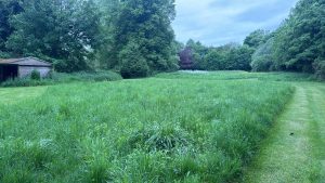
Method Statements in Staffordshire discussed on a large open construction site

Used where multiple ecological controls apply across a site. 
They coordinate clearance, groundworks, access, storage and sequencing in one structured document. 

Required where works must follow specific controls for bats, nesting birds, reptiles, great crested newts, badgers or other species. 
These set out timing, exclusion zones, supervision and contingency actions. 

Used where habitats must be protected, created or enhanced during construction, often linked to planning conditions, BNG or action plans. 

For physical ecological measures such as: 

  • bird and bat boxes 
  • hibernacula 
  • reptile fencing 
  • habitat features 
  • exclusion or protection fencing 

These explain how, when and by whom measures will be installed correctly and safely. 

When are Method Statements Required?

Method statements are commonly requested where: 

  • ecological planning conditions must be discharged 
  • protected-species licences apply 
  • mitigation must be delivered during construction 
  • LPAs require assurance before works begin 
  • contractors need clear ecological instructions 

They are usually required after permission but before construction, and increasingly expected as standard on medium and large sites. 

What You Receive:

Our planning-ready method statements typically cover: 

  • site activities and ecological constraints 
  • timing and seasonal restrictions 
  • protection measures during works 
  • installation or delivery of mitigation 
  • procedures if unexpected ecology is encountered 

In simple terms: it tells everyone involved what must happen on site to stay compliant. 

What We Deliver

Every ProHort method statement is practical, site-specific and planning-ready.

Service Element Purpose Outcome
Site-specific ecological controls Translate planning conditions and licence requirements into clear on-site instructions Contractors work with certainty and compliance risk is controlled
Mitigation delivery guidance Define how ecological measures must be implemented during worksy Measures are delivered correctly, consistently and defensibly
Trigger & response procedures Set out what happens if protected species or unexpected ecology is encountered Issues are managed without enforcement, delay or site shutdown
Integration with wider ecology Align method statements with surveys, licences, ECoW and action plans All ecological documents work together without conflict or duplication

How it Works

Confirm What Planners Require

We align the document exactly to your planning condition or licence wording.

Control Ecological Risk On-site

Clear instructions prevent breaches during clearance, groundworks and construction.

Secure Approval and Keep Works Moving

A planning-ready document that supports compliance, not delay.

Case Insight

A mixed-use redevelopment on a former employment site progressed to pre-commencement with planning permission in place, but without an agreed ecological method statement. During early groundworks, contractors uncovered scrub and drainage features not accounted for in the original programme. The local authority paused works and requested clarification on ecological controls before allowing construction to continue. A proportionate method statement was prepared, setting out clear working methods, timing controls and responsibilities on site. Once approved, works resumed immediately and the project progressed without further interruption or enforcement risk. This is the point where method statements add value — not as paperwork, but as control.

Your Next Step

If your planning permission includes ecological conditions or mitigation requirements, we can confirm which method statements are required and scope them proportionately. 

Phone: 0800 494 7479 
Email: [email protected] 

Areas We Cover

We cover many areas across England. Click below to find out more.

Method Statement FAQs

What is an ecological method statement?

An ecological method statement sets out how construction works will be carried out without breaching planning conditions, licences or wildlife legislation. It translates ecological requirements into practical instructions that contractors can follow on site.

Most commonly before works start, either as a pre-commencement planning condition or where ecological risk needs to be controlled during construction. Authorities use method statements to confirm that mitigation and protection measures will actually be delivered on site.

No. A CEMP sets the overall environmental framework for a project.
An ecological method statement focuses specifically on how sensitive works will be undertaken, often forming a targeted appendix that planners review in detail.

Yes, in many cases. Smaller sites can carry higher proportional risk, particularly where vegetation clearance, demolition, drainage or works near boundaries are involved. Size alone does not remove ecological duty.

What happens if works start without an approved method statement?

This commonly leads to site stoppages, planning enforcement queries or revised conditions. Method statements exist to prevent reactive intervention once construction is already underway.

The method statement defines responsibilities clearly — typically involving the principal contractor, site manager and ecological support. This removes uncertainty during live works and protects all parties involved.

They sit between surveys and construction.
Surveys identify risk. Licences authorise impacts.
Method statements control how works are carried out day-to-day so those permissions are not breached.

No. Method statements can be prepared year-round. However, they often reference seasonal constraints identified through surveys, ensuring works are sequenced lawfully and efficiently.


Still have questions?

Still have questions?

Related Services

Biodiversity Enhancement Plans

Biodiversity Enhancement Plans

Clear, planning-ready evidence of biodiversity improvements where Net Gain is not mandatory. 

Request a Biodiversity Enhancement Plan

Request a Biodiversity Enhancement Plan

Maximum file size: 8.39MB

Do you need a Biodiversity Enhancement Plan?

You may be asked for a Biodiversity Enhancement Plan where: 

  • Biodiversity Net Gain is not legally triggered, but biodiversity improvement is still expected 
  • The Local Planning Authority requests ecological uplift evidence to support validation 
  • Your site is small, exempt, or phased in a way that falls outside mandatory BNG 
  • Landscape proposals need to be justified in ecological terms 
  • Planning policy requires measurable environmental benefit, not just mitigation 

In simple terms, this Plan explains what biodiversity improvements will be delivered, where they will occur, and how they will be achieved — without relying on the statutory BNG framework. 

What is a Biodiversity Enhancement Plan?

A Biodiversity Enhancement Plan sets out how a development will improve biodiversity beyond baseline, even where statutory Biodiversity Net Gain does not apply. Planning authorities often request one to support validation, justify landscape proposals, or demonstrate policy compliance on smaller or exempt schemes. 

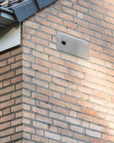
Swift Brick

Common enhancement features:

The guidance below relates to commonly requested, straightforward enhancement measures. Where bespoke solutions are proposed, the Plan should explain the reasoning and reference relevant guidance or best practice. 

Bird and bat boxes 

  • Integrated boxes or bricks are preferred wherever possible. These are typically more durable and longer-lasting than retrofitted units. 
  • Integrated installations should align with British Standard BS 42021:2022 (Integral nest boxes. Selection and installation for new developments. Specification). 
  • Woodcrete boxes are generally preferred, as they offer greater longevity than timber alternatives. 

Key Differences: BNG, BGP and BEP

Biodiversity Enhancement Plans are often requested alongside other biodiversity documents, depending on the scale and stage of development. 

BNG is the legal requirement that sits behind many modern planning decisions. It defines what level of biodiversity improvement is required. 

  • Required by law under the Environment Act 2021 
  • Sets a minimum biodiversity uplift that developments must achieve 
  • Calculated using the statutory biodiversity metric 
  • Applies to most new developments, with limited exemptions 

In short, BNG sets the target, but it does not explain how that target will be delivered on site. 

Once BNG applies, a Biodiversity Gain Plan is the document that unlocks the site start. It shows how the required gain will actually happen. 

  • Acts as the legal delivery plan for BNG 
  • Required to discharge the BNG planning condition 
  • Explains where habitats will be created, who delivers them, and when 
  • Must be approved before development can lawfully begin 

Without an approved BGP, planning permission often cannot be implemented. 

A Biodiversity Enhancement Plan sits outside the statutory BNG framework and is used where planning policy still expects improvement, even if formal BNG is not the route being used. 

  • A planning-support document, not a statutory requirement 
  • Focuses on proportionate biodiversity improvement 
  • Does not use the statutory BNG metric 
  • Commonly requested on smaller, exempt or early-stage schemes 

It provides planning officers with confidence that biodiversity has been properly considered and improved. 

Our Process

Review & Scope

We review your site, planning context and any ecology or landscape inputs to confirm what level of biodiversity enhancement is appropriate and proportionate.

Enhancement Strategy

We define realistic biodiversity improvements, map where they will be delivered, and align them with planning policy and layout proposals.

Submission & Support

The Plan is issued in a submission-ready format, with support provided to address any planning officer or consultee queries.

What We Deliver

To support validation and decision-making, a Biodiversity Enhancement Plan will typically include: 

What We Provide Purpose Benefit
Clear plans Enhancement features clearly shown on layout and elevation drawings. No uncertainty about locations on site.
Feature specification Simple details of what is being installed and how. Clear requirements for contractors.
Installation guidance Advice on height, position and orientation. Features work properly from day one.
Management advice Straightforward guidance to keep features effective. Long-term value without added complexity.
Ecological context Short explanation of how features support local wildlife. Clear planning justification.
Homeowner information Brief leaflet or letter explaining features and why they matter. Better understanding and compliance.

Case Insight

A small residential development was proposed on the edge of a settlement where statutory Biodiversity Net Gain did not apply due to the scale of works. During validation, the Local Planning Authority requested evidence of biodiversity improvement to support local plan policy. A Biodiversity Enhancement Plan was prepared setting out targeted hedgerow reinforcement, species-rich grass margins and integrated planting within the site layout. The Plan provided clear, proportionate commitments without triggering statutory BNG obligations. Planning permission was granted without additional ecological conditions, allowing the project to proceed as programmed.

Your Next Step

If planning officers have asked for biodiversity improvements, we’ll confirm the right approach and prepare a clear, proportionate Biodiversity Enhancement Plan that supports approval. 

Phone: 0800 494 7479 
Email: [email protected] 

Areas We Cover

We cover many areas across England. Click below to find out more.

Biodiversity Enhancement Plan FAQs

What is a Biodiversity Enhancement Plan?

A Biodiversity Enhancement Plan is a planning document that sets out how a development will improve biodiversity on site through practical and achievable measures. It focuses on enhancements such as planting, habitat creation, and ecological features, helping developments meet local planning policy requirements where statutory Biodiversity Net Gain does not apply.

A Biodiversity Enhancement Plan is prepared by assessing the existing site and identifying realistic opportunities to improve biodiversity. This includes selecting appropriate habitats, recommending species, and ensuring enhancements integrate with the development layout. The final document provides clear, planning ready guidance that can be implemented on site.

The primary objectives are to:

  • Improve habitat quality and diversity
  • Support local wildlife and protected species
  • Align with Local Planning Authority policy
  • Deliver practical and achievable ecological improvements

The focus is on meaningful on site enhancement rather than formal biodiversity unit calculations.

For small residential developments, Enhancement Plans typically start from £480 + VAT.

More complex sites generally range from £480 to £950 + VAT, depending on habitat diversity and site layout.

Larger or multi parcel schemes are quoted individually.

The fee typically includes:

  • Site walkover assessment
  • Identification of enhancement opportunities
  • Target habitat and species recommendations
  • Practical implementation guidance
  • A planning ready Enhancement Plan report

The service is focused on delivering measurable ecological uplift aligned with local planning policy.

No.

A Biodiversity Enhancement Plan supports local policy requirements and provides a strategy for improving biodiversity on site.

Biodiversity Net Gain is a statutory requirement under the Environment Act 2021 that involves formal metric calculations and a minimum 10% uplift.

The two serve different regulatory purposes.

An Enhancement Plan will not be sufficient where statutory Biodiversity Net Gain applies. In these cases, a full BNG assessment and associated documentation will be required.

Clarifying planning requirements early helps avoid delays and unnecessary duplication.

Common and effective enhancement measures include:

  • Native tree and hedgerow planting
  • Wildflower meadow creation
  • Installation of bird and bat boxes
  • Creating habitat features such as log piles
  • Designing wildlife friendly drainage features

These measures are tailored to the site to ensure long term success.

What types of biodiversity enhancements are typically included in a BEP?

Enhancements are site specific but often include:

  • Habitat creation and restoration
  • Native planting schemes
  • Species specific features
  • Connectivity improvements such as hedgerows
  • Small scale habitat features to support wildlife

All recommendations are designed to be practical and deliverable.

Not all developments require a BEP, but many Local Planning Authorities expect biodiversity improvements as part of planning policy.

For example, authorities such as Stafford Borough Council require developments to demonstrate biodiversity enhancement in line with planning guidance:
https://www.staffordbc.gov.uk/planning

Requirements vary depending on location and scale of development.

Most plans are completed within 5 to 10 working days from the date payment was received, depending on site complexity and available ecological information.

Timescales can often be adjusted to meet planning deadlines.

A qualified ecologist should prepare the plan to ensure it is policy compliant, realistic, and suitable for the site.

Professionally prepared plans are more likely to be accepted by the Local Planning Authority without revisions.

Yes, if it is required and not submitted, or if the plan does not meet policy expectations.

A well prepared Enhancement Plan helps ensure planning conditions are discharged efficiently and reduces the risk of delays.

A biodiversity action plan is typically a broader strategic document used at a regional or organisational level.

A Biodiversity Enhancement Plan is site specific and focused on delivering practical enhancements as part of a planning application.

Biodiversity enhancement ensures that development contributes positively to the environment. It supports planning approval, aligns with policy, and helps create more sustainable and resilient landscapes for the future.

Still have questions?

Still have questions?

Related Services

Reptile Surveys

Reptile Surveys Services for Planning & Development

Professional reptile surveys that support planning, protect your programme and minimise ecological risk. 

Request a Reptile Survey

Request a Reptile Survey

Maximum file size: 8.39MB

Do you need a Reptile Survey?

You may need a reptile survey if your site contains features such as rough grassland, scrub, heath, woodland edges, brownfield areas or warm, open mosaics with good cover. PEAs frequently flag reptile potential early in the design process. 

What is a Reptile Survey?

A reptile survey confirms presence/likely absence, maps activity levels and provides the evidence planners need to validate your application. It also defines any mitigation required to keep works lawful and efficient.

Grass Snake
Grass Snake (Natrix Natrix)

Early Signs a Reptile Survey is Needed

LPAs scrutinise sites with: 

  • rough grassland, scrub, heath or brownfield habitat 
  • rubble piles, banks, metal sheets, log stacks or warm microhabitats 
  • good sun exposure with nearby cover 
  • PEA flags for reptile potential 
  • local records of slow worm, common lizard, grass snake or adder 
  • earthworks planned between March and October 

Early confirmation avoids validation queries, redesigns and seasonal friction. 

Adder (Vipera Berus)

What We Deliver

Service Purpose Outcome
Initial Habitat & Risk Check Early clarity before design commits. Fast confirmation of risk and next steps.
Full Reptile Survey Programme Presence/likely absence evidence. Planning-ready report for validation and design.
Monitoring (Refugia / Transects / Camera) Detailed activity data where risk is higher. Clear mapping to guide planners and site teams.
Mitigation & Method Statements Keep works lawful when reptiles are present. Practical, build-friendly measures.
Licensing Support (if required) Where habitat loss may affect reptiles. Prepared applications aligned to project timelines.

A practical, proportionate, planning-ready service. 

How it Works

Scope & Schedule

Share your project location, habitat condition and intended programme. We confirm the correct survey level.

Fieldwork

Multi-visit surveys across suitable weather conditions using refugia, transects and targeted checks

Reporting

Planning-ready reporting, mitigation guidance (if needed), and clear actions for designers and site teams.

Timing & Survey Windows

Missing suitable weather conditions can delay evidence-gathering; early planning protects your programme. 

Main Survey Season

March to October

Optimum

April–May, early autumn (weather-dependent)

Visits

Typically 2–7 under suitable temperatures (9–20°C), low wind, no heavy rain

What You Receive:

  • site-specific habitat assessment 
  • presence/likely absence mapping 
  • risk summary for planners 
  • proportionate mitigation options 
  • licensing guidance (only if required) 
  • decisions and timelines your team can build around 

Evidence planners rely on. Practical steps your project team can deliver. 

Why Developers Choose ProHort:

  • programme-first delivery 
  • practical, straight advice 
  • fast mobilisation where feasible 
  • reports shaped for planners, designers and contractors 
  • nationwide coverage 
  • development-focused ecological expertise 

Legal Compliance & Planning risk

All common UK reptiles (slow worm, common lizard, grass snake, adder) are legally protected from killing, injury and harmful disturbance. LPAs require proportionate evidence where suitable habitat is present. 

Missing or inadequate surveys can result in:

  • planning refusal or validation delays 
  • design changes late in the programme 
  • stop-work requirements if reptiles are discovered during clearance 
  • more restrictive mitigation conditions 
  • project downtime caused by seasonal survey limits 

Relevant legislation includes:

  • Wildlife & Countryside Act 1981 
  • Conservation of Habitats and Species Regulations 
  • NPPF biodiversity and mitigation requirements 

Our role is to keep everything compliant and predictable. 

Your Next Step

Need an invertebrate survey? We’ll confirm your requirements and secure the right survey window. 

Phone: 0800 494 7479 
Email: [email protected] 

Areas We Cover

We cover many areas across England and Wales. Click below to find out more.

Case Note

On a mixed-use development with rough grassland margins, an early habitat check confirmed moderate reptile potential. A multi-visit survey recorded slow worms in one corner of the site. Proportionate mitigation and phased clearance allowed construction to proceed without redesign or downtime.

Reptile Survey FAQs

What is a reptile survey and when is it required?

A reptile survey is an ecological assessment used to identify the presence or likely absence of common British reptiles on a site. It is typically required where habitat such as rough grassland, scrub, or brownfield land is present and a planning application could impact protected species. Local Planning Authorities (LPAs) often request reptile surveys to ensure compliance with wildlife legislation and planning policy.

The UK has six native reptile species: slow worm, common lizard, grass snake, adder, sand lizard, and smooth snake. All are protected under the Wildlife and Countryside Act 1981. While the rarer species have higher levels of protection, all reptiles are safeguarded from harm, making surveys essential where suitable habitat exists.

Reptile surveys are typically undertaken using artificial refugia such as felt mats or tins placed across the site. These provide basking and shelter opportunities, allowing ecologists to monitor reptile presence over multiple visits. Surveys are completed in suitable weather conditions to maximise detection rates.

A standard reptile survey usually involves a minimum of seven visits to determine presence or likely absence. Where reptiles are confirmed, additional visits may be required to establish population size class, which is important for informing mitigation and planning decisions.

The main reptile survey season runs from March to October. The optimum survey periods are typically April to May and early autumn, when reptiles are most active and weather conditions are suitable. Surveys must be carried out in appropriate temperatures, as reptile activity is strongly influenced by weather conditions, with extremes of heat, cold, or heavy rain reducing survey effectiveness.

If reptiles are identified, the next steps will depend on the population size and development proposals. This may include mitigation measures such as habitat retention, sensitive site design, or translocation to a suitable receptor site. A detailed mitigation strategy will be required to support planning.

Yes, development can usually proceed where reptiles are present, provided appropriate mitigation measures are implemented. Early identification through survey work allows impacts to be addressed within the design and planning process, reducing risk of delays.

What habitats are most likely to support reptiles?

Reptiles are commonly found in habitats such as rough grassland, field margins, scrub, woodland edges, railway embankments, and brownfield sites. Sites with good connectivity and undisturbed areas are particularly suitable.

A reptile survey may be required if your site includes or is near suitable habitat and there is potential for reptiles to be present. LPAs will often request this as part of validation or determination. Early ecological advice helps confirm whether a survey is necessary.

For local planning requirements, refer to your relevant authority, for example:
https://www.staffordshire.gov.uk/Environment/Planning/Planning-applications.aspx

A reptile mitigation strategy is a detailed plan outlining how impacts to reptiles will be avoided, reduced, or compensated. This may include phased habitat clearance, installation of exclusion fencing, supervised works, and long-term habitat management.

Reptile translocation involves safely capturing and relocating reptiles from a development site to a suitable receptor site. This process must be carefully managed and carried out over an appropriate timeframe to ensure success and compliance with legislation.

Reptile survey results are typically considered valid for up to two years, although this can vary depending on site conditions and planning authority requirements. Changes in habitat or site use may require updated surveys.

Yes, reptile surveys are often undertaken alongside other ecological assessments such as Preliminary Ecological Appraisals (PEA) or habitat surveys. Combining surveys can improve efficiency and provide a more complete ecological baseline for planning.

Failure to carry out a required reptile survey can result in planning delays, refusal, or enforcement action if protected species are harmed. Early survey work reduces uncertainty and ensures compliance with ecological and planning requirements.

Still have questions?

Still have questions?

Related Services

3D Landscape Design

3D Landscape Design​

Planning-ready 3D visualisations that clarify intent, support decision-making and bring external works to life before construction begins.

Whether you’re progressing design options, strengthening a planning submission, coordinating with contractors or resolving visual impact concerns, a 3D landscape design gives your team a clear, shared understanding of how your external environment will function and look.

Our role is to provide visual clarity, technical accuracy and proportionate detail that keeps your project moving.

Request a 3D Landscape Design

Request a 3D Landscape Design

Maximum file size: 8.39MB

Do you need a 3D Landscape Design?

A 3D landscape design is typically required when your project needs clear visual confirmation of how layouts, planting, materials, levels and external features will work together.

If teams are debating interpretation, a 3D design removes the ambiguity.

What is a 3D Landscape Design?

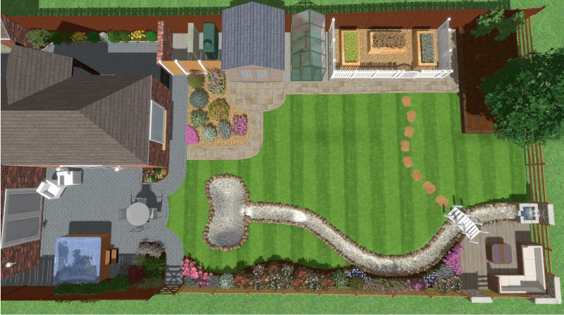
A 3D landscape design is a computer-generated visual model showing the proposed external environment, including materials, planting, levels, boundaries, structures, views and sequencing.
It creates a realistic, navigable representation of your site to support planning, design coordination and construction.

Trigger points — signs your site needs a 3D landscape design

You’re likely to benefit from a 3D landscape design when:

  • LVIA or planners require visual confirmation of mitigation

  • the project includes detailed hardscape, multi-level changes or complex planting

  • the design team needs clarity on how external works integrate with buildings

  • options need testing before committing to a layout

  • stakeholders require visualisation for review or consultation

  • contractors require a visual reference before build

These triggers help determine when modelling supports progression.

What We Deliver

We keep guidance clear and planning-ready — supporting predictable project delivery. 

Service Purpose Outcome
3D Visual Model Show the full external environment in a realistic, navigable format. Your team sees exactly how the scheme functions and interacts.
Rendered Views Provide fixed-angle visuals for planning or internal review. Clear, proportionate images supporting submissions and decisions.
Annotated Plans Connect visuals to specifications, edges, levels and transitions. Contractors and planners understand the design logic instantly.
Concept Variations (optional) Test alternative materials, layouts or planting structures. Faster decision-making with side-by-side comparison.
Planning-ready Visuals Strengthen submissions that require visual justification. Reduce negotiation by clarifying appearance and intent early.
Digital Pack (PDF + image set) Supply deliverables in usable, consistent formats. A complete visual record ready for planning, design or tender.

How it Works

Our process is designed to remove friction and keep decisions moving. 

Site Review & Briefing

We take measurements, identify constraints and confirm design objectives.

Model Build & Visualisation

We create the full 3D environment, with accurate levels, materials and planting structure.

Review & Finalisation

You review the visuals; refinements are made; final files are issued for planning or design coordination.

Timing & Submission Windows

3D landscape design can be completed year-round, but the optimal window depends on what the visuals support in your project:

Pre-Planning Design Development

Year-round. Use 3D visuals early to test materials, levels, boundaries, and planting logic before drawings are fixed.

Planning Submission Support

Any Time – but best before validation. LPAs often ask for visual clarification when schemes involve complex external works, key views, or sensitive settings.

Construction & Tender Stage

Post-Planning, Year-Round. 3D visuals help contractors interpret detail accurately, avoiding misunderstandings and reducing variation risk.

We guide you through the most efficient route for your programme.

Why planning officers request LVIAs

Planning officers request visuals to confirm:

  • visual coherence and alignment with local character

  • planting and mitigation logic

  • relationships between buildings, boundaries and levels

  • integration with retained trees and constraints

  • the accuracy of LVIA viewpoints

  • clarity of material finishes and transitions

3D visuals do not replace LVIA requirements but strengthen submissions by illustrating proposed mitigation clearly and accurately.

Our Approach

We produce 3D landscape designs with a planning-first, detail-conscious mindset.


Our approach is defined by:

  • realistic, proportionate visualisation

  • clear logic linking planting, levels and hardscape

  • consistent documentation planners can interpret easily

  • internal coordination with arboriculture and ecology

  • build-friendly sequencing that avoids ambiguity

  • predictable, defendable outputs that reduce negotiation

We design with clarity, precision and planning alignment. Visuals are realistic without exaggeration, technically consistent and formatted to support real-world design decisions.

 The purpose is simple: remove doubt and accelerate agreement.

How this supports your project

A 3D design strengthens the project by:

  • aligning architects, planners, engineers and ecologists around one source of truth

  • reducing redesign caused by unclear drawings or assumptions

  • clarifying interactions between trees, drainage, hardscape and planting

  • improving the narrative of LVIA and planning documents

  • helping contractors understand expectations before tender or construction

3D design integrates naturally with:

  • LVIA — visuals support mitigation logic and visual effects

  • Landscape Schemes — the model informs plant structure, surfaces and external logic

  • Arboriculture & Ecology — allows instant visual alignment of RPAs, SuDS, habitat zones and design intent

This alignment is significant: a strong 3D model stabilises decisions across the entire consultancy team.

It brings certainty at the stage when decisions carry weight.

Case Insight

A commercial expansion required clarification of levels, screening and boundary treatments. Traditional 2D plans created uncertainty between design disciplines, and the LPA raised early concerns about visual impact. The 3D model allowed planners to assess the true effect of screening, enabled the architect to adjust the interface between structures and planting, and resolved a potential redesign before validation. The project proceeded with confidence — and without further visual queries.

Areas We Cover

View areas that we cover for our 3D Landscape Design

Your Next Step

Get the clarity that keeps your design on track. 

Phone: 0800 494 7479

Email: [email protected]

3D Landscape Design - FAQ

What is 3D landscape design?

3D landscape design is a digital modelling process that creates a realistic visual representation of your proposed outdoor space. It allows layouts, planting, materials, and levels to be viewed in a fully rendered environment before construction begins, helping clients and planning stakeholders clearly understand the final outcome.

3D landscape design helps communicate proposals clearly to planning officers by visually demonstrating layout, scale, and integration with the surrounding environment. This supports landscape led design, reduces ambiguity in drawings, and strengthens submissions where visual impact is a key consideration.

Yes, 3D visuals can be submitted alongside traditional plans to support planning applications. While not always mandatory, they are particularly valuable in demonstrating design intent, especially for sensitive sites or developments requiring clear visual justification.

2D design focuses on technical layouts such as plans, measurements, and specifications. 3D landscape design brings these layouts to life, allowing you to see depth, scale, materials, and spatial relationships, making it easier to understand and refine the scheme before implementation.

3D landscape designs are highly accurate when based on detailed site data, surveys, and design inputs. They reflect real dimensions and spatial relationships, although they are primarily used as a visual communication tool rather than a construction drawing.

Yes, planting schemes can be visualised within 3D designs to show structure, density, and overall character. While exact growth cannot be predicted, designs can illustrate how planting will establish and develop over time.

3D landscape design is suitable for a wide range of projects, from private gardens to large scale commercial developments. It is particularly beneficial where stakeholder engagement, planning approval, or design coordination is required.

What software is used for 3D landscape design?

Professional 3D landscape design uses advanced modelling and rendering software, often combining CAD based layouts with visualisation tools. This ensures designs are both technically accurate and visually clear.

Yes, one of the main advantages of 3D design is flexibility. Layouts, materials, and planting can be adjusted during the design stage, allowing the scheme to be refined before any work begins on site.

By visualising the final scheme in detail, potential issues such as space constraints, level changes, and design conflicts can be identified early. This reduces the likelihood of costly changes during construction and helps keep projects on programme.

Yes, 3D designs complement technical drawings but do not replace them. Detailed plans, specifications, and construction information are still required for contractors to accurately deliver the scheme.

Yes, 3D visuals can support submissions to Local Planning Authorities by clearly illustrating design intent and landscape integration. Requirements vary by authority, so it is advisable to review validation criteria through your Local Planning Authority or via the Planning Portal: https://www.planningportal.co.uk

No, 3D landscape design is a visualisation tool used within the wider landscape architecture process. Landscape architecture includes site analysis, planning strategy, ecological considerations, and technical design, with 3D modelling supporting communication of the final scheme.

AI tools can provide basic concepts and inspiration, but professional 3D landscape design requires site specific data, technical understanding, and planning awareness. For projects involving planning or construction, a professionally developed design is recommended.

Related Services

3D design frequently integrates with other ProHort services:

These connections create a unified, planning-first approach and reduce the risk of conflicting recommendations.

Still have questions?

Still have questions?

Landscaping Schemes

Landscaping Schemes​

Planning-ready landscape schemes that clarify external works, strengthen applications, and keep design decisions predictable.

Request a Landscaping Scheme

Request a Landscaping Scheme

Maximum file size: 8.39MB

Do you need a landscaping scheme?

If your project involves external works, planting, boundaries, levels, drainage, visual impact or coordination with trees, your LPA will normally require a landscaping scheme.

It’s the document set that shows how the external environment fits together — materials, planting, levels, structure, and how the site responds to local policy. A clear scheme prevents avoidable planning queries, late-stage design changes and condition-related delays.

What is a landscaping scheme?

A landscaping scheme is the full package of drawings, planting plans, materials, levels and detailing that define how external spaces function, look and integrate with trees, drainage and built form.

In practical terms: it shows what goes where, how it fits, and how it will be managed.

Trigger points — signs your site needs a landscape scheme

Common triggers include:

  • Landscape required at validation

  • LPA requests planting or mitigation detail

  • LVIA requires visual strengthening

  • Trees or RPAs influence layout or levels

  • BNG requirements need planting structure

  • External design is entering tender or condition-discharge stages

These triggers frequently lead to delays when landscape is introduced too late. We make the process predictable.

What We Deliver

We keep guidance clear and planning-ready — supporting predictable project delivery. 

Service Purpose Outcome
Landscape Plans Define hard/soft layout, materials, surfaces and boundaries Clear external logic aligned to architectural drawings
Planting Plans Species structure, habitat logic, BNG alignment Policy-aligned, manageable and visually coherent planting
Landscape Strategy Higher-level direction for phased schemes or pre-application Early clarity that keeps design conversations predictable
Mitigation & Visual Logic Structure to support LVIA / character integration Proportionate planting and layout refinement
Root & Tree Integration Resolve RPA, canopy and levels conflict Clear, defensible detailing that avoids redesign
Planning-Ready Documentation Full package aligned with LPA expectations Smooth validation, condition discharge and programme stability

How it Works

Our process is designed to remove friction and keep decisions moving. 

Site Review & Brief

Context, levels, trees, drainage, materials, constraints and planning requirements.

Design & Detailing

Landscape plans, planting plans, material logic, mitigation and coordination with other disciplines.

Submission & Support

Planning-ready files, LPA responses, condition discharge and design-team coordination.

Timing & Submission Windows

Landscape schemes can be produced year-round, with three key timing considerations:

Planning Validation

Many LPAs require landscape detail upfront when external works or visual character form part of the proposal.

Condition Discharge

Planting plans, mitigation and material detail often form pre-commencement or pre-occupation conditions.

Integration with Trees / BNG / LVIA

Landscape must align with survey outputs — sequencing matters when RPAs, BNG uplift or visual mitigation influence design logic.

We guide you through the most efficient route for your programme.

Why planning officers request LVIAs

Local planning authorities rely on landscaping schemes to judge whether a development will sit comfortably within its setting and meet policy expectations.

LPAs typically expect landscaping schemes to demonstrate:

  • Visual Integration — how the proposal responds to local character, views and neighbouring properties.

  • Planting Logic & Structure — appropriate, proportionate species, spacing, canopy strategy and long-term management.

  • Technical Coordination — clear relationships between landscape, access, drainage, levels, boundaries and retained trees (often under BS 5837 constraints).

  • Mitigation & Green Infrastructure — proportionate measures for screening, biodiversity, SuDS integration or BNG relevance.

  • Compliance With Conditions — many approvals attach landscape conditions; strong schemes reduce discharge risk and negotiation.

LPAs request landscape schemes to confirm visual integration, proportionate planting and coherent external design aligned with:

  • National & local planning policy

  • BS 5837 — trees & development

  • BNG guidance

  • GLVIA3 principles (where visual considerations apply)

  • Local design codes & character assessments

  • SuDS / drainage requirements

When these elements are missing, planners commonly issue validation queries, request resubmissions, or pause progression until a compliant scheme is supplied. Early clarity avoids the cycle of redesign.

Our Approach

We design with a planning-first mindset, integrating visual clarity with the technical accuracy your wider team needs.

Our approach ensures:

  • Policy-aligned design logic that strengthens planning outcomes and avoids unnecessary negotiation.

  • Buildable, realistic solutions that reflect genuine site constraints — not theoretical drawings.

  • Early coordination with arboriculture, ecology, drainage and engineering to prevent conflicts later in the programme.

  • Clear, consistent documentation that planners can read quickly and contractors can build from confidently.

  • Steady project momentum through defensible detail, proportionate mitigation and a reporting format shaped for planning and condition discharge.

Our role is to bring certainty, joining together technical surveys, design requirements and planning expectations so your project progresses without avoidable delays.

How this supports your project

When landscape needs surface late, we stabilise it.

Landscape is often reviewed after architectural layouts, resulting in:

  • level clashes

  • insufficient planting detail

  • unclear boundary logic

  • tree conflicts

  • missing mitigation

  • validation queries

We deal with this scenario routinely.

Our role:
Resolve the landscape requirements quickly, proportionately and in a format planners trust — while avoiding unnecessary redesign.

Earlier involvement simply gives the design team more room to manoeuvre, but when we join late, we focus on stabilising the programme and meeting planning expectations with minimum disruption.

A strong landscape scheme:

  • stabilises planning conversations

  • clarifies intent for contractors

  • reduces need for layout redesign

  • integrates trees and drainage early

  • strengthens visual and character outcomes

  • provides long-term management clarity

Landscape is the interface between design, planning and construction — we ensure those interfaces work.

Case Insight

A small residential scheme progressed to validation with no landscape detail. The LPA flagged missing planting structure, unclear materials and unresolved tree constraints, causing a three-week delay and a sequence of redesigns. We produced a focused landscape package resolving planting, tree interfaces and boundary logic. The application stabilised, conditions were predictable, and no further landscape queries were raised. Earlier landscape involvement would have avoided the delay — but coordinated intervention kept the programme on track.

Your Next Step

Need a planning-ready landscape scheme?


We’ll confirm requirements, stabilise your programme and deliver clear, proportionate documentation.

Phone: 0800 494 7479

Email: [email protected]

Areas We Cover

We cover many areas across England and Wales. Click below to find out more.

Landscaping Scheme - FAQ

What is a landscaping scheme?

A landscaping scheme is a detailed plan that sets out how land will be designed, planted, and managed as part of a development. It typically includes planting plans, hard landscape features, materials, and long term management considerations to ensure the space is functional, visually appropriate, and compliant with planning requirements.

Landscaping schemes are often required as part of a planning application or as a condition of approval set by the Local Planning Authority. They help demonstrate how the development will integrate into its surroundings and may be required to support biodiversity, visual amenity, or site usability.

A landscaping scheme usually includes:

  • Planting plans with species selection
  • Hard landscaping details such as paths, surfaces, and boundaries
  • Layout drawings showing spatial design
  • Soil preparation and planting specifications
  • Maintenance and management recommendations

This ensures the scheme is deliverable and suitable for planning approval.

A well designed landscaping scheme helps satisfy planning requirements by demonstrating:

  • Visual integration with the surrounding area
  • Appropriate use of materials and planting
  • Biodiversity enhancement opportunities
  • Long term sustainability of the site

Local Planning Authorities often review landscaping schemes to ensure developments do not negatively impact the local environment or character.

A landscaping scheme is typically more technical and planning focused, prepared to meet Local Planning Authority requirements. A landscape design may be broader and more conceptual, focusing on aesthetics and usability, whereas a landscaping scheme provides the detail required for approval and implementation.

Yes. Landscaping schemes increasingly need to demonstrate how biodiversity is protected or enhanced. This may include:

  • Native planting
  • Habitat creation such as wildflower areas
  • Retention of existing features such as trees and hedgerows
  • Integration with Biodiversity Net Gain requirements where applicable

Landscaping schemes are usually prepared by qualified landscape architects or environmental consultants. This ensures the scheme meets planning standards, is technically accurate, and aligns with ecological and arboricultural constraints where required.

How detailed does a landscaping scheme need to be?

The level of detail depends on the development and planning requirements. However, most Local Planning Authorities expect:

  • Clear plans and drawings
  • Defined planting schedules
  • Material specifications
  • Practical implementation details

Insufficient detail can lead to delays in planning approval or discharge of conditions.

Changes may be possible, but they usually require approval from the Local Planning Authority. Any revisions must still meet planning conditions and environmental requirements, so early accuracy in the original scheme is important to avoid delays.

Landscaping schemes are often required to discharge specific planning conditions. This means the scheme must be approved before development can proceed or before occupation. Failure to submit an acceptable scheme can delay the project timeline.

Local Planning Authorities review and approve landscaping schemes to ensure they meet local policy and environmental standards. For example, guidance from authorities such as
https://www.planningportal.co.uk/
helps outline expectations for landscaping and planning compliance.

A successful landscaping scheme:

  • Meets planning and policy requirements
  • Reflects the character of the local area
  • Is practical to implement and maintain
  • Supports biodiversity and environmental goals
  • Integrates seamlessly with the overall development

This balance ensures both approval and long term performance.

Yes. Many schemes include or link to ongoing management requirements to ensure planting establishes correctly and continues to perform over time. This is particularly important where biodiversity or planning conditions are involved.

It is best to prepare a landscaping scheme as early as possible in the planning process. Early integration allows the design to influence site layout, avoid conflicts, and reduce the risk of revisions later in the project.

Related Services

Landscaping Schemes frequently integrate with other ProHort services:

These connections create a unified, planning-first approach and reduce the risk of conflicting recommendations.

Still have questions?

Still have questions?

Japanese Knotweed Training Courses

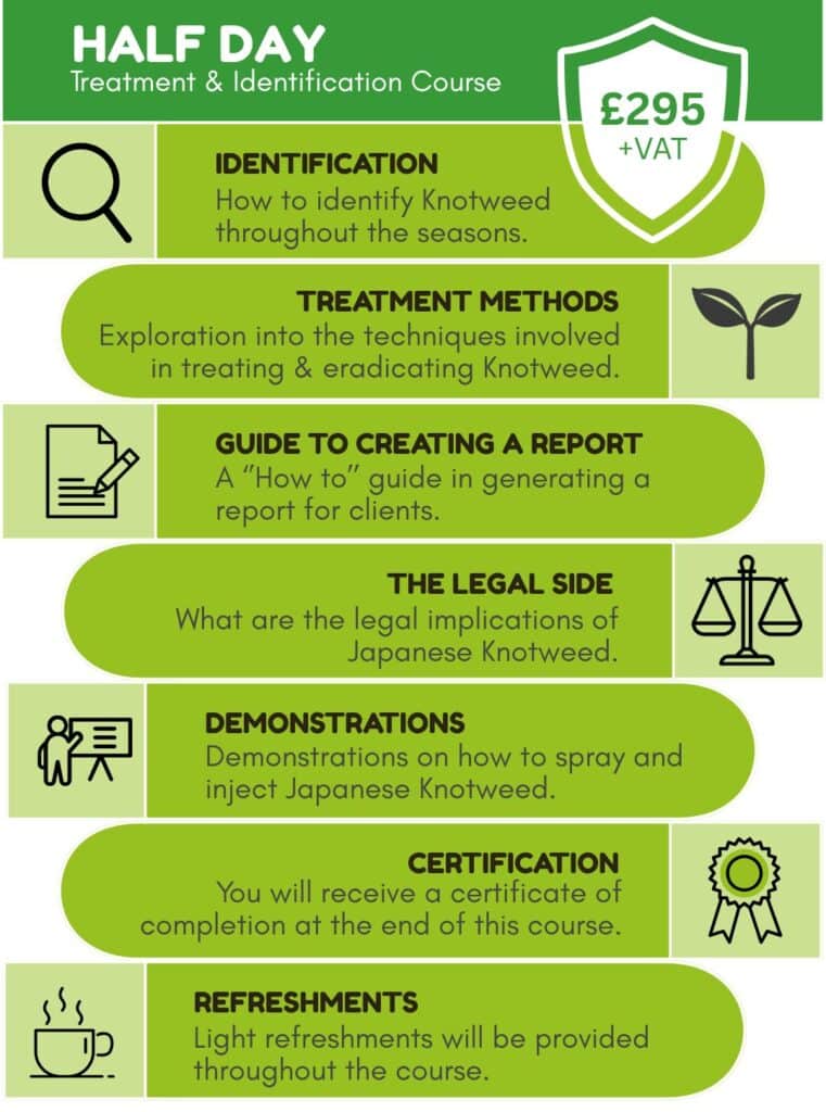
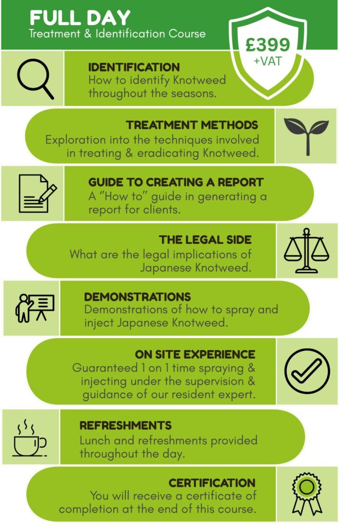
Japanese Knotweed CPD Training Courses

CPD-accredited Japanese knotweed training for surveyors, property professionals and contractors – delivered by the team behind Japanese Knotweed Expert.

Your Next Step

If you’re ready to organise training for your team, contact us today!

Phone: 0800 494 7479

Email: [email protected]

FAQ - Japanese Knotweed CPD

What is a Japanese knotweed training course?

A Japanese knotweed training course provides structured guidance on how to identify, manage, and understand the legal responsibilities associated with this invasive plant. It is designed for professionals such as contractors, surveyors, developers, and land managers who may encounter knotweed as part of their work.

Japanese knotweed training is suitable for anyone responsible for land, property, or vegetation management. This includes site managers, landscapers, ecological consultants, property developers, housing associations, and local authority teams who need to recognise risks and respond appropriately.

Training typically covers accurate identification, common misidentifications, growth patterns, how the plant spreads, and the risks it poses to structures and land. It also includes legal responsibilities, waste handling requirements, and best practice approaches to management and control.

Japanese knotweed can impact planning decisions and site viability. Understanding how it is identified and managed helps ensure that risks are addressed early, avoiding delays during planning validation or later stages of development. Training supports informed decision making before surveys or treatment strategies are required.

There is no direct legal requirement to complete training. However, there are legal responsibilities around preventing the spread of Japanese knotweed and managing it correctly. Training helps demonstrate due diligence and reduces the risk of non compliance with environmental legislation.
Training provides clarity on responsibilities under environmental law, including the risks of allowing knotweed to spread onto neighbouring land. It also explains how improper handling or disposal can lead to enforcement action, helping organisations avoid costly mistakes.

The 7 metre rule refers to the potential underground spread of Japanese knotweed rhizomes, which can extend up to 7 metres horizontally from visible growth. Training explains how this influences site assessments, risk zones, and why accurate identification is essential before any works begin.

Yes, Japanese knotweed is commonly mistaken for other plants such as bindweed, Russian vine, or bamboo. Training focuses on clear identification features throughout the seasons, helping avoid incorrect assumptions that could lead to unnecessary concern or missed risk.

What responsibilities do landowners have regarding Japanese knotweed?

Landowners are responsible for preventing Japanese knotweed from spreading beyond their boundary. Training explains these responsibilities in practical terms and outlines when professional surveys or management plans are required to demonstrate control.

Yes, most courses explain when a professional Japanese knotweed survey is needed and what it involves. This includes understanding site risk, how surveys support planning applications, and how findings are used to inform management strategies.

Training helps contractors recognise knotweed early and avoid disturbing it unintentionally. This reduces the risk of spreading the plant during groundworks, landscaping, or construction activities, which can otherwise lead to delays and additional remediation.
Guidance is often set at a local level alongside national legislation. For example, local authority advice can be found through council planning and environmental pages such as
https://www.gov.uk/guidance/prevent-japanese-knotweed-from-spreading
and relevant Local Planning Authority websites, which outline expectations for managing invasive species on development sites.

Yes, training explains how Japanese knotweed spreads primarily through rhizome movement rather than seed. Understanding this is critical for preventing accidental spread during soil movement, excavation, or landscaping works.

Yes, property professionals benefit from understanding how knotweed affects mortgages, valuations, and property transactions. Training provides context around risk assessment and when specialist advice is required.

Training does not replace professional advice, but it helps you recognise when treatment is likely to be required and what the next steps should be. This ensures that decisions are made based on informed understanding rather than uncertainty.

Please Note

These CPD courses give strong practical understanding of Japanese knotweed identification and risk. They do not qualify delegates to issue guarantee-backed knotweed reports or treatment plans. High-risk cases still require a specialist survey.

Related Services

Species Action Plans

Species Action Plans

Focused ecological strategies that align your development with biodiversity policy, protect key habitats and keep projects compliant across the UK.   

Request a Species Action Plan

Request a Species Action Plan

Maximum file size: 8.39MB

Do you need a Species Action Plan?

If your site supports protected or priority species, your planning authority may require a Species Action Plan (SAP). 
These plans set out targeted actions that protect species, demonstrate legal compliance and show measurable biodiversity improvements within your scheme. 

Handled early, a SAP helps you satisfy planning conditions, avoid reactive mitigation, and build biodiversity gain into design rather than retrofit it later. 

What is a Species Action Plan?

A SAP is a structured plan describing how development activity will protect, manage and enhance populations of specific species on-site or nearby. 

It combines ecological evidence, proportionate measures and monitoring proposals to satisfy both Environment Act 2021 and NPPF Section 15 expectations. Our ecologists follow CIEEM standards, using actions mapped directly to your programme milestones.

high brown fritillary butterfly for sAP
Orange and black butterfly in flower meadow

Signs your site needs an SAP...

These indicators suggest your site might require more than a basic walkover and may attract LPA scrutiny:

  • your PEA or protected-species survey identifies notable populations 
  • habitats host Section 41 or Annex II/IV species 
  • mitigation measures extend beyond a single construction phase 
  • biodiversity enhancements are condition-linked to specific species 
  • the site contributes to a local Nature Recovery Network 

When these triggers appear, preparing a SAP before submission keeps ecological obligations manageable and proportional. 

What We Deliver

We keep guidance clear and planning-ready — supporting predictable project delivery. 

Service Component Purpose Outcome
Species Review Identify target species and ecological context Defined scope for actions
Impact Assessment Evaluate risks to populations Evidence for proportionate response
Mitigation Design Develop avoidance and reduction measures Legal and planning compliance
Enhancement Strategy Add long-term biodiversity value Quantifiable uplift for BNG
Implementation Plan Set methods, timing and responsibility Predictable delivery sequence
Monitoring Framework Track effectiveness over time Transparent reporting for LPAs
Reporting & Sign-off Produce planning-ready documentation Defensible submission evidence

How it Works

Our process is designed to remove friction and keep decisions moving. 

Scope & Review

We assess survey findings and planning context to confirm target species and required outcomes.

Action Planning

Mitigation and enhancement measures are developed alongside your design and construction phases.

Implementation & Monitoring

Actions are integrated with site works and tracked against planning conditions.

Timing & Survey Windows

Species Action Plans can be produced year-round once baseline data is available. 
However, the surveys that inform them such as bat activity, great crested newt, reptile, or bird surveys are strictly seasonal

Bat Surveys

PRA: Year-round Emergence: May - August

GCN survey

GCN Surveys

eDNA April – June / activity mid-March – June​

Reptile Surveys

Only April, May and September

bird surveys

Bird Surveys

Year-round for scoping; nesting activity March–August

invertebrate surveys

Invertebrate Surveys

April - September

Securing your SAP early allows results from these seasonal surveys to flow straight into planning documentation and keep your schedule predictable.

Why planning officers request SAPs:

Under the NERC Act 2006 (S41) and local biodiversity policies, LPAs must ensure that developments deliver tangible benefits for priority species. 
A clear SAP demonstrates that responsibility has been met in a measurable, transparent way. Satisfying planning conditions and policy duties under NPPF and Environment Act 2021.

Without one, projects often face: 

  • delayed discharges of ecological conditions 
  • re-consultation with statutory bodies 
  • stop-work clauses during construction 
  • increased scrutiny at validation or appeal 

A well-built SAP prevents that cycle by giving planning officers certainty upfront. 
Act early and your evidence works for you, not against you. 

Our Approach

Each ProHort appraisal follows CIEEM guidance, Natural England standards and UKHab classification, producing reports LPAs recognise immediately. 

Our planning-ready SAP includes: 

  • baseline species data and risk evaluation 
  • practical mitigation and enhancement actions 
  • delivery methods and responsible parties 
  • measurable outcomes for planning and BNG tracking 
  • monitoring and reporting framework 

You’ll know exactly what each measure achieves, how it will be delivered and how to evidence success at sign-off.  

How this supports your project

A well-timed SAP: 

  • translates ecological findings into practical, buildable measures 
  • satisfies planning conditions and policy duties under NPPF and Environment Act 2021 
  • integrates with BNG strategy and contractor method statements 
  • provides traceable ecological evidence for audits and monitoring 
  • keeps environmental risk low and programme certainty high 

Clear actions. Predictable delivery. Verified outcomes. 

Its purpose is simple: provide clarity for planners, confidence for contractors and predictability for your programme.

Case Insight

A housing scheme in the Midlands required species-specific measures for bats and great crested newts. The SAP established phased lighting control, habitat creation and post-construction monitoring. Planners approved the discharge of conditions in one round, saving months on programme. That’s the impact of clarity backed by data.

Your Next Step

Get the ecological clarity that keeps your design on track. 

Phone: 0800 494 7479

Email: [email protected]

Areas We Cover

We cover many areas across England. Click below to find out more.

SAP FAQ - Planning and Programme Clarity

What is a Species Action Plan?

A Species Action Plan is a structured ecological document that sets out how specific species will be protected, mitigated for, and enhanced within a development. It provides clear, practical measures to ensure species are safeguarded while allowing development to proceed in line with planning policy.

A Species Action Plan is typically required where ecological surveys identify protected or notable species that may be affected by development. Local Planning Authorities often request a SAP to demonstrate how impacts will be properly managed before granting permission or discharging conditions.

Species Action Plans are commonly required for protected and priority species such as bats, great crested newts, reptiles, breeding birds, and other species of principal importance. The requirement depends on survey findings and the level of risk posed by the development.

A planning compliant SAP will typically include baseline survey data, an assessment of impacts, and detailed mitigation and enhancement measures. It also sets out timing restrictions, habitat proposals, and where required, monitoring and management commitments.

A Species Action Plan provides clear evidence that ecological impacts have been properly assessed and addressed. It gives the Local Planning Authority confidence that species will be protected in accordance with legislation, helping to avoid delays or refusals.

No. A Species Action Plan focuses on individual species and how they are protected or enhanced. Biodiversity Net Gain assesses habitat value across a site using a metric approach. Both may be required, but they serve different purposes within the planning process.

Where protected species are present or likely to be affected, development is unlikely to proceed without appropriate mitigation. A Species Action Plan is often essential to demonstrate compliance with wildlife legislation and planning policy.

What are the main objectives of a Species Action Plan?

The primary objectives are to avoid harm to species, reduce impacts where avoidance is not possible, and deliver measurable ecological enhancements. The plan ensures species are considered at every stage of the development process.

Mitigation measures vary depending on the species but may include timing works outside sensitive periods, retaining or creating habitats, installing features such as bat boxes or reptile refugia, and implementing precautionary working methods.

In many cases, yes. Monitoring may be required to confirm that mitigation and enhancement measures are working effectively. This can form part of planning condition compliance and may need to be reported back to the Local Planning Authority.

The duration depends on the species and the scale of impact. Some measures apply during construction only, while others may require ongoing management or monitoring over several years to ensure successful outcomes.

A Species Action Plan must be prepared by a qualified ecologist with relevant survey experience. This ensures the document is technically robust, policy compliant, and suitable for submission as part of a planning application.

Mitigation focuses on avoiding or reducing harm to species, while enhancement aims to improve habitats and provide additional ecological value. A well prepared SAP will deliver both, ensuring compliance and long term biodiversity benefit.

Local Planning Authorities assess whether the proposed measures are proportionate, deliverable, and compliant with legislation and policy. Requirements are often set out in local validation checklists and national planning guidance such as:
https://www.planningportal.co.uk/permission/common-projects/biodiversity-and-planning

Still have questions?

Still have questions?

Related Services

Habitat Management and Monitoring Plan (HMMP)

Habitat Management & Monitoring Plan (HMMP)

Long-term habitat management and monitoring plans that secure compliance, protect biodiversity uplift, and keep planning conditions on track nationwide.

Request a Habitat Management and Monitoring Plan

Request a Habitat Management and Monitoring Plan

Maximum file size: 8.39MB

Do you need a Habitat Management & Monitoring Plan (HMMP)?

You’ll need an HMMP when your development must demonstrate measurable habitat delivery after planning approval.
LPAs request HMMPs to prove that habitat creation, enhancement and long-term stewardship will be delivered as committed in your BNG, SAP, HAP or EIA ecology.

If your permission includes a BNG condition, long-term habitat enhancement, or post-construction ecological actions, an HMMP is almost always required.

Handled early, an HMMP protects your planning conditions from delays, avoids re-submission cycles, and gives contractors a clear, workable route to compliance.

What is an HMMP?

A Habitat Management & Monitoring Plan sets out how habitats will be created, enhanced and maintained for at least 30 years, with clear monitoring to prove success.

Its purpose is simple: secure your planning conditions and demonstrate long-term ecological delivery without uncertainty or drift.

BNG Screening Assessment potential across fields

Trigger points — signs you need an HMMP

You’ll likely need an HMMP if your application includes:

  • BNG uplift through habitat creation

  • enhancement of grassland, wetland, woodland or mosaics

  • long-term management conditions

  • post-construction ecological requirements

  • EIA or HRA recommendations

  • off-site BNG units linked to your scheme

  • conditions referencing “management”, “maintenance”, “long-term” or “monitoring”

When these appear, an HMMP is the document planners rely on for assurance.

How is a Habitat Management and Monitoring Plan different from a BNG Assessment or Biodiversity Gain Plan?

Purpose: quantify biodiversity change

Output: DEFRA Metric 4.0 calculation

When: before design freeze / planning submission

Audience: design teams, planners, ecologists

Depth: technical, evidence-led

Purpose: satisfy the legal BNG condition

Output: statutory-compliant plan for LPA approval and the BNG Register

When: AFTER BNG Assessment, BEFORE permission or condition discharge

Audience: planning officers, legal teams, Natural England

Depth: formal, structured, compliance-focused


Think of it as the difference between calculating the uplift and legally securing it.

Purpose: long-term delivery

Output: 30-year habitat management and monitoring framework

When: after BNG approval, before condition discharge or commencement

Audience: LPAs, ecologists, site managers, long-term stewards

Depth: detailed and operational

What We Deliver

We keep guidance clear and planning-ready — supporting predictable project delivery. 

Component Purpose Outcome
Habitat Baseline Review Identify starting condition and constraints Clear foundation for management
Management Objectives Define targets for each habitat Transparent goals for planners
Creation & Enhancement Measures Set prescriptions for habitat establishment Robust, achievable uplift
Annual Maintenance Actions Detail tasks year by year Predictable workload for contractors
Monitoring Framework Indicators, frequency and success thresholds Evidence for planning condition sign-off
Reporting Schedule Clarify who submits what and when No ambiguity for the LPA
Risk & Contingency Measures Address failure points early Programme and ecological resilience
30-Year Delivery Plan Secure long-term compliance Confidence for planners and stakeholders

How it Works

Our process is designed to remove friction and keep decisions moving. 

Review & Scope

We review your BNG Assessment, SAP/HAP and planning conditions to define HMMP requirements.

Prescriptions & Management Plan

We develop clear, deliverable measures aligned to habitat type, condition targets and the DEFRA metric.

Monitoring & Reporting Framework

We set monitoring intervals, indicators and success criteria backed by Natural England standards.

Submission & Ongoing Support

You receive a planning-ready HMMP with optional monitoring support throughout the 30-year period.

Timing & Integration

Early preparation keeps your post-permission conditions predictable.

That’s how project control is maintained. 

BNG Assessment

Year-round

Biodiversity Gain Plan

Year-round

HMMP

Year-round

Why planners request HMMPs

LPAs must be confident that habitat uplift is real, deliverable and maintained.
A clear HMMP gives them the evidence they need, aligned to:

  • Environment Act 2021

  • BNG Regulations

  • DEFRA Metric 4.0

  • Natural England BNG standards

  • Local plan policy and SPDs

Without an HMMP, projects often face:

  • delayed discharge of BNG or ecological conditions

  • repeat requests for missing information

  • pushback from consultees

  • increased scrutiny at the post-determination stage

  • stalled construction during compliance checks

Early clarity strengthens your submission and avoids administrative bottlenecks later.

Our Approach

ProHort HMMPs are written in plain English, aligned to planning conditions, and structured so contractors can deliver the actions without confusion.

We integrate ecology with design and site management, ensuring:

  • deliverable actions

  • measurable outcomes

  • practical sequencing

  • reports planners accept the first time

This is long-term ecology written for real-world construction and maintenance teams.

How this supports your project

A well-timed HMMP:

  • protects your BNG uplift from challenge

  • secures condition discharge without rework

  • aligns ecology with contractor workflows

  • prevents long-term management problems

  • keeps monitoring predictable and budgeted

  • demonstrates control and foresight to planners

Early clarity strengthens the entire 30-year delivery arc.

Case Insight

A large mixed-use scheme required a long-term habitat strategy to support grassland, hedgerow and wetland enhancement tied to BNG conditions. The HMMP set measurable targets, annual tasks and success indicators, enabling the LPA to discharge conditions in the first round. Contractors followed a clear schedule, avoiding costly rework and ensuring habitats established as planned. That’s the impact of a well-built HMMP.

Your Next Step

Get the ecological clarity that keeps your design on track. 

Phone: 0800 494 7479

Email: [email protected]

Areas We Cover

We cover many areas across England. Click below to find out more.

FAQ for HMMP

What is a Habitat Management and Monitoring Plan?

A Habitat Management and Monitoring Plan is a long term document that sets out how habitats will be created, managed, and monitored to deliver biodiversity outcomes. It is typically required by planning conditions to ensure habitats are successfully established and maintained over a minimum 30 year period.

The purpose of habitat monitoring is to track whether newly created or enhanced habitats are meeting agreed biodiversity targets. Monitoring ensures that habitats are developing as intended and allows for corrective action if performance falls below expectations.

An HMMP typically includes:

  • Detailed habitat management prescriptions for 30 years
  • A structured monitoring schedule and reporting framework
  • Measurable success criteria and performance targets
  • Remedial actions if habitats fail to meet targets
  • Alignment with the approved Biodiversity Net Gain strategy
  • Planning ready documentation for condition discharge

Legal agreements or conservation covenant drafting are usually separate services where required.

An HMMP is usually required after planning permission has been granted where biodiversity enhancements or Biodiversity Net Gain must be delivered. Local Planning Authorities use HMMPs to secure long term ecological outcomes through planning conditions or legal agreements.

HMMP pricing is based on habitat complexity and long term management requirements.

  • Schemes with up to two habitats typically start from £3,200 plus VAT
  • Additional habitats are generally charged at £1,000 plus VAT per habitat
  • Larger or phased developments are quoted on a site specific basis

Costs increase where habitats are more complex or require detailed monitoring strategies.

Each habitat requires its own management approach, monitoring framework, and measurable targets over a 30 year period. As the number of habitats increases, so does the level of technical detail, reporting requirements, and long term compliance responsibility.

Who is responsible for delivering and monitoring an HMMP?

Responsibility typically sits with the landowner, developer, or a nominated management company. In some cases, a Responsible Body may be involved where conservation covenants are used. The HMMP clearly defines roles, responsibilities, and reporting obligations.

HMMPs are secured through planning conditions, Section 106 agreements, or conservation covenants. They must usually be approved by the Local Planning Authority before development progresses or conditions are discharged.

For example, guidance can be found via:
https://www.gov.uk/guidance/biodiversity-net-gain
alongside your relevant Local Planning Authority planning portal.

Monitoring is carried out at defined intervals across the 30 year period. This often includes early stage checks in years one and two, followed by longer term reviews at key milestones such as years five, ten, twenty, and thirty.

If monitoring shows that habitats are not meeting their targets, the HMMP sets out remedial actions. These may include changes to management techniques, additional planting, or revised maintenance regimes, all agreed with the Local Planning Authority.

Yes, HMMPs can be adapted where monitoring identifies issues or where improvements are needed. Any updates must typically be agreed with the Local Planning Authority to ensure continued compliance.

No. HMMPs are generally required where biodiversity enhancements must be maintained over time, particularly under Biodiversity Net Gain. Smaller developments without long term habitat obligations may not require one.

Still have questions?

Still have questions?

Related Services

Biodiversity Net Gain Assessment

Biodiversity Net Gain (BNG) Assessment

Planning-ready Biodiversity Net Gain assessments that define your baseline, set a practical route to uplift, and keep your project moving with clarity and control — delivered nationwide by experienced ecologists. 

Request a Biodiversity Net Gain Assessment

Request a Biodiversity Net Gain Assessment

Maximum file size: 8.39MB

When is a Biodiversity Net Gain (BNG) Assessment Required?

A BNG assessment is usually needed for developments requiring planning permission, especially where existing habitats could be affected.

This includes:

  • Sites impacting habitats of 25 m²+  or linear features (e.g., hedgerows) of 5 m+
  • Residential, commercial, industrial, or mixed-use developments involving site clearance or land use change
  • Greenfield or brownfield sites with existing vegetation or ecological value 
  • Projects involving removal or alteration of trees, scrub, grassland, or hedgerows
  • Larger or phased developments, where biodiversity must be assessed across multiple stages

Smaller developments may be exempt if they fall below thresholds and don’t affect priority habitats or protected features, but confirmation early in the planning process is recommended.

Habitat degradation is also considered:

  • Sites degraded or cleared since 30th January 2020 are assessed based on their condition before the damage
  • This includes both unauthorised works and certain permitted activities that reduce biodiversity value 
  • Where previous site conditions are unclear, a precautionary approach is applied using the best available evidence
  • Applicants must declare prior degradation with supporting evidence and biodiversity calculations 

This ensures developments deliver real and measurable biodiversity net gain, preventing artificial reduction of habitat value.

Do you need a Biodiversity Net Gain Assessment?

You’ll need a BNG Assessment if your development falls under the Environment Act 2021 or local planning policy requiring at least a 10 percent net gain. 
Most planning authorities now expect clear, measurable evidence that your design will leave biodiversity better than it found it. 

Early assessment prevents validation delays, redesign, and seasonal constraints that can stall project schedules. 

What is a Biodiversity Net Gain Assessment?

A BNG Assessment quantifies ecological change using the DEFRA Biodiversity Metric 4.0, comparing pre- and post-development habitat value. 
It defines a realistic route to achieve or exceed the 10 % requirement through on-site enhancement, off-site delivery, or statutory biodiversity credits. 

BNG evidence supports planning validation, mitigation design, BNG Metric 4.0 outputs, and long-term management plans — keeping your project compliant and predictable. 

A clear BNG pathway keeps your planning route defensible from first layout to final condition sign-off. 

Trigger points — signs your site needs BNG clarity

These indicators suggest your site might require more than a basic walkover and may attract LPA scrutiny:

  • New build or major infrastructure projects 
  • Brownfield redevelopment with habitat value 
  • Greenfield expansion or edge-of-settlement schemes 
  • Sites near habitat networks or water features 
  • Applications referencing BNG in validation checklists 
  • Local policy or SPD requiring measurable uplift 

Early BNG scoping identifies the simplest route to compliance before design is fixed.

How is a BNG Assessment different from a Biodiversity Gain Plan and Habitat Management and Monitoring Plan?

Purpose: quantify biodiversity change

Output: DEFRA Metric 4.0 calculation

When: before design freeze / planning submission

Audience: design teams, planners, ecologists

Depth: technical, evidence-led

Purpose: satisfy the legal BNG condition

Output: statutory-compliant plan for LPA approval and the BNG Register

When: AFTER BNG Assessment, BEFORE permission or condition discharge

Audience: planning officers, legal teams, Natural England

Depth: formal, structured, compliance-focused

Think of it as the difference between calculating the uplift and legally securing it.

Purpose: long-term delivery

Output: 30-year habitat management and monitoring framework

When: after BNG approval, before condition discharge or commencement

Audience: LPAs, ecologists, site managers, long-term stewards

Depth: detailed and operational

What We Deliver

We keep guidance clear and planning-ready — supporting predictable project delivery. 

Service Element Purpose Outcome
Baseline Survey & Habitat Classification Map and score existing habitats Verified data for BNG metric
DEFRA Metric Calculation Quantify pre/post development biodiversity units Transparent 10%+ gain evidence
Design Integration Link layout and landscape plans to BNG targets Realistic habitat creation plan
Mitigation & Enhancement Strategy Define habitat measures and maintenance Planning-ready documentation
Off-Site or Credit Assessment Evaluate alternatives if on-site gain is limited Fully compliant BNG route
Monitoring & Management Plans Secure long-term habitat value Predictable compliance over time

How it Works

Our process is designed to remove friction and keep decisions moving. 

Scoping & Baseline

Review your layout and context to confirm survey and metric requirements.

Habitat Survey & Mapping

Undertake UKHab classification to map baseline value.

Metric Analysis & Design Input

Calculate unit change and advise on layout adjustments or off-site options.

Reporting & Submission

Deliver a planning-ready BNG report aligned to DEFRA and local policy.

Early alignment between design and metric keeps BNG predictable — not reactive. 

Timing & Survey Windows

Early instruction secures the survey window and keeps ecology off the critical path. 

That’s how project control is maintained. 

BNG integration

Year-round

Follow-on Species Surveys

Seasonal

PEA Survey Season

Year-round

Why planning officers request BNG Assessments

BNG is now embedded in national policy. Without early clarity, LPAs issue validation queries, request redesigns, or defer decisions until BNG deficits are resolved.

Planners expect structured, defensible evidence showing compliance towards: 

  • Environment Act 2021 — mandatory 10 % net gain 
  • Town and Country Planning Act 1990 (as amended) 
  • NPPF Section 15 — Conserve and enhance the natural environment 
  • DEFRA Metric 4.0 & BNG Guidance 
  • Local Planning Policy and SPD requirements 

Early alignment with these standards ensures your planning authority receives clear, compliant evidence from the first submission — no second rounds required. 

Our Approach

ProHort BNG reports are built to meet national and local policy tests, delivered nationwide with clarity and precision. Our reports are written for real-world application, concise enough for planners, and detailed enough for scrutiny. 

Planners expect structured, defensible evidence:

  • Baseline habitats are accurately classified. 
  • Post-development design achieves measurable uplift. 
  • Long-term management is secured. 
  • Off-site measures or credits are proportionate and costed. 

Proactive BNG work demonstrates control, foresight, and credibility. Our methods are transparent and applied consistently nationwide. 

That’s how evidence stays proportionate, design stays on schedule, and your programme keeps moving. 

How this supports your project

A well-timed BNG: 

  • Establishes a clear habitat baseline early. 
  • Prevents planning delays from missing BNG evidence. 
  • Supports design and layout optimisation. 
  • Integrates with EIA and Protected Species reports. 
  • Provides quantified outputs for planning conditions and the BNG register. 

Securing BNG early keeps planning and construction timelines predictable. 

Case Insight

A mixed-use redevelopment needed BNG clarity before reserved matters. Baseline mapping revealed opportunities within existing landscape corridors, achieving a 12 % net gain without off-site credits. The application validated first time, proof that proportionate evidence, done early, protects both schedule and credibility.

Your Next Step

Get the ecological clarity that keeps your design on track. 

Phone: 0800 494 7479

Email: [email protected]

Areas We Cover

We cover many areas across England and Wales. Click below to find out more.

BNG FAQ - Planning and Programme Clarity

How much does a Biodiversity Net Gain assessment cost?

The cost of a Biodiversity Net Gain assessment typically starts from £850 + VAT for straightforward single plot residential sites with low habitat complexity and clear access.

For sites up to 0.5 acres, costs usually range between £1,000 and £1,500 + VAT, depending on factors such as habitat diversity, the presence of hedgerows or mature trees, and how developed the site layout is at the time of instruction.

Larger sites, phased developments, or schemes with more complex ecological features will require a bespoke quotation. Engaging early in the design process can often reduce overall costs by minimising redesign and additional survey requirements.

A standard BNG assessment is a comprehensive piece of ecological work designed to support your planning application. It typically includes:

  • A detailed site visit by a qualified ecologist
  • Habitat classification in line with UKHab or equivalent standards
  • DEFRA biodiversity metric calculations to establish baseline and post development values
  • An impact assessment of the proposed development
  • A planning ready BNG report suitable for submission to the Local Planning Authority

This process ensures that your development is assessed correctly from the outset and provides a clear strategy for achieving compliance.

A Biodiversity Net Gain assessment focuses on measuring and demonstrating biodiversity uplift at the planning stage. It does not include:

  • A Biodiversity Gain Plan, which is required after planning permission is granted
  • A Habitat Management and Monitoring Plan, which sets out how biodiversity will be maintained over 30 years
  • Design revisions or repeated metric calculations following layout changes
  • The sourcing or brokerage of off site biodiversity units

These elements form part of the wider BNG process and are typically commissioned separately as the project progresses.

Costs can increase depending on the complexity of the site and the level of input required. This commonly includes situations where:

  • Habitat diversity is moderate or high, requiring more detailed assessment
  • Hedgerows need formal condition surveys and classification
  • The development layout is still evolving, requiring multiple metric iterations
  • Additional clarification or revisions are requested by the Local Planning Authority
  • The site includes constraints such as protected habitats or ecological sensitivities

Starting the process early, particularly at concept or pre planning stage, can significantly reduce costs by limiting the need for rework.

Yes. Biodiversity Net Gain is now a mandatory requirement in England under the Environment Act 2021. Most developments must demonstrate at least a 10 percent increase in biodiversity value compared to the pre development baseline.

This requirement applies to the majority of residential and commercial developments and is enforced through the planning system. Failure to demonstrate compliance can result in planning applications being delayed, refused, or subject to additional conditions.

Biodiversity Net Gain is calculated using the statutory biodiversity metric developed by Natural England.

The metric assigns biodiversity units based on habitat size, type, condition, and distinctiveness. These units are calculated for the site in its existing condition and then compared against the proposed post development scenario.

The aim is to demonstrate a measurable increase of at least 10 percent. The process requires technical expertise to ensure that inputs are accurate and that assumptions align with planning policy and best practice guidance.

For straightforward residential sites, a Biodiversity Net Gain assessment can typically be completed within 5-10 working days from appointment, assuming access is available and no additional surveys are required.

More complex sites, or those requiring further ecological input, may take longer. Timescales can also be influenced by planning deadlines, site conditions, and the need for coordination with design teams or planners.

In most cases, yes. A BNG assessment is now a key requirement for planning applications in England. Local Planning Authorities expect to see clear evidence that biodiversity net gain has been considered and can be achieved.

Without this information, your application may not be validated or could be delayed while additional information is requested. Including a robust BNG assessment early in the process helps ensure a smoother planning journey.

What is a Biodiversity Gain Plan and when is it required?

A Biodiversity Gain Plan is a formal document that must be submitted after planning permission has been granted but before development begins.

It sets out in detail how the biodiversity enhancements identified in the assessment will be delivered, managed, and monitored over time. The plan must be approved by the Local Planning Authority and forms part of the legal framework ensuring compliance with BNG requirements.

All biodiversity enhancements delivered as part of a development must be maintained for a minimum of 30 years.

This long term commitment is typically secured through planning conditions, Section 106 agreements, or conservation covenants with a Responsible Body. Proper planning at the assessment stage is essential to ensure that these obligations are realistic, achievable, and cost effective over the full term.

If it is not possible to achieve the required uplift within the site boundary, alternative solutions must be explored. This usually involves securing off site biodiversity units from a third party or purchasing statutory biodiversity credits.

These options must be clearly justified and agreed with the Local Planning Authority, and they often come at a higher cost than delivering biodiversity enhancements onsite.

A Biodiversity Net Gain assessment should be carried out by a qualified and experienced ecologist.

The process involves technical habitat classification, use of the statutory metric, and an understanding of planning policy and local authority expectations. Errors or omissions can lead to delays, increased costs, or refusal of planning permission, so professional input is essential.

Yes, particularly if it is not completed correctly or submitted at the right stage. Missing or inaccurate BNG information is a common cause of planning delays.

Engaging an ecologist early and ensuring that the assessment aligns with your proposed layout can significantly reduce the risk of delays and improve the likelihood of a smooth planning process.

The Local Planning Authority is responsible for reviewing your BNG assessment and ensuring it meets both national and local policy requirements.

They will assess the biodiversity metric calculations, proposed mitigation measures, and long term management strategy. For example, guidance from Staffordshire County Council and other LPAs will influence how applications are validated and determined.

Some exemptions exist, such as certain householder applications or developments that fall below defined thresholds. However, the majority of residential and commercial schemes will still require compliance with Biodiversity Net Gain.

It is always advisable to confirm requirements at an early stage, as assumptions about exemptions can lead to delays or complications during the planning process.

Still have questions?

Still have questions?

Related Services

Biodiversity Gain Plan (Statutory BNG Plan)

Biodiversity Gain Plan (BGP)

Planning-ready documentation that translates your BNG evidence into a clear, regulator-compliant plan — structured exactly to LPA and statutory requirements.

Request a Biodiversity Gain Plan

Request a Biodiversity Gain Plan

Maximum file size: 8.39MB

Do you need a Biodiversity Gain Plan?

You’ll need a Biodiversity Gain Plan (BGP) if your development triggers the statutory BNG requirement under the Environment Act 2021.
Even when your BNG Assessment is complete, planners still require a formalised plan setting out:

  • how biodiversity gain will be delivered

  • how it will be maintained for 30 years

  • who is responsible for delivery and monitoring

  • how risks are controlled

  • how evidence satisfies the BNG register

If this document is missing or unclear, planners will not sign off your BNG condition.

Scaffolding in the development of a field

What is a Biodiversity Net Gain Assessment?

A Biodiversity Gain Plan is the final step between BNG evidence and planning approval. It is a formal planning document required under the Environment Act 2021 to legally demonstrate how you will achieve the mandatory 10% biodiversity net gain.

It translates your BNG metric, baseline evidence and design measures into a structured plan that LPAs can approve with confidence.

Trigger points — when you need a Biodiversity Gain Plan

A Biodiversity Gain Plan is required when:

  • BNG is a validation requirement

  • the LPA has imposed a BNG condition

  • the project involves habitat loss

  • the BNG metric shows an uplift requirement

  • habitat creation must be secured for 30 years

If any apply, you will need a fully evidenced, planning-ready plan before you can lawfully begin development.

How is a Biodiversity Gain Plan different from a BNG Assessment or Habitat Management and Monitoring Plan?

Purpose: quantify biodiversity change

Output: DEFRA Metric 4.0 calculation

When: before design freeze / planning submission

Audience: design teams, planners, ecologists

Depth: technical, evidence-led

Purpose: satisfy the legal BNG condition

Output: statutory-compliant plan for LPA approval and the BNG Register

When: AFTER BNG Assessment, BEFORE permission or condition discharge

Audience: planning officers, legal teams, Natural England

Depth: formal, structured, compliance-focused

Think of it as the difference between calculating the uplift and legally securing it.

Purpose: long-term delivery

Output: 30-year habitat management and monitoring framework

When: after BNG approval, before condition discharge or commencement

Audience: LPAs, ecologists, site managers, long-term stewards

Depth: detailed and operational

What We Deliver

We keep guidance clear and planning-ready, supporting predictable project delivery. 

Component Purpose Outcome
Baseline Summary Confirm pre-development condition Strong foundation for the plan
Uplift Summary Show how the 10% gain is achieved Clear, measurable trajectory
On-site Measures Define creation and enhancement works Practical, buildable actions
Off-site Measures (if needed) Confirm units, providers and evidence Fully compliant off-site strategy
Management & Monitoring (30 years) Secure long-term habitat success Predictable compliance
Roles & Responsibilities Assign delivery tasks Clear accountability
Mapping & Parcel References Match metric parcels to habitats Clean alignment for planners
Submission-ready BGP Document Meet statutory requirements Approval with minimal queries

How it Works

Our process is designed to remove friction and keep decisions moving. 

Review

We review your BNG Assessment, site plans and uplift route.

Drafting

We produce the structured Biodiversity Gain Plan against statutory requirements.

Integration

We align the plan with contractors, phasing and real-world delivery.

Submission Support

We handle LPA queries and refine the plan if required.

Timing & Programme Integration

Biodiversity Gain Plans can be prepared year-round, but delays arise when baseline data is missing, uplift measures aren’t costed or mapped, or off-site units are not secured in advance.

BNG Screening Assessment

year-round

BNG Assessment

year-round

Biodiversity Gain Plan

Year-round

Early preparation keeps the BNG pathway stable and prevents last-minute submission failure.

Why planning officers request Biodiversity Gain Plans

Local planning authorities must be able to show that biodiversity uplift is real, measurable and deliverable for at least 30 years, with risks controlled and any off-site units properly registered. A Biodiversity Gain Plan is where that evidence is laid out clearly, so planners can sign it off and your project can move forward.

These are the benchmarks LPAs use to test your submission:

  • Environment Act 2021

  • BNG Regulations and Guidance

  • DEFRA Biodiversity Metric 4.0

  • Natural England BNG Standards & Guidance

  • Local Planning Policy and Supplementary Planning Documents (SPDs)


Without a structured BGP, planners will issue:

  • validation queries

  • requests for BGP revisions

  • conditions preventing commencement

  • deferrals or refusal


A strong BGP protects your timeline by showing planners that delivery is organised, allocated and evidenced.

Our Approach

We translate ecological evidence into a clear delivery document — aligning BNG with design, programme and costs. 

Our planning-ready Biodiversity Gain Plan includes:

  • a clear summary of baseline habitats

  • your proposed uplift and delivery route

  • on-site and off-site measures

  • mapping and parcel references

  • management and monitoring for 30 years

  • responsibilities, milestones, and reporting structure

  • evidence linking directly to the statutory Biodiversity Gain Register

Its purpose: turn ecological data into a compliant, approvable route through planning.

The outcome: a proportionate, defensible plan that planners can approve without multiple revision rounds.

How this supports your project

A well-structured Biodiversity Gain Plan:

  • gives planners confidence that uplift is deliverable

  • prevents condition discharge delays

  • protects the programme from seasonal constraints

  • integrates seamlessly with BNG, PEA and EIA ecology

  • reduces risk of redesign late in the process

  • clarifies responsibilities for contractors and land managers

Clear plan. Predictable uplift. Smooth sign-off.

Case Insight

A mixed-use scheme required a BGP to discharge its BNG condition. The biodiversity gain plan aligned on-site enhancements with phased landscaping, mapped responsibilities and secured off-site units early. The LPA approved the BGP in the first review round — avoiding a three-month delay at pre-start. That’s the value of clarity backed by evidence.

Your Next Step

Get the ecological clarity that keeps your design on track. 

Phone: 0800 494 7479

Email: [email protected]

Areas We Cover

We cover many areas across England and Wales. Click below to find out more.

BGP FAQ - Planning and Programme Clarity

What is a Biodiversity Gain Plan in planning terms?

A Biodiversity Gain Plan is the formal document used to discharge biodiversity net gain planning conditions. It translates the approved BNG metric and ecological strategy into a clear, submission-ready format that LPAs can assess and approve. It confirms how biodiversity uplift will be delivered, monitored and secured over the required 30-year period.

Biodiversity Net Gain is now a statutory requirement for many large developments in England. Major developments are subject to the requirement from February 2024, with smaller sites offering some exemption. Where BNG applies, a compliant Biodiversity Gain Plan is required to confirm how the approved strategy will be delivered.

Biodiversity Net Gain applies to most developments that impact habitat or land use, including residential, commercial and mixed-use schemes. Certain exemptions exist, such as householder applications and some low-impact developments, but these must be confirmed carefully. Where applicable, the requirement is secured through planning conditions, making early clarity essential.

Yes — they perform different roles within the planning process.

  • A BNG Assessment establishes the biodiversity baseline and produces the metric
  • A Biodiversity Gain Plan formalises that approved outcome into a planning document

The plan confirms delivery and compliance, rather than generating or recalculating the strategy.

In most cases, LPAs expect the Biodiversity Gain Plan either at validation or as part of condition discharge prior to commencement. Submitting without it can delay validation or prevent conditions from being discharged. In practice, the plan is prepared once the metric and layout are finalised and aligned.

This depends on how the LPA structures BNG requirements, but it is often high risk. Where required at validation, omission will result in an invalid application. Where secured by condition, development cannot begin until the plan is approved, so delays still directly affect programme.

A Biodiversity Gain Plan must clearly reflect the approved biodiversity strategy in a format LPAs can rely on.

It typically includes:

  • The approved metric position
  • Baseline habitat information and plans
  • Confirmed habitat creation and enhancement measures
  • Details of any off-site biodiversity units
  • A 30-year management and monitoring framework

Any inconsistency between these elements can delay validation or lead to rejection.

Discharging a Biodiversity Gain Plan condition requires submission of a compliant, fully aligned document that reflects the approved metric and planning decision. The LPA must be satisfied that biodiversity uplift is clearly defined, deliverable and secured. Approval of this condition is often required before development can legally commence.

Does the Biodiversity Gain Plan replace the BNG metric?

No — both are required and serve different purposes.

  • The BNG metric is the technical calculation
  • The Biodiversity Gain Plan is the formal planning document

The metric defines the outcome, while the plan demonstrates how that outcome will be delivered and secured.

This is resolved at the BNG Assessment stage rather than within the Biodiversity Gain Plan itself.

Where on-site delivery is not achievable, alternatives may include:

  • Off-site biodiversity units
  • Statutory biodiversity credits

The plan then formalises the agreed approach, rather than redesigning it.

Yes — this is a key part of validation and determination. LPAs require evidence that off-site units are measurable, secured and correctly allocated to the development. Any gaps or inconsistencies can delay approval or prevent the condition from being discharged.

Long-term management is a fundamental requirement of Biodiversity Net Gain. The Biodiversity Gain Plan must show how habitats will be managed, monitored and maintained for at least 30 years. This ensures the approved uplift is deliverable, enforceable and capable of withstanding scrutiny.

A Biodiversity Gain Plan is typically prepared within one to two weeks once the metric and design are finalised. Timescales extend where inputs are incomplete or the strategy is still changing. The most efficient route is to prepare the plan from a stable, approved position.

Preparation requires a clear, approved or near-final biodiversity strategy.

This typically includes:

  • The completed BNG metric
  • Site layout and habitat plans
  • Ecological surveys or baseline reports
  • Off-site unit details where relevant

The plan is built from this information rather than generating it.

Where a Biodiversity Net Gain assessment has already been completed and approved, preparation of the statutory Biodiversity Gain Plan typically starts from £250 + VAT. This covers preparation of the formal document, alignment with the approved metric and submission-ready documentation for condition discharge. Where revisions or recalculations are required, fees are quoted separately.

No — a Biodiversity Gain Plan does not replace a Biodiversity Net Gain assessment. The assessment establishes the ecological baseline and metric outputs, while the plan formalises that approved position for planning validation and condition discharge. Both are required to progress through planning successfully.

Still have questions?

Still have questions?

Related Services

---