(AIA) Arboricultural Impact Assessment in Berkshire

(AIA) Arboricultural Impact Assessment in Berkshire

Is tree impact uncertainty putting your Berkshire layout at risk?

We provide clear, defensible Arboricultural Impact Assessments that explain how retained trees interact with layouts, access and foundations so planners and designers can move forward with confidence.

Request an Arboricultural Impact Assessment

Request an Arboricultural Impact Assessment

Maximum file size: 8.39MB

Fast, Clear, Planning-Ready Support

Fast response 

Calls answered in 2 rings, emails replied to within the hour.

Free expert advice

Clear guidance before you commit.

Cost-effective

Working in partnership with clients to ensure planning approval first time

Typical 10-day turnaround

Industry Leading Standard

Expert Team

We stay with you from first call through to submission. 

Do you need an AIA in Berkshire?

If your proposal cannot avoid tree influence, Berkshire planners will expect a formal Arboricultural Impact Assessment to validate the application.

If you’re a homeowner, you may need an AIA when an extension, driveway or garage sits close to retained trees or their roots.

If you’re a developer, an AIA is typically required where layouts, access routes, drainage or foundation designs interact with existing trees shown on a BS 5837 tree survey.

Across Berkshire, Arboricultural Impact Assessments are often required where:

  • Residential schemes place buildings and driveways near mature trees

  • Settlement-edge growth intersects with tree-lined corridors

  • Regeneration land includes established trees shaping layout design

  • Semi-rural plots introduce construction within root protection zones

Tree retention feasibility forms a key part of planning assessment.

Our Arboricultural Impact Assessments support projects in Reading and the wider Berkshire area, where layouts, access and retained trees interact.

Why Planning Authorities Require an AIA in Berkshire

Berkshire planning authorities request Arboricultural Impact Assessments where development proposals interact directly with retained trees. LPAs use AIAs to test whether layouts, access routes, drainage strategies and foundation designs respond realistically to canopy spread and root protection areas, in line with BS 5837 and the National Planning Policy Framework. Where impacts are unclear or poorly justified, applications are commonly delayed, conditioned or returned for redesign.

Local Case Insight

A residential redevelopment in Berkshire proposed rear extensions near retained trees. Early proposals conflicted with root protection zones and access design. A proportionate AIA refined the layout and construction sequencing. The revised scheme progressed without tree-related delay.

The Process - Arboricultural Impact Assessment

Our AIAs in Berkshire are commercially aware, proportionate and planning-led, designed to support real-world construction sequencing, access logistics and foundation strategy without unnecessary escalation.

Key Deliverables for an AIA in Berkshire

We resolve tree-related planning risk across Berkshire through:

  • Defensible impact assessment aligned to BS 5837

  • Proportionate mitigation and construction guidance

  • Clear layout compatibility testing for planners

  • Integrated reporting with TPPs, drainage or ecology where required

Your application is strengthened with evidence that planners trust.

Step 1

Site & Design Review

Assessment of site layout alongside tree survey data.

Step 2

Impact Testing

Root protection areas, canopy spread, access routes and construction zones are fully assessed.

Step 3

Mitigation & Design Alignment

Protection, construction methods and layout refinements defined.

Step 4

Planning-ready Reporting

Integrated with Tree Protection Plans (TPPs), drainage design or ecological surveys.

Next Steps

Ready to confirm whether your Berkshire project needs an AIA?


Send us your site details and we’ll give you a clear, proportionate route forward.

FAQ - AIA in Berkshire

Why are Arboricultural Impact Assessments important for developments in Berkshire?

Arboricultural Impact Assessments are important in Berkshire due to the county’s high demand for residential development and strong emphasis on landscape quality. Trees often form part of established settings, particularly along the Thames corridor and within mature residential areas, making their protection a key planning consideration.

An AIA is required where trees are present on or near a development site and could be affected by construction. In Berkshire, this commonly applies to residential schemes, redevelopment sites, and projects involving significant changes to layout or ground conditions.

Trees along the Thames and associated landscapes play an important role in visual amenity and environmental quality. An AIA assesses how development may affect these trees, ensuring that proposals respect the character of the river corridor and maintain tree health.

On high value residential plots, trees often contribute to privacy, screening, and visual appeal. An AIA evaluates how development proposals interact with these features, helping to retain important trees while accommodating new layouts.

In suburban areas, trees are often located close to buildings, boundaries, and infrastructure. An AIA assesses these constraints and ensures development proposals minimise impact while retaining viable trees where possible.

Can an Arboricultural Impact Assessment help with planning approval in Berkshire?

Yes. An AIA provides clear evidence that tree related constraints have been properly assessed and addressed. In Berkshire, this supports planning applications by demonstrating alignment with local policy and environmental expectations.

Trees near water features can be sensitive to changes in ground conditions and drainage. An AIA evaluates these impacts, ensuring that development proposals do not compromise tree stability or long term health.

Mitigation measures may include protective fencing, revised layouts, and construction techniques designed to reduce root disturbance. In Berkshire, recommendations often reflect site specific conditions such as proximity to rivers and established residential settings.

Local Planning Authorities across Berkshire frequently require Arboricultural Impact Assessments where trees are present. This includes Reading Borough Council, Wokingham Borough Council, and West Berkshire Council. Validation requirements vary and should be reviewed early.

Carrying out an AIA early helps identify tree related constraints before designs are finalised. In Berkshire, this reduces planning risk, supports better site layout decisions, and ensures development proposals align with local planning expectations and landscape quality.

Related Services

(AIA) Arboricultural Impact Assessment in Buckinghamshire

Arboricultural Impact Assessment (AIA) in Buckinghamshire

Is tree impact uncertainty putting your Buckinghamshire layout at risk?

We provide clear, defensible Arboricultural Impact Assessments that explain how retained trees interact with layouts, access and foundations so planners and designers can move forward with confidence.

Request an Arboricultural Impact Assessment

Request an Arboricultural Impact Assessment

Maximum file size: 8.39MB

Fast, Clear, Planning-Ready Support

Fast response 

Calls answered in 2 rings, emails replied to within the hour.

Free expert advice

Clear guidance before you commit.

Cost-effective

Working in partnership with clients to ensure planning approval first time

Typical 10-day turnaround

Industry Leading Standard

Expert Team

We stay with you from first call through to submission. 

Do you need an AIA in Buckinghamshire?

If your proposal cannot avoid tree influence, Buckinghamshire planners will expect a formal Arboricultural Impact Assessment to validate the application.

If you’re a homeowner, you may need an AIA when an extension, driveway or garage sits close to retained trees or their roots.

If you’re a developer, an AIA is typically required where layouts, access routes, drainage or foundation designs interact with existing trees shown on a BS 5837 tree survey.

In Buckinghamshire, Arboricultural Impact Assessments are commonly required where:

  • Development encroaches on mature trees at village or town edges

  • Access roads and services cross retained tree belts

  • Regeneration sites include long-established trees influencing layout

  • Semi-rural plots introduce foundations within root protection areas

Local authorities assess whether retained trees can remain healthy long term.

Our Arboricultural Impact Assessments support projects in the wider Buckinghamshire area, where layouts, access and retained trees interact.

Why Planning Authorities Require an AIA in Buckinghamshire

Buckinghamshire planning authorities request Arboricultural Impact Assessments where development proposals interact directly with retained trees. LPAs use AIAs to test whether layouts, access routes, drainage strategies and foundation designs respond realistically to canopy spread and root protection areas, in line with BS 5837 and the National Planning Policy Framework. Where impacts are unclear or poorly justified, applications are commonly delayed, conditioned or returned for redesign.

Local Case Insight

A residential redevelopment in Buckinghamshire proposed extensions close to retained boundary trees. The initial layout conflicted with root protection areas and access routes. An Arboricultural Impact Assessment refined foundation positioning and layout design. The amended scheme validated smoothly without arboricultural conditions.

The Process - Arboricultural Impact Assessment

Our AIAs in Buckinghamshire are commercially aware, proportionate and planning-led, designed to support real-world construction sequencing, access logistics and foundation strategy without unnecessary escalation.

Key Deliverables for an AIA in Buckinghamshire

We resolve tree-related planning risk across Buckinghamshire through:

  • Defensible impact assessment aligned to BS 5837

  • Proportionate mitigation and construction guidance

  • Clear layout compatibility testing for planners

  • Integrated reporting with TPPs, drainage or ecology where required

Your application is strengthened with evidence that planners trust.

Step 1

Site & Design Review

Assessment of site layout alongside tree survey data.

Step 2

Impact Testing

Root protection areas, canopy spread, access routes and construction zones are fully assessed.

Step 3

Mitigation & Design Alignment

Protection, construction methods and layout refinements defined.

Step 4

Planning-ready Reporting

Integrated with Tree Protection Plans (TPPs), drainage design or ecological surveys.

Next Steps

Ready to confirm whether your Buckinghamshire project needs an AIA?


Send us your site details and we’ll give you a clear, proportionate route forward.

FAQ - AIA in Buckinghamshire

Why are Arboricultural Impact Assessments important for developments in Buckinghamshire?

Arboricultural Impact Assessments are important in Buckinghamshire due to the county’s extensive woodland cover, areas of protected landscape, and high demand for residential development. Trees often form a defining part of the local environment, making their protection a key planning consideration.

An AIA is required where trees are present on or near a development site and could be affected by construction. In Buckinghamshire, this commonly applies to residential developments, extensions within wooded plots, and sites near designated landscapes.

The Chilterns area is known for its wooded hills and landscape sensitivity. An AIA assesses how development proposals may affect trees within this setting, helping to ensure that designs respect the character and environmental value of the area.

On wooded plots, trees may be closely spaced and have overlapping root systems. An AIA evaluates these conditions and helps ensure development proposals minimise impact while retaining as much tree cover as possible.

Trees in these areas often contribute to visual amenity, privacy, and property value. An AIA assesses their condition and significance, helping to guide development proposals that retain important features while accommodating new layouts.

Can an Arboricultural Impact Assessment help with planning approval in Buckinghamshire?

Yes. An AIA demonstrates that tree related constraints have been properly assessed and addressed. In Buckinghamshire, this supports planning applications by aligning proposals with local policy and landscape expectations.

Wooded boundaries and tree belts are common across Buckinghamshire. An AIA assesses how development may affect these features and recommends appropriate setbacks or protection measures to ensure their retention.

Mitigation measures may include protective fencing, revised layouts, and construction techniques designed to reduce root disturbance. In Buckinghamshire, recommendations often reflect the need to work within densely wooded and sensitive landscapes.

Local Planning Authorities across Buckinghamshire frequently require Arboricultural Impact Assessments where trees are present. This includes Buckinghamshire Council and Milton Keynes City Council. Validation requirements vary and should be reviewed early.

Carrying out an AIA early helps identify tree related constraints before designs are finalised. In Buckinghamshire, this reduces planning risk, supports better site layout decisions, and ensures development proposals align with local planning expectations and landscape sensitivity.

Related Services

(SAP) Species Action Plan in Kent

Species Action Plan (SAP) in Kent

How will species constraints be managed without delaying delivery on your Kent site?

Our Species Action Plans. We define targeted actions to control risk, meet conditions, and keep projects moving.

Request a Species Action Plan

Request a Species Action Plan

Maximum file size: 8.39MB

Fast, Clear, Planning-Ready Support

Fast response 

Calls answered in 2 rings, emails replied to within the hour.

Free expert advice

Clear guidance before you commit.

Cost-effective

Working in partnership with clients to ensure planning approval first time

Typical 10-day turnaround

Industry Leading Standard

Expert Team

We stay with you from first call through to submission. 

Do you need a Species Action Plan (SAP) in Kent?

If your Kent scheme affects habitats linked to protected or priority species, or if your ecology reports recommend species specific mitigation, a Species Action Plan may be required. 

A Species Action Plan sets out what will be protected, what will change on the ground, and how the outcomes will be delivered and evidenced. It is the practical plan that helps your team avoid late restrictions, unclear conditions, and stop start delivery once permission is granted. 

Across Kent, Species Action Plans are often requested where site context increases the likelihood of species constraints being material to planning and delivery.

  • Medway, Stour, and Darent floodplains near Maidstone, Canterbury, and Dartford — floodplain grasslands, ditches, and riparian corridors often require clearly defined, species-led mitigation.
  • Coastal margins and estuaries along the Thames, Swale, and North Kent Marshes — grazing marsh, saltmarsh, and reedbed habitats frequently support protected birds and mammals, influencing design and construction controls.
  • Former industrial land and port areas around Gravesend, Chatham, and Sittingbourne — brownfield sites, scrub, and mosaic habitats can elevate species interest and planning scrutiny.
  • Agricultural and semi-rural landscapes near Ashford, Tonbridge, and Sevenoaks — hedgerows, ponds, ditches, and field margins create important commuting and foraging routes, making species impacts a live planning issue.
  • Historic village and town edges such as Tenterden, Faversham, and Cranbrook — mature trees, churchyards, and retained garden features can introduce multi-species constraints that need to be managed in one plan.

These are the settings where Kent planners expect a clear delivery plan, not general wording.

Our Species Action Plans cover sites across Kent and surrounding areas. Suitable for residential, commercial and mixed use development, from small edge of village sites to multi plot delivery. 

Why Planning Authorities Request an SAP in Kent

Kent planning authorities use Species Action Plans to meet duties under the Wildlife and Countryside Act 1981, the Habitats Regulations, the NERC Act 2006, and local plan biodiversity policies. Where species outcomes are vague, applications can pick up tighter conditions, extra rounds of review, and delays at discharge when the site team needs certainty the most. 

A well scoped plan reduces that risk by turning policy and survey findings into actions a planning officer can sign off and a contractor can follow. 

Local Case Insight

A small employment scheme near Sittingbourne involved upgrading a group of single-storey units on land previously used for storage and informal vehicle parking. The site included rough grassland margins, drainage ditches, scattered scrub, and boundary hedgerows, which provided habitat for foraging bats, reptiles, nesting birds, and hedgehogs. Initial ecological surveys identified species constraints, but the original planning submission did not clearly set out how impacts would be avoided or mitigated during construction. A Species Action Plan was prepared, defining controlled clearance methods, timing restrictions, exclusion fencing around retained habitats, and protection of drainage features, alongside enhancements including reptile refugia, bat roost features, bird nesting boxes, and native planting. Responsibilities for ecological supervision and post-works monitoring were assigned to a named ecologist. The planning condition was discharged without further requests for clarification, allowing the scheme to proceed on programme while safeguarding local species.

The Species Action Plan (SAP) Process

Species Action Plans in Kent are expected to translate survey findings into clear, enforceable action. We scope plans to the species and risks actually present, avoid unnecessary complexity, and set out measures that planners and contractors can follow with confidence.

Key SAP Deliverables for Kent Projects

Every Species Action Plan in Kent is tailored to the site. Key deliverables include:

  • Species-specific objectives. Clear explanation of which species are being addressed and why they matter in planning terms.
  • Practical protection and enhancement measures. Targeted actions that can be delivered on site without unnecessary complexity.
  • Defined responsibilities and timing. Who does what, when, and how actions align with construction phases.

Integration with wider ecology. Alignment with PEAs, Habitat Action Plans, BNG strategies or HMMPs where required, so documents support each other rather than conflict. 

Step 1

Species Focus

Identification of target species and relevant legal or policy drivers.

Step 2

Impact and Risk Assessment

Clear evaluation of how construction and occupation affect species.

Step 3

Action Design

Proportionate, species-specific mitigation and enhancement measures.

Step 4

Monitoring and Reporting

Defined success criteria and responsibilities agreed with planners.

Next Steps

Not sure what you’re expected to do for protected species in Kent?


Our Species Action Plan provides clarity, so nothing is left open to interpretation.

FAQ - Species Action Plans in Kent

What is a Species Action Plan in Kent developments?

A Species Action Plan, or SAP, is a detailed ecological document that explains how specific species will be protected, mitigated, and enhanced during development. In Kent, SAPs are often needed where protected or priority species are identified through survey work and planning authorities require clear ecological measures to support decision making. 

A SAP is usually required when ecological surveys show that development could affect protected species through construction, demolition, site clearance, land use change, or related works. In Kent, county level planning applies to minerals, waste, oil, gas, and county council development, while other planning matters are generally dealt with through district or borough councils.

Kent includes a broad mix of rural land, settlement edge locations, river corridors, orchards, woodland, and coastal environments. That variety means ecological issues can arise on many different types of site, so a SAP helps show how species impacts will be understood and managed from the outset.

Habitats that often lead to SAP requirements in Kent include ponds, hedgerows, mature trees, grassland margins, woodland edges, watercourses, coastal habitats, and buildings with bat roost potential. The exact trigger depends on the ecological survey findings and the type of development proposed.

SAPs in Kent frequently relate to bats, great crested newts, badgers, reptiles, and breeding birds. On some sites, the plan may also need to address species linked to wetland, coastal, or older built environments, depending on the location and survey results.

What should a Kent compliant SAP include?

A planning ready SAP will usually include a summary of survey findings, an explanation of likely impacts, species specific mitigation measures, compensation proposals where needed, biodiversity enhancement opportunities, and a clear implementation and monitoring framework. This helps ensure the document is practical, proportionate, and suitable for planning purposes.

A SAP gives planning officers a clear explanation of how species issues will be handled before, during, and after development. That can reduce uncertainty, improve the quality of the ecological submission, and help applications progress where protected species are a material consideration.

No. Smaller developments can also require a SAP if protected species are present or likely to be affected. Extensions, conversions, infill plots, redevelopment sites, and land close to suitable habitat can all trigger the need for species specific mitigation where ecological risk exists.

A SAP should be prepared by a qualified ecologist with suitable experience in protected species, mitigation design, and planning policy. This helps ensure the plan is technically robust, proportionate to the site, and capable of meeting Local Planning Authority expectations.

Species Action Plans may be required by Local Planning Authorities across Kent, including Kent County Council: https://www.kent.gov.uk, Canterbury City Council: https://www.canterbury.gov.uk, and Maidstone Borough Council: https://www.maidstone.gov.uk. Kent County Council states that it deals with minerals, waste, oil, gas, and county council planning applications, while applicants are directed to district councils for household, commercial, and industrial building works.

Related Services

Still have questions?

Still have questions?

(SAP) Species Action Plan in London

Species Action Plan (SAP) in London

How will species constraints be managed without delaying delivery on your London site?

Our Species Action Plans. We define targeted actions to control risk, meet conditions, and keep projects moving.

Request a Species Action Plan

Request a Species Action Plan

Maximum file size: 8.39MB

Fast, Clear, Planning-Ready Support

Fast response 

Calls answered in 2 rings, emails replied to within the hour.

Free expert advice

Clear guidance before you commit.

Cost-effective

Working in partnership with clients to ensure planning approval first time

Typical 10-day turnaround

Industry Leading Standard

Expert Team

We stay with you from first call through to submission. 

Do you need a Species Action Plan (SAP) in London?

If your London scheme affects habitats linked to protected or priority species, or if your ecology reports recommend species specific mitigation, a Species Action Plan may be required. 

A Species Action Plan sets out what will be protected, what will change on the ground, and how the outcomes will be delivered and evidenced. It is the practical plan that helps your team avoid late restrictions, unclear conditions, and stop start delivery once permission is granted. 

Across London, Species Action Plans are often requested where site context increases the likelihood of species constraints being material to planning and delivery.

  • Thames, Lea, and Wandle corridors through boroughs such as Greenwich, Hackney, and Wandsworth — tidal margins, wet grassland, and riparian corridors often require clearly defined, species-led mitigation.
  • Large parks and green infrastructure such as Hampstead Heath, Richmond Park, and Epping Forest fringes — woodland edges, veteran trees, and acid grassland influence layout, timing, and construction controls.
  • Former industrial land and regeneration areas around Stratford, Old Oak Common, and the Royal Docks — brownfield sites, scrub, and mosaic habitats can elevate species interest and planning scrutiny.
  • Suburban and semi-urban fringes near Bromley, Enfield, and Havering — hedgerows, ponds, drainage features, and railway embankments create important commuting and foraging routes, making species impacts a live planning issue.
  • Historic neighbourhoods and urban edges such as Dulwich, Highgate, and Blackheath — mature trees, cemeteries, and long-established gardens can introduce multi-species constraints that need to be managed in one plan.

These are the settings where London planners expect a clear delivery plan, not general wording.

Our Species Action Plans cover sites across London and surrounding areas. Suitable for residential, commercial and mixed use development, from small edge of village sites to multi plot delivery. 

Why Planning Authorities Request an SAP in London

London planning authorities use Species Action Plans to meet duties under the Wildlife and Countryside Act 1981, the Habitats Regulations, the NERC Act 2006, and local plan biodiversity policies. Where species outcomes are vague, applications can pick up tighter conditions, extra rounds of review, and delays at discharge when the site team needs certainty the most. 

A well scoped plan reduces that risk by turning policy and survey findings into actions a planning officer can sign off and a contractor can follow. 

Local Case Insight

A small commercial courtyard redevelopment in Wandsworth involved refurbishing underused warehouse units and creating service yards on land with rough grassland patches, scattered scrub, ornamental trees, and drainage channels. The site provided habitat for foraging bats, nesting birds, amphibians, and hedgehogs. Early ecological surveys identified species constraints, but the original planning submission did not clearly explain mitigation or enhancement measures. A Species Action Plan was prepared, setting out phased vegetation clearance outside breeding and hibernation periods, protective fencing around retained trees and scrub, and safeguarding of drainage features, alongside enhancements such as bat roost boxes, bird nesting boxes, amphibian hibernacula, and native planting to improve foraging and shelter. Post-construction monitoring and reporting responsibilities were assigned to a named ecologist. The planning condition was discharged efficiently, allowing the redevelopment to proceed without disruption to protected species or seasonal activity.

The Species Action Plan (SAP) Process

Species Action Plans in London are expected to translate survey findings into clear, enforceable action. We scope plans to the species and risks actually present, avoid unnecessary complexity, and set out measures that planners and contractors can follow with confidence.

Key SAP Deliverables for London Projects

Every Species Action Plan in London is tailored to the site. Key deliverables include:

  • Species-specific objectives. Clear explanation of which species are being addressed and why they matter in planning terms.
  • Practical protection and enhancement measures. Targeted actions that can be delivered on site without unnecessary complexity.
  • Defined responsibilities and timing. Who does what, when, and how actions align with construction phases.

Integration with wider ecology. Alignment with PEAs, Habitat Action Plans, BNG strategies or HMMPs where required, so documents support each other rather than conflict. 

Step 1

Species Focus

Identification of target species and relevant legal or policy drivers.

Step 2

Impact and Risk Assessment

Clear evaluation of how construction and occupation affect species.

Step 3

Action Design

Proportionate, species-specific mitigation and enhancement measures.

Step 4

Monitoring and Reporting

Defined success criteria and responsibilities agreed with planners.

Next Steps

Not sure what you’re expected to do for protected species in London?


Our Species Action Plan provides clarity, so nothing is left open to interpretation.

FAQ - Species Action Plans in London

What is a Species Action Plan in London developments?

A Species Action Plan, or SAP, is a detailed ecological document that explains how specific species will be protected, mitigated, and enhanced during development. In London, SAPs are often needed where protected or priority species are identified through survey work and planning authorities require clear ecological measures to support decision making.

A SAP is usually required when ecological surveys show that development could affect protected species through demolition, site clearance, vegetation removal, land use change, or related construction works. In London, planning applications are handled through the relevant London planning authority, with strategic schemes also capable of referral to the Mayor through the Greater London Authority planning process.

London is highly urbanised, but it still supports significant biodiversity across parks, rivers, canals, railway corridors, brownfield land, mature trees, and older buildings. The Greater London Authority also recognises London priority species, which is why SAPs can play an important role in showing how ecological impacts will be properly addressed within urban development.

Habitats that often lead to SAP requirements in London include brownfield sites, ponds, canals, riverside corridors, mature trees, parks, grassland, green roofs and walls in some schemes, and buildings with bat roost potential. The exact trigger depends on the ecological survey findings and the type of development proposed. This habitat mix is a reason biodiversity remains a material planning issue across London.

SAPs in London frequently relate to bats, breeding birds, badgers, reptiles, amphibians, and other species identified through site specific survey work. The precise species focus will vary by borough, site context, and habitat type, but the Mayor’s published priority species work shows that London has a recognised biodiversity framework beyond purely national designations.

What should a London compliant SAP include?

A planning ready SAP will usually include a summary of survey findings, an explanation of likely impacts, species specific mitigation measures, compensation proposals where needed, biodiversity enhancement opportunities, and a clear implementation and monitoring framework. This helps ensure the document is practical, proportionate, and suitable for planning purposes across London authorities.

A SAP gives planning officers a clear explanation of how species issues will be handled before, during, and after development. That can reduce uncertainty, improve the quality of the ecological submission, and help applications progress where protected species are a material consideration. This is especially useful in London, where local authority review sits alongside wider strategic planning oversight on certain schemes.

No. Smaller developments can also require a SAP if protected species are present or likely to be affected. Works to existing buildings, infill plots, roof level alterations, redevelopment sites, and land close to suitable habitat can all trigger the need for species specific mitigation where ecological risk exists. London’s planning authorities each maintain their own planning search systems, reflecting how these requirements can arise across a wide range of project types.

A SAP should be prepared by a qualified ecologist with suitable experience in protected species, mitigation design, and planning policy. This helps ensure the plan is technically robust, proportionate to the site, and capable of meeting Local Planning Authority expectations, whether the application is reviewed solely at borough level or also through the Mayor’s planning process for strategic schemes.

Species Action Plans may be required by London planning authorities across the capital, including Greater London Authority planning functions for referable schemes: https://www.london.gov.uk, City of London Corporation: https://www.cityoflondon.gov.uk, and borough councils such as Hammersmith and Fulham: https://www.lbhf.gov.uk. The Greater London Authority also maintains a dedicated page linking to London’s planning authorities and their planning application search pages.

Related Services

Still have questions?

Still have questions?

Biodiversity Net Gain Assessment in Nottinghamshire

Biodiversity Net Gain (BNG) in Nottinghamshire

Planning-ready BNG assessments for Nottinghamshire — clear metrics, proportionate uplift strategies and predictable progress through planning.

Request a Biodiversity Net Gain Assessment

Request a Biodiversity Net Gain Assessment

Maximum file size: 8.39MB

Fast, Clear, Planning-Ready Support

Fast response 

Calls answered in 2 rings, emails replied to within the hour.

Free expert advice

Clear guidance before you commit.

Cost-effective

Working in partnership with clients to ensure planning approval first time

Typical 10-day turnaround

Industry Leading Standard

Expert Team

We stay with you from first call through to submission. 

BNG Requirements in Nottinghamshire

Most developments in Nottinghamshire now require a mandatory 10% biodiversity net gain under the Environment Act 2021.

Local planning authorities expect clear baseline data, a defensible Metric 4.0 calculation and a proportionate uplift strategy before your application can progress. 

Across Nottinghamshire, the type and depth of ecological evidence requested by planners is often shaped by recurring landscape characteristics:

  • river corridors and floodplain habitats along the Trent and Idle

  • brownfield regeneration sites around Nottingham, Mansfield and Worksop

  • hedgerow-dominated agricultural land in rural districts

  • mixed woodland and pasture near Sherwood Forest

  • canal and waterway networks with linked habitat corridors

  • edge-of-settlement growth around Nottingham, Newark and Retford

Regardless of site location, early confirmation of baseline value and realistic uplift options helps maintain a clear and defensible planning process.

We work throughout Nottinghamshire, including Nottingham, Newark, Mansfield, Worksop and nearby towns and villages.

Why planning officers in Nottinghamshire request BNG Assessments 

Nottinghamshire LPAs request BNG evidence early because many developments sit close to watercourses, settlement edges or regeneration land, where small layout changes can noticeably affect habitat value and connectivity.

Officers want verified baseline habitats and clear Metric 4.0 scoring before designs progress, so uplift options can be understood without late-stage compromise. The county’s focus on canal corridors, historic field patterns and woodland-edge mosaics also means uplift feasibility needs to be established upfront.

Early Indicators Your Nottinghamshire Site May Need BNG Evidence

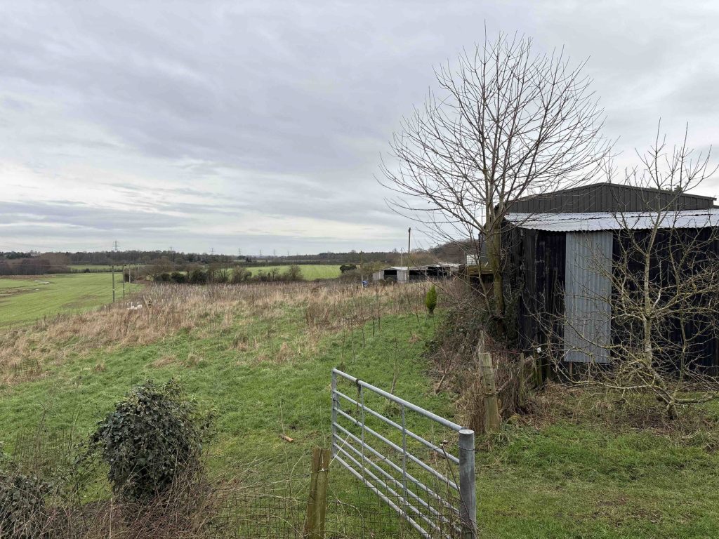
Rural field with a metal farm gate, small shed, and leafless trees

On the ground, site-level features signal when BNG evidence will be needed:

  • semi-improved grassland or species-rich margins 
  • hedgerows that link into wider networks 
  • wet ditches, streams or floodplain edges 
  • brownfield mosaics with herb-rich patches 
  • woodland edges or scattered trees 
  • PEA recommendations for botanical verification 
  • layout changes affecting habitat parcels 

Providing this clarity early prevents validation queries, redesign instructions and delays during casework. 

BNG Requirements — Delivered in a Predictable Sequence

We produce planning-ready BNG Assessments aligned to Nottinghamshire’s policy expectations.

Case Insight

BNG baseline mapping was undertaken for a mixed-use development in Nottinghamshire, where retained hedgerows and drainage features influenced uplift targets. By integrating habitat values into the landscape strategy, the scheme delivered an 11.2% net gain entirely on site.

What We Deliver for Nottinghamshire Projects

 Every report includes:

  • verified UKHab habitat mapping

  • defensible condition and distinctiveness scoring

  • full DEFRA Metric 4.0 calculation

  • uplift strategy shaped around LPA priorities

  • integration with layout, drainage and protected species

  • clear, structured reporting for validation and negotiation

Step 1

Habitat baseline surveys

Year-round, with botanical elements best May–September.

Step 2

Metric 4.0 calculations

 Completed once habitat data is verified.


Step 3

Uplift strategy development

Aligned with design progression and layout refinement.


Step 4

Integration with PEA, EIA or protected species

Used where additional clarity is needed around baseline or constraints.

Our approach keeps evidence proportionate, technically robust and predictable through the full planning sequence.

Next Steps

Contact us and we’ll confirm exactly what your site requires and support a planning-ready, proportionate route forward. 

FAQ - BNG in Nottinghamshire

Why are Biodiversity Net Gain assessments required for development in Nottinghamshire?

In Nottinghamshire, BNG assessments are required to demonstrate compliance with national planning policy where development affects habitats such as hedgerows, watercourses, grassland, or woodland edges.

You can check local planning guidance here: 

Nottinghamshire County Council – https://www.nottinghamshire.gov.uk/

BNG is triggered in Nottinghamshire for most major and many minor developments where habitat loss or change occurs as part of the proposal.


Hedgerow networks, drainage ditches, river corridors and semi-improved grassland frequently influence BNG outcomes in Nottinghamshire.


Can Biodiversity Net Gain be delivered on-site in Nottinghamshire?

In many cases, on-site delivery is achievable in Nottinghamshire through landscape-led design and early baseline mapping.


A clear BNG assessment gives planners confidence that biodiversity impacts are understood and mitigation is secured.


BNG assessments should be prepared by competent ecologists using the latest DEFRA metric.


Related Services

Still have questions?

Still have questions?

Biodiversity Net Gain Assessment in Sussex

Biodiversity Net Gain (BNG) in Sussex

Planning-ready BNG assessments for Sussex — clear metrics, proportionate uplift strategies and predictable progress through planning.

Request a Biodiversity Net Gain Assessment

Request a Biodiversity Net Gain Assessment

Maximum file size: 8.39MB

BNG Requirements in Sussex

Most developments in Sussex now require a mandatory 10% biodiversity net gain under the Environment Act 2021.

Local planning authorities expect clear baseline data, a defensible Metric 4.0 calculation and a proportionate uplift strategy before your application can progress. 

Across Sussex, planning authorities frequently tailor evidence requirements based on prevailing landscape patterns:

  • river valleys and wet grassland associated with the Arun, Adur and Ouse

  • former industrial and coastal regeneration sites

  • intensively managed farmland with historic hedgerow networks

  • woodland and downland mosaics near the South Downs

  • linear habitat corridors following railways and waterways

  • greenfield growth areas around Crawley, Horsham and Lewes

Establishing baseline constraints and achievable enhancement early helps avoid uncertainty later in the application process.

Our services cover locations across Sussex, supporting schemes in Crawley, Horsham, Lewes, Worthing and surrounding communities.

Why planning officers in Sussex request BNG Assessments 

Sussex LPAs request BNG evidence early because many developments sit close to watercourses, settlement edges or regeneration land, where small layout changes can noticeably affect habitat value and connectivity.

Officers want verified baseline habitats and clear Metric 4.0 scoring before designs progress, so uplift options can be understood without late-stage compromise. The county’s focus on canal corridors, historic field patterns and woodland-edge mosaics also means uplift feasibility needs to be established upfront.

Early Indicators Your Sussex Site May Need BNG Evidence

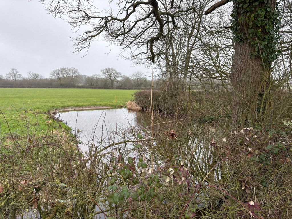
Small pond beside a grassy field, framed by brambles and leafless trees on a grey winter day.

On the ground, site-level features signal when BNG evidence will be needed:

  • semi-improved grassland or species-rich margins 
  • hedgerows that link into wider networks 
  • wet ditches, streams or floodplain edges 
  • brownfield mosaics with herb-rich patches 
  • woodland edges or scattered trees 
  • PEA recommendations for botanical verification 
  • layout changes affecting habitat parcels 

Providing this clarity early prevents validation queries, redesign instructions and delays during casework. 

BNG Requirements — Delivered in a Predictable Sequence

We produce planning-ready BNG Assessments aligned to Sussex’s policy expectations.

Case Insight

For a mixed-use scheme in Sussex, baseline habitat assessment identified interconnected hedgerows and wet features that raised biodiversity expectations. Aligning baseline outputs with the landscape framework allowed the design to achieve an 11.2% net gain without reliance on off-site provision.

What We Deliver for Sussex Projects

 Every report includes:

  • verified UKHab habitat mapping

  • defensible condition and distinctiveness scoring

  • full DEFRA Metric 4.0 calculation

  • uplift strategy shaped around LPA priorities

  • integration with layout, drainage and protected species

  • clear, structured reporting for validation and negotiation

Step 1

Habitat baseline surveys

Year-round, with botanical elements best May–September.

Step 2

Metric 4.0 calculations

 Completed once habitat data is verified.


Step 3

Uplift strategy development

Aligned with design progression and layout refinement.


Step 4

Integration with PEA, EIA or protected species

Used where additional clarity is needed around baseline or constraints.

Our approach keeps evidence proportionate, technically robust and predictable through the full planning sequence.

Next Steps

Contact us and we’ll confirm exactly what your site requires and support a planning-ready, proportionate route forward. 

FAQ - BNG in Sussex

Why do planning authorities in Sussex require Biodiversity Net Gain assessments?

In Sussex, BNG assessments are required due to the sensitivity of downland, river valleys and coastal habitats affected by development.

You can check local planning guidance here: 

East Sussex County Council – https://www.eastsussex.gov.uk/

West Sussex County Council – https://www.westsussex.gov.uk/

Most new developments in Sussex that result in habitat loss or alteration must demonstrate at least 10% BNG.


Grassland, hedgerows, woodland edges and wetland habitats commonly influence BNG calculations in Sussex.

Is on-site Biodiversity Net Gain achievable in Sussex?

On-site BNG delivery is often possible through integrated landscape design, particularly on edge-of-settlement sites.


It provides evidence that biodiversity impacts have been quantified and addressed in line with policy.


BNG assessments in Sussex should be completed by qualified ecologists familiar with local habitat character.


Related Services

Still have questions?

Still have questions?

Biodiversity Net Gain Assessment in Bristol

Biodiversity Net Gain (BNG) in Bristol

Planning-ready BNG assessments for Bristol — clear metrics, proportionate uplift strategies and predictable progress through planning.

Request a Biodiversity Net Gain Assessment

Request a Biodiversity Net Gain Assessment

Maximum file size: 8.39MB

BNG Requirements in Bristol

Most developments in Bristol now require a mandatory 10% biodiversity net gain under the Environment Act 2021.

Local planning authorities expect clear baseline data, a defensible Metric 4.0 calculation and a proportionate uplift strategy before your application can progress. 

Across Bristol, ecological scrutiny is often informed by the city’s varied land use and landscape structure:

  • river corridors along the Avon and Frome

  • redevelopment of brownfield and dockland sites

  • green infrastructure links between urban neighbourhoods

  • wooded valley sides and informal open space

  • transport corridors with connected verge habitats

  • outward growth at the urban fringe

Early clarity on baseline value and deliverable uplift allows proposals to move through planning more efficiently.

We assist projects across Bristol, from the city centre and suburbs to adjoining neighbourhoods and fringe locations.


Why planning officers in Bristol request BNG Assessments 

Bristol LPAs request BNG evidence early because many developments sit close to watercourses, settlement edges or regeneration land, where small layout changes can noticeably affect habitat value and connectivity.

Officers want verified baseline habitats and clear Metric 4.0 scoring before designs progress, so uplift options can be understood without late-stage compromise. The county’s focus on canal corridors, historic field patterns and woodland-edge mosaics also means uplift feasibility needs to be established upfront.

Early Indicators Your Bristol Site May Need BNG Evidence

Small pond beside a grassy field, framed by brambles and leafless trees on a grey winter day.

On the ground, site-level features signal when BNG evidence will be needed:

  • semi-improved grassland or species-rich margins 
  • hedgerows that link into wider networks 
  • wet ditches, streams or floodplain edges 
  • brownfield mosaics with herb-rich patches 
  • woodland edges or scattered trees 
  • PEA recommendations for botanical verification 
  • layout changes affecting habitat parcels 

Providing this clarity early prevents validation queries, redesign instructions and delays during casework. 

BNG Requirements — Delivered in a Predictable Sequence

We produce planning-ready BNG Assessments aligned to Bristol’s policy expectations.

Case Insight

A mixed-use development in Bristol required detailed BNG baseline mapping due to linked green corridors and drainage networks. By embedding habitat values into the landscape design, the project achieved an 11.2% on-site biodiversity net gain.

What We Deliver for Bristol Projects

 Every report includes:

  • verified UKHab habitat mapping

  • defensible condition and distinctiveness scoring

  • full DEFRA Metric 4.0 calculation

  • uplift strategy shaped around LPA priorities

  • integration with layout, drainage and protected species

  • clear, structured reporting for validation and negotiation

Step 1

Habitat baseline surveys

Year-round, with botanical elements best May–September.

Step 2

Metric 4.0 calculations

 Completed once habitat data is verified.


Step 3

Uplift strategy development

Aligned with design progression and layout refinement.


Step 4

Integration with PEA, EIA or protected species

Used where additional clarity is needed around baseline or constraints.

Our approach keeps evidence proportionate, technically robust and predictable through the full planning sequence.

Next Steps

Contact us and we’ll confirm exactly what your site requires and support a planning-ready, proportionate route forward. 

FAQ - BNG in Bristol

What is a Biodiversity Net Gain assessment in Bristol?

A Biodiversity Net Gain assessment measures the existing habitat value of a site using the statutory Biodiversity Metric and calculates how development will change that value. It confirms whether at least 10 percent measurable uplift can be achieved in line with national legislation.

No. Brownfield land is not automatically exempt. Even previously developed sites may contain habitats such as scrub, grassland or urban mosaic habitats that carry biodiversity value. A BNG assessment must accurately calculate baseline units before modelling development proposals.

On tight urban sites, baseline habitats are mapped and assessed using the Biodiversity Metric. The proposed layout is then modelled to test whether on site measures such as green roofs, tree planting or habitat corridors achieve the required uplift.

A habitat survey in accordance with UK Habitat Classification is required to identify and map all habitats. In urban environments, careful classification is essential to avoid underestimating ecological value.

Sites near the River Avon may contain riparian habitats or ecological corridors. The assessment must accurately reflect these habitats and ensure that proposals protect or enhance ecological connectivity where possible.

How long does a BNG assessment take for a mixed use Bristol scheme?

Timescales depend on site size and complexity. Urban regeneration schemes often require iterative modelling alongside architectural design to optimise biodiversity outcomes within limited space.

Achieving uplift on site can be challenging in dense urban areas. Green roofs, podium planting and street tree strategies may contribute to uplift, but some schemes require off site biodiversity units to reach compliance.

If the assessment identifies a shortfall in biodiversity units, developers may secure registered off site biodiversity units to meet the statutory requirement.

Bristol City Council acts as the Local Planning Authority and reviews Biodiversity Net Gain assessments submitted alongside planning applications.

Planning guidance can be accessed at:
https://www.bristol.gov.uk/residents/planning-and-building-regulations/planning

ProHort undertakes detailed habitat surveys and Biodiversity Metric modelling tailored to Bristol’s urban regeneration context. We provide clear unit calculations, feasibility advice and practical design input to reduce planning risk and avoid unexpected biodiversity shortfalls.

Related Services

Still have questions?

Still have questions?

Biodiversity Net Gain Assessment in Lancashire

Biodiversity Net Gain (BNG) in Lancashire

Planning-ready BNG assessments for Lancashire — clear metrics, proportionate uplift strategies and predictable progress through planning.

Request a Biodiversity Net Gain Assessment

Request a Biodiversity Net Gain Assessment

Maximum file size: 8.39MB

Fast, Clear, Planning-Ready Support

Fast response 

Calls answered in 2 rings, emails replied to within the hour.

Free expert advice

Clear guidance before you commit.

Cost-effective

Working in partnership with clients to ensure planning approval first time

Typical 10-day turnaround

Industry Leading Standard

Expert Team

We stay with you from first call through to submission. 

BNG Requirements in Lancashire

Most developments in Lancashire now require a mandatory 10% biodiversity net gain under the Environment Act 2021.

Local planning authorities expect clear baseline data, a defensible Metric 4.0 calculation and a proportionate uplift strategy before your application can progress. 

Across Lancashire, the level of evidence requested by planners commonly reflects distinct landscape features:

  • river floodplains and wet grassland along the Ribble and Wyre

  • former industrial and mill town regeneration areas

  • pastoral farmland with dense hedgerow networks

  • woodland and edge habitats near the Forest of Bowland

  • canal corridors with ecological connectivity

  • settlement expansion around Preston, Blackburn and Chorley

Understanding constraints and enhancement potential at an early stage supports a predictable planning outcome.

We support developments across Lancashire, including Preston, Blackburn, Chorley, Lancaster and neighbouring rural areas.


Why planning officers in Lancashire request BNG Assessments 

Lancashire LPAs request BNG evidence early because many developments sit close to watercourses, settlement edges or regeneration land, where small layout changes can noticeably affect habitat value and connectivity.

Officers want verified baseline habitats and clear Metric 4.0 scoring before designs progress, so uplift options can be understood without late-stage compromise. The county’s focus on canal corridors, historic field patterns and woodland-edge mosaics also means uplift feasibility needs to be established upfront.

Early Indicators Your Lancashire Site May Need BNG Evidence

Shallow freshwater stream with exposed stones and a gravel bed, flowing between dense riparian vegetation and nearby buildings in a semi rural setting under bright sunlight.

On the ground, site-level features signal when BNG evidence will be needed:

  • semi-improved grassland or species-rich margins 
  • hedgerows that link into wider networks 
  • wet ditches, streams or floodplain edges 
  • brownfield mosaics with herb-rich patches 
  • woodland edges or scattered trees 
  • PEA recommendations for botanical verification 
  • layout changes affecting habitat parcels 

Providing this clarity early prevents validation queries, redesign instructions and delays during casework. 

BNG Requirements — Delivered in a Predictable Sequence

We produce planning-ready BNG Assessments aligned to Lancashire’s policy expectations.

Case Insight

BNG baseline mapping supported a mixed-use scheme in Lancashire, where boundary hedgerows and wet ditches increased required uplift. Coordinating habitat baselines with the landscape proposals enabled the delivery of 11.2% net gain on site.

What We Deliver for Lancashire Projects

 Every report includes:

  • verified UKHab habitat mapping

  • defensible condition and distinctiveness scoring

  • full DEFRA Metric 4.0 calculation

  • uplift strategy shaped around LPA priorities

  • integration with layout, drainage and protected species

  • clear, structured reporting for validation and negotiation

Step 1

Habitat baseline surveys

Year-round, with botanical elements best May–September.

Step 2

Metric 4.0 calculations

 Completed once habitat data is verified.


Step 3

Uplift strategy development

Aligned with design progression and layout refinement.


Step 4

Integration with PEA, EIA or protected species

Used where additional clarity is needed around baseline or constraints.

Our approach keeps evidence proportionate, technically robust and predictable through the full planning sequence.

Next Steps

Contact us and we’ll confirm exactly what your site requires and support a planning-ready, proportionate route forward. 

FAQ - BNG in Lancashire

Why are Biodiversity Net Gain assessments important for development in Lancashire?

In Lancashire, BNG assessments are needed to address impacts on farmland, watercourses and regeneration land.

You can check local planning guidance here: 

Lancashire County Council – https://lancashire.gov.uk/

Most major and many minor developments in Lancashire must demonstrate a minimum 10% biodiversity net gain.


Hedgerows, wet ditches, grassland and woodland edges frequently influence BNG calculations in Lancashire.


Is on-site Biodiversity Net Gain achievable in Lancashire?

Yes, on-site delivery is often possible through landscape-led layouts and early habitat assessment.


It provides clear evidence of baseline value, losses and secured enhancements.


Qualified ecologists using the DEFRA biodiversity metric should prepare BNG assessments.


Related Services

Still have questions?

Still have questions?

Biodiversity Net Gain Assessment in Worcestershire

Biodiversity Net Gain (BNG) in Worcestershire

Planning-ready BNG assessments for Worcestershire — clear metrics, proportionate uplift strategies and predictable progress through planning.

Request a Biodiversity Net Gain Assessment

Request a Biodiversity Net Gain Assessment

Maximum file size: 8.39MB

Fast, Clear, Planning-Ready Support

Fast response 

Calls answered in 2 rings, emails replied to within the hour.

Free expert advice

Clear guidance before you commit.

Cost-effective

Working in partnership with clients to ensure planning approval first time

Typical 10-day turnaround

Industry Leading Standard

Expert Team

We stay with you from first call through to submission. 

BNG Requirements in Worcestershire

Most developments in Worcestershire now require a mandatory 10% biodiversity net gain under the Environment Act 2021.

Local planning authorities expect clear baseline data, a defensible Metric 4.0 calculation and a proportionate uplift strategy before your application can progress. 

Across Worcestershire, planners commonly look to landscape context when determining evidence needs:

  • river valleys and wet meadows along the Severn and Avon

  • brownfield and regeneration land within market towns

  • hedgerow-rich farmland across rural districts

  • woodland and pasture mosaics on settlement edges

  • canal networks providing linear habitat links

  • greenfield growth around Worcester, Redditch and Evesham

Clear early assessment of baseline value and enhancement feasibility helps reduce uncertainty at determination.

We operate across Worcestershire, supporting projects in Worcester, Redditch, Bromsgrove, Evesham and nearby villages.


Why planning officers in Worcestershire request BNG Assessments 

Worcestershire LPAs request BNG evidence early because many developments sit close to watercourses, settlement edges or regeneration land, where small layout changes can noticeably affect habitat value and connectivity.

Officers want verified baseline habitats and clear Metric 4.0 scoring before designs progress, so uplift options can be understood without late-stage compromise. The county’s focus on canal corridors, historic field patterns and woodland-edge mosaics also means uplift feasibility needs to be established upfront.

Early Indicators Your Worcestershire Site May Need BNG Evidence

Aerial view of a mixed use development in Worcestershire featuring retained hedgerows, wetland drainage features, native planting and connected green corridors integrated alongside new homes

On the ground, site-level features signal when BNG evidence will be needed:

  • semi-improved grassland or species-rich margins 
  • hedgerows that link into wider networks 
  • wet ditches, streams or floodplain edges 
  • brownfield mosaics with herb-rich patches 
  • woodland edges or scattered trees 
  • PEA recommendations for botanical verification 
  • layout changes affecting habitat parcels 

Providing this clarity early prevents validation queries, redesign instructions and delays during casework. 

BNG Requirements — Delivered in a Predictable Sequence

We produce planning-ready BNG Assessments aligned to Worcestershire’s policy expectations.

Case Insight

A mixed-use scheme in Worcestershire underwent BNG baseline mapping, identifying hedgerows and wet features that influenced uplift expectations. Alignment between habitat baselines and the landscape plan delivered an 11.2% net gain entirely within the site.

What We Deliver for Worcestershire Projects

 Every report includes:

  • verified UKHab habitat mapping

  • defensible condition and distinctiveness scoring

  • full DEFRA Metric 4.0 calculation

  • uplift strategy shaped around LPA priorities

  • integration with layout, drainage and protected species

  • clear, structured reporting for validation and negotiation

Step 1

Habitat baseline surveys

Year-round, with botanical elements best May–September.

Step 2

Metric 4.0 calculations

 Completed once habitat data is verified.


Step 3

Uplift strategy development

Aligned with design progression and layout refinement.


Step 4

Integration with PEA, EIA or protected species

Used where additional clarity is needed around baseline or constraints.

Our approach keeps evidence proportionate, technically robust and predictable through the full planning sequence.

Next Steps

Contact us and we’ll confirm exactly what your site requires and support a planning-ready, proportionate route forward. 

FAQ - BNG in Worcestershire

What is a Biodiversity Net Gain assessment in Worcestershire?

A Biodiversity Net Gain assessment establishes the ecological baseline of a site using the statutory Biodiversity Metric and models proposed development to confirm whether at least 10 percent measurable uplift can be achieved in accordance with national legislation.

Yes. Development within floodplain areas must still comply with statutory Biodiversity Net Gain requirements. Floodplain grassland, wetland and riparian habitats must be accurately classified and assessed within the Biodiversity Metric.

Sites near the River Severn may contain higher value riparian habitats. The baseline must be carefully surveyed and quantified to ensure realistic modelling of both habitat losses and enhancements.

A BNG assessment is required where development falls within the statutory scope of mandatory Biodiversity Net Gain legislation. This includes residential, commercial and mixed use proposals.

Improved grassland and arable land are mapped and assessed for condition. Although often lower distinctiveness habitats, baseline calculations must be accurate to avoid overestimating achievable uplift.

Can edge of settlement housing schemes achieve 10 percent uplift?

Many sites can achieve uplift through meadow creation, hedgerow strengthening, woodland planting and sustainable drainage features. However, early feasibility modelling is important to confirm compliance.

Timescales depend on site size, habitat diversity and design complexity. Larger rural sites may require more detailed mapping and modelling before final metric outputs are confirmed.

If the Biodiversity Metric identifies a shortfall in habitat units, developers may secure registered off site biodiversity units to meet statutory requirements.

Depending on site location, Biodiversity Net Gain assessments are reviewed by authorities such as Worcester City Council, Wychavon District Council, Malvern Hills District Council or Wyre Forest District Council.

Planning guidance for Malvern Hills District Council can be accessed at:
https://www.malvernhills.gov.uk/planning

ProHort delivers detailed habitat surveys and robust Biodiversity Metric modelling tailored to Worcestershire’s floodplain and rural context. We provide clear unit calculations, feasibility advice and defensible reporting to support planning applications.

Related Services

Still have questions?

Still have questions?

Biodiversity Net Gain Assessment in Merseyside

Biodiversity Net Gain (BNG) in Merseyside

Planning-ready BNG assessments for Merseyside — clear metrics, proportionate uplift strategies and predictable progress through planning.

Request a Biodiversity Net Gain Assessment

Request a Biodiversity Net Gain Assessment

Maximum file size: 8.39MB

Fast, Clear, Planning-Ready Support

Fast response 

Calls answered in 2 rings, emails replied to within the hour.

Free expert advice

Clear guidance before you commit.

Cost-effective

Working in partnership with clients to ensure planning approval first time

Typical 10-day turnaround

Industry Leading Standard

Expert Team

We stay with you from first call through to submission. 

BNG Requirements in Merseyside

Most developments in Merseyside now require a mandatory 10% biodiversity net gain under the Environment Act 2021.

Local planning authorities expect clear baseline data, a defensible Metric 4.0 calculation and a proportionate uplift strategy before your application can progress. 

Across Merseyside, ecological scrutiny is often influenced by a mix of urban and coastal landscape features:

  • river and estuary corridors associated with the Mersey

  • docklands and industrial regeneration areas

  • urban green corridors linking parks and waterways

  • peripheral farmland with retained boundaries

  • transport infrastructure with linear habitats

  • housing growth around Liverpool, Knowsley and St Helens

Addressing baseline constraints and uplift opportunities early supports a smoother planning pathway.

We deliver services throughout Merseyside, including Liverpool, St Helens, Knowsley, Sefton and surrounding areas.


Why planning officers in Merseyside request BNG Assessments 

Merseyside LPAs request BNG evidence early because many developments sit close to watercourses, settlement edges or regeneration land, where small layout changes can noticeably affect habitat value and connectivity.

Officers want verified baseline habitats and clear Metric 4.0 scoring before designs progress, so uplift options can be understood without late-stage compromise. The county’s focus on canal corridors, historic field patterns and woodland-edge mosaics also means uplift feasibility needs to be established upfront.

Early Indicators Your Merseyside Site May Need BNG Evidence

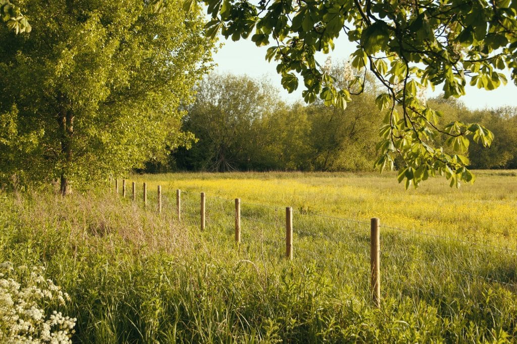
Sunlit meadow with a wooden fence running along the field, dense trees and overhanging branches in the background.

On the ground, site-level features signal when BNG evidence will be needed:

  • semi-improved grassland or species-rich margins 
  • hedgerows that link into wider networks 
  • wet ditches, streams or floodplain edges 
  • brownfield mosaics with herb-rich patches 
  • woodland edges or scattered trees 
  • PEA recommendations for botanical verification 
  • layout changes affecting habitat parcels 

Providing this clarity early prevents validation queries, redesign instructions and delays during casework. 

BNG Requirements — Delivered in a Predictable Sequence

We produce planning-ready BNG Assessments aligned to Merseyside’s policy expectations.

Case Insight

BNG baseline mapping for a mixed-use development in Merseyside identified linear habitats and wet drainage features requiring enhanced biodiversity outcomes. Incorporating these constraints into the landscape design achieved an 11.2% on-site net gain.

What We Deliver for Merseyside Projects

 Every report includes:

  • verified UKHab habitat mapping

  • defensible condition and distinctiveness scoring

  • full DEFRA Metric 4.0 calculation

  • uplift strategy shaped around LPA priorities

  • integration with layout, drainage and protected species

  • clear, structured reporting for validation and negotiation

Step 1

Habitat baseline surveys

Year-round, with botanical elements best May–September.

Step 2

Metric 4.0 calculations

 Completed once habitat data is verified.


Step 3

Uplift strategy development

Aligned with design progression and layout refinement.


Step 4

Integration with PEA, EIA or protected species

Used where additional clarity is needed around baseline or constraints.

Our approach keeps evidence proportionate, technically robust and predictable through the full planning sequence.

Next Steps

Contact us and we’ll confirm exactly what your site requires and support a planning-ready, proportionate route forward. 

FAQ - BNG in Merseyside

What is a Biodiversity Net Gain assessment in Merseyside?

A Biodiversity Net Gain assessment establishes the baseline ecological value of a site using the statutory Biodiversity Metric and models the proposed development to confirm whether at least 10 percent measurable uplift can be achieved in accordance with national legislation.

No. Port and dockland sites are not exempt. Even heavily developed land can support habitats such as scrub, grassland or urban mosaic features which must be properly surveyed and quantified within the Biodiversity Metric.

Sites near the River Mersey may be influenced by estuarine habitats or tidal corridors. The baseline must accurately classify any associated habitats and reflect their ecological value within the assessment.

Yes. Coastal residential, commercial or logistics schemes must demonstrate measurable uplift. The BNG assessment must quantify any habitat losses and model realistic enhancements.

Former industrial land often supports temporary grassland or scrub. A detailed habitat survey is required to establish the true baseline before development modelling takes place.

Can high density urban schemes achieve 10 percent uplift on site?

In dense urban areas, space for habitat creation may be limited. Green roofs, tree planting and sustainable drainage may contribute, but some schemes require off site biodiversity units to reach compliance.

Sites within flood risk zones may include grassland or wetland habitats. The assessment must reflect realistic deliverability of enhancements without conflicting with flood mitigation design.

Common issues include underestimating baseline habitat value on brownfield land, over specifying roof habitats without meeting Biodiversity Metric criteria, and failing to model estuarine influence accurately.

Depending on site location, Biodiversity Net Gain assessments are reviewed by authorities such as Liverpool City Council, Wirral Council, Sefton Council, Knowsley Council or St Helens Borough Council.

Planning guidance for Liverpool City Council can be accessed at:
https://liverpool.gov.uk/planning-and-building-control/planning/

ProHort undertakes detailed habitat surveys and robust Biodiversity Metric modelling tailored to Merseyside’s dockland and estuarine context. We provide clear unit calculations, early feasibility advice and defensible planning documentation to minimise biodiversity compliance risk.

Related Services

Still have questions?

Still have questions?

---