Biodiversity Net Gain Assessment in London

Biodiversity Net Gain (BNG) in London

Planning-ready BNG assessments for London — clear metrics, proportionate uplift strategies and predictable progress through planning.

Request a Biodiversity Net Gain Assessment

Request a Biodiversity Net Gain Assessment

Maximum file size: 8.39MB

Fast, Clear, Planning-Ready Support

Fast response 

Calls answered in 2 rings, emails replied to within the hour.

Free expert advice

Clear guidance before you commit.

Cost-effective

Working in partnership with clients to ensure planning approval first time

Typical 10-day turnaround

Industry Leading Standard

Expert Team

We stay with you from first call through to submission. 

BNG Requirements in London

Most developments in London now require a mandatory 10% biodiversity net gain under the Environment Act 2021.

Local planning authorities expect clear baseline data, a defensible Metric 4.0 calculation and a proportionate uplift strategy before your application can progress. 

Across London, planners regularly tailor evidence expectations to the capital’s complex urban landscape:

  • river corridors along the Thames and its tributaries

  • redevelopment of brownfield and intensification sites

  • interconnected green spaces and urban habitats

  • historic parkland and mature boundary planting

  • rail, road and canal corridors with ecological value

  • outer-London growth and redevelopment zones

Early clarity on baseline conditions and achievable enhancement is key to maintaining a defensible application.

We support schemes across Greater London, working in inner and outer boroughs as well as adjoining neighbourhoods.


Why planning officers in London request BNG Assessments 

London LPAs request BNG evidence early because many developments sit close to watercourses, settlement edges or regeneration land, where small layout changes can noticeably affect habitat value and connectivity.

Officers want verified baseline habitats and clear Metric 4.0 scoring before designs progress, so uplift options can be understood without late-stage compromise. The county’s focus on canal corridors, historic field patterns and woodland-edge mosaics also means uplift feasibility needs to be established upfront.

Early Indicators Your London Site May Need BNG Evidence

Large field with livestock

On the ground, site-level features signal when BNG evidence will be needed:

  • semi-improved grassland or species-rich margins 
  • hedgerows that link into wider networks 
  • wet ditches, streams or floodplain edges 
  • brownfield mosaics with herb-rich patches 
  • woodland edges or scattered trees 
  • PEA recommendations for botanical verification 
  • layout changes affecting habitat parcels 

Providing this clarity early prevents validation queries, redesign instructions and delays during casework. 

BNG Requirements — Delivered in a Predictable Sequence

We produce planning-ready BNG Assessments aligned to London’s policy expectations.

Case Insight

For a mixed-use scheme in London, baseline habitat mapping highlighted the role of retained boundaries and drainage features in shaping BNG targets. Integrating habitat values into the landscape strategy resulted in an 11.2% net gain without off-site compensation.

What We Deliver for London Projects

 Every report includes:

  • verified UKHab habitat mapping

  • defensible condition and distinctiveness scoring

  • full DEFRA Metric 4.0 calculation

  • uplift strategy shaped around LPA priorities

  • integration with layout, drainage and protected species

  • clear, structured reporting for validation and negotiation

Step 1

Habitat baseline surveys

Year-round, with botanical elements best May–September.

Step 2

Metric 4.0 calculations

 Completed once habitat data is verified.


Step 3

Uplift strategy development

Aligned with design progression and layout refinement.


Step 4

Integration with PEA, EIA or protected species

Used where additional clarity is needed around baseline or constraints.

Our approach keeps evidence proportionate, technically robust and predictable through the full planning sequence.

Next Steps

Contact us and we’ll confirm exactly what your site requires and support a planning-ready, proportionate route forward. 

FAQ - BNG in London

Is a Biodiversity Net Gain assessment required for developments in London?

Yes. Where development falls within the statutory scope of Biodiversity Net Gain legislation, applicants must demonstrate at least 10 percent measurable uplift using the statutory Biodiversity Metric as part of the planning submission.

The statutory requirement is national, but borough level validation requirements and planning expectations can vary. The BNG assessment must align with the relevant borough’s planning documentation and submission standards.

Baseline habitats are mapped and assessed using the Biodiversity Metric. The post development layout is then modelled to confirm whether measures such as green roofs, podium planting and tree strategies achieve the required uplift in habitat units.

Urban Greening Factor requirements are separate planning policy tools. While some features may contribute to both, the BNG assessment must independently demonstrate measurable uplift using the Biodiversity Metric.

Yes. Redevelopment of housing estates must quantify existing habitat value, including grassed areas and trees, before modelling new layouts to ensure the 10 percent requirement is met.

Can tall building schemes realistically achieve 10 percent uplift on site?

Achieving uplift on constrained vertical sites can be challenging. Roof habitats, terraces and tree planting may contribute, but careful metric modelling is required to avoid unit shortfalls.

Sites adjacent to the River Thames may include riparian habitats or contribute to ecological connectivity. The baseline must accurately classify any associated habitats and reflect their value within the assessment.

Shortfalls often arise where baseline habitat value is underestimated or where roof and podium habitats are over specified without meeting Biodiversity Metric criteria. Early stage modelling reduces this risk.


Biodiversity Net Gain assessments are reviewed by the relevant London borough council, such as Camden Council, Southwark Council, Tower Hamlets Council or the Royal Borough of Greenwich depending on site location.

Planning guidance for Camden Council can be accessed at:
https://www.camden.gov.uk/planning

ProHort undertakes detailed habitat surveys and robust Biodiversity Metric modelling tailored to London’s high density planning context. We work with architects and planning consultants to optimise layouts, reduce biodiversity unit deficits and provide clear, defensible calculations for submission.
Related Services

Still have questions?

Still have questions?

Biodiversity Net Gain Assessment in Cornwall

Biodiversity Net Gain (BNG) in Cornwall

Planning-ready BNG assessments for Cornwall — clear metrics, proportionate uplift strategies and predictable progress through planning.

Request a Biodiversity Net Gain Assessment

Request a Biodiversity Net Gain Assessment

Maximum file size: 8.39MB

Fast, Clear, Planning-Ready Support

Fast response 

Calls answered in 2 rings, emails replied to within the hour.

Free expert advice

Clear guidance before you commit.

Cost-effective

Working in partnership with clients to ensure planning approval first time

Typical 10-day turnaround

Industry Leading Standard

Expert Team

We stay with you from first call through to submission. 

BNG Requirements in Cornwall

Most developments in Cornwall now require a mandatory 10% biodiversity net gain under the Environment Act 2021.

Local planning authorities expect clear baseline data, a defensible Metric 4.0 calculation and a proportionate uplift strategy before your application can progress. 

Across Cornwall, landscape context plays a significant role in shaping planning evidence requirements:

  • river valleys and wet grassland inland

  • coastal habitats and associated buffer zones

  • former industrial and mineral sites

  • small-field farmland with historic boundaries

  • woodland and pasture mosaics near settlements

  • greenfield housing growth around towns and villages

Early understanding of baseline constraints and enhancement opportunities supports a clear planning strategy.

We work throughout Cornwall, supporting projects in Truro, Falmouth, Penzance, St Austell and surrounding communities.


Why planning officers in Cornwall request BNG Assessments 

Cornwall LPAs request BNG evidence early because many developments sit close to watercourses, settlement edges or regeneration land, where small layout changes can noticeably affect habitat value and connectivity.

Officers want verified baseline habitats and clear Metric 4.0 scoring before designs progress, so uplift options can be understood without late-stage compromise. The county’s focus on canal corridors, historic field patterns and woodland-edge mosaics also means uplift feasibility needs to be established upfront.

Early Indicators Your Cornwall Site May Need BNG Evidence

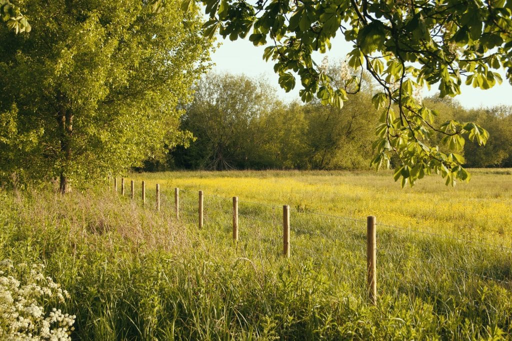
Sunlit meadow with a wooden fence running along the field, dense trees and overhanging branches in the background.

On the ground, site-level features signal when BNG evidence will be needed:

  • semi-improved grassland or species-rich margins 
  • hedgerows that link into wider networks 
  • wet ditches, streams or floodplain edges 
  • brownfield mosaics with herb-rich patches 
  • woodland edges or scattered trees 
  • PEA recommendations for botanical verification 
  • layout changes affecting habitat parcels 

Providing this clarity early prevents validation queries, redesign instructions and delays during casework. 

BNG Requirements — Delivered in a Predictable Sequence

We produce planning-ready BNG Assessments aligned to Cornwall’s policy expectations.

Case Insight

BNG baseline mapping was completed for a mixed-use scheme in Cornwall, where retained boundaries and wet features influenced uplift requirements. Aligning baseline outputs with the landscape design achieved an 11.2% net gain on site.

What We Deliver for Cornwall Projects

 Every report includes:

  • verified UKHab habitat mapping

  • defensible condition and distinctiveness scoring

  • full DEFRA Metric 4.0 calculation

  • uplift strategy shaped around LPA priorities

  • integration with layout, drainage and protected species

  • clear, structured reporting for validation and negotiation

Step 1

Habitat baseline surveys

Year-round, with botanical elements best May–September.

Step 2

Metric 4.0 calculations

 Completed once habitat data is verified.


Step 3

Uplift strategy development

Aligned with design progression and layout refinement.


Step 4

Integration with PEA, EIA or protected species

Used where additional clarity is needed around baseline or constraints.

Our approach keeps evidence proportionate, technically robust and predictable through the full planning sequence.

Next Steps

Contact us and we’ll confirm exactly what your site requires and support a planning-ready, proportionate route forward. 

FAQ - BNG in Cornwall

What is a Biodiversity Net Gain assessment in Cornwall?

A Biodiversity Net Gain assessment establishes the ecological baseline of a site using the statutory Biodiversity Metric and models the proposed development to confirm whether at least 10 percent measurable uplift can be achieved in accordance with national legislation.

Yes. Development near coastal cliffs or headlands must comply with statutory Biodiversity Net Gain legislation. Baseline habitats such as coastal grassland or scrub must be accurately classified and quantified before modelling development proposals.

Sites near estuaries or tidal inlets may contain higher value habitats. The assessment must carefully map and classify these features to ensure baseline units are correctly calculated within the Biodiversity Metric.

Moorland and heathland fringe habitats may carry higher distinctiveness values. Accurate field survey and condition assessment are essential to avoid underestimating baseline biodiversity units.

Yes. Lodges, caravan parks and tourism developments must demonstrate measurable biodiversity uplift using the Biodiversity Metric where they fall within the statutory scope of the legislation.

Can small rural housing schemes achieve 10 percent uplift?

Often yes, but feasibility depends on site constraints and baseline habitat value. Early stage metric modelling is important to confirm that sufficient habitat units can be delivered on site.

Shallow soils and exposed coastal conditions can limit the type of habitats that can realistically be created. The BNG assessment must reflect genuine deliverability rather than theoretical planting assumptions.

If the Biodiversity Metric identifies a shortfall in habitat units, the applicant may secure registered off site biodiversity units to meet statutory requirements.

Cornwall Council acts as the Local Planning Authority and reviews Biodiversity Net Gain assessments submitted alongside planning applications.

Planning guidance can be accessed at:
https://www.cornwall.gov.uk/planning-and-building-control/planning/

ProHort undertakes detailed habitat surveys and robust Biodiversity Metric modelling tailored to Cornwall’s coastal and moorland context. We provide clear unit calculations, feasibility advice and defensible reporting to support planning applications.

Related Services

Still have questions?

Still have questions?

Biodiversity Net Gain Assessment in Somerset

Biodiversity Net Gain (BNG) in Somerset

Planning-ready BNG assessments for Somerset — clear metrics, proportionate uplift strategies and predictable progress through planning.

Request a Biodiversity Net Gain Assessment

Request a Biodiversity Net Gain Assessment

Maximum file size: 8.39MB

Fast, Clear, Planning-Ready Support

Fast response 

Calls answered in 2 rings, emails replied to within the hour.

Free expert advice

Clear guidance before you commit.

Cost-effective

Working in partnership with clients to ensure planning approval first time

Typical 10-day turnaround

Industry Leading Standard

Expert Team

We stay with you from first call through to submission. 

BNG Requirements in Somerset

Most developments in Somerset now require a mandatory 10% biodiversity net gain under the Environment Act 2021.

Local planning authorities expect clear baseline data, a defensible Metric 4.0 calculation and a proportionate uplift strategy before your application can progress. 

Across Somerset, ecological evidence is often guided by recurring landscape patterns:

  • river corridors and wet meadows within low-lying areas

  • brownfield and regeneration land in market towns

  • hedgerow-dominated agricultural landscapes

  • woodland and pasture mosaics near settlement edges

  • canal and drainage networks with habitat connectivity

  • greenfield expansion around Taunton, Bridgwater and Yeovil

Early clarity on baseline value and uplift feasibility helps maintain planning certainty.

We cover the whole of Somerset, assisting developments in Taunton, Bridgwater, Yeovil, Frome and nearby villages.


Why planning officers in Somerset request BNG Assessments 

Staffordshire LPAs request BNG evidence early because many developments sit close to watercourses, settlement edges or regeneration land, where small layout changes can noticeably affect habitat value and connectivity.

Officers want verified baseline habitats and clear Metric 4.0 scoring before designs progress, so uplift options can be understood without late-stage compromise. The county’s focus on canal corridors, historic field patterns and woodland-edge mosaics also means uplift feasibility needs to be established upfront.

Early Indicators Your Somerset Site May Need BNG Evidence

A rural grassland landscape with a mown pathway leading through tall meadow grasses, bordered by mature trees and hedgerows, overlooking rolling countryside and a valley beneath a clear summer sky.

On the ground, site-level features signal when BNG evidence will be needed:

  • semi-improved grassland or species-rich margins 
  • hedgerows that link into wider networks 
  • wet ditches, streams or floodplain edges 
  • brownfield mosaics with herb-rich patches 
  • woodland edges or scattered trees 
  • PEA recommendations for botanical verification 
  • layout changes affecting habitat parcels 

Providing this clarity early prevents validation queries, redesign instructions and delays during casework. 

BNG Requirements — Delivered in a Predictable Sequence

We produce planning-ready BNG Assessments aligned to Somerset’s policy expectations.

Case Insight

For a mixed-use development in Somerset, baseline habitat assessment identified hedgerows and drainage features that shaped biodiversity targets. Integrating these findings into the landscape strategy delivered an 11.2% net gain without off-site units.

What We Deliver for Somerset Projects

 Every report includes:

  • verified UKHab habitat mapping

  • defensible condition and distinctiveness scoring

  • full DEFRA Metric 4.0 calculation

  • uplift strategy shaped around LPA priorities

  • integration with layout, drainage and protected species

  • clear, structured reporting for validation and negotiation

Step 1

Habitat baseline surveys

Year-round, with botanical elements best May–September.

Step 2

Metric 4.0 calculations

 Completed once habitat data is verified.


Step 3

Uplift strategy development

Aligned with design progression and layout refinement.


Step 4

Integration with PEA, EIA or protected species

Used where additional clarity is needed around baseline or constraints.

Our approach keeps evidence proportionate, technically robust and predictable through the full planning sequence.

Next Steps

Contact us and we’ll confirm exactly what your site requires and support a planning-ready, proportionate route forward. 

FAQ - BNG in Somerset

Why do developments in Somerset require Biodiversity Net Gain assessments?

In Somerset, BNG assessments address impacts on farmland, wetlands and settlement-edge habitats.

You can check local planning guidance here: 

Somerset Council – https://www.somerset.gov.uk/

BNG applies where habitat loss or change occurs.


Grassland, hedgerows, wet ditches and woodland edges are key drivers.


Can Biodiversity Net Gain be delivered on-site in Somerset?

On-site delivery is commonly achievable with early ecological input.


It provides evidence-based assurance of policy compliance.


BNG assessments should be completed by experienced ecologists.


Related Services

Still have questions?

Still have questions?

Biodiversity Net Gain Assessment in Leicestershire

Biodiversity Net Gain (BNG) in Leicestershire

Planning-ready BNG assessments for Leicestershire — clear metrics, proportionate uplift strategies and predictable progress through planning.

Request a Biodiversity Net Gain Assessment

Request a Biodiversity Net Gain Assessment

Maximum file size: 8.39MB

Fast, Clear, Planning-Ready Support

Fast response 

Calls answered in 2 rings, emails replied to within the hour.

Free expert advice

Clear guidance before you commit.

Cost-effective

Working in partnership with clients to ensure planning approval first time

Typical 10-day turnaround

Industry Leading Standard

Expert Team

We stay with you from first call through to submission. 

BNG Requirements in Leicestershire

Most developments in Leicestershire now require a mandatory 10% biodiversity net gain under the Environment Act 2021.

Local planning authorities expect clear baseline data, a defensible Metric 4.0 calculation and a proportionate uplift strategy before your application can progress. 

Across Leicestershire, planners frequently consider landscape context when assessing evidence needs:

  • river corridors associated with the Soar and Welland

  • former industrial and regeneration sites

  • intensively managed farmland with retained hedgerows

  • woodland blocks and pasture on settlement edges

  • transport and canal corridors acting as habitat links

  • residential expansion around Leicester and market towns

Confirming baseline conditions and enhancement potential early helps avoid late-stage complications.

We support projects across Leicestershire, including Leicester, Loughborough, Melton Mowbray and surrounding settlements.


Why planning officers in Leicestershire request BNG Assessments 

Leicestershire LPAs request BNG evidence early because many developments sit close to watercourses, settlement edges or regeneration land, where small layout changes can noticeably affect habitat value and connectivity.

Officers want verified baseline habitats and clear Metric 4.0 scoring before designs progress, so uplift options can be understood without late-stage compromise. The county’s focus on canal corridors, historic field patterns and woodland-edge mosaics also means uplift feasibility needs to be established upfront.

Early Indicators Your Leicestershire Site May Need BNG Evidence

Freshwater body surrounded by reed beds, riparian vegetation and mature trees, with open agricultural fields and rolling countryside visible beneath a clear blue sky

On the ground, site-level features signal when BNG evidence will be needed:

  • semi-improved grassland or species-rich margins 
  • hedgerows that link into wider networks 
  • wet ditches, streams or floodplain edges 
  • brownfield mosaics with herb-rich patches 
  • woodland edges or scattered trees 
  • PEA recommendations for botanical verification 
  • layout changes affecting habitat parcels 

Providing this clarity early prevents validation queries, redesign instructions and delays during casework. 

BNG Requirements — Delivered in a Predictable Sequence

We produce planning-ready BNG Assessments aligned to Leicestershire’s policy expectations.

Case Insight

BNG baseline mapping supported a mixed-use scheme in Leicestershire, where hedgerow networks and wet features increased required uplift. Coordinating habitat baselines with landscape proposals resulted in an 11.2% on-site net gain.

What We Deliver for Leicestershire Projects

 Every report includes:

  • verified UKHab habitat mapping

  • defensible condition and distinctiveness scoring

  • full DEFRA Metric 4.0 calculation

  • uplift strategy shaped around LPA priorities

  • integration with layout, drainage and protected species

  • clear, structured reporting for validation and negotiation

Step 1

Habitat baseline surveys

Year-round, with botanical elements best May–September.

Step 2

Metric 4.0 calculations

 Completed once habitat data is verified.


Step 3

Uplift strategy development

Aligned with design progression and layout refinement.


Step 4

Integration with PEA, EIA or protected species

Used where additional clarity is needed around baseline or constraints.

Our approach keeps evidence proportionate, technically robust and predictable through the full planning sequence.

Next Steps

Contact us and we’ll confirm exactly what your site requires and support a planning-ready, proportionate route forward. 

FAQ - BNG in Leicestershire

Why are Biodiversity Net Gain assessments required for development in Leicestershire?

In Leicestershire, BNG assessments address impacts on farmland, waterways and settlement-edge habitats.

You can check local planning guidance here: 

Leicestershire County Council – https://www.leicestershire.gov.uk/

BNG applies where development results in habitat loss or alteration.


Hedgerows, grassland, wet features and woodland edges often influence calculations.


Can Biodiversity Net Gain be delivered on-site in Leicestershire?

On-site delivery is often achievable with coordinated landscape design.


It provides clarity on biodiversity impacts and enhancements.


BNG assessments should be prepared by qualified ecologists.


Related Services

Still have questions?

Still have questions?

Biodiversity Net Gain Assessment in Berkshire

Biodiversity Net Gain (BNG) in Berkshire

Planning-ready BNG assessments for Berkshire — clear metrics, proportionate uplift strategies and predictable progress through planning.

Request a Biodiversity Net Gain Assessment

Request a Biodiversity Net Gain Assessment

Maximum file size: 8.39MB

Fast, Clear, Planning-Ready Support

Fast response 

Calls answered in 2 rings, emails replied to within the hour.

Free expert advice

Clear guidance before you commit.

Cost-effective

Working in partnership with clients to ensure planning approval first time

Typical 10-day turnaround

Industry Leading Standard

Expert Team

We stay with you from first call through to submission. 

BNG Requirements in Berkshire

Most developments in Berkshire now require a mandatory 10% biodiversity net gain under the Environment Act 2021.

Local planning authorities expect clear baseline data, a defensible Metric 4.0 calculation and a proportionate uplift strategy before your application can progress. 

Across Berkshire, the level of evidence requested by planners commonly reflects local landscape characteristics:

  • river corridors and floodplain habitats along the Thames and Kennet

  • regeneration sites within urban centres

  • agricultural land with dense hedgerow networks

  • woodland and parkland associated with larger estates

  • transport corridors providing habitat connectivity

  • settlement expansion around Reading, Newbury and Bracknell

Early clarity on baseline and enhancement feasibility keeps planning decisions predictable.

We operate across Berkshire, supporting schemes in Reading, Newbury, Bracknell, Maidenhead and nearby communities.


Why planning officers in Berkshire request BNG Assessments 

Berkshire LPAs request BNG evidence early because many developments sit close to watercourses, settlement edges or regeneration land, where small layout changes can noticeably affect habitat value and connectivity.

Officers want verified baseline habitats and clear Metric 4.0 scoring before designs progress, so uplift options can be understood without late-stage compromise. The county’s focus on canal corridors, historic field patterns and woodland-edge mosaics also means uplift feasibility needs to be established upfront.

Early Indicators Your Berkshire Site May Need BNG Evidence

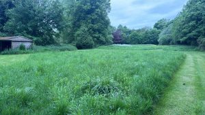
Agricultural landscape with grassy land and a small outbuilding

On the ground, site-level features signal when BNG evidence will be needed:

  • semi-improved grassland or species-rich margins 
  • hedgerows that link into wider networks 
  • wet ditches, streams or floodplain edges 
  • brownfield mosaics with herb-rich patches 
  • woodland edges or scattered trees 
  • PEA recommendations for botanical verification 
  • layout changes affecting habitat parcels 

Providing this clarity early prevents validation queries, redesign instructions and delays during casework. 

BNG Requirements — Delivered in a Predictable Sequence

We produce planning-ready BNG Assessments aligned to Berkshire’s policy expectations.

Case Insight

For a mixed-use development in Berkshire, baseline habitat mapping highlighted the influence of hedgerows and wet ditches on uplift expectations. Aligning habitat baselines with the landscape framework achieved an 11.2% biodiversity net gain without off-site provision.

What We Deliver for Berkshire Projects

 Every report includes:

  • verified UKHab habitat mapping

  • defensible condition and distinctiveness scoring

  • full DEFRA Metric 4.0 calculation

  • uplift strategy shaped around LPA priorities

  • integration with layout, drainage and protected species

  • clear, structured reporting for validation and negotiation

Step 1

Habitat baseline surveys

Year-round, with botanical elements best May–September.

Step 2

Metric 4.0 calculations

 Completed once habitat data is verified.


Step 3

Uplift strategy development

Aligned with design progression and layout refinement.


Step 4

Integration with PEA, EIA or protected species

Used where additional clarity is needed around baseline or constraints.

Our approach keeps evidence proportionate, technically robust and predictable through the full planning sequence.

Next Steps

Contact us and we’ll confirm exactly what your site requires and support a planning-ready, proportionate route forward. 

FAQ - BNG in Berkshire

Why are Biodiversity Net Gain assessments required for development in Berkshire?

In Berkshire, BNG assessments address impacts on river corridors, farmland and urban-edge habitats.

You can check local planning guidance here: 

West Berkshire Council – https://www.westberks.gov.uk/

Reading Borough Council – https://www.reading.gov.uk/

BNG applies where proposals affect existing habitats.


Hedgerows, grassland, woodland and watercourses are key drivers.


Can Biodiversity Net Gain be delivered on-site in Berkshire?

On-site delivery is often achievable with early landscape integration.


It provides evidence of compliance with national and local policy.


BNG assessments should be prepared by competent ecologists.


Related Services

Still have questions?

Still have questions?

Biodiversity Net Gain Assessment in Buckinghamshire

Biodiversity Net Gain (BNG) in Buckinghamshire

Planning-ready BNG assessments for Buckinghamshire — clear metrics, proportionate uplift strategies and predictable progress through planning.

Request a Biodiversity Net Gain Assessment

Request a Biodiversity Net Gain Assessment

Maximum file size: 8.39MB

Fast, Clear, Planning-Ready Support

Fast response 

Calls answered in 2 rings, emails replied to within the hour.

Free expert advice

Clear guidance before you commit.

Cost-effective

Working in partnership with clients to ensure planning approval first time

Typical 10-day turnaround

Industry Leading Standard

Expert Team

We stay with you from first call through to submission. 

BNG Requirements in Buckinghamshire

Most developments in Buckinghamshire now require a mandatory 10% biodiversity net gain under the Environment Act 2021.

Local planning authorities expect clear baseline data, a defensible Metric 4.0 calculation and a proportionate uplift strategy before your application can progress. 

Across Buckinghamshire, planners frequently consider landscape patterns when determining evidence requirements:

  • river valleys and wet habitats

  • redevelopment of previously developed land

  • hedgerow-rich farmland across rural areas

  • woodland and pasture mosaics near the Chilterns

  • canal corridors with high connectivity

  • greenfield expansion around towns and villages

Wherever a site sits, early agreement on baseline value and realistic enhancement options helps keep planning routes clear and defensible.

We work across Buckinghamshire, assisting developments in Aylesbury, High Wycombe, Milton Keynes and surrounding areas.

Why planning officers in Buckinghamshire request BNG Assessments 

Buckinghamshire LPAs request BNG evidence early because many developments sit close to watercourses, settlement edges or regeneration land, where small layout changes can noticeably affect habitat value and connectivity.

Officers want verified baseline habitats and clear Metric 4.0 scoring before designs progress, so uplift options can be understood without late-stage compromise. The county’s focus on canal corridors, historic field patterns and woodland-edge mosaics also means uplift feasibility needs to be established upfront.

Early Indicators Your Buckinghamshire Site May Need BNG Evidence

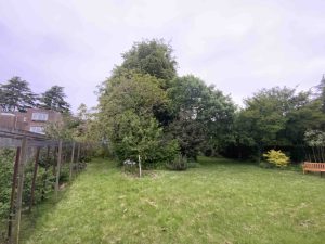
Grazed grass paddock enclosed by post and rail fencing, with residential buildings, outbuildings, mature trees and boundary vegetation in the surrounding landscape.

On the ground, site-level features signal when BNG evidence will be needed:

  • semi-improved grassland or species-rich margins 
  • hedgerows that link into wider networks 
  • wet ditches, streams or floodplain edges 
  • brownfield mosaics with herb-rich patches 
  • woodland edges or scattered trees 
  • PEA recommendations for botanical verification 
  • layout changes affecting habitat parcels 

Providing this clarity early prevents validation queries, redesign instructions and delays during casework. 

BNG Requirements — Delivered in a Predictable Sequence

We produce planning-ready BNG Assessments aligned to Buckinghamshire’s policy expectations.

Case Insight

A mixed-use development in Buckinghamshire required BNG baseline mapping where hedgerows and wet features shaped uplift requirements. By coordinating habitat baselines with the landscape plan, the scheme achieved an 11.2% net gain entirely on site.

What We Deliver for Buckinghamshire Projects

 Every report includes:

  • verified UKHab habitat mapping

  • defensible condition and distinctiveness scoring

  • full DEFRA Metric 4.0 calculation

  • uplift strategy shaped around LPA priorities

  • integration with layout, drainage and protected species

  • clear, structured reporting for validation and negotiation

Step 1

Habitat baseline surveys

Year-round, with botanical elements best May–September.

Step 2

Metric 4.0 calculations

 Completed once habitat data is verified.


Step 3

Uplift strategy development

Aligned with design progression and layout refinement.


Step 4

Integration with PEA, EIA or protected species

Used where additional clarity is needed around baseline or constraints.

Our approach keeps evidence proportionate, technically robust and predictable through the full planning sequence.

Next Steps

Contact us and we’ll confirm exactly what your site requires and support a planning-ready, proportionate route forward. 

FAQ - BNG in Buckinghamshire

What is a Biodiversity Net Gain assessment in Buckinghamshire?

A Biodiversity Net Gain assessment establishes the baseline ecological value of a site using the statutory Biodiversity Metric and models the proposed development to confirm whether at least 10 percent measurable uplift can be achieved in accordance with national legislation.

Development within or close to the Chilterns National Landscape must carefully quantify baseline habitats, particularly woodland, grassland and scrub. Accurate condition assessment is essential before modelling development proposals within the Biodiversity Metric.

Yes. Woodland habitats often have higher distinctiveness values within the Biodiversity Metric. Misclassifying woodland condition can significantly alter baseline unit calculations.

No. Green Belt designation does not remove the statutory requirement to demonstrate at least 10 percent measurable uplift where development is permitted.

Sites influenced by infrastructure projects must still establish a clear ecological baseline. Where land has been previously disturbed, accurate habitat classification is critical before modelling post development scenarios.

Can small village infill schemes achieve 10 percent uplift?

Often yes, but space for habitat creation may be limited. Early metric modelling helps confirm whether on site enhancements such as meadow creation or tree planting are sufficient.

On larger rural estates, baseline habitats are mapped across the entire site boundary. Multiple metric scenarios may be tested to optimise biodiversity performance alongside masterplanning.

Shortfalls often arise where woodland value is underestimated, habitat condition is incorrectly assessed or proposed enhancements are unrealistic for chalk soil conditions.

Buckinghamshire Council acts as the Local Planning Authority and reviews Biodiversity Net Gain assessments submitted with planning applications.

Planning guidance can be accessed at:
https://www.buckinghamshire.gov.uk/planning-and-building-control/

ProHort undertakes detailed habitat surveys and robust Biodiversity Metric modelling tailored to Buckinghamshire’s Chilterns and Green Belt context. We provide early feasibility advice, accurate unit calculations and defensible planning documentation to minimise biodiversity compliance risk.

Related Services

Still have questions?

Still have questions?

(SAP) Species Action Plan in Cornwall

Species Action Plan (SAP) in Cornwall

How will species constraints be managed without delaying delivery on your Cornwall site?

Our Species Action Plans. We define targeted actions to control risk, meet conditions, and keep projects moving.

Request a Species Action Plan

Request a Species Action Plan

Maximum file size: 8.39MB

Fast, Clear, Planning-Ready Support

Fast response 

Calls answered in 2 rings, emails replied to within the hour.

Free expert advice

Clear guidance before you commit.

Cost-effective

Working in partnership with clients to ensure planning approval first time

Typical 10-day turnaround

Industry Leading Standard

Expert Team

We stay with you from first call through to submission. 

Do you need a Species Action Plan (SAP) in Cornwall?

If your Cornwall scheme affects habitats linked to protected or priority species, or if your ecology reports recommend species specific mitigation, a Species Action Plan may be required. 

A Species Action Plan sets out what will be protected, what will change on the ground, and how the outcomes will be delivered and evidenced. It is the practical plan that helps your team avoid late restrictions, unclear conditions, and stop start delivery once permission is granted. 

Across Cornwall, Species Action Plans are often requested where site context increases the likelihood of species constraints being material to planning and delivery.

  • River Camel, Fal, and Tamar corridors near Wadebridge, Truro, and Saltash — wet meadows, ditches, and riparian scrub often require clearly defined, species-led mitigation.
  • Bodmin Moor, Lizard Peninsula, and Cornish coastal woodlands — heathland, granite outcrops, and woodland edges support bats, dormice, and rare invertebrates, influencing layout, timing, and construction controls.
  • Former mining sites and industrial land around St Austell, Camborne, and Penzance — spoil heaps, scrub, and mosaic habitats can elevate species interest and planning scrutiny.
  • Agricultural and semi-rural fringes near Launceston, Newquay, and Helston — hedgerows, ponds, ditches, and field margins create important commuting and foraging routes, making species impacts a live planning issue.
  • Historic village and town edges such as St Ives, Fowey, and Mousehole — mature trees, churchyards, and retained garden features can introduce multi-species constraints that need to be managed in one plan.

These are the settings where Cornwall planners expect a clear delivery plan, not general wording.

Our Species Action Plans cover sites across Cornwall and surrounding areas. Suitable for residential, commercial and mixed use development, from small edge of village sites to multi plot delivery. 

Why Planning Authorities Request an SAP in Cornwall

Cornwall planning authorities use Species Action Plans to meet duties under the Wildlife and Countryside Act 1981, the Habitats Regulations, the NERC Act 2006, and local plan biodiversity policies. Where species outcomes are vague, applications can pick up tighter conditions, extra rounds of review, and delays at discharge when the site team needs certainty the most. 

A well scoped plan reduces that risk by turning policy and survey findings into actions a planning officer can sign off and a contractor can follow. 

Local Case Insight

A visitor centre redevelopment near Fowey involved upgrading disused storage and workshop buildings and creating a courtyard area on land with rough grassland patches, scattered scrub, hedgerows, and drainage ditches. The site provided habitat for foraging bats, nesting birds, amphibians, and hedgehogs, as well as invertebrates associated with coastal grassland. Early ecological surveys identified species constraints, but the initial planning submission did not clearly set out mitigation or enhancement measures. A Species Action Plan was prepared, detailing phased vegetation clearance outside breeding and hibernation periods, protective fencing around retained scrub and hedgerows, and safeguarding of drainage features, alongside targeted enhancements including bat roost boxes, bird nesting boxes, amphibian hibernacula, and native planting to improve foraging and shelter. Post-construction monitoring and reporting responsibilities were assigned to a named ecologist. The planning condition was discharged efficiently, allowing the redevelopment to proceed without disturbance to protected species or seasonal activity.

The Species Action Plan (SAP) Process

Species Action Plans in Cornwall are expected to translate survey findings into clear, enforceable action. We scope plans to the species and risks actually present, avoid unnecessary complexity, and set out measures that planners and contractors can follow with confidence.

Key SAP Deliverables for Cornwall Projects

Every Species Action Plan in Cornwall is tailored to the site. Key deliverables include:

  • Species-specific objectives. Clear explanation of which species are being addressed and why they matter in planning terms.
  • Practical protection and enhancement measures. Targeted actions that can be delivered on site without unnecessary complexity.
  • Defined responsibilities and timing. Who does what, when, and how actions align with construction phases.

Integration with wider ecology. Alignment with PEAs, Habitat Action Plans, BNG strategies or HMMPs where required, so documents support each other rather than conflict. 

Step 1

Species Focus

Identification of target species and relevant legal or policy drivers.

Step 2

Impact and Risk Assessment

Clear evaluation of how construction and occupation affect species.

Step 3

Action Design

Proportionate, species-specific mitigation and enhancement measures.

Step 4

Monitoring and Reporting

Defined success criteria and responsibilities agreed with planners.

Next Steps

Not sure what you’re expected to do for protected species in Cornwall?


Our Species Action Plan provides clarity, so nothing is left open to interpretation.

FAQ - Species Action Plans in Cornwall

What is a Species Action Plan in Cornwall developments?

A Species Action Plan, or SAP, is a detailed ecological document that explains how specific species will be protected, mitigated, and enhanced during development. In Cornwall, SAPs are often needed where protected or priority species are identified through survey work and the planning authority requires clear ecological measures to support decision making.

A SAP is usually required when ecological surveys show that development could affect protected species through demolition, site clearance, vegetation removal, land use change, or related construction works. Cornwall Council’s planning application pages and guidance confirm that applicants may need to submit supporting planning information and ecology related material as part of the application process.

Cornwall includes a wide range of rural, coastal, and settlement edge environments, so ecological constraints can arise on many different types of site. A SAP helps show how species impacts will be properly considered and managed from the outset, which is important in a county where planning guidance is closely linked to site constraints and supporting evidence.

Habitats that often lead to SAP requirements in Cornwall include ponds, hedgerows, mature trees, woodland edges, grassland, coastal habitats, watercourses, and buildings with bat roost potential. The exact trigger depends on the ecological survey findings and the type of development proposed, but Cornwall Council’s planning guidance makes clear that site constraints and ecology can affect what information is needed at submission stage.

SAPs in Cornwall frequently relate to bats, great crested newts, badgers, reptiles, and breeding birds, depending on the site and surrounding habitat. On some schemes, the plan may also need to address species associated with coastal, river, or semi natural habitats where survey work identifies a relevant ecological risk. This is an ecology based inference supported by Cornwall’s planning framework for constraints and validation.

What should a Cornwall compliant SAP include?

A planning suitable SAP will usually include a summary of survey findings, an explanation of likely impacts, species specific mitigation measures, compensation proposals where needed, biodiversity enhancement opportunities, and a clear implementation and monitoring framework. This helps ensure the document is practical, proportionate, and suitable for planning purposes.

A SAP gives planning officers a clear explanation of how species issues will be handled before, during, and after development. That can reduce uncertainty, improve the quality of the ecological submission, and help applications progress where protected species are a material consideration. Cornwall Council’s planning guidance emphasises better applications, validation requirements, and the role of supporting information in the planning process.

No. Smaller developments can also require a SAP if protected species are present or likely to be affected. Householder works, conversions, infill plots, redevelopment sites, and land close to suitable habitat can all trigger the need for species specific mitigation where ecological risk exists. Cornwall Council’s planning guidance specifically notes ecology considerations for some householder and permitted development scenarios.

A SAP should be prepared by a qualified ecologist with suitable experience in protected species, mitigation design, and planning policy. This helps ensure the plan is technically robust, proportionate to the site, and capable of meeting Local Planning Authority expectations. That is a professional best practice inference consistent with Cornwall Council’s validation and planning guidance.

Species Action Plans may be required in Cornwall through Cornwall Council as the Local Planning Authority: https://www.cornwall.gov.uk. Relevant planning pages include Planning and Building Control: https://www.cornwall.gov.uk/planning-and-building-control and Planning Applications: https://www.cornwall.gov.uk/planning-and-building-control/planning-applications. Cornwall Council also provides an online planning register for searching and reviewing applications.

Related Services

Still have questions?

Still have questions?

(SAP) Species Action Plan in Somerset

(SAP) Species Action Plan in Somerset

How will species constraints be managed without delaying delivery on your Somerset site?

Our Species Action Plans. We define targeted actions to control risk, meet conditions, and keep projects moving.

Request a Species Action Plan

Request a Species Action Plan

Maximum file size: 8.39MB

Fast, Clear, Planning-Ready Support

Fast response 

Calls answered in 2 rings, emails replied to within the hour.

Free expert advice

Clear guidance before you commit.

Cost-effective

Working in partnership with clients to ensure planning approval first time

Typical 10-day turnaround

Industry Leading Standard

Expert Team

We stay with you from first call through to submission. 

Do you need a Species Action Plan (SAP) in Somerset?

If your Somerset scheme affects habitats linked to protected or priority species, or if your ecology reports recommend species specific mitigation, a Species Action Plan may be required. 

A Species Action Plan sets out what will be protected, what will change on the ground, and how the outcomes will be delivered and evidenced. It is the practical plan that helps your team avoid late restrictions, unclear conditions, and stop start delivery once permission is granted. 

Across Somerset, Species Action Plans are often requested where site context increases the likelihood of species constraints being material to planning and delivery.

  • River Parrett, Tone, and Brue floodplains near Bridgwater, Taunton, and Glastonbury — wet grasslands, rhynes, and riparian margins often require clearly defined, species-led mitigation.
  • Exmoor, Quantock Hills, and Mendip Hills landscapes — heathland, limestone grassland, woodland edges, and veteran trees support bats, dormice, and notable invertebrates, influencing layout, timing, and construction controls.
  • Former quarry sites and industrial land around Frome, Shepton Mallet, and Highbridge — spoil areas, scrub, and mosaic habitats can elevate species interest and planning scrutiny.
  • Agricultural and semi-rural fringes near Yeovil, Langport, and Cheddar — hedgerows, ponds, ditches, and field margins create important commuting and foraging routes, making species impacts a live planning issue.
  • Historic village and town edges such as Wells, Axbridge, and Dulverton — mature trees, churchyards, and retained garden features can introduce multi-species constraints that need to be managed in one plan.

These are the settings where Somerset planners expect a clear delivery plan, not general wording.

Our Species Action Plans cover sites across Somerset and surrounding areas. Suitable for residential, commercial and mixed use development, from small edge of village sites to multi plot delivery. 

Why Planning Authorities Request an SAP in Somerset

Somerset planning authorities use Species Action Plans to meet duties under the Wildlife and Countryside Act 1981, the Habitats Regulations, the NERC Act 2006, and local plan biodiversity policies. Where species outcomes are vague, applications can pick up tighter conditions, extra rounds of review, and delays at discharge when the site team needs certainty the most. 

A well scoped plan reduces that risk by turning policy and survey findings into actions a planning officer can sign off and a contractor can follow. 

Local Case Insight

An education hub near Glastonbury involved refurbishing former agricultural outbuildings and creating a courtyard and access area on land with rough grassland, scattered scrub, hedgerows, and drainage rhynes. The site supported foraging bats, nesting birds, amphibians, and hedgehogs, alongside invertebrates associated with lowland grassland and wet margins. Early ecological surveys identified species constraints, but the initial planning submission did not clearly set out mitigation or enhancement measures. A Species Action Plan was prepared, detailing phased vegetation management outside breeding and hibernation periods, protective fencing around retained hedgerows and scrub, and safeguarding of drainage features, alongside targeted enhancements including bat roost boxes, bird nesting boxes, amphibian hibernacula, and native planting to improve foraging and shelter. Post-construction monitoring and reporting responsibilities were assigned to a named ecologist. The planning condition was discharged efficiently, allowing the project to proceed without disturbance to protected species or seasonal activity.

The Species Action Plan (SAP) Process

Species Action Plans in Somerset are expected to translate survey findings into clear, enforceable action. We scope plans to the species and risks actually present, avoid unnecessary complexity, and set out measures that planners and contractors can follow with confidence.

Key SAP Deliverables for Somerset Projects

Every Species Action Plan in Somerset is tailored to the site. Key deliverables include:

  • Species-specific objectives. Clear explanation of which species are being addressed and why they matter in planning terms.
  • Practical protection and enhancement measures. Targeted actions that can be delivered on site without unnecessary complexity.
  • Defined responsibilities and timing. Who does what, when, and how actions align with construction phases.

Integration with wider ecology. Alignment with PEAs, Habitat Action Plans, BNG strategies or HMMPs where required, so documents support each other rather than conflict. 

Step 1

Species Focus

Identification of target species and relevant legal or policy drivers.

Step 2

Impact and Risk Assessment

Clear evaluation of how construction and occupation affect species.

Step 3

Action Design

Proportionate, species-specific mitigation and enhancement measures.

Step 4

Monitoring and Reporting

Defined success criteria and responsibilities agreed with planners.

Next Steps

Not sure what you’re expected to do for protected species in Somerset?


Our Species Action Plan provides clarity, so nothing is left open to interpretation.

FAQ - Species Action Plans in Somerset

What is a Species Action Plan in Somerset developments?

A Species Action Plan, or SAP, is a detailed ecological document that explains how specific species will be protected, mitigated, and enhanced during development. In Somerset, SAPs are often needed where protected or priority species are identified through survey work and the planning authority requires clear ecological measures to support decision making.

A SAP is usually required when ecological surveys show that development could affect protected species through demolition, site clearance, vegetation removal, land use change, or related construction works. Somerset Council’s planning pages and local validation guidance confirm that supporting information is needed to register a valid application where relevant ecological issues arise.

Somerset includes a broad mix of rural land, settlement edges, river corridors, wetlands, and previously developed sites, so ecological constraints can arise on many different types of project. A SAP helps show how species impacts will be identified and managed from the outset, which is important in a planning system supported by local plans, validation requirements, and application review processes.

Habitats that often lead to SAP requirements in Somerset include ponds, hedgerows, mature trees, grassland margins, woodland edges, watercourses, wetlands, and buildings with bat roost potential. The exact trigger depends on the ecological survey findings and the nature of the proposed development, but Somerset Council’s planning framework makes clear that supporting ecological information may be needed where site constraints are relevant.

SAPs in Somerset frequently relate to bats, great crested newts, badgers, reptiles, and breeding birds. Depending on the site, the plan may also need to address species linked to wetland, river, or rural habitats where survey work identifies a relevant ecological risk. This is an ecology based inference grounded in the county’s planning context and habitat range.

What should a Somerset compliant SAP include?

A planning ready SAP will usually include a summary of survey findings, an explanation of likely impacts, species specific mitigation measures, compensation proposals where needed, biodiversity enhancement opportunities, and a clear implementation and monitoring framework. This helps ensure the document is practical, proportionate, and suitable for planning purposes.

A SAP gives planning officers a clear explanation of how species issues will be handled before, during, and after development. That can reduce uncertainty, improve the quality of the ecological submission, and help applications progress where protected species are a material consideration within the local planning process.

No. Smaller developments can also require a SAP if protected species are present or likely to be affected. Extensions, conversions, infill plots, redevelopment sites, and land close to suitable habitat can all trigger the need for species specific mitigation where ecological risk exists. This is consistent with Somerset Council’s validation approach, which focuses on the information needed for the application rather than simply the size of the scheme.

A SAP should be prepared by a qualified ecologist with suitable experience in protected species, mitigation design, and planning policy. This helps ensure the plan is technically robust, proportionate to the site, and capable of meeting Local Planning Authority expectations.

Species Action Plans may be required by Local Planning Authorities across the wider Somerset area, including Somerset Council: https://www.somerset.gov.uk, Bath and North East Somerset Council: https://www.bathnes.gov.uk, and North Somerset Council: https://www.n-somerset.gov.uk. These authorities all maintain active planning policy and application pages, showing that ecology related requirements can arise through different planning bodies across the Somerset area.

Related Services

Still have questions?

Still have questions?

WAC Testing in Staffordshire

WAC Testing in Staffordshire

How will waste classification and disposal routes affect your Staffordshire project budget and timeline?


Our WAC testing confirms waste treatment options early, preventing disposal delays and unexpected cost uplift. You get laboratory clarity, straightforward interpretation and confident decision-making before ground is broken.

Request Wac Testing

Request Wac Testing

Maximum file size: 8.39MB

Fast, Clear, Planning-Ready Support

Fast response 

Calls answered in 2 rings, emails replied to within the hour.

Free expert advice

Clear guidance before you commit.

Cost-effective

Working in partnership with clients to ensure planning approval first time

Typical 10-day turnaround

Industry Leading Standard

Expert Team

We stay with you from first call through to submission. 

Do you need WAC testing in Staffordshire?

WAC testing confirms how excavated material must be legally disposed of, preventing rejected loads, spiralling landfill costs and delays at validation or discharge.

We help homeowners, developers and contractors confirm waste classification early, align disposal routes, and avoid expensive misdirection of soils or spoil.

Across Staffordshire, WAC testing is frequently triggered on:

  • Brownfield plots in Stoke-on-Trent and Newcastle-under-Lyme where historic fill and pottery industry residues remain.

  • Redevelopment in Burton-upon-Trent and Uttoxeter, especially where soils include ash, clinker or brewery-waste deposits.

  • Rural settlement upgrades near Stone or Eccleshall, where imported hardcore and pre-1980s rubble sit beneath gardens and farmyards.

  • Canal-side schemes near Rugeley and Penkridge, where dredgings and silt contamination risk landfill restrictions.

These conditions often leave disposal routes uncertain until laboratory evidence is produced.

Our WAC testing service supports projects across Staffordshire and nearby areas, providing landfill classification and disposal clarity for residential, commercial and redevelopment sites.

Compliance & Legal Context for WAC Testing in Staffordshire

WAC testing supports compliance with:

The Landfill Directive

WM3 Waste Classification Guidelines

Environment Agency acceptance criteria

Missing or incorrect evidence can lead to rejected loads, double-handling costs, redesign, or project delay.

Local Case Insight

A redevelopment project in Burton-upon-Trent required disposal classification to progress demolition works. Initial assumptions suggested hazardous status, risking higher disposal costs and delay. WAC testing confirmed non-hazardous outputs from the made-ground, enabling the project to proceed using a lower-cost disposal route. Planning conditions were discharged without further queries, and the construction schedule remained intact.

The Process - WAC Testing

Our WAC testing services in Staffordshire support projects across Staffordshire and nearby areas, providing landfill classification and disposal clarity for residential, commercial and redevelopment sites.

Key Deliverables for Staffordshire WAC Testing

Our WAC Testing typically includes:

  • Representative soil sampling 
  • Laboratory analysis by accredited facilities 
  • WAC classification: inert / non-hazardous / hazardous 
  • Clear interpretation of leachate results 
  • Disposal guidance aligned with permitting rules 
  • Nationwide coverage and predictable turnaround 

Step 1

Pre-Sampling Review

Confirm required tests and disposal pathways.

Step 2

Soil Sampling

Obtain representative samples with correct methodology.

Step 3

Accredited Laboratory Testing

Perform full leachate analysis and classification.

Step 4

Report & Guidance

Assign inert / non-hazardous / hazardous class. Outline compliant, cost-effective routes.

Next Steps

Need WAC testing in Staffordshire?


We’ll confirm exactly what’s required and keep disposal decisions predictable.

FAQ - WAC Testing in Staffordshire

Where can I dispose of WAC-tested waste in Staffordshire?

Local routes are determined by classification results. Staffordshire planning teams may request evidence through councils such as:
https://www.staffordbc.gov.uk/planning
https://www.newcastle-staffs.gov.uk/planning
https://www.stoke.gov.uk/planning

Is WAC testing always required on brownfield land in Staffordshire?


Most results can be completed within 7–10 working days depending on lab pressure.

Can WAC and soil testing be combined in Staffordshire?

Yes — doing both together avoids duplicated sampling and programme drift.


Only if spoil disposal volume is significant or if contamination risk is raised in initial reports.


Yes — correct classification can significantly reduce landfill charges and haulage fees.

Related Services

Still have questions?

Still have questions?

Soil Testing & Analysis in Staffordshire

Soil Testing and Analysis in Staffordshire

How will soil conditions shape planning, design and risk management across your Staffordshire site?


Our soil testing service provides clear, lab-verified evidence on composition, contamination and suitability. We translate results into practical recommendations developers, architects and contractors can act on from day one.

Request Soil Testing and Analysis

Request Soil Testing and Analysis

Maximum file size: 8.39MB

Fast, Clear, Planning-Ready Support

Fast response 

Calls answered in 2 rings, emails replied to within the hour.

Free expert advice

Clear guidance before you commit.

Cost-effective

Working in partnership with clients to ensure planning approval first time

Typical 10-day turnaround

Industry Leading Standard

Expert Team

We stay with you from first call through to submission. 

Do you need Soil & Analysis Testing in Staffordshire?

If you’re building, extending or altering land in Staffordshire, soil analysis provides the evidence architects and engineers need to design foundations, drainage and risk mitigation accurately.

We deliver fast, planning-ready results that remove guesswork and help keep construction choices efficient.

Planning and engineering requirements surface across a wide spectrum of landscapes in Staffordshire including:

  • Clay-rich corridors around Stoke-on-Trent and Kidsgrove, increasing shrink–swell risk.

  • Sandy ridgelines near Cannock Chase and Hednesford, influencing bearing capacity.

  • River terrace soils near Stafford, Rugeley and Burton, affecting permeability and drainage.

  • Former industrial land around Burslem and Longton, where contaminant screening is essential.

Each landscape type influences foundation design choices and planning demands.

Our soil testing and analysis service is delivered across Staffordshire and its surrounding districts, supporting planning, design and land quality assessment for homes, developments and large construction projects.

Compliance & Legal Context for Soil Testing & Analysis in Staffordshire

Soil data interacts with multiple planning requirements:

NHBC foundation guidance & shrink–swell tables

BS 5930 Site Investigation Standard

Contaminated land policy & Environmental Protection Act principles

Accurate soil classification reduces structural risk and avoids unnecessary over-engineering.

Local Case Insight

A residential self-build near Stafford required foundation design clarity after variable topsoil conditions were identified. Soil analysis confirmed shrink-swell characteristics linked to clay strata and moisture variation from surrounding tree belts. The reporting allowed the structural engineer to adjust foundation depth and type early, preventing redesign later and protecting the project from subsidence risk.

Soil Testing & Analysis Packages in Staffordshire

Our Soil Analysis Reports in Staffordshire give developers, designers and landscapers reliable baseline data that informs planting plans, remediation strategies and specification choices with confidence.

Key Deliverables for Staffordshire Soil Analysis

  • Accredited laboratory analysis (ISO 17025 & ISO 9001) 
  • Nutrient and contamination profiling 
  • Suitability assessment for development, remediation or planting 
  • Clear recommendations aligned with regulatory and planning needs 
  • Field observations (Comprehensive Package) 
  • Planning-ready, remediation-ready and design-support reporting 
  • Nationwide coverage 

Core Package

You collect the sample using the ProHort sampling kit and instructions.
The sample is returned to ProHort via our courier.

Analytical Package

(Includes the full Core Package)

Adds professional interpretation of laboratory data, showing how results compare with accepted standards.

Comprehensive Package

(Includes Core + Analytical)

A ProHort expert attends site, undertakes sampling and conducts a visual assessment of factors influencing soil behaviour.

Support

Our team is here to guide you throughout the process.

Next Steps

Need soil testing in Staffordshire?


Share your address and goals and we’ll confirm testing scope immediately.

FAQ - Soil Testing & Analysis in Staffordshire

When might soil testing be needed for a development in Staffordshire?

Soil testing may be needed where a development site has a history of industrial, commercial, agricultural or other potentially contaminative use, or where made ground or unusual soil conditions are identified.

Testing can also be requested to support a planning application, satisfy a planning condition or provide evidence about whether soil is suitable for its proposed use. The exact testing required should be based on the site’s history, proposed development and the risks that need to be investigated.

They can. Local Planning Authorities may request further investigation where there is evidence or reasonable potential for land contamination.

Requirements vary according to the site and development. For example, Stoke-on-Trent City Council identifies circumstances where a Land Contamination Assessment is required, including development on land where contamination is known or suspected and certain previously developed sites.

For current local requirements, applicants should check the relevant Local Planning Authority guidance. Staffordshire County Council also provides environmental planning information at:

https://www.staffordshire.gov.uk/planning/environmental-planning-policy

Staffordshire has a long history of industrial, manufacturing and mineral-related land uses. Depending on what previously occupied a particular site, contaminants may remain within the soil even where there are few obvious signs at the surface.

Laboratory soil analysis can investigate substances associated with the site’s previous use, such as heavy metals and hydrocarbons. The results can then help determine whether further assessment or remediation is necessary before development proceeds.

Yes. Soil analysis can investigate characteristics that influence how successfully plants are likely to establish, including pH, nutrient availability, organic matter and other relevant soil properties.

Where landscaping is proposed on previously developed or imported soils, additional testing may also be appropriate to investigate potential contamination. This helps distinguish between soil that requires improvement for plant growth and soil where a wider environmental issue may need to be addressed.

The testing suite should be selected according to the site rather than using the same laboratory analysis for every property.

Depending on previous land use and the purpose of the investigation, testing may include heavy metals, petroleum hydrocarbons and other chemical contaminants, alongside pH, nutrients, organic matter and other soil characteristics.

Reviewing the site’s history before selecting the laboratory suite helps ensure testing is proportionate and relevant to the potential risks.

Can I have soil tested before buying or developing land in Staffordshire?

Yes. Soil testing can form part of environmental due diligence before purchasing or developing land, particularly where previous site uses create uncertainty about ground conditions.

Testing before committing to a project can provide useful evidence about contamination, soil quality or suitability for the intended use. Where a contamination risk has been identified, however, laboratory testing may need to form part of a wider land contamination assessment rather than being relied upon in isolation.

Finding a contaminant does not automatically mean that a site cannot be developed.

The results need to be considered in relation to the concentration detected, where it occurs, the proposed use of the land and the potential pathways through which people or the environment could be exposed.

Further investigation, risk assessment or remediation may be recommended where necessary. Professional interpretation is therefore important because laboratory figures alone do not determine the overall suitability of a site.

Yes. ProHort provides Soil Testing & Analysis for sites across Staffordshire, including Stafford, Stone, Stoke-on-Trent, Newcastle-under-Lyme, Cannock, Lichfield, Tamworth, Burton upon Trent and surrounding areas.

Depending on the service required, samples can either be collected using a supplied sampling kit or sampling can be undertaken as part of a professional site attendance. Samples are then submitted for laboratory analysis, with interpretation and reporting available where required.

The overall timescale depends on the number of samples, the laboratory analysis required and whether professional interpretation or additional reporting is needed.

ProHort’s standard Soil Testing & Analysis service typically aims to provide laboratory analysis and reporting within approximately 10 working days. Fast track testing may also be available for projects where planning, construction or another deadline makes a quicker turnaround necessary.

It is advisable to arrange testing as early as possible where the results could influence a planning submission, remediation strategy or construction programme.

Providing the site address or postcode, proposed use of the land and reason for testing is a useful starting point.

Where available, it can also help to provide previous environmental reports, planning correspondence, site plans, photographs, details of former land uses and information about any suspected contamination.

This allows the testing scope to be selected around the actual purpose of the investigation rather than carrying out unnecessary analysis. For planning-related projects, details of any specific request or condition from the Local Planning Authority should also be provided.

Related Services

Still have questions?

Still have questions?

---