
LVIA Required Before Planning in Surrey?
We support Surrey developments by providing LVIAs that assess effects on countryside views, settlement edges and heritage settings. Supplying an LVIA early helps prevent planning delays and further information requests
Calls answered in 2 rings, emails replied to within the hour.
Clear guidance before you commit.
Working in partnership with clients to ensure planning approval first time
Industry Leading Standard
We stay with you from first call through to submission.
In simple terms, you’ll need a Landscape & Visual Impact Assessment (LVIA) for your Surrey site if your planning application could affect the character of the landscape or the views experienced by people nearby.
An LVIA is the document that explains how your development will look, how it fits into the surrounding landscape, whether it will change key views, and what can be done to reduce visual impacts. It helps the Local Planning Authority understand the real-world effects of your proposal and decide whether it is acceptable in landscape and visual terms.
Surrey planning authorities frequently require LVIAs where development may be visible from sensitive landscapes, including:
Settlement edges adjoining countryside or green belt land
River-valley and canal-side locations
Elevated sites with views across rolling landscapes
Areas intervisible with historic estates or conservation areas
Infrastructure corridors where cumulative landscape effects need assessment
An LVIA is often requested where visual impact has been raised at pre-application stage.
We deliver expert Landscape and Visual Impact Assessment services across Surrey, supporting projects in towns, villages and sensitive landscape settings.
In Surrey, an LVIA is often required where development may alter countryside views or affect heritage settings. Prepared in line with the Landscape Institute’s GLVIA3 guidance and relevant planning policy, an LVIA explains how your proposal will appear in the landscape and identifies the measures taken to minimise visual and landscape effects.
We deliver compliant, planning-ready LVIAs that meet Surrey policy standards and support your application with robust visual evidence.
Your Landscape Visual Impact Assessment (LVIA) is structured to meet Surrey’s planning requirements and typically includes:
Baseline assessment – Landscape character review, policy context and on-site survey with key viewpoints captured.
Visual outputs – Accurate photography, wireframes and ZTV mapping to show potential visibility and change.
Impact and mitigation analysis – Clear GLVIA3-aligned assessment of landscape and visual effects with proportionate mitigation.
Submission-ready report – A concise, LPA-aligned LVIA formatted for smooth planning submission.
This ensures your LVIA in Surrey can be submitted confidently, supporting a smoother planning process and clear decision-making.
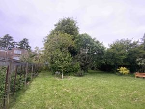
Site is assessed to capture potential viewpoints.
Desk research of the landscape study area
Collate assessments and evaluate the key components
We respond to any LVIA queries or amendments required.
Ready to secure approval and start on site? We’ll confirm what your Surrey site needs and help you move forward without unnecessary delay.
Surrey includes protected landscapes and visually sensitive commuter belt locations.
Surrey County Council – https://www.surreycc.gov.uk/
Residential schemes, infrastructure projects and commercial development.
It assesses visual impact on settlements, roads and countryside.
Yes, especially near designated landscapes.
Yes, to minimise visual intrusion.
Often, where open landscape character is affected.