

Planning-ready BNG assessments for Merseyside — clear metrics, proportionate uplift strategies and predictable progress through planning.
Calls answered in 2 rings, emails replied to within the hour.
Clear guidance before you commit.
Working in partnership with clients to ensure planning approval first time
Industry Leading Standard
We stay with you from first call through to submission.
Most developments in Merseyside now require a mandatory 10% biodiversity net gain under the Environment Act 2021.
Local planning authorities expect clear baseline data, a defensible Metric 4.0 calculation and a proportionate uplift strategy before your application can progress.
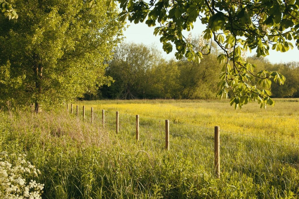
Across Merseyside, ecological scrutiny is often influenced by a mix of urban and coastal landscape features:
river and estuary corridors associated with the Mersey
docklands and industrial regeneration areas
urban green corridors linking parks and waterways
peripheral farmland with retained boundaries
transport infrastructure with linear habitats
housing growth around Liverpool, Knowsley and St Helens
Addressing baseline constraints and uplift opportunities early supports a smoother planning pathway.
We deliver services throughout Merseyside, including Liverpool, St Helens, Knowsley, Sefton and surrounding areas.
Merseyside LPAs request BNG evidence early because many developments sit close to watercourses, settlement edges or regeneration land, where small layout changes can noticeably affect habitat value and connectivity.
Officers want verified baseline habitats and clear Metric 4.0 scoring before designs progress, so uplift options can be understood without late-stage compromise. The county’s focus on canal corridors, historic field patterns and woodland-edge mosaics also means uplift feasibility needs to be established upfront.
On the ground, site-level features signal when BNG evidence will be needed:
Providing this clarity early prevents validation queries, redesign instructions and delays during casework.
We produce planning-ready BNG Assessments aligned to Merseyside’s policy expectations.
Every report includes:
verified UKHab habitat mapping
defensible condition and distinctiveness scoring
full DEFRA Metric 4.0 calculation
uplift strategy shaped around LPA priorities
integration with layout, drainage and protected species
clear, structured reporting for validation and negotiation
Year-round, with botanical elements best May–September.
Completed once habitat data is verified.
Aligned with design progression and layout refinement.
Used where additional clarity is needed around baseline or constraints.
Our approach keeps evidence proportionate, technically robust and predictable through the full planning sequence.
Contact us and we’ll confirm exactly what your site requires and support a planning-ready, proportionate route forward.
A Biodiversity Net Gain assessment establishes the baseline ecological value of a site using the statutory Biodiversity Metric and models the proposed development to confirm whether at least 10 percent measurable uplift can be achieved in accordance with national legislation.
No. Port and dockland sites are not exempt. Even heavily developed land can support habitats such as scrub, grassland or urban mosaic features which must be properly surveyed and quantified within the Biodiversity Metric.
Sites near the River Mersey may be influenced by estuarine habitats or tidal corridors. The baseline must accurately classify any associated habitats and reflect their ecological value within the assessment.
Yes. Coastal residential, commercial or logistics schemes must demonstrate measurable uplift. The BNG assessment must quantify any habitat losses and model realistic enhancements.
Former industrial land often supports temporary grassland or scrub. A detailed habitat survey is required to establish the true baseline before development modelling takes place.
In dense urban areas, space for habitat creation may be limited. Green roofs, tree planting and sustainable drainage may contribute, but some schemes require off site biodiversity units to reach compliance.
Sites within flood risk zones may include grassland or wetland habitats. The assessment must reflect realistic deliverability of enhancements without conflicting with flood mitigation design.
Common issues include underestimating baseline habitat value on brownfield land, over specifying roof habitats without meeting Biodiversity Metric criteria, and failing to model estuarine influence accurately.
Depending on site location, Biodiversity Net Gain assessments are reviewed by authorities such as Liverpool City Council, Wirral Council, Sefton Council, Knowsley Council or St Helens Borough Council.
Planning guidance for Liverpool City Council can be accessed at:
https://liverpool.gov.uk/planning-and-building-control/planning/
ProHort undertakes detailed habitat surveys and robust Biodiversity Metric modelling tailored to Merseyside’s dockland and estuarine context. We provide clear unit calculations, early feasibility advice and defensible planning documentation to minimise biodiversity compliance risk.

