Benefits and Disadvantages of Drone Surveying
In today’s rapidly evolving technological society, drones have altered various industries for the better. However, when it comes to drone surveying is there more pros or cons?
Benefits of Drone Surveying:
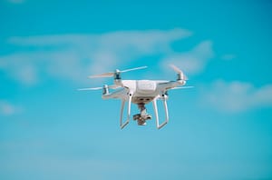
- Faster data collection compared to traditional methods.
- Improved safety as a result of removing humans from potentially hazardous situations.
- Increased accuracy.
- Realtime monitoring.
- Cost effective in the long run, although has high initial investment costs.
Drawbacks of Drone Surveying:
Cost Implications:
Firstly, the initial cost of drone technology is expensive. It can cost thousands of pounds to buy a drone equipped with the cameras and sensors needed for drone surveying. On top of this there may be an additional need for accessories and software to enhance the drones functionality.
Maintenance costs also need to be considered as regular repairs, services, software updates and part replacements may be needed to keep the drone in optimal condition. All of the above need to be carried out by a professional and add to the overall operation cost of the drone.
In addition, drone pilots need to undertake expert training in order to operate a drone legally and safely. This training and certification come at a cost and is an ongoing expense as continuous professional development is necessary to maintain your certification.
Legal Requirements:
Drone surveying is subject to regulations set by the Civil Aviation Authorities (CAA). Commercial drones used for drone surveying need to be registered with the CAA and this needs to be renewed each year. The registration is of you as the operator rather than the drone. You can register, get your flyer ID and find more information at register-drones.caa.co.uk.
Furthermore, there are several privacy concerns that need to be considered. Failure to navigate the issues can result in hefty fines, legal repercussions and privacy violations. Drones that are equipped with cameras can take videos, images and collect data from private properties and individuals without their consent which has resulted in numerous lawsuits for alleged privacy violations.

Airspace Limitations:
Adhering to and understanding these airspace limitations is critical for drone operators. Drones are often restricted in certain areas such as airports, military bases and other sensitive locations. Additionally specific locations may be ”no-flight” zones due to safety or environmental concerns. You should never fly more than 120m (400ft) above the surface and always keep it in your site, taking extra caution in built up areas. Temporary airspace restrictions are frequently put in place across the UK, therefore you should check airspace information section before flying.
Weather Setbacks:
As we know, the UK is often subject to poor weather. This can be a disadvantage when drone surveying as strong winds and rain can limit the use of drones and can therefore delay data collection.
Fly Time:
The majority of drones have a limited flying time of approximately 15 to 30 minutes, therefore multiple flights may be required to complete surveys of large areas, resulting in prolonged survey times.
Contact Us:

At ProHort we understand the implications drones can have on wildlife and avoid drone use where possible. Get in touch with us now to discuss how we can help you with your planning needs.
Alternatively, you can find out more about the services we offer here.
Why not check out our Facebook page and connect with us on Linkedin?